
Soil Associations
0343a ELMTON 1
Soil and site characteristics
Shallow well drained brashy calcareous fine loamy soils over limestone. Some similar deeper soils and some non-calcareous and calcareous clayey soils.
Geology
Jurassic Limestone
Cropping and Land Use
Cereals, sugar beet and potatoes; winter cereals and dairying in the South West.
Component soil series
| Subgroup | Series name | Percentage | WRB 2006 link |
|---|---|---|---|
| 3.43 | ELMTON | 40% | Calcaric Leptosols |
| 5.11 | ABERFORD | 30% | Calcaric Endoleptic Cambisols |
| 5.11 | MORETON | 10% | Calcaric Endoleptic Cambisols |
| 5.71 | SHIPPON | 10% | Clayic Endoleptic Luvisol |
Covers 1392 km2 in England and Wales
Soilscapes Classification
| 3 |
Shallow lime-rich soils over chalk or limestone |
0343a ELMTON 1
Detailed Description
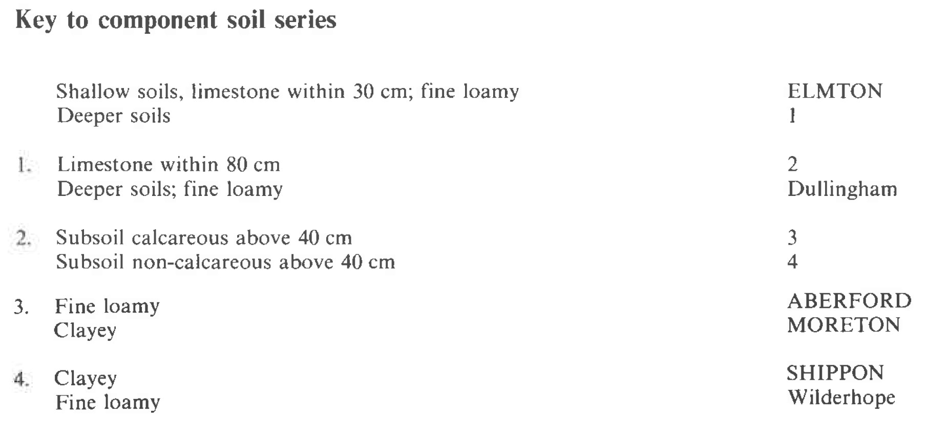
This association is extensive (1,351 km²) from Dorset to Yorkshire on Jurassic limestone beds including the Middle Lias, Lincolnshire Limestone, Great Oolite and Corallian beds. It is usually found on gently undulating plateaux or dipslopes dissected by dry valleys containing Head or colluvial deposits. Although there is wide variation in the component soils because of the range of parent materials, the association consists mainly of shallow brown rendzinas of the Elmton series, with small areas of deeper brown calcareous earths of the Aberford and Moreton series and argillic brown earths of the Shippon series These fine loamy or clayey, variably stony soils are permeable and rarely wet. There is much variation in depth to limestone in Aberford soils, the general range being 40 to 80 cm.
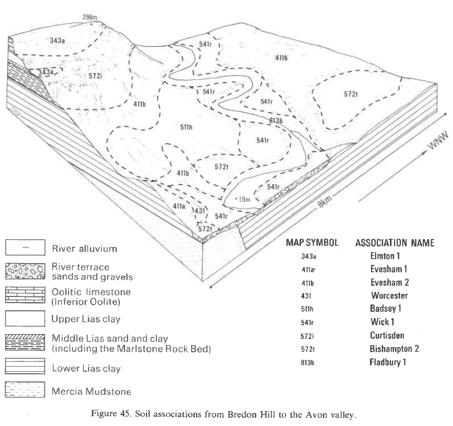
The association occurs mainly in east Leicestershire but also on the Warwickshire-Oxfordshire border and on Bredon and Broadway Hills, Hereford and Worcester. In Leicestershire, rendzinas, mostly Elmton series, comprise about two-thirds of the association and Aberford series about one-fifth. Moreton and Sherborne soils occur locally where there are thin bands of clay in the Inferior Oolite Limestone, and colluvial brown calcareous earths, Dullingham and Millington series (Clayden and Hollis 1984), occupy the floors of narrow dry valleys. Argillic brown earths are uncommon but where present are Wilderhope, rather than Shippon, series. On the Jurassic limestone in Warwickshire and Hereford and Worcester, Elmton soils are markedly dominant, with some Aberford but few other associated soils.
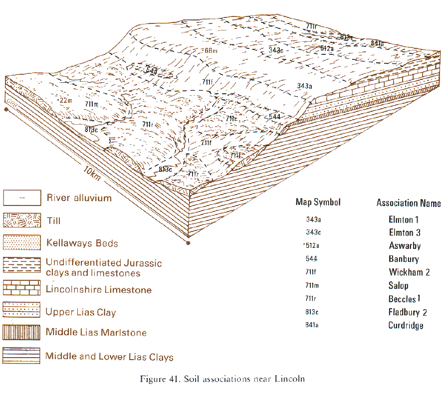
In Eastern England the association is mainly on the wide, gently undulating dipslope of the Inferior Oolite Limestone between 30 and 90 m O.D. In much of Lincolnshire, Elmton and Aberford series comprise most of the association, but in north Lincolnshire some dry valleys contain Dullingham rather than Aberford series and, near the scarp crest, Wick soils have been included on outcrops of Lower Estuarine Beds. In central Lincolnshire, where there are remnants of high-level gravels, Marcham and Cranwell series are locally important and small patches of Maxted soils occur. In parts of south Lincolnshire and Northamptonshire, the association occurs also on Great Oolite Limestone and Sherborne soils are common, locally occupying almost half the land. In Northamptonshire the proportion of Moreton soils is larger, and the valleys are floored with Dullingham or Millington soils.
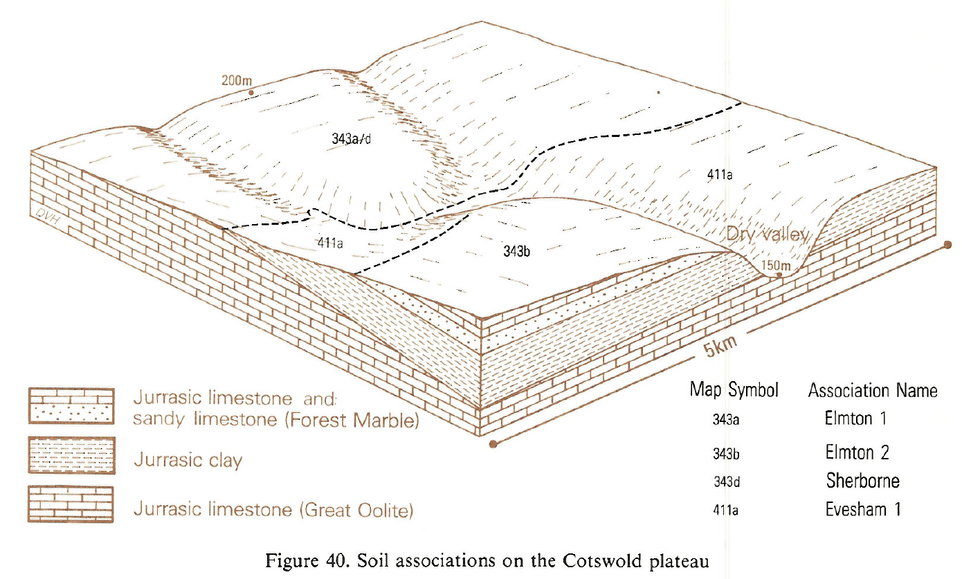
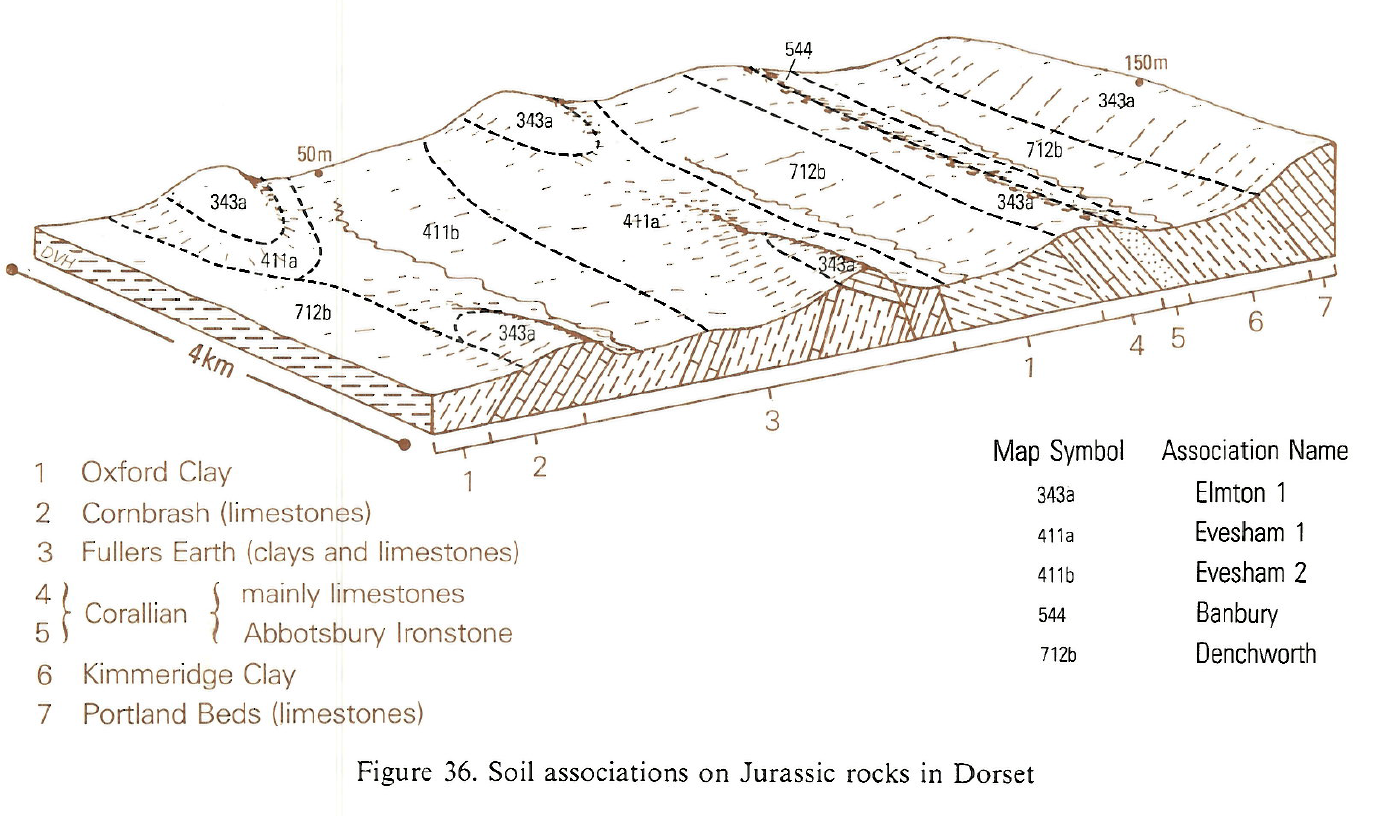
In the South West the association occurs on limestones in all the Jurassic formations except the Lower Lias. The soils are mainly calcareous and loamy, but there are some silty soils and deeper non-calcareous soils of Waltham, Tetbury and Shippon series. Calcareous clayey soils of the Moreton, Evesham and Haselor series are also small inclusions. Aberford soils are generally less stony than those of Elmton series and occur on benches or wide valley floors around Andoversford in the north Cotswolds. Dullingham and Didmarton series are confined to the bottoms of the very narrow dry valleys cutting the dipslope. In north Gloucestershire clayey Sherborne series occur with Elmton series, in a complex soil pattern. In south and west Dorset, Elmton and Aberford soils occur together on limestones capping the flat tops of ridges.
In Northern England the association is limited to a small area near Kirton in Lindsey, Humberside, mainly on the wide, gently undulating dipslope of the Lincolnshire Limestone at 2 to 5 m O.D. Elmton and Aberford series are the most common soils but some dry valleys contain colluvial brown calcareous earths of the Dullingham series.
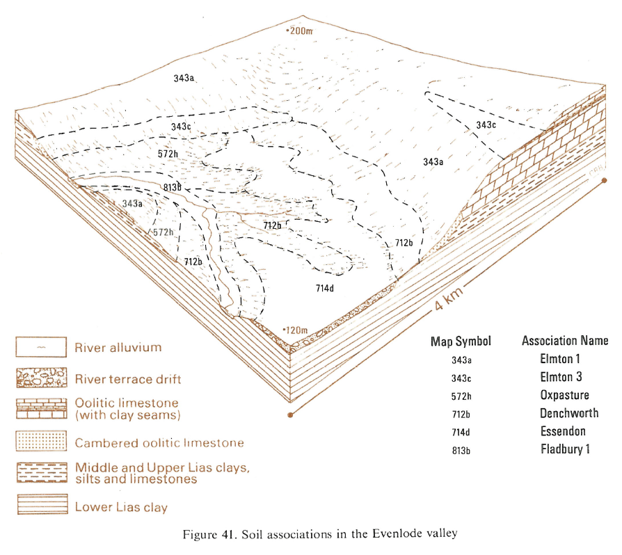
In South East England the association is mainly on the Inferior or Great Oolite and Corallian limestones at altitudes of 60-200 m O.D. Thin bands of clay in the limestone give a significant content of Moreton soils, and Sherborne soils are locally common. Shippon series covers up to a sixth of the land near the edge of the limestone plateau where small areas of Evesham and Haselor series also occur. In some places on the Corallian ridge west of Oxford, Marcham soils cover a third of the ground.
Soil Water Regime
Elmton and Aberford soils are permeable and overlie well-fissured limestone and are thus well drained (Wetness Class I). The soils readily absorb winter rain and there is little surface run-off. Wetter land occurs locally where Haselor and Evesham soils are included. Elmton and Moreton soils are moderately droughty for most arable crops and very droughty for grassland; Aberford soils are generally less droughty.
Cropping and Land Use
The soils are easily worked, though stoniness interferes with cultivation in some localities and may inhibit germination. There are usually adequate working periods in the spring and autumn and the soils warm up quickly in the spring. Cereals, sugar beet, potatoes, peas and grass for drying are grown and direct drilling of winter and spring cereals on these soils gives similar yields to conventional techniques. There is some ley grassland for sheep grazing but the droughtiness of Elmton series restricts grass growth to spring and early summer. There is negligible poaching risk.
In Oxfordshire these thin base rich limestone soils support several woodland and grassland sites of ecological interest. Wychwood Forest, formerly a Royal Forest, has mainly oak-ash woodland with an understorey of hawthorn, hazel and some sallow and a range of calcicole species including privet (Ligustrum vulgare), buckthorn (Rhamnus catharticus), wild cherry and dogwood (Cornus sanguinea). Honeysuckle (Lonicera periclymenum) and traveller's joy (Clematis vitalba) are common. Steep slopes in the Evenlode valley have oak, ash and wych elm woodland. There are also some old limestone grasslands with for grass (Brachypodium pinnatum), ploughman's spikenard (Inula conyza), clustered bellflower (Campanula glomerata), common rockrose (Helian¬themum nummularium) and the hairy violet (Viola hirta).
0343a ELMTON 1
Distribution Map
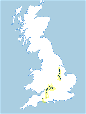 |
Note that the yellow shading represents a buffer to highlight the location of very small areas of the association.
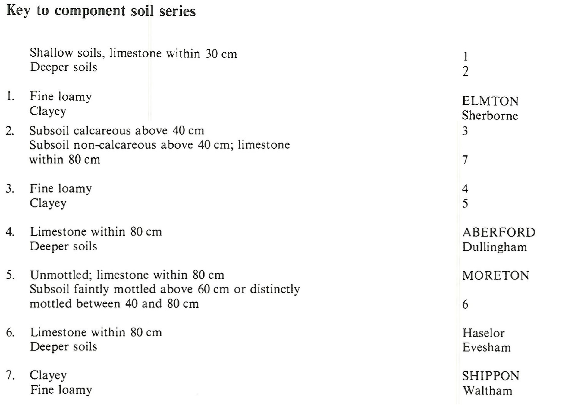
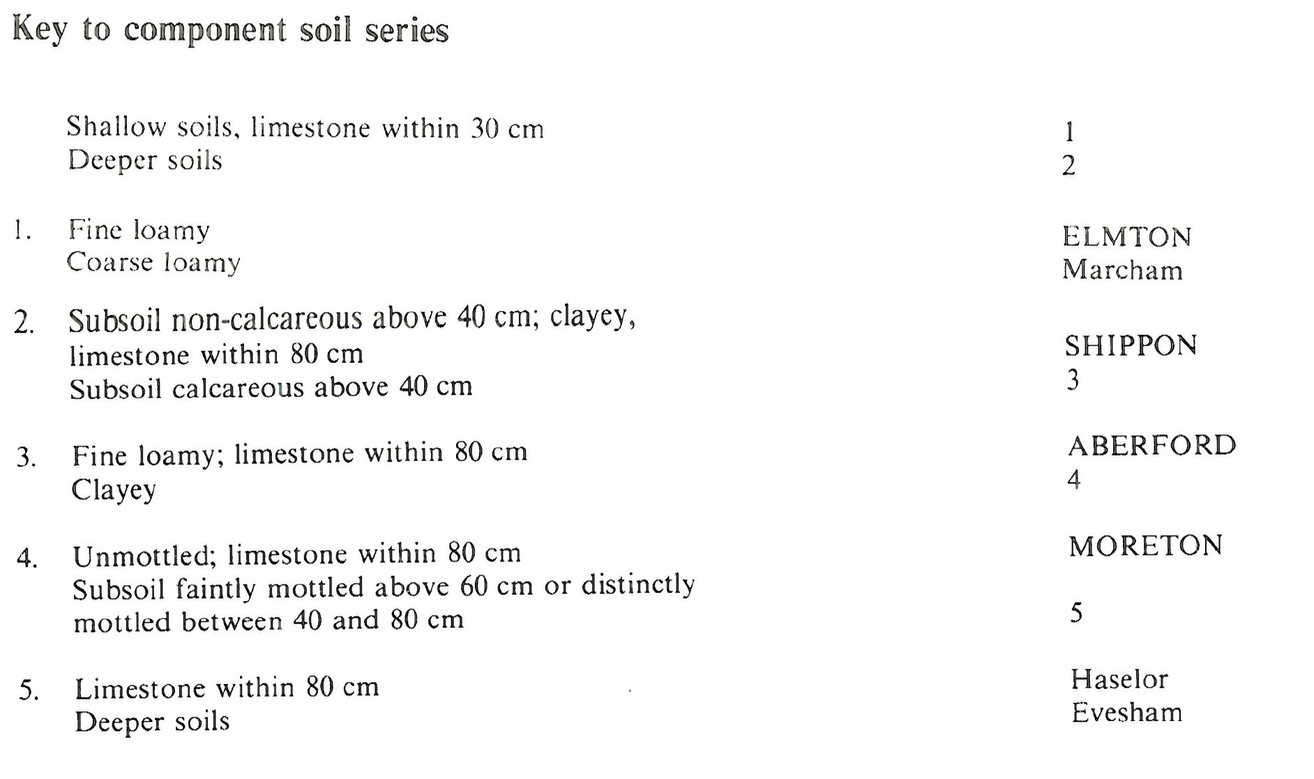
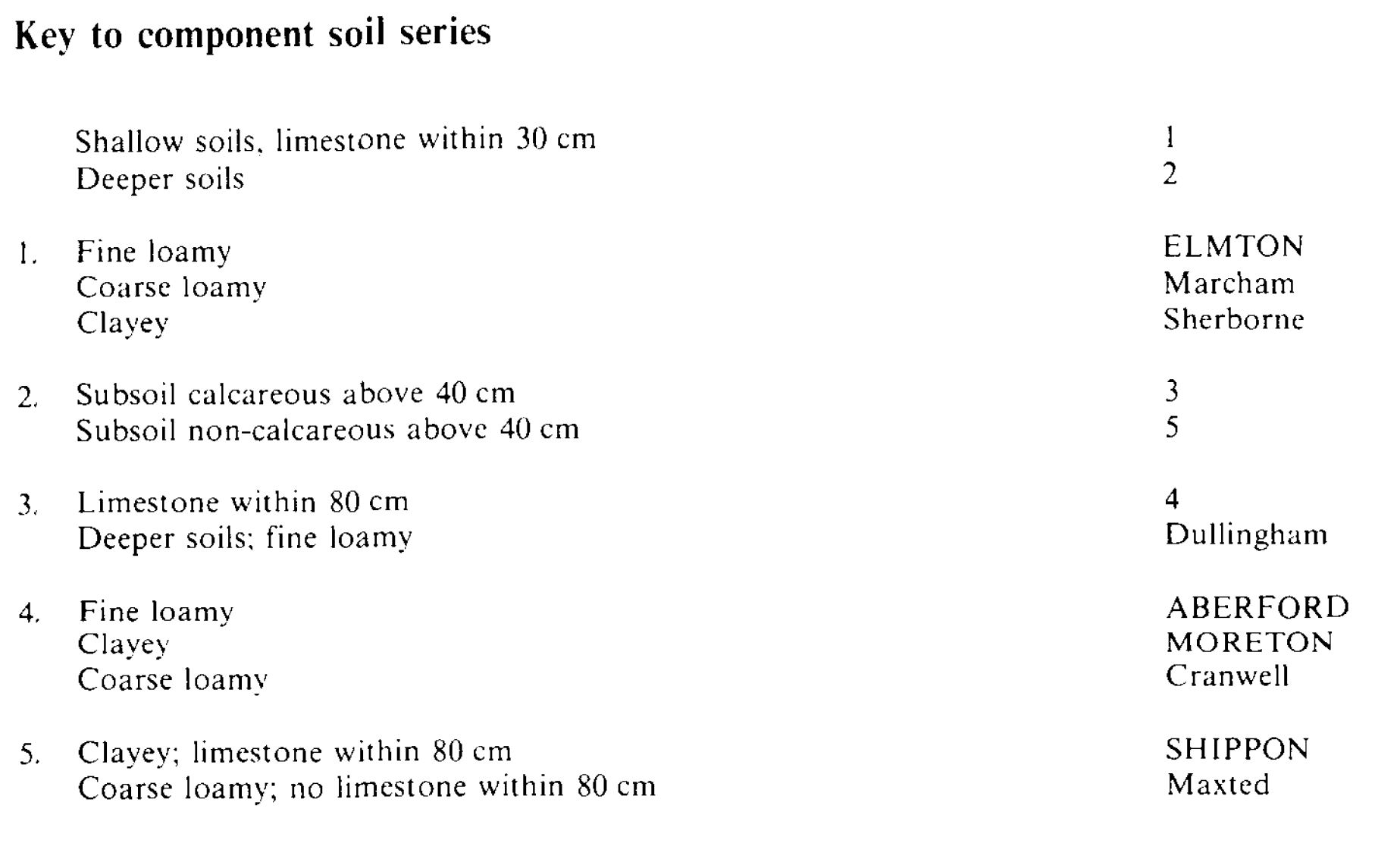
Keys to component soil series
South Western Region
 |
South Eastern Region
 |
Eastern Region
 |
Midlands
 |
Typical Landscapes
South Western Region
 |
South Western Region
 |
Midlands
 |
Eastern Region
 |
South Eastern Region
 |
All information Copyright, Cranfield University © 2024
Citation: To use information from this web resource in your work, please cite this as follows:
Cranfield University 2024. The Soils Guide. Available: www.landis.org.uk. Cranfield University, UK. Last accessed 25/04/2024
