
Soil Associations
0411d HANSLOPE
Soil and site characteristics
Slowly permeable calcareous clayey soils. Some slowly permeable non-calcareous clayey soils. Slight risk of water erosion.
Geology
Chalky till
Cropping and Land Use
Winter cereals with some other arable crops; some grassland.
Component soil series
| Subgroup | Series name | Percentage | WRB 2006 link |
|---|---|---|---|
| 4.11 | HANSLOPE | 65% | Calcaric Stagnic Cambisols |
| 4.31 | FAULKBOURNE | 12% | Clayic Stagnic Luvisols |
Covers 3742 km2 in England and Wales
Soilscapes Classification
| 9 |
Lime-rich loamy and clayey soils with impeded drainage |
0411d HANSLOPE
Detailed Description
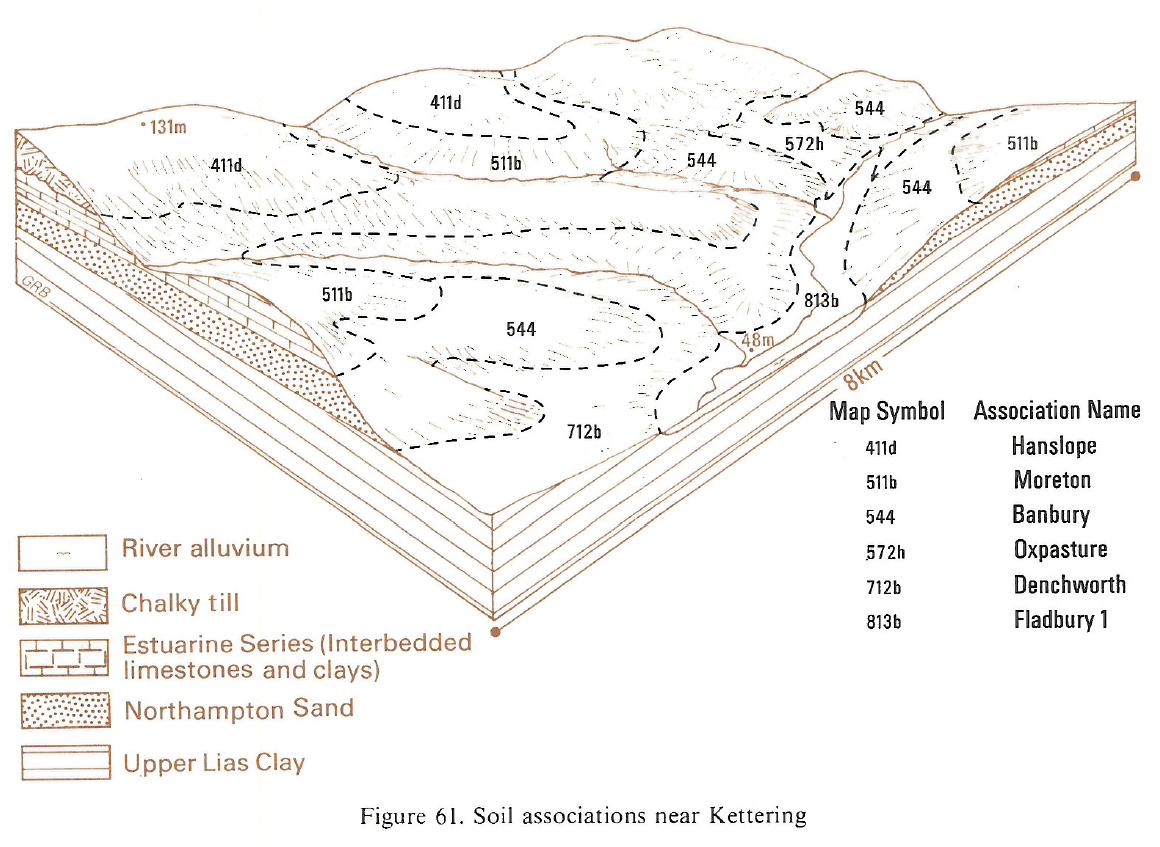
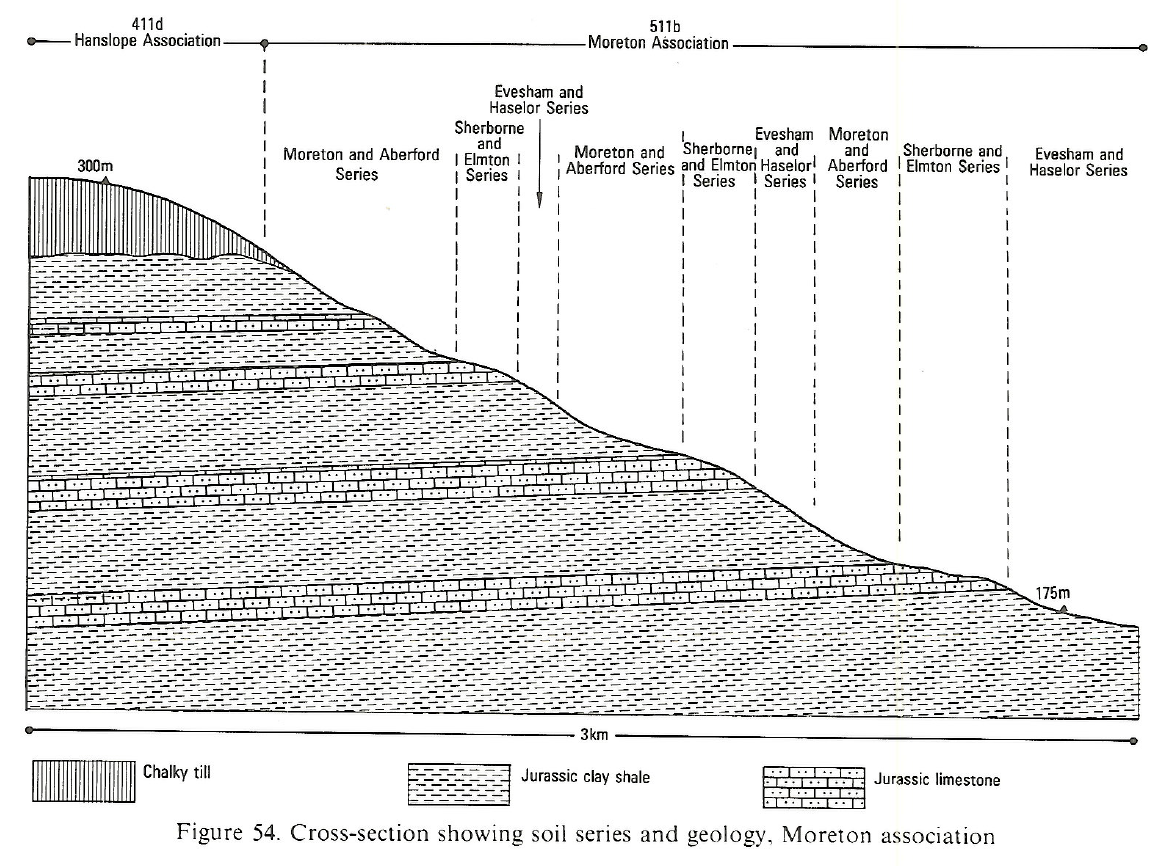
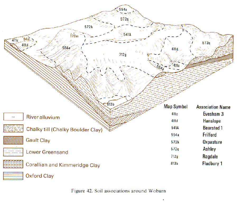
This association of Hanslope series and Faulkbourne series, calcareous pelosols and argillic pelosols respectively, provides some of the most extensive cereal growing land in the Midlands and Eastern England, covering 3,634 km². The soils are developed in chalky till on low plateaux and gently to strongly sloping valley flanks. Both the main soils are clayey to the surface, have slowly permeable subsurface horizons but are seldom seriously waterlogged. Hanslope soils have a calcareous, chalky subsurface horizon that is normally brown but can be grey mottled. It passes below into a dense mottled substrate containing chalk stones. Faulkbourne soils are similar, but have brown decalcified upper horizons. Included in the association are small areas of Ragdale, Beccles and Ashley series mainly on level hilltops. The Hanslope association covers almost 170 km², mainly in Leicestershire, on moderately or strongly sloping valley sides or convex upper slopes, often adjoining the Ragdale association on more level plateau sites. Hanslope soils account for over half of the map unit. Ashley series is a common component around Birstall, South Croxton and Great Dalby. Small patches of stagnogley soils, Denchworth, Lawford and Wickham series, argillic pelosols, Holdenby seriesand pelo-alluvial gley soils, Fladbury series are included at the margins of delineations or in narrow valleys cutting through the chalky till to the underlying Jurassic clay shales.
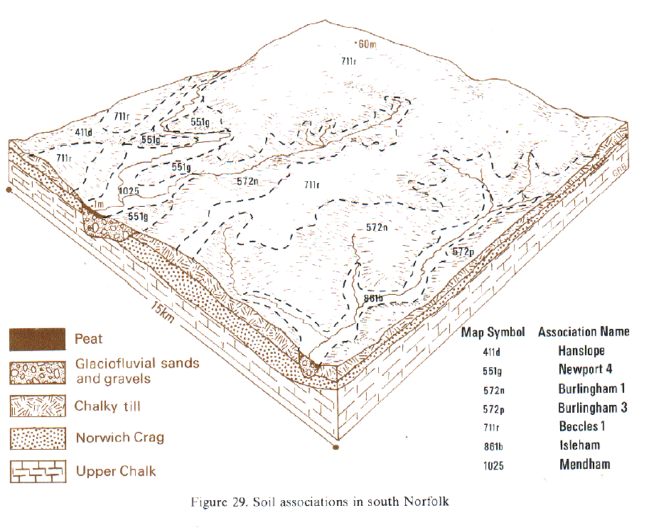
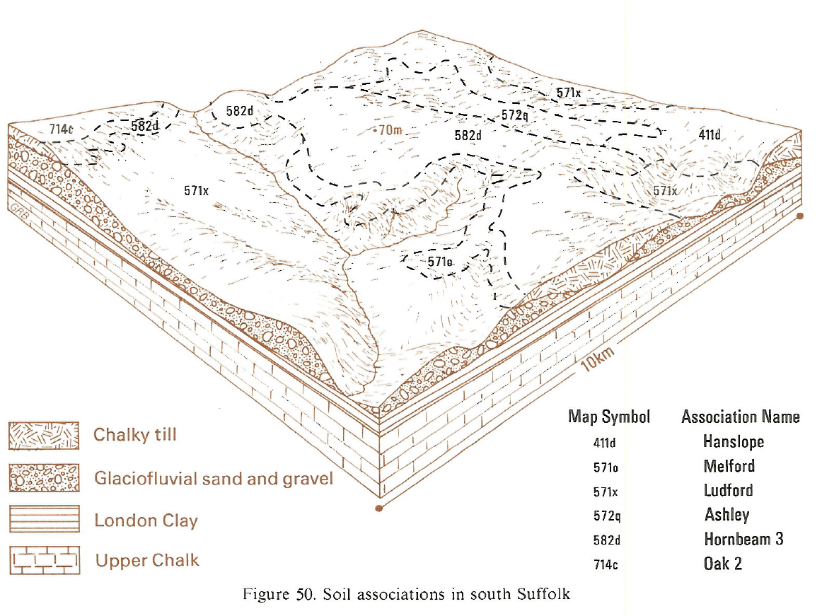
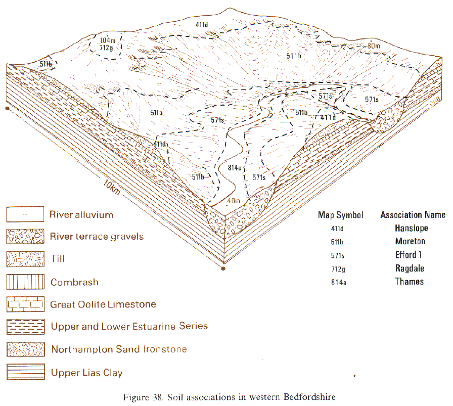
In Bedfordshire, west Cambridgeshire, south Suffolk and parts of Northamptonshire, Hanslope series covers three-quarters of the soil association. Faulkbourne soils occur on level sites and well-drained clayey Stretham series is common in places on valley sides and narrow spurs, often adjacent to other associations. Fine loamy Cannamore series is found locally on convex crests where the subsoil contains more fine chalk and is more loamy than usual, or where the surface horizons contain some aeolian drift. Colluvial soils are found locally in dry valleys. In Essex, and parts of Suffolk, Hertfordshire and Northamptonshire, Hanslope soils cover only about half of the association with Faulkbourne, Ashley and Ragdale soils common on level sites and Stretham series on slopes and narrow spurs. Faulkbourne soils are particularly common around Braintree and between Chelmsford and Great Dunmow. Near Stevenage and Letchworth, the boundaries with the Hornbeam associations are complex resulting in inclusions of Marlow and Hornbeam series. Generally, inclusions of other soils are rare except in East Suffolk where small patches of Newport soils occur on lower slopes on small patches of glaciofluvial sands and Crag deposits .
Chalky till deposits extend from the Midland plains just into north-east Gloucestershire, where Hanslope soils cap 3 km² of hilltop in the Liassic vale east of Chipping Campden. They cover about half of the land, with subsidiary Faulkbourne and occasional Ragdale and Ashley series. A thin strip of loamy drift is included at the margins of the association on lower and middle valley sides.
In South East England, the association is confined to north Buckinghamshire, where it occurs on plateaux sites. It contains random inclusions of Ashley series and small patches of Denchworth, Lawford, Wickham, Oxpasture and Fladbury series, either at the edges of delineations or in narrow valleys cutting through the chalky till to the underlying Jurassic clay shales.
Soil Water Regime
When undrained, Hanslope and Faulkbourne soils are seldom seriously waterlogged (Wetness Class III), despite a slowly permeable subsurface horizon, and waterlogging at shallow depth is brief in duration. Both soils are responsive to drainage which can achieve an improvement to Wetness Class II in the drier districts (less than 125 F.C. days). With moderately permeable upper horizons but restriction at depth, they have a moderate potential for winter rain acceptance. Disposal of excess winter rain at shallow depth is by lateral flow and is more rapid on sloping than on level sites.
Cropping and Land Use
Hanslope and Faulkbourne soils have clayey water-retentive topsoils and slowly permeable subsoils but after appropriate drainage treatment they are moderately easy to work for sustained arable cropping. Opportunities for spring cultivations are restricted, so autumn-sown crops of winter cereals and oilseed rape are preferred, though spring barley, beans, sugar beet, brassicas and potatoes are also grown. These are soils on which, with good management, direct drilling can achieve similar yields of winter cereals to those achieved with conventional cultivation. Direct drilled spring crops, however, are less successful. Profile available water is slightly deficient for arable crops but the soils are moderately droughty for grass. Irrigation of root crops on these soils, however, can increase the risk of soil structural damage during harvesting. A significant proportion of the land is in grass, either leys as part of an arable rotation or permanent grassland on the steeper slopes, but a large retained water capacity in the topsoil and the associated poaching risk restricts winter use. Drought reduces summer herbage yields. With a mean field capacity period ranging from 90 days near Cambridge to 150 days in wetter areas of Northamptonshire, there is a corresponding range in field work opportunity. Over much of Essex, Suffolk and Northamptonshire, opportunities for spring cultivation are restricted, especially in wet years, and autumn-sown cereal and oilseed rape crops are preferred. However, in the dry district between Bedford and Cambridge, the greater opportunities for spring cultivation, even in wet years, give greater flexibility and some spring barley, beans, peas, brassicas and potatoes are grown. With good management, direct drilling can achieve similar yields of winter cereals to those achieved with conventional cultivation. Direct drilled spring crops, however, are less successful. In eastern districts grassland is mainly restricted to steep slopes but grassland is more common in Northamptonshire where the soils are less droughty. Potassium and magnesium status is generally good and phosphorus levels depend mainly on past management. Acidity is rare, base status is high and there are no trace element problems.
0411d HANSLOPE
Distribution Map
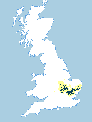 |
Note that the yellow shading represents a buffer to highlight the location of very small areas of the association.
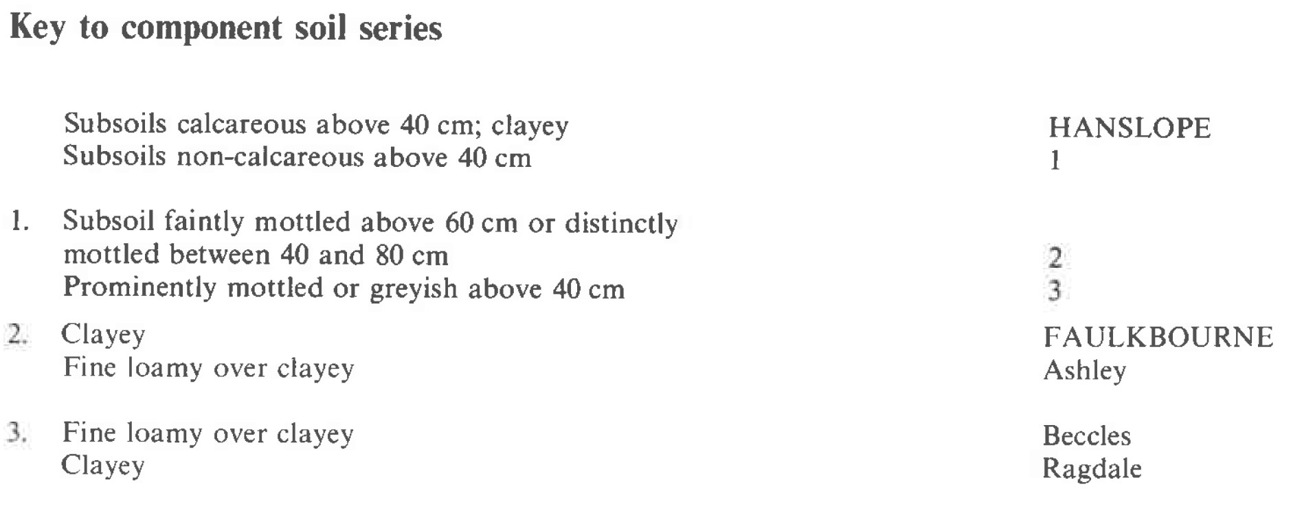
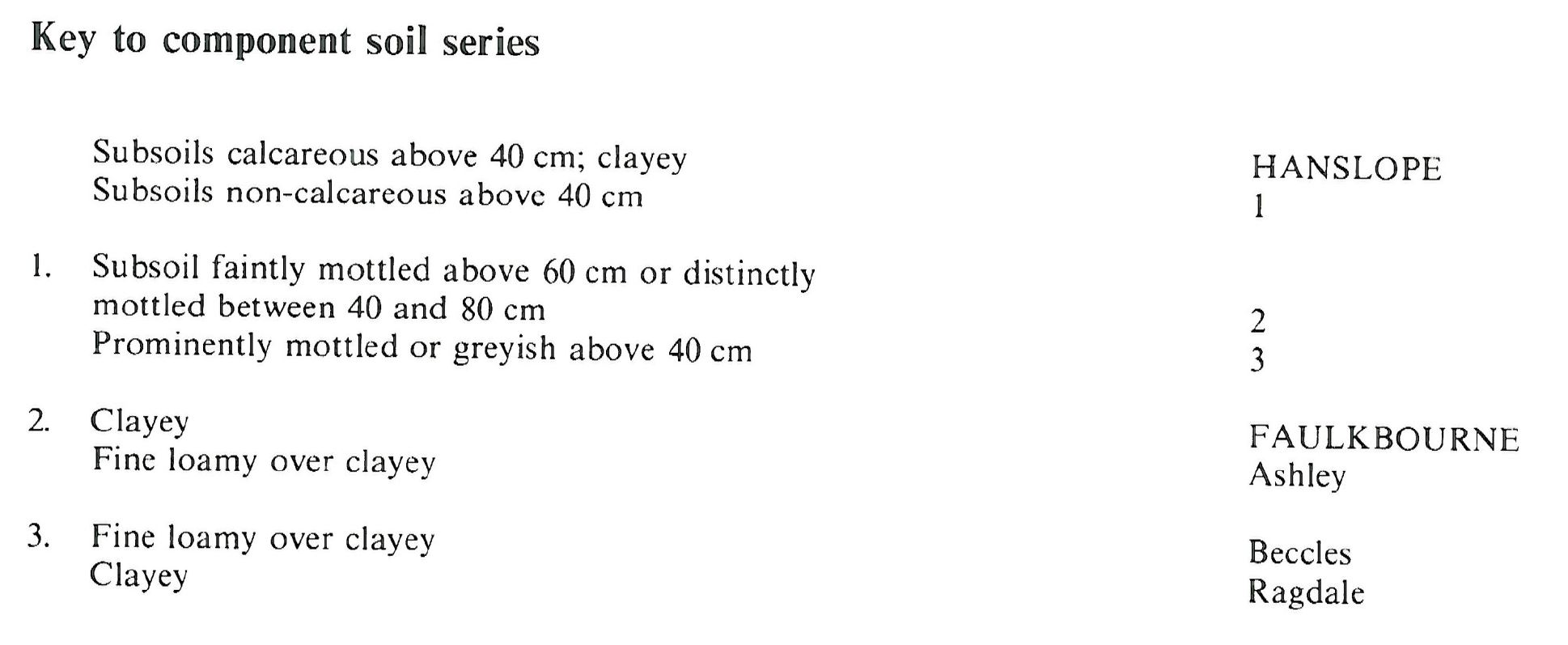
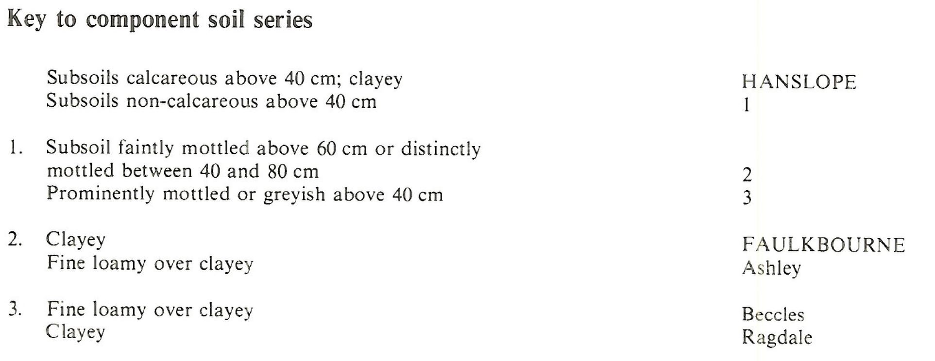
Keys to component soil series
Midlands
 |
South Eastern Region
 |
Eastern Region
 |
Typical Landscapes
Midlands
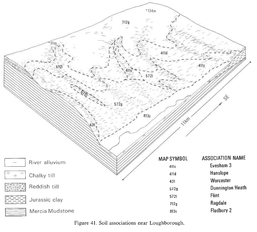 |
Eastern Region
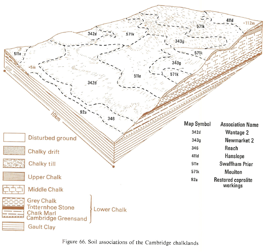 |
Eastern Region
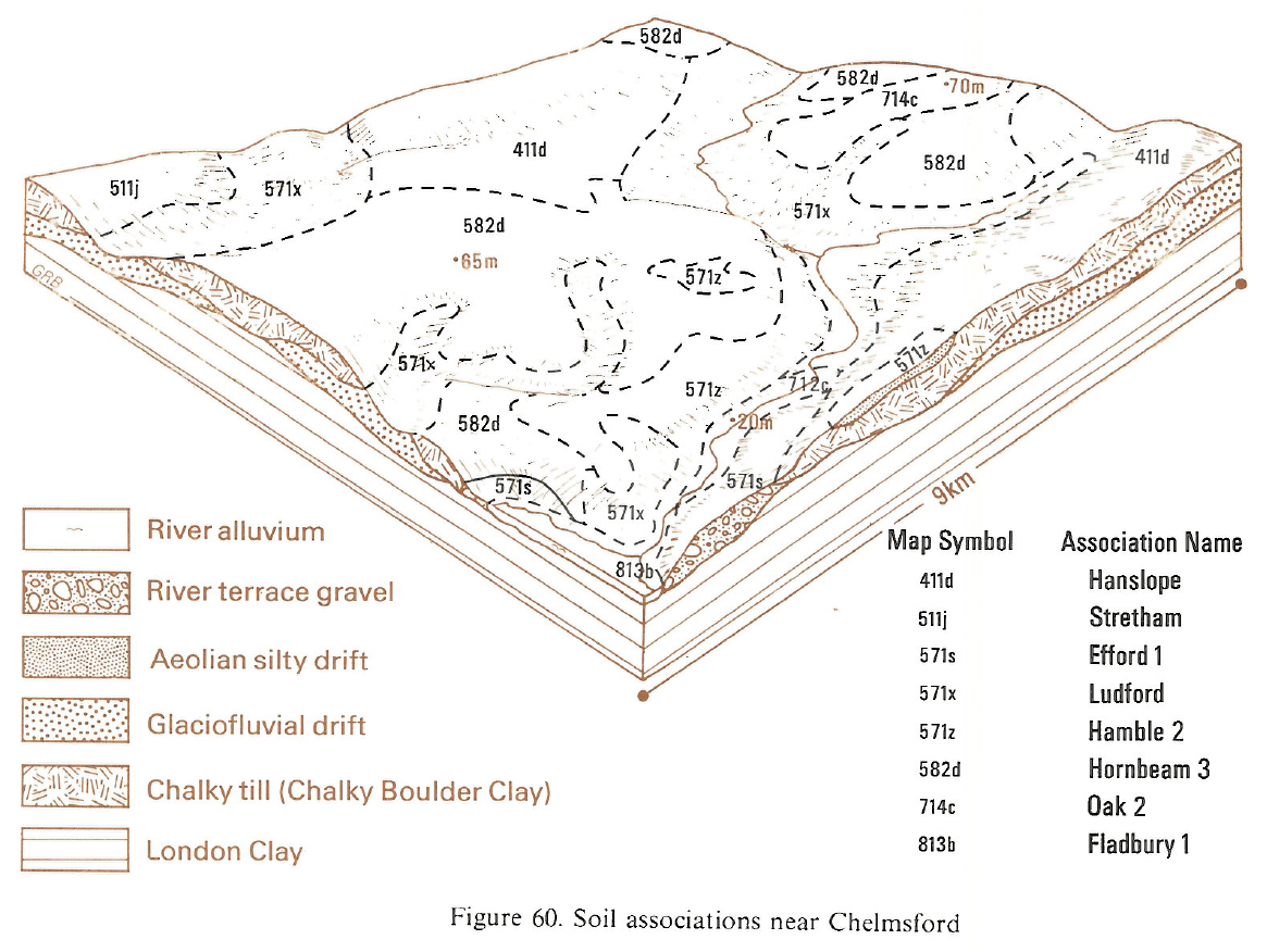 |
Eastern Region
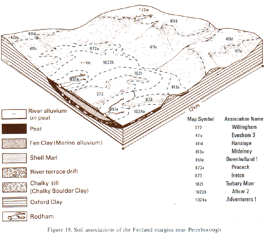 |
Eastern Region
 |
Eastern Region
 |
Eastern Region
 |
Eastern Region
 |
Eastern Region
 |
Eastern Region
 |
All information Copyright, Cranfield University © 2024
Citation: To use information from this web resource in your work, please cite this as follows:
Cranfield University 2024. The Soils Guide. Available: www.landis.org.uk. Cranfield University, UK. Last accessed 16/04/2024
