
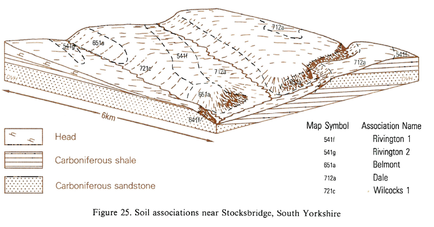
Soil Associations
0541f RIVINGTON 1
Soil and site characteristics
Well drained coarse loamy soils over sandstone. Locally associated with similar soils affected by groundwater.
Geology
Carboniferous and Jurassic sandstone
Cropping and Land Use
Dairying and stock rearing; some arable land in drier areas; coniferous woodland.
Component soil series
| Subgroup | Series name | Percentage | WRB 2006 link |
|---|---|---|---|
| 5.41 | RIVINGTON | 60% | Eutric Endoleptic Cambisols |
| 5.43 | MELBOURNE | 30% | Eutric Endogleyic Endoleptic Cambisols |
Covers 1024 km2 in England and Wales
Soilscapes Classification
| 6 |
Freely draining slightly acid loamy soils |
0541f RIVINGTON 1
Detailed Description
This association covers over 800 km² of Northern England and the Midlands, being most extensive in Yorkshire. It consists mainly of well drained coarse loamy soils on gentle or moderate slopes on sandstone, generally below 200 m O.D. The chief soils are the well drained Rivington series, typical brown earths, and the Melbourne series, gleyic brown earths. The association is found on the wider outcrops of Coal Measures sandstone in Staffordshire, Derbyshire and Warwickshire, on Triassic sandstone between Coventry and Leamington and on Devonian sandstone in the Clee Hills. It is most widespread in east Derbyshire where it covers about 50 km² of gently and moderately sloping land and is dominated by the Rivington series. There are also profiles of Neath and Newtondale series. The subsidiary Melbourne series is wetter than Rivington because of thin, clayey bands in the sandstone below 100 cm. The Rivington series includes soils formerly described as Swindon Bank series, and Clive series.
In the South West it is found north of the Forest of Dean on Howle Hill where the well drained Rivington series, typical brown earths, formerly mapped in the Cinderford district as Swindon Bank series are dominant. Subordinate soils include Melbourne series, stagnogleyic brown earths, and Newtondale series, brown rankers. There is some disturbed ground where opencast workings have been restored to agriculture.
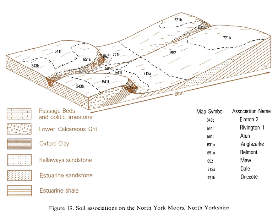
The association is found throughout foothills of the Pennines on the eastern Carboniferous rocks, and on the Moors and Howardian North York Hills on Jurassic rocks. The Rivington series includes soils formerly described as Swindon Bank series and Firby series. The Wick and Arrow series, and, more rarely, the Wigton Moor series are found with the Melbourne series on receiving sites or where there is thick sandstone Head. There are some Newtondale soils where sandstone is close to the surface and, occasionally, Bridgnorth series where the parent rock is coarse grained. In places the sandstone is stained red, particularly where the land surface is close to an exhumed pre-Permian surface and subsoils there have reddish colours. Bardsey series occurs locally where there is a slowly permeable substrate. On recently reclaimed land, vestiges of former podzols, stagnopodzols or brown podzolic soils can be found.
Soil Water Regime
The Rivington series is very porous and well drained (Wetness Class I). The Melbourne series, though porous, has slight restrictions to downward water movement and is occasionally waterlogged in winter (Wetness Class II). Excess winter rainwater passes downwards easily through the permeable substrate. Soils, where the annual rainfall is less than 850 mm, are moderately droughty under grass and slightly droughty for arable crops. The Melbourne series contains larger amounts of water available to plants, particularly sugar beet and potatoes, than the Rivington series and is therefore less droughty.
Cropping and Land Use
These soils provide easy working land and are mainly in arable use. Winter and spring cereals are the main crops but there is intensive market gardening, mostly brassicas, around Melbourne. On the Clee Hills, however, the soils support permanent grassland and woodland, because of climate and steepness of slope.In areas with less than 750 mm rainfall, autumn ploughing is not essential as there are ample opportunities for spring cultivations. The permeable topsoil dries out sufficiently after a few rain-free days for ploughing and other cultivations to proceed at intervals during winter and spring, though care is needed to avoid a subsoil pan caused by heavy machinery. Traditional equipment is adequate but on Melbourne soils timing is less flexible than on the drier Rivington soils. Generally the soils are well suited to direct drilling and yields are similar to those obtained by conventional cultivations. Some sandstone is ploughed to the surface but the stones weather readily and only cause drilling or germination difficulties on the shallowest and stoniest soils. The soil is naturally acid and regular dressings of lime and fertilizer are desirable, as soluble nutrients are easily leached out. The land often suffers drought in summer, so grass yields are usually small and autumn growth is limited, but trafficability is good.
In the North the soils have only minor limitations to tree growth apart from the moderately small available water capacity. Tree roots penetrate deeply and a wide range of species can be supported, including Sitka spruce, Norway spruce, Douglas fir, Japanese and hybrid larch, sycamore, beech and elm. Oak could also be grown on some sites and western hemlock has yielded well in experimental plots. The only extensive plantations are on the North York Moors but there are many small woodlands and copses scattered throughout the area.
0541f RIVINGTON 1
Distribution Map
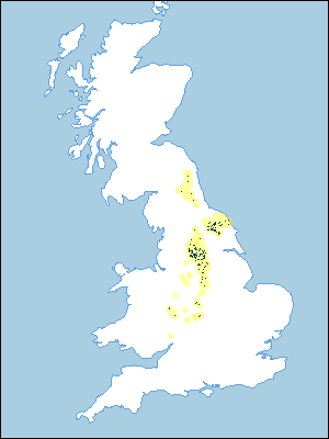 |
Note that the yellow shading represents a buffer to highlight the location of very small areas of the association.
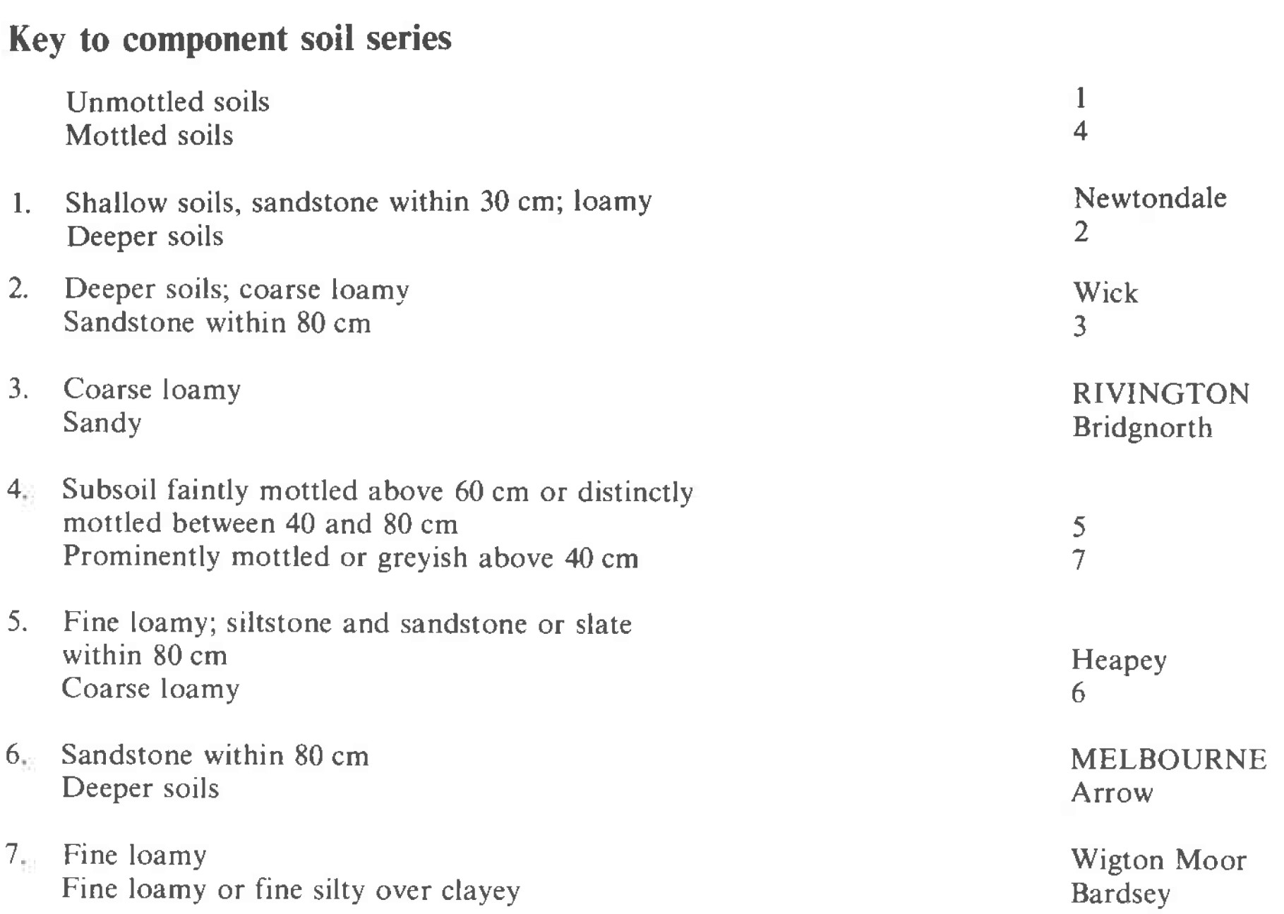
Keys to component soil series
Midlands
 |
Northern Region
 |
Typical Landscapes
Midlands
 |
Northern Region
 |
Northern Region
 |
All information Copyright, Cranfield University © 2024
Citation: To use information from this web resource in your work, please cite this as follows:
Cranfield University 2024. The Soils Guide. Available: www.landis.org.uk. Cranfield University, UK. Last accessed 18/04/2024
