
Soil Associations
0541n Trusham
Soil and site characteristics
Well drained fine loamy soils over deeply weathered rock locally. Some shallow soils. Steep slopes in places. Bare rock locally.
Geology
Basic igneous and metamorphic rock
Cropping and Land Use
Dairying and stock rearing, some cereals and horticultural crops in drier districts; some moorland of good grazing value.
Component soil series
| Subgroup | Series name | Percentage | WRB 2006 link |
|---|---|---|---|
| 5.41 | TRUSHAM | 18% | Eutric Endoleptic Cambisols |
| 3.13 | DUNWELL | 17% | Umbric Leptosols |
| 5.41 | RYDON | 17% | Eutric Chromic Endoleptic Cambisols |
| 5.41 | LESNEAGUE | 16% | Eutric Endoleptic Cambisols |
| 5.41 | ERISEY | 16% | Eutric Cambisols |
| 5.41 | DENBIGH | 16% | Eutric Endoleptic Cambisols |
Covers 323 km2 in England and Wales
Soilscapes Classification
| 7 |
Freely draining slightly acid but base-rich soils |
0541n Trusham
Detailed Description
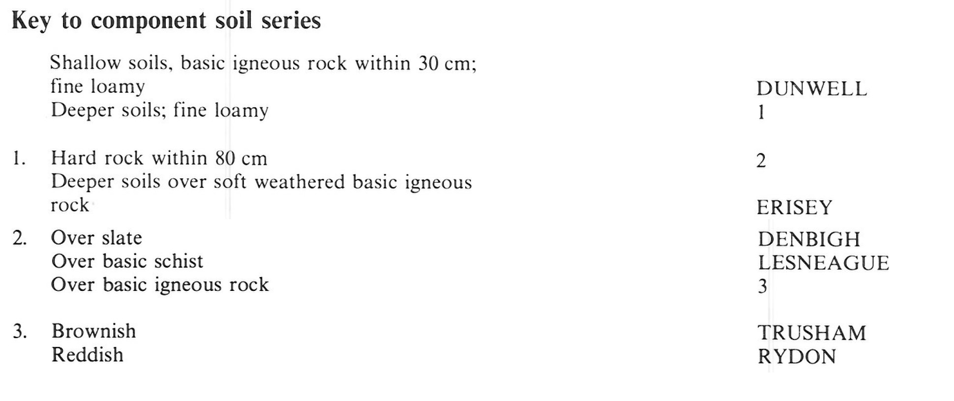
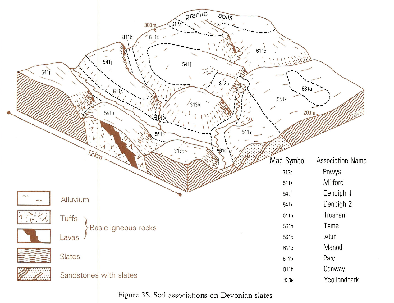
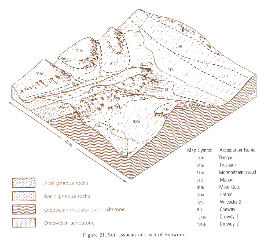
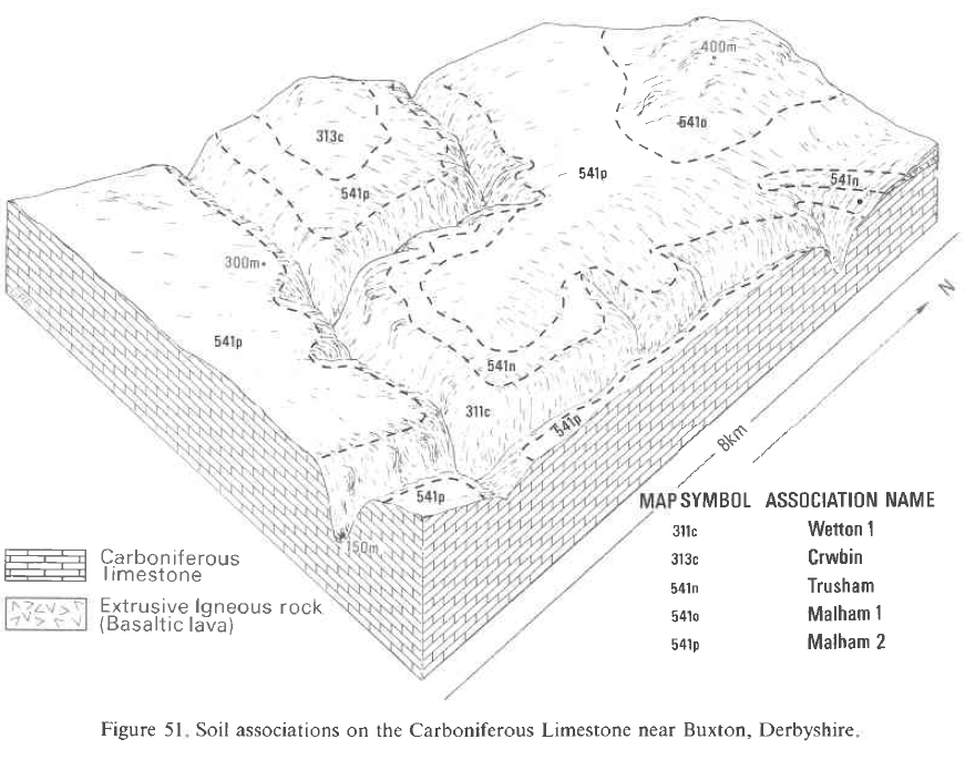
This association covers 312 km² mainly in Devon and Cornwall on basic tuffs and lavas interbedded with Devonian slates or on intrusions of altered dolerite and greenstone around the granite outcrops of Bodmin Moor and Dartmoor. The soils are also found on the basic schists and gabbro on the Lizard and on schists around Start Point. The association is also mapped in the Peak District of Derbyshire and in the Welsh Borderland and in north Wales there are small patches around Snowdon. Most of the soils, Trusham, Lesneague and Denbigh series, are fine loamy typical brown earths over hard rocks or stony Head. The Trusham soils overlie the more massive basic igneous rocks such as dolerite or gabbro while the Lesneague soils are are on schists and Denbigh soils on slates. Rydon soils are similar to Trusham soils but redder in colour. Erisey series, typical brown earths, occurs on deeply weathered gneiss and there are occassional Dunwell soils, shallow loamy brown rankers.
The Rydon series is a common associate in south Devon between Totnes and Ivybridge where the Devonian rocks are reddened and near Exeter on volcanic rocks of Permian age. Erisey series predominates on the Lizard and sporadically elsewhere where the rocks are deeply weathered, while Lesneague soils are confined to the hornblende schists of the Lizard and Start peninsulas. Denbigh soils are included where slate is interbedded with igneous rock. Shallow Dunwell soils occupy convex brows and ridge crests. Near Penzance and St Ives some soils have dark man-made topsoils from the addition of sand, seaweed and town refuse over a long period.
Soil Water Regime
The soils are well drained (Wetness Class I) and readily absorb surplus winter rainfall even on the steepest slopes. There is a wide range of rainfall so droughtiness varies. Table 31 illustrates droughtiness for grass, winter wheat, spring barley and potatoes in west Cornwall around St Erth. On Dartmoor the higher rainfall overcomes the potential droughtiness of these soils so grass production is sustained throughout the growing season.
Cropping and Land Use
In west Cornwall there is a long growing season and the soils allow a wide range of crops to be grown, though dairying is the major enterprise. Near Hayle, most slopes are relatively gentle and arable cropping is widespread. The soils can be worked soon after periods of rain. Generally, working conditions in spring are less suitable than in autumn. Around Marazion calcareous beach sand is added regularly to land used for the production of brassica crops. On the Lizard, cereals are grown on Erisey soils, but on more dissected land with Lesneague soils, grass is the main crop. Droughtiness limits grass growth on shallow soils during dry summer months though this is compensated for by the length of the growing season which extends almost throughout winter. Exposure is a severe limitation to cropping on west-facing coasts and on hill tops. Reddish soils of the Rydon series form a belt of mixed farming country around Totnes, where steep slopes are the main limitation on agricultural use. Near Dartmoor, grassland becomes predominant, dairying eventually giving way to stock rearing on the permanent pasture of the moorland fringe. The soils here poach under the wettest conditions only, so they are well suited to pasture, except where steep slopes or rock outcrops and boulders seriously restrict their use. The association rises to 465 m O.D. on west Dartmoor, where the growing season is short and yields reduced. Some of the highest land is unenclosed, especially where steep slopes or tors and boulders preclude agricultural improvement, but the acid bent-fescue grassland is of high hill grazing value. As the granite outcrop is approached there is an increase in topsoil organic matter content accompanied by a change to bristle agrostis or Molinia grassland of lower grazing value.
0541n Trusham
Distribution Map
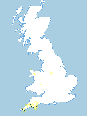 |
Note that the yellow shading represents a buffer to highlight the location of very small areas of the association.
Keys to component soil series
South Western Region
 |
Typical Landscapes
South Western Region
 |
Wales
 |
Midlands
 |
All information Copyright, Cranfield University © 2024
Citation: To use information from this web resource in your work, please cite this as follows:
Cranfield University 2024. The Soils Guide. Available: www.landis.org.uk. Cranfield University, UK. Last accessed 20/04/2024
