Soil Associations
0572d Whimple 1
Soil and site characteristics
Reddish fine loamy over clayey soils with slowly permeable subsoils and slight seasonal waterlogging. Associated with similar well drained soils, some over gravel.
Geology
Drift over Permo-Triassic reddish mudstone
Cropping and Land Use
Cereals and some potatoes; dairying on short term grassland; some horticultural crops.
Component soil series
| Subgroup | Series name | Percentage | WRB 2006 link |
|---|---|---|---|
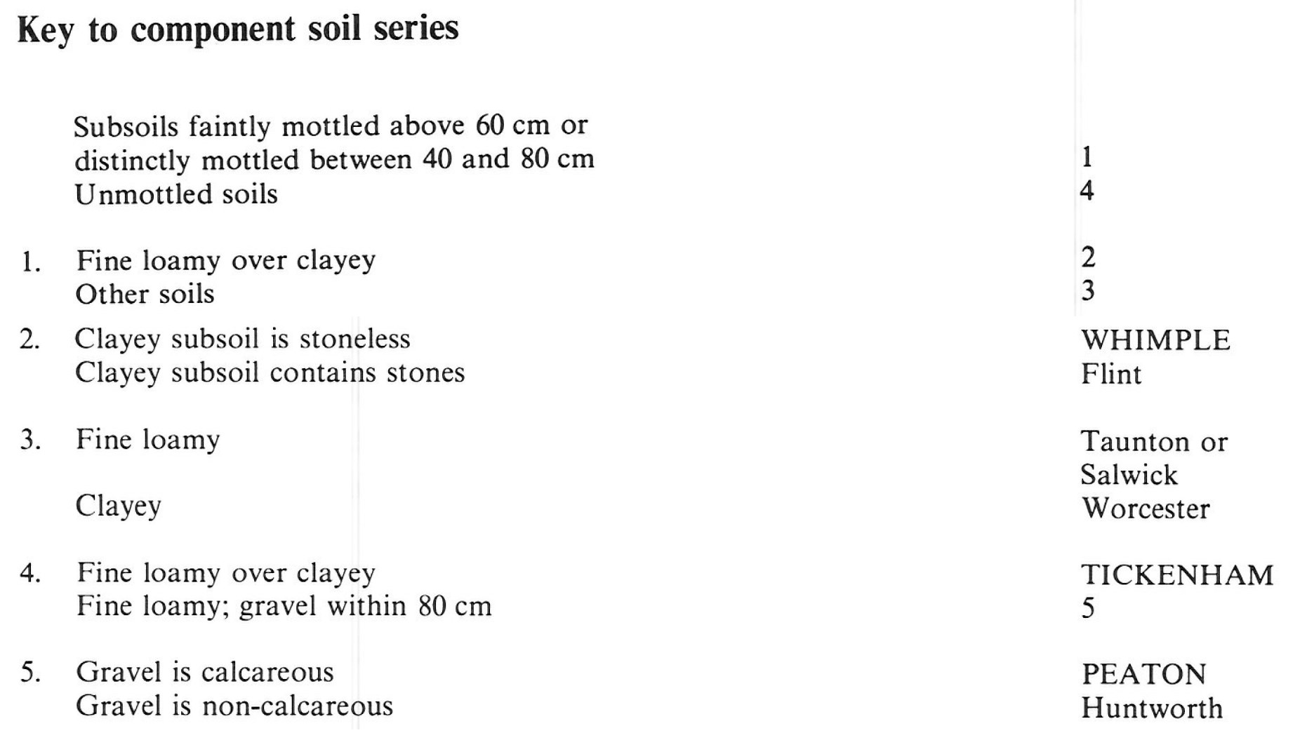
| 5.72 | WHIMPLE | 33% | Chromic Endostagnic Luvisols |
| 5.71 | PEATON | 31% | Eutric Chromic Endoskeletic Luvisols |
| 5.71 | TICKENHAM | 27% | Eutric Chromic Luvisols |
Covers 182 km2 in England and Wales
Soilscapes Classification
| 8 |
Slightly acid loamy and clayey soils with impeded drainage |
0572d Whimple 1
Detailed Description
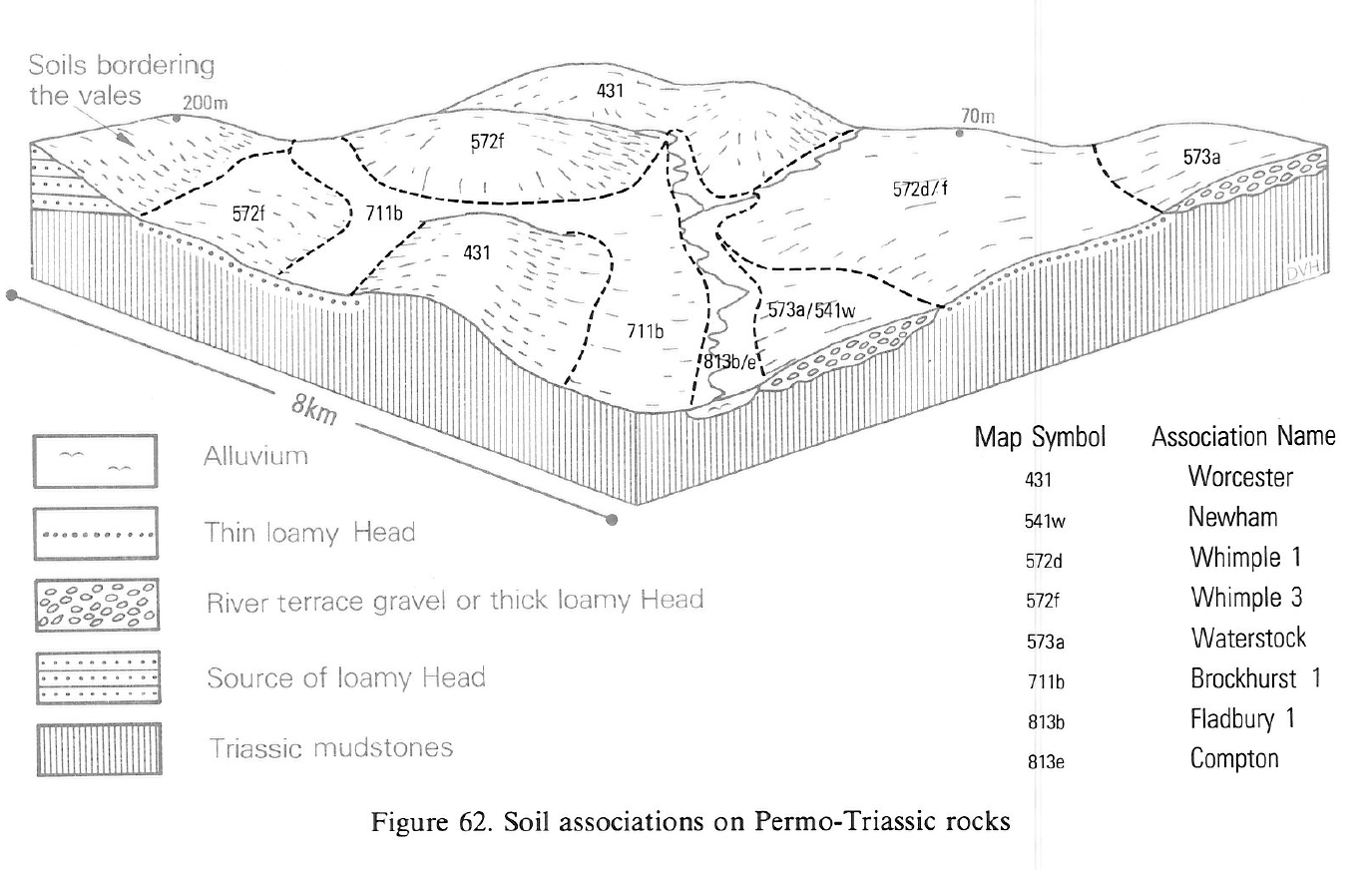
The association includes soils in reddish drift of variable thickness over Triassic mudstone. It occurs mainly on the footslopes of higher ground formed by Palaeozoic limestone, sandstone or slate, or Cretaceous sands with chert, from which the drift is derived. Whimple soils, stagnogleyic argillic brown earths, cover about one third of the land, where the drift is relatively thin. These soils have upper fine loamy or fine silty horizons over a slowly permeable clayey horizon which restricts water movement. The associated Peaton and Tickenham series are typical argillic brown earths in thick drift. Peaton soils have fine loamy horizons overlying limestone gravel within 80 cm depth. In the Tickenham series the fine loamy horizon overlies a stony clayey horizon, which in turn passes to mudstone below 80 cm depth. Other loamy or loamy over clayey soils, mostly in thick drift containing siliceous stones with occasionally waterlogged slowly permeable or gravelly subsoils, include Flint and Taunton series. There are also clayey soils of the Worcester series on slopes where drift is largely absent.
In south-west Somerset around Bridgwater, Wellington and Taunton the drift is mainly derived from the slates, sandstones and grits of the Quantock and Brendon Hills, together with some chert from the Greensand of the Blackdown Hills. Whimple soils cover half the land mainly on gentle or moderate slopes. On ridge crests and in low concave sites near streams Flint and Salwick series, Taunton and Huntworth series are found together with small areas of typical stagnogley soils.
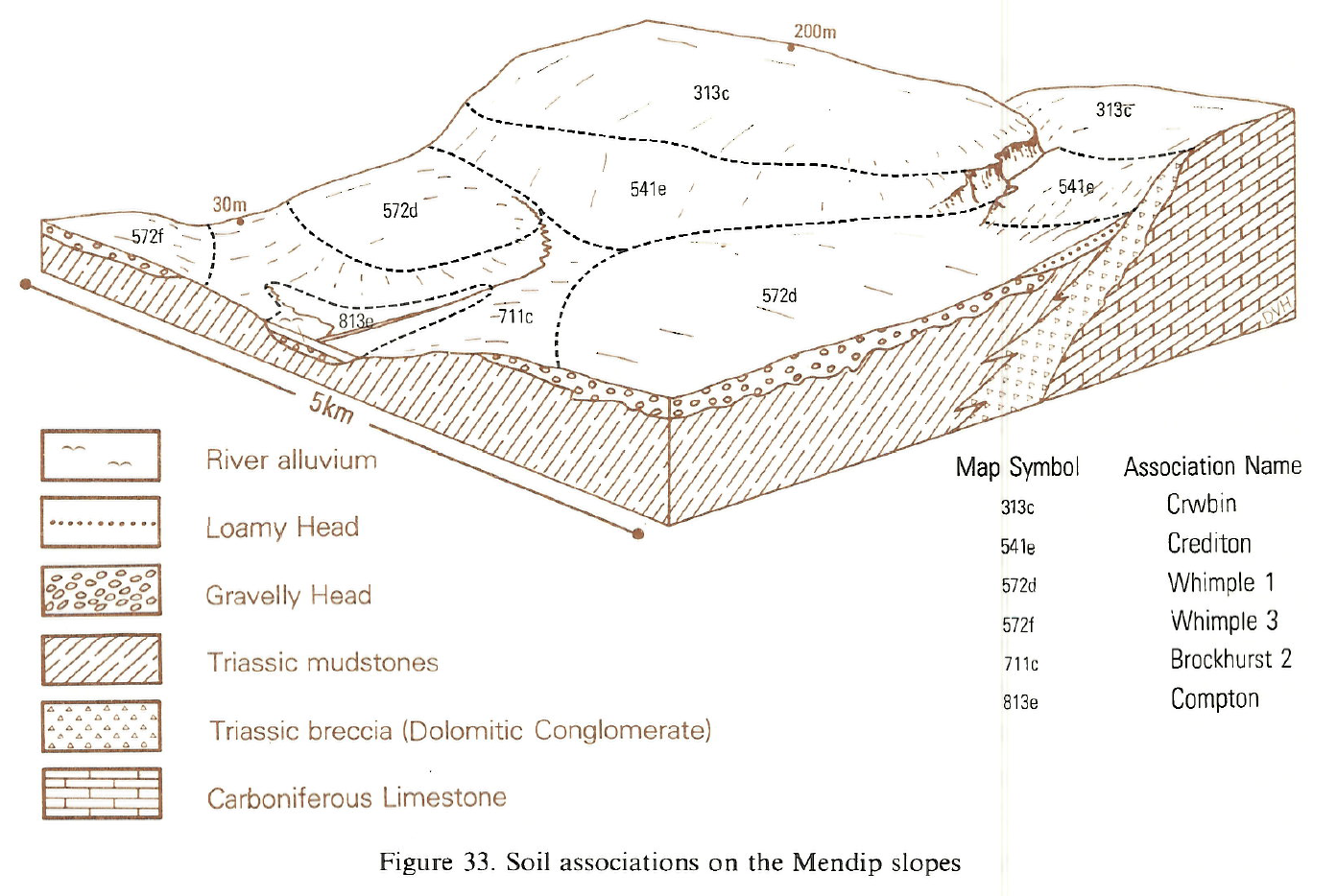
In Avon and north Somerset the drift contains hard limestone derived from the Mendips, Broadfield Down, and lesser ridges formed of Carboniferous limestone. The drift is relatively thick near to these sources and Whimple series is a less extensive component than elsewhere. Peaton soils occur on several well-drained gravel fans extending from the mouths of combes as at Burrington and Cheddar, accompanied by Huntworth soils where sandstone is the main component of the stone assemblage. There are smaller areas of the association in west Gloucestershire where some of the drift is derived from Silurian and Devonian rocks. In the Somerset Levels, low islands rising above the alluvium at Othery and Westonzoyland are formed of reddish mudstones overlain by calcareous sands and clays of the Burtle Beds. The soils, referred to in part as Chedzoy series, are mostly formed in a drift composed of a mixture of the sands with the underlying mudstone and are included in this association.
Soil Water Regime
Whimple soils have a slowly permeable subsoil causing seasonal waterlogging (Wetness Class III), Tickenham and Peaton soils are naturally well drained (Wetness Class I).
Cropping and Land Use
Arable crops and temporary grass occupy most of the land on these soils, but, in north Somerset and Avon, horticulture is important, including soft fruits, salad crops and flowers, especially in the Cheddar district on south-facing slopes. Opportunities for landwork on Whimple soils are restricted even in an average autumn and negligible in spring or in a wet autumn. On the better drained Tickenham and Peaton soils in the Bristol district landwork opportunities are more numerous.
0572d Whimple 1
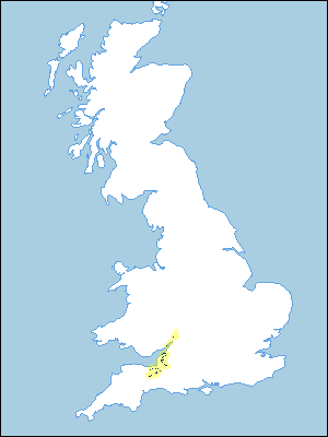
Distribution Map
 |
Note that the yellow shading represents a buffer to highlight the location of very small areas of the association.
Keys to component soil series
South Western Region
 |
Typical Landscapes
South Western Region
 |
South Western Region
 |
All information Copyright, Cranfield University © 2024
Citation: To use information from this web resource in your work, please cite this as follows:
Cranfield University 2024. The Soils Guide. Available: www.landis.org.uk. Cranfield University, UK. Last accessed 17/04/2024
