Soil Associations
0572o BURLINGHAM 2
Soil and site characteristics
Deep fine loamy soils with slowly permeable subsoils and slight seasonal waterlogging. Some slowly permeable seasonally waterlogged fine loamy soils. Some well drained fine and coarse loamy soils.
Geology
Chalky till
Cropping and Land Use
Winter cereals, some field vegetables.
Component soil series
| Subgroup | Series name | Percentage | WRB 2006 link |
|---|---|---|---|
| 5.72 | BURLINGHAM | 60% | Endostagnic Luvisols |
| 7.11 | HOLDERNESS | 20% | Eutric Albic Luvic Stagnosols |
| 5.71 | LUDFORD | 15% | Haplic Luvisols |
Covers 319 km2 in England and Wales
Soilscapes Classification
| 8 |
Slightly acid loamy and clayey soils with impeded drainage |
0572o BURLINGHAM 2
Detailed Description
This association is dominated by fine loamy soils with slowly permeable subsoils formed in chalky till. Stones of Norwegian origin are common in the till, along with much locally derived chalk at depth. The soils occur in small scattered areas in Holderness, and on undulating ground at the eastern margin of the chalk Wolds in Humberside and Lincolnshire where it covers less than 2 km². Burlingham series which belongs to the stagnogleyic argillic brown earths, is the principal soil. Other soils include the Holderness series, of slowly permeable fine loamy typical stagnogley soils, and well drained Ludford soils, typical argillic brown earths. Holderness series occurs and is most common on low flat ground particularly where the land adjoins the Holderness association. The Ludford series is most common on higher ground on the edge of the Lincolnshire Wolds where the association passes into the adjacent Hunstanton association, and here there are some profiles of the coarse loamy Wick series.
The association covers 274 km², large areas being covered solely by the Burlingham series. The Holderness series occurs at random but is most common on low flat ground, particularly where the land adjoins the Holderness association. The Ludford series is most common on higher ground near the Wolds where the association passes into the related Hunstanton association, and here there are some coarse loamy Wick soils. There are few variations other than the occurrence of occasional coarse loamy profiles of the Wighill and Arrow series in Holderness. Altitude varies from 0 to 30 m O.D. in Holderness, to around 90 m O.D. near Immingham and 135 m O.D. near Flamborough Head.
Soil Water Regime
Most soils have slowly permeable subsoils and are occasionally or seasonally waterlogged (Wetness Classes II or III). Drainage measures are advisable to reduce waterlogging and so lengthen the landwork period. Subsoiling helps to reduce surface waterlogging. The main soils are slightly or moderately droughty under grass and most arable crops.
Cropping and Land Use
The soils are suited to general arable cropping. Cereals, oilseed rape and, to a smaller extent, potatoes and grass are grown. There is more opportunity to work the soils in autumn than in spring, when some soils can remain wet until the end of March. Direct drilling of autumn-sown crops speeds sowing and, if carefully done under suitable soil and weather conditions, gives yields similar to those from conventional cultivations.
In the North although seasonal wetness and fine loamy surface layers to some degree restrict flexibility, the soils are well suited to general arable cropping. Cereals, oilseed rape, field vegetables and to a smaller extent potatoes and grass are grown. Present farming reflects the popularity of cereals, but the other crops are widely grown, particularly near processing factories in Hull.The Burlingham and Holderness series are of average workability whilst the Ludford series is easy to work. The climate further east and south, in Holderness, and south of the Humber, is slightly drier and gives more working opportunities. In all areas there is more opportunity to work this land in autumn, spring cultivations being difficult even in a normal year and almost impossible in a wet season. Thus autumn ploughing is essential and timeliness critical. Subsoiling in early autumn when the soil is still dry helps to reduce wetness by breaking up subsurface compaction. Direct drilling of autumn sown crops speeds sowing and, if done carefully under suitable soil and weather conditions, should give yields similar to those from conventional cultivations.
Grass grows well but there is risk of poaching. Good yields of other crops are possible with normal fertilizer use but periodic liming is necessary to correct acidity. Slurry disposal is important since Humberside has one of the largest pig populations in Britain. The soils are only moderately suited for this practice however, and spreading in winter can result in wheel rutting, excessive surface wetness, severe compaction and possibly stream pollution. Exposure affects agriculture along the Holderness coast and is severe at Flamborough Head.
0572o BURLINGHAM 2
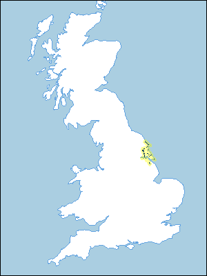
Distribution Map
 |
Note that the yellow shading represents a buffer to highlight the location of very small areas of the association.
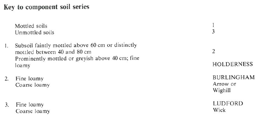
Keys to component soil series
Northern Region
 |
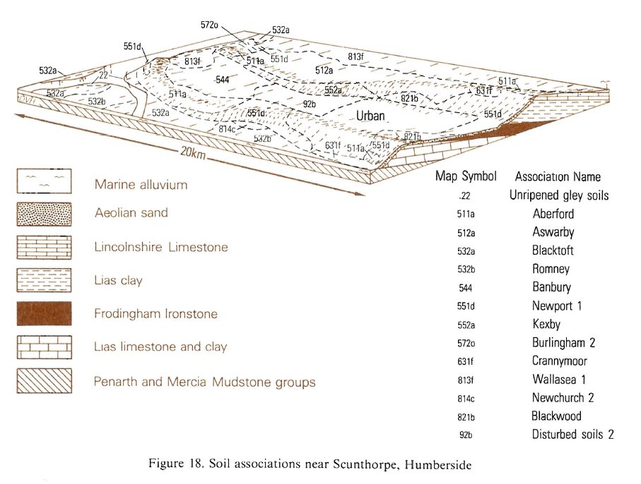
Typical Landscapes
Northern Region
 |
All information Copyright, Cranfield University © 2024
Citation: To use information from this web resource in your work, please cite this as follows:
Cranfield University 2024. The Soils Guide. Available: www.landis.org.uk. Cranfield University, UK. Last accessed 25/04/2024
