Soil Associations
0572t BISHAMPTON 2
Soil and site characteristics
Deep fine loamy and fine loamy over clayey soils with slowly permeable subsoils and slight seasonal waterlogging associated with similar slowly permeable seasonally waterlogged soils.
Geology
River terrace drift
Cropping and Land Use
Cereals, often winter sown, and short term grassland some vegetables and potatoes in the South East Region.
Component soil series
| Subgroup | Series name | Percentage | WRB 2006 link |
|---|---|---|---|
| 5.72 | BISHAMPTON | 40% | Endostagnic Luvisols |
| 7.11 | PINDER | 25% | Eutric Albic Luvic Stagnosols |
| 7.11 | WICKHAM | 15% | Eutric Luvic Planosols |
| 5.72 | OXPASTURE | 10% | Endostagnic Luvisols |
Covers 125 km2 in England and Wales
Soilscapes Classification
| 8 |
Slightly acid loamy and clayey soils with impeded drainage |
0572t BISHAMPTON 2
Detailed Description
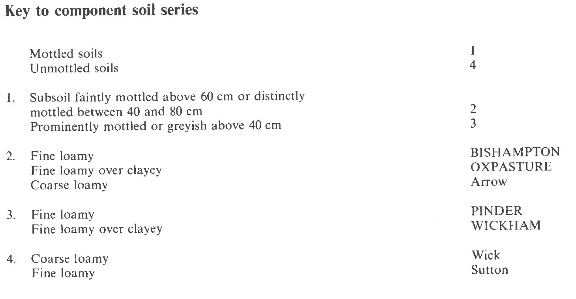
This association occurs mainly in Worcestershire and Warwickshire with small patches in Oxfordshire, Buckinghamshire and Bedfordshire. It consists of stagnoglcyic argillic brown earths, Bishampton and Oxpasture series, and typical stagnogley soils of the Pinder and Wickham series on river terrace drift and other but thinner drift over Jurassic clay or clay shale. Bishampton is the predominant soil and has fine loamy, slightly stony profiles that are waterlogged occasionally in winter. The wetter Pinder soils, formerly called Bow series, have a similar morphology, the wetness usually being caused by slowly permeable layers below 80 cm depth. Oxpasture and Wickham soils have fine loamy or fine silty over clayey profiles with slowly permeable clay within 80 cm depth. Coarse loamy Wick series, and similar but occasionally waterlogged Arrow soils occur where the river terrace deposits are of coarse texture. Sutton soils are locally a minor constituent on calcareous gravels.
This association covers just over 70 km² and is best represented on river terraces in the Bow valley north of Pershore. Bishampton and Pinder soils are mainly on the terrace flats with Oxpasture and Wickham soils on their convex edges but generally the drift is thin and impermeable. Clay usually occurs within 1 m of the soil surface in the west and Pinder series is more common in some localities than Bishampton soils. Wickham soils are extensive where the terrace drift is less than 80 cm thick. Further east, particularly around Stratford-upon-Avon, Bishampton soils predominate on thicker drift. On the upper fringes of the terraces, where the deposits thin over Lias clay, Oxpasture soils are important. Wick and Arrow soils have a sporadic distribution near Stratford-upon-Avon where the drift is of coarser texture.
The association occurs on low terraces in the Ouse valley west of Bedford. Here the drift is generally thick, so Bishampton series is dominant and Oxpasture soils are common only on sloping ground on the terrace edges. There are few inclusions of wetter soils but coarse loamy Wick, similar but periodically waterlogged Arrow and Sutton series occur in places.
The association covers only 31 km² on a low river terrace between the Avon and Severn near Twyning Green north of Tewkesbury. Bishampton and Pinder soils are mainly on the flat parts of the terrace, with Wickham and Oxpasture profiles on the convex edges. Arrow and Wick soils occur on small patches of coarse textured drift on the highest ground.
The association forms narrow continuous strips on low terraces in the Ouse valley around Milton Keynes and along the Evenlode valley in north Oxfordshire. Here the drift is generally thick so Bishampton series is dominant and Oxpasture soils are common on sloping ground of the terrace edges. There are few Pinder and Wickham soils but coarse loamy Wick, Arrow and Sutton soils are important locally. Much of the ground is disturbed by gravel excavations.
Soil Water Regime
The soil water regime of Bishampton and Pinder soils depends upon the thickness of the overlying drift and is also influenced to some extent by cultivation. Where undrained, Bishampton soils are occasionally waterlogged (Wetness Class III) and Pinder profiles are generally wet for longer periods (Wetness Class III or IV). Tile drainage improves the soil water regime to Wetness Class II for Bishampton series, but the formation of compacted layers, such as plough pans, may result in surface ponding. Oxpasture and Wickham soils have slowly permeable subsoils and are seasonally waterlogged (Wetness Class III and IV) but respond well to tile drainage.
Cropping and Land Use
The soils are mostly under cereals and ley grassland but some farms are under continuous corn, and intensive vegetables are grown locally. With a long period available for autumn field work but few days in the spring winter cereals are preferred. In wet years the soils can remain waterlogged until mid-May so precluding all cultivations. The soils have weak structure in the plough layer so careful timing of cultivations is needed and there is risk of damage to structure when crops are harvested late in the year. Surface capping and slaking are common under continuous cropping. Grass yields are moderate but the risk of poaching and sward damage restricts early and late grazing in Pinder soils. Bishampton soils carry only a small poaching risk. Bishampton, Pinder, Wickham and Oxpasture soils have similar profile available water capacities and are slightly droughty for cereals and moderately droughty for potatoes and grass. The soils are naturally acid and require regular applications of lime. Potassium levels are moderately low on arable land but under grassland there is usually sufficient for plant growth. Phosphorus levels are low and on the wetter soils may be held in relatively unavailable form.
0572t BISHAMPTON 2
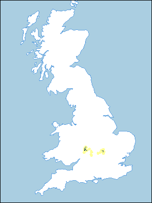
Distribution Map
 |
Note that the yellow shading represents a buffer to highlight the location of very small areas of the association.
Keys to component soil series
Midlands
 |
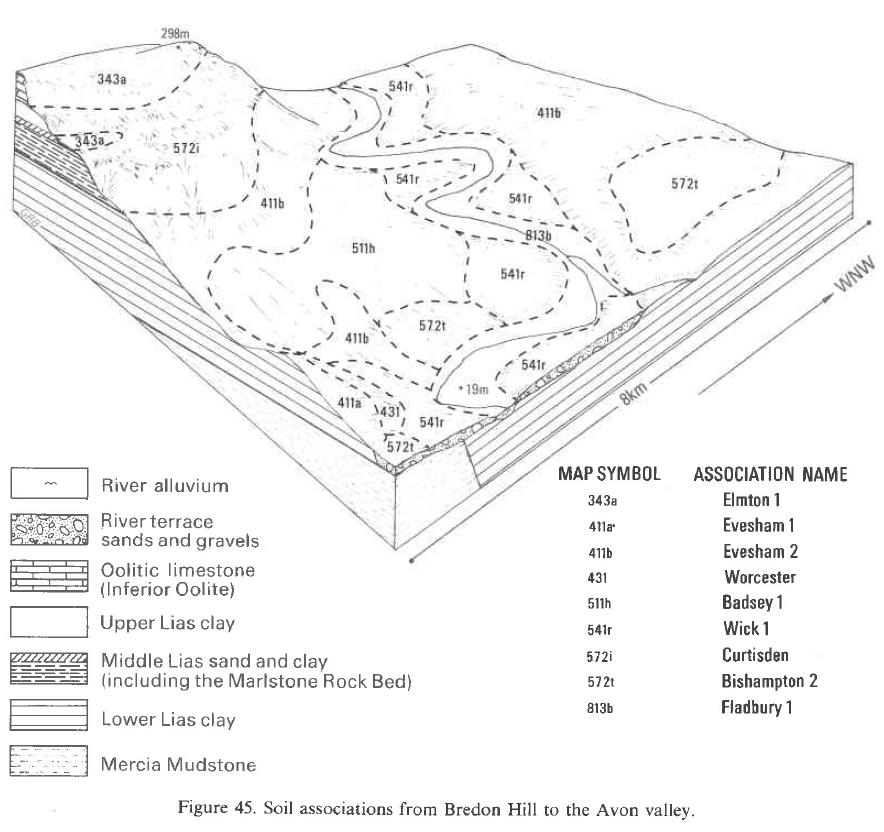
Typical Landscapes
Midlands
 |
All information Copyright, Cranfield University © 2024
Citation: To use information from this web resource in your work, please cite this as follows:
Cranfield University 2024. The Soils Guide. Available: www.landis.org.uk. Cranfield University, UK. Last accessed 20/04/2024
