
Soil Associations
0612b MOOR GATE
Soil and site characteristics
Well drained humose gritty loamy soils. Occasionally with thin ironpan. Many steep slopes. Often bouldery or rocky.
Geology
Granite and other acid igneous rock
Cropping and Land Use
Dry moorland habitats of variable razing value in uplands; some dairying on improved ground; coniferous woodland; recreation; military use.
Component soil series
| Subgroup | Series name | Percentage | WRB 2006 link |
|---|---|---|---|
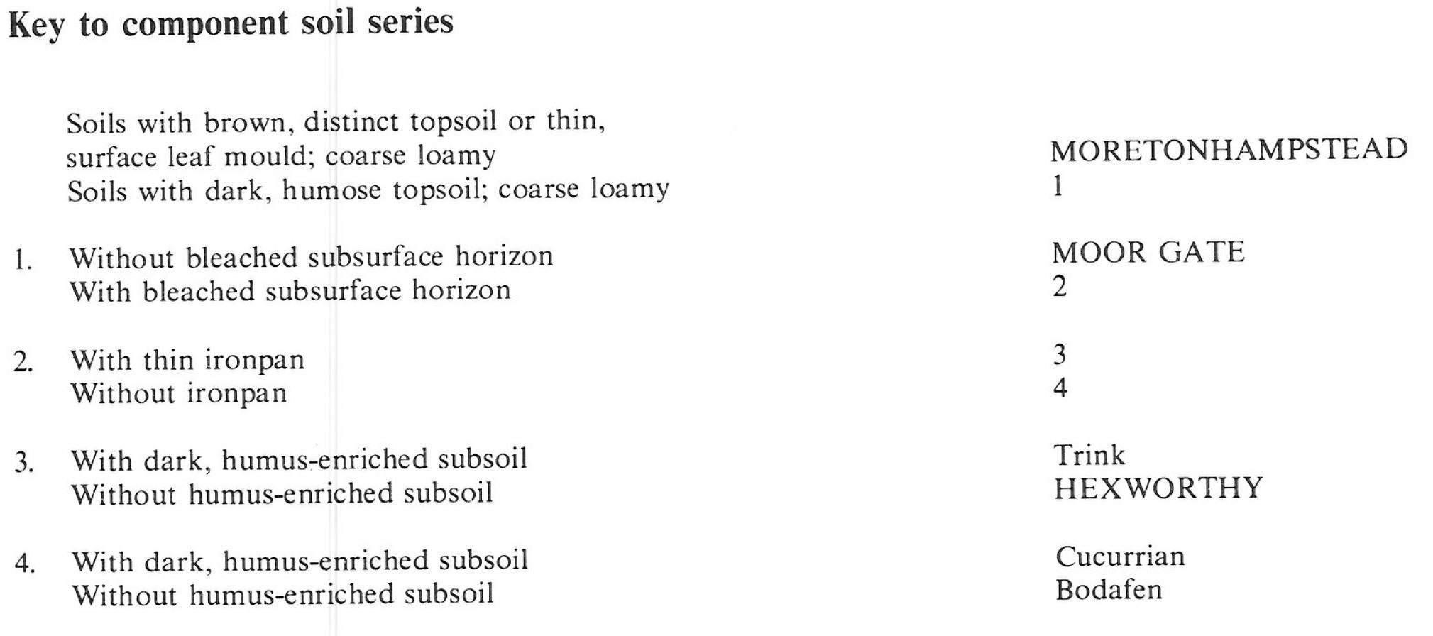
| 6.12 | MOOR GATE | 55% | Humic Endoskeletic Umbrisols |
| 6.11 | MORETONHAMPSTEAD | 15% | Chromic Mollic Endoskeletic Umbrisols |
| 6.51 | HEXWORTHY | 10% | Placic Endoskeletic Histic Stagnic Albic Podzols |
Covers 383 km2 in England and Wales
Soilscapes Classification
| 13 |
Freely draining acid loamy soils over rock |
0612b MOOR GATE
Detailed Description
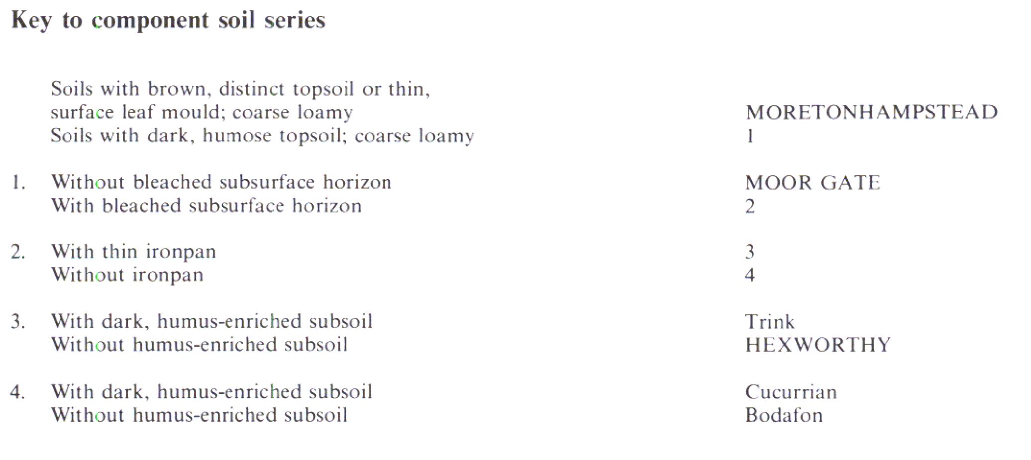
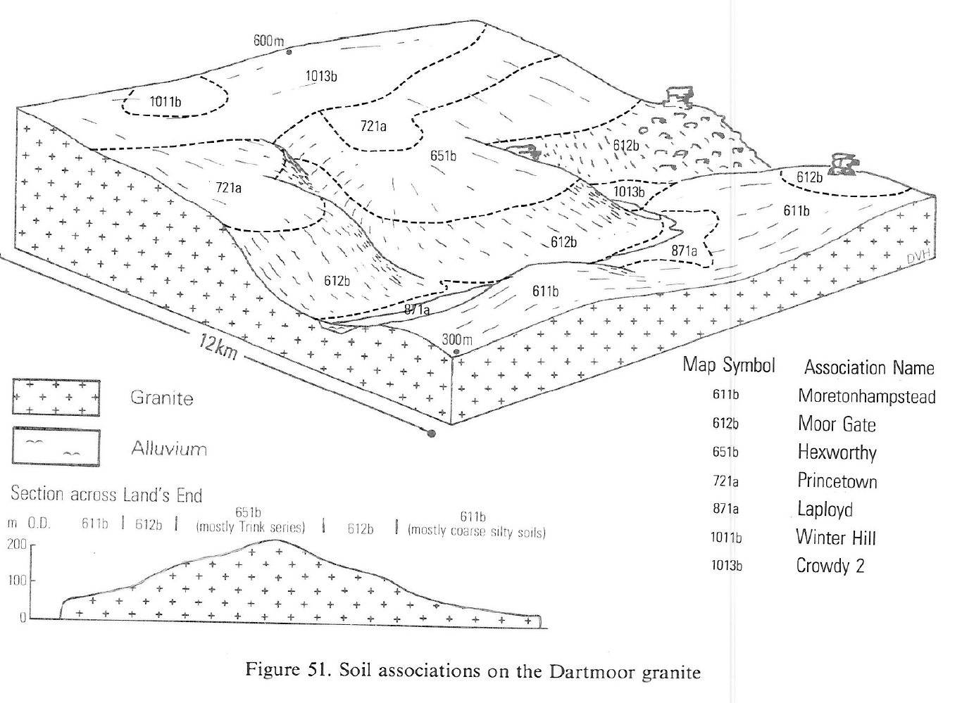
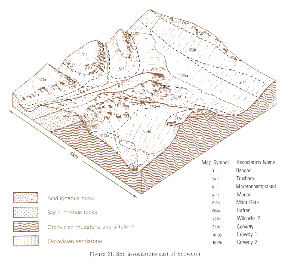
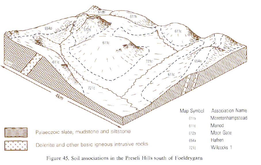
The Moor Gate association consists mainly of podzolic soils developed over acid igneous rocks in South West England and in Wales. It is extensive on granite in Devon and Cornwall where the parent material is gravelly granitic Head (growan) with local additions of silty drift. In Wales the soils are on rhyolite and other acid igneous and metamorphic rocks, in south-west Dyfed and further north on the Lleyn Peninsula and around Cader Idris and Snowdon. The association is widespread on the unenclosed moorland margins of Dartmoor, and at lower altitude in west Cornwall. In Wales, this land is generally rough grazing on rocky and bouldery steep slopes. Coarse loamy humic brown podzolic soils of the Moor Gate series have a dark humose topsoil overlying a finely structured permeable brown or brightly coloured subsoil of gritty sandy silt loam or gritty sandy loam. These soils occupy a little more than half the land. The remainder is taken up by typical brown podzolic soils of the Moretonhampstead series, and ironpan stagnopodzols of the Hexworthy series, in which a bleached subsurface horizon overlies a thin ironpan. Very acid, permeable Cucurrian series, Bodafon series and Trink series are locally important. In north Wales, Bodafon series and freely drained coarse formerly included in the Ceiri series, are often with bedrock, boulders and scree. The soils in south-west with those of Hafren, Manod and Wilcocks associations loamy humic cryptopodzols major components together Wales are closely associated with those of Hafren, Manod and Wilcocks associations.
The association ranges from sea level in west Cornwall to 550 m O.D. on Dartmoor, the relative proportions of component soil series altering as climate changes with altitude. Moor Gate and Moretonhampstead series are the main soils on cultivated land on the Land's End and Carnmenellis Granites, where aeolian drift gives some silty soils, and Trink and Cucurrian soils occupy steep uncultivated slopes. On Hensbarrow Downs, Bodmin Moor and Kit Hill there are a few wetter soils of the Hexworthy series. The Moretonhampstead series is the main associate soil on Dartmoor with some Hexworthy series on gentle moorland slopes. Podzols of the Cucurrian series occur on some steep valley sides, notably below Avon Dam, but they are generally inextensive, and the few Princetown soils mostly have humose topsoils and carry dry vegetation. Groundwater in valley bottoms, small basins and flushes gives rise to hydromorphic soils of the Camel, Crowdy and Laployd series.On the island of Lundy the unenclosed northern part includes some Cucurrian and Princetown soils with rankers of the Bangor series and some bare rock.
Soil Water Regime
The soils are permeable, well drained (Wetness Class I) and readily accept winter rain, except on steeper land where there is some run-off.
Cropping and Land Use
Much of the land particularly in north Wales is under heather moor or Nardus grassland since rock and boulders discourage agricultural improvement. In parts of south-west Dyfed however, where rainfall is relatively low, there is fairly good quality grazing, though some grassland is deficient in essential trace elements such as copper, cobalt and selenium. On the islands of Skomer and Ramsey and on the mainland around St David's the rocky rough grazing land has considerable amenity value.
The most productive land is in west Cornwall where climate is favourable. In West Penwith and on Carnmenellis much has been reclaimed from dry heathland, boulders having been cleared from gentler slopes to provide good grassland. Available water is limited by stoniness to about 100 mm, but there are larger reserves in the more silty soils. The soils are easily cultivated under a wide range of moisture conditions but they are usually on exposed land so are rarely used for arable crops, though some early potatoes and broccoli are grown on Land's End around St Just. The soils are well suited to grassland being capable of maintaining ample growth throughout the long grazing season. While at most times there is little risk of poaching, the humose topsoils have slightly increased susceptibility when wet compared with the adjacent Moretonhampstead soils.
On Dartmoor the association is on higher ground and rough grazing predominates. Many steep slopes are under acid bent-fescue grassland often overrun by bracken which reduces grazing value where it is dense enough to suppress the grasses. Whortleberry often flourishes among boulders. Gentler slopes around Merrivale on western Dartmoor carry bristle Agrostis grassland of low grazing value. Dry atlantic heather moor occupies many commons on eastern Dartmoor, where the dominance of ling is maintained by burning. The steep and bouldery land offers little further scope for improvement and as the heather and grass moor have substantial landscape value, conservation and amenity are also important considerations. There are small surviving copses of indigeneous oak wood on Dartmoor in Wistman's Wood, Black Tor Copse and Higher Piles Copse. On Lundy the soils support a complex pattern of heath and grassland interspersed with bog vegetation in flushes.
This is the most productive forestry land on Dartmoor, with plantations at Fernworthy, Soussons Down and Bellever. The soils, being deep, well drained and in sheltered positions are well suited to Douglas fir and Japanese larch, which contribute to the attractive scenery around Fernworthy Reservoir. A little of the land lies within the Dartmoor military firing ranges.
0612b MOOR GATE
Distribution Map
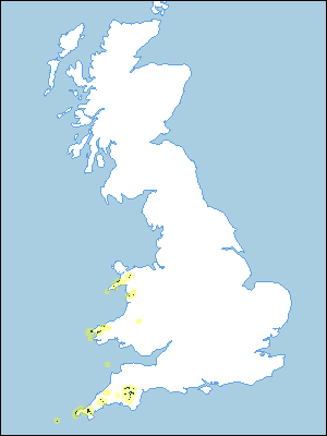 |
Note that the yellow shading represents a buffer to highlight the location of very small areas of the association.
Keys to component soil series
South Western Region
 |
Wales
 |
Typical Landscapes
South Western Region
 |
Wales
 |
Wales
 |
All information Copyright, Cranfield University © 2024
Citation: To use information from this web resource in your work, please cite this as follows:
Cranfield University 2024. The Soils Guide. Available: www.landis.org.uk. Cranfield University, UK. Last accessed 25/04/2024
