
Soil Associations
0651a BELMONT
Soil and site characteristics
Coarse loamy very acid upland soils over rock with a wet peaty surface horizon and thin ironpan. Some shallow peaty soils. Bare rock scree and crag locally. Frequent steep slopes.
Geology
Carboniferous and Jurassic sandstone
Cropping and Land Use
Wet moorland habitats of poor grazing value; coniferous woodland; recreation; dairying on improved ground; military use.
Component soil series
| Subgroup | Series name | Percentage | WRB 2006 link |
|---|---|---|---|
| 6.51 | BELMONT | 50% | Placic Endoleptic Histic Stagnic Albic Podzols |
| 3.11 | REVIDGE | 15% | Dystric Epileptic Histosols |
| 6.31 | ANGLEZARKE | 15% | Endoleptic Albic Podzols |
Covers 858 km2 in England and Wales
Soilscapes Classification
| 16 |
Very acid loamy upland soils with a wet peaty surface |
0651a BELMONT
Detailed Description
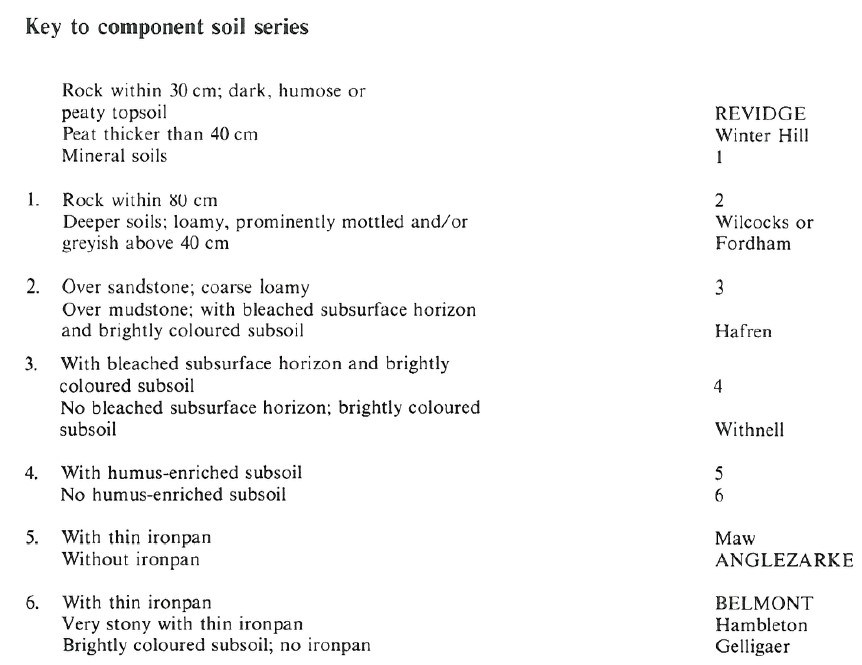
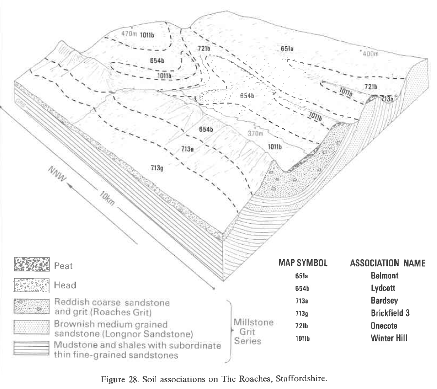
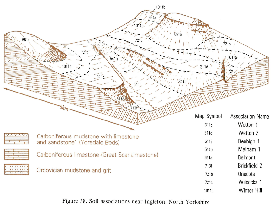
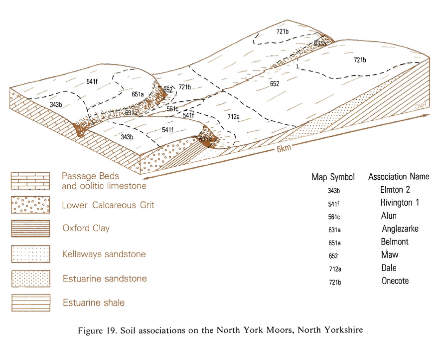
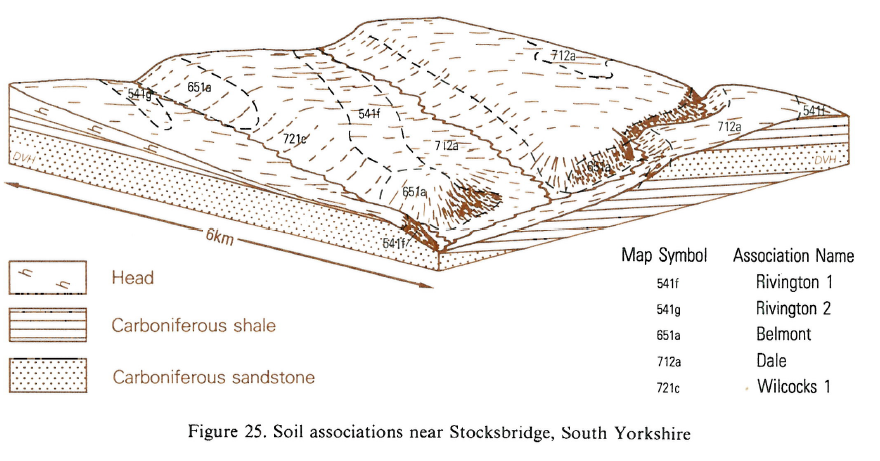
The Belmont association extends throughout the Pennines, from Derbyshire to the Scottish border and is also found on the North York Moors. The most common soils are the Belmont series, ironpan stagnopodzols, the Revidge series, humic rankers, and the Anglezarke series, humo-ferric podzols. These soils are associated with sandstone or grit and related thin drift deposits. In many places they are on steep valley-sides or on gritstone escarpments, often with terracettes, gullies and rock exposures. They are also found on gently or moderately sloping ridges and plateaux surfaces. Altitudes vary between 175 and 750 m O.D., and the climate is cold, wet and windy. The land is covered by heather (Calluna vulgaris), bilberry (Vaccinium myrtillus), Nardus and wavy hair-grass (Deschampsia flexuosa). Bracken (Pteridium aquilinurn) is common on the deeper soils. The association covers about 335 km² in Lancashire and north Derbyshire with small areas in north Staffordshire and Cheshire, mostly on the upper slopes of the Pennines. The Revidge series is usually on the steepest slopes or around rock exposures and is often covered by bilberry. The Anglezarke series is common on drier upper slopes, particularly on the steep north and east faces of Longridge Fell and Pendle Hill in Lancashire and around Stanage Edge, Derbyshire where the Belmont association passes southwards into the Anglezarke association. Various other podzolic soils occur: the Gelligaer series (Clayden and Hollis 1984) occurs sporadically with Belmont soils on steep slopes in north Derbyshire and Maw series (Carroll and Bendelow 1981) intermingled with the Anglezarke series. Withnell soils are locally common, particularly on south- and west-facing slopes and on reclaimed land. There are small inclusions of hill peat, with soils of the Winter Hill series. Fordham or Wilcocks series are found in patches of deep drift, often in concave sites around springs and small streams. Hafren soils are sometimes found on shale or mudstone bands of the Millstone Grit.
The association covers 525 km². The Revidge series is usually on the steepest slopes or around rock exposures; it is often covered by bilberry. The Anglezarke series is common on shedding, drier upper slopes, and the Belmont series is on most of the lower slopes. Various other podzolic soils occur in places, especially the Hambleton, Gelligaer or Withnell series, and in drier areas, the Maw series. Some soils have an argillic, possibly paleo-argillic, horizon below the pan. There are small inclusions of hill peat, with soils of the Winter Hill series. Fordham or Wilcocks series are found in patches of deeper drift, often on concave sites around springs and small streams. Hafren soils are sometimes noted on the steepest slopes where shale or mudstone is exposed. Soils on reclaimed land are usually of the Withnell series.
Soil Water Regime
In the Midlands there is a large surplus of winter rainwater and a moisture deficit of less than 75 mm in most summers. Percolation through Belmont soils is impeded by the thin but continuous ironpan, which also prevents root penetration. Improvement is possible if the pan is broken by deep cultivation. On level or gently sloping land, the soil overlying the pan is waterlogged in winter, but on steep slopes most surplus water moves away laterally. The preponderance of steep slopes, wet peaty surface horizons and thin ironpan causes rapid run-off leading to erosion after storms or prolonged heavy rain.
In Eastern England all the soils have slowly permeable lower horizons which restrict downward water movement and cause lateral flow at shallow depth in winter. With adequate underdrainage Beccles soils are seasonally waterlogged (Wetness Class III) but Ashley and Hanslope soils are only waterlogged for short periods in winter (Wetness Class II). The soils are moderately droughty for cereals, less droughty for sugar beet and oilseed rape and very droughty for grass.
Cropping and Land Use
Where unimproved, the land is only marginally suitable for grassland, as it is inaccessible to machinery in winter and there is a great risk of poaching because of the low bearing strength of the topsoil. The land is also often too steep or high and exposed to warrant improvement. Where the soils can be improved, however, grass will yield well if sufficient lime and fertilizer are applied. Trace element deficiencies have been reported from some reclaimed areas. The semi-natural moorland vegetation provides only poor grazing, but better grazing is possible where Nardus or Molinia are dominant. Productive forestry is possible following remedial measures; deep ploughing is necessary before planting to break the ironpan, otherwise trees in exposed places can blow over because of restricted rooting depth. The ground is sometimes difficult because of rock exposures and steep slopes. The choice of species is usually limited to conifers. The main afforested areas are for water catchment protection. In the Hodder valley, Forest of Bowland, plantations are dominantly of Sitka spruce with some Norway spruce and Scots and Lodgepole pines. Those in the upper Derwent valley are a mixture of Sitka spruce, Scots pine and Japanese larch, with some hardwoods planted for fire protection and amenity reasons. In response to public demand, there is access to large areas of the Belmont association for recreation, particularly in the Peak District National Park. This land is easily eroded following trampling when wet, making it poorly suited for footpaths, camp sites or picnic areas.
In Eastern England Beccles soils are more difficult to work than Ashley and Hanslope soils and are less suited to spring-sown crops. All the soils are well suited to autumn-sown crops and cereals predominate. Yields for autumn-sown direct-drilled cereals are likely to be similar to those achieved from traditional cultivations. Droughtiness restricts grass yields in summer and autumn and poor trafficability makes most of the soils unsuitable for winter use because of the risk of poaching. Potassium levels are usually adequate for most crops and phosphorus levels depend upon past management.
0651a BELMONT
Distribution Map
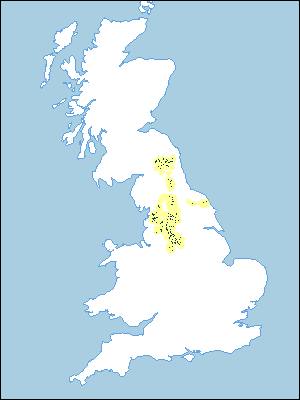 |
Note that the yellow shading represents a buffer to highlight the location of very small areas of the association.
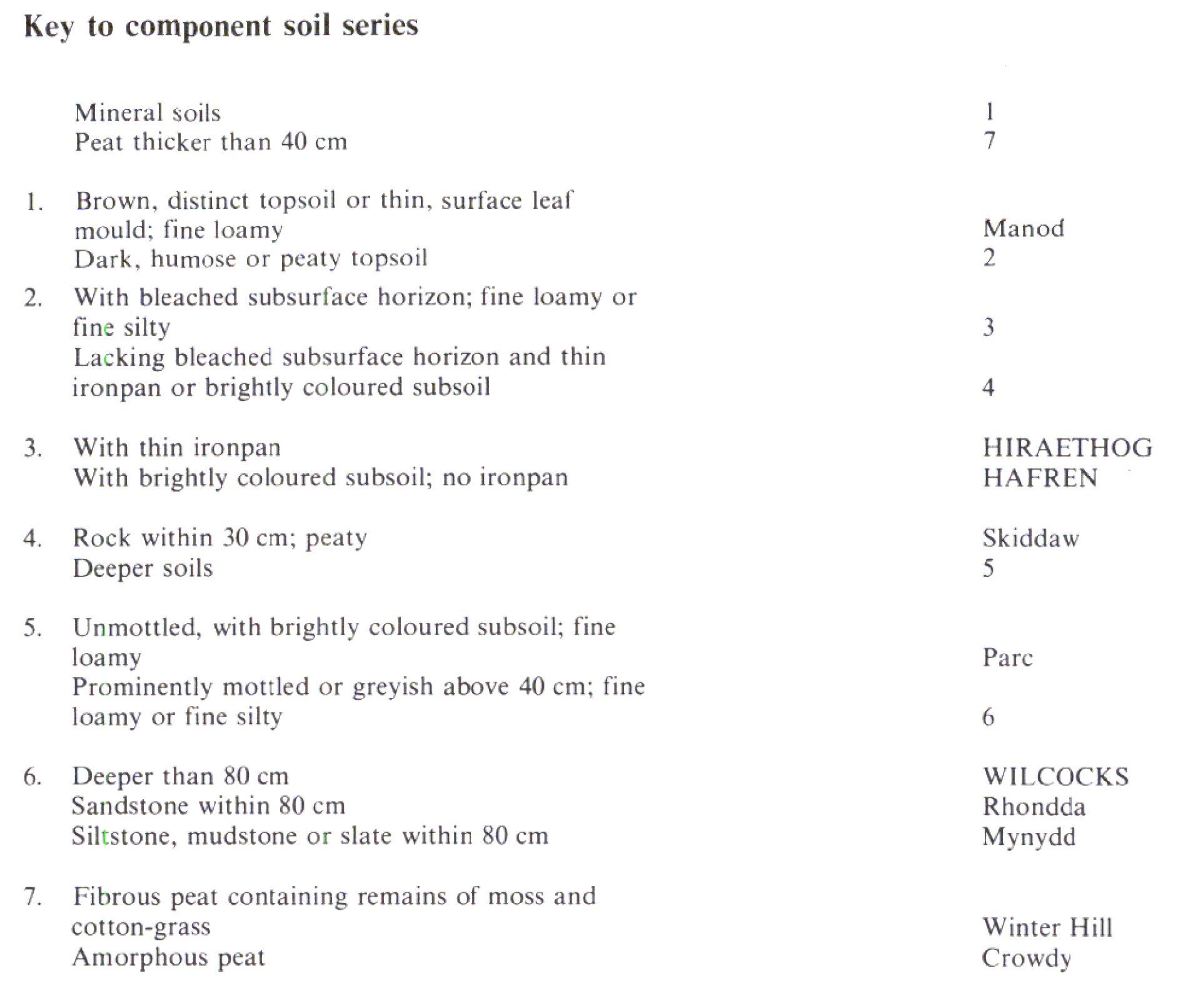
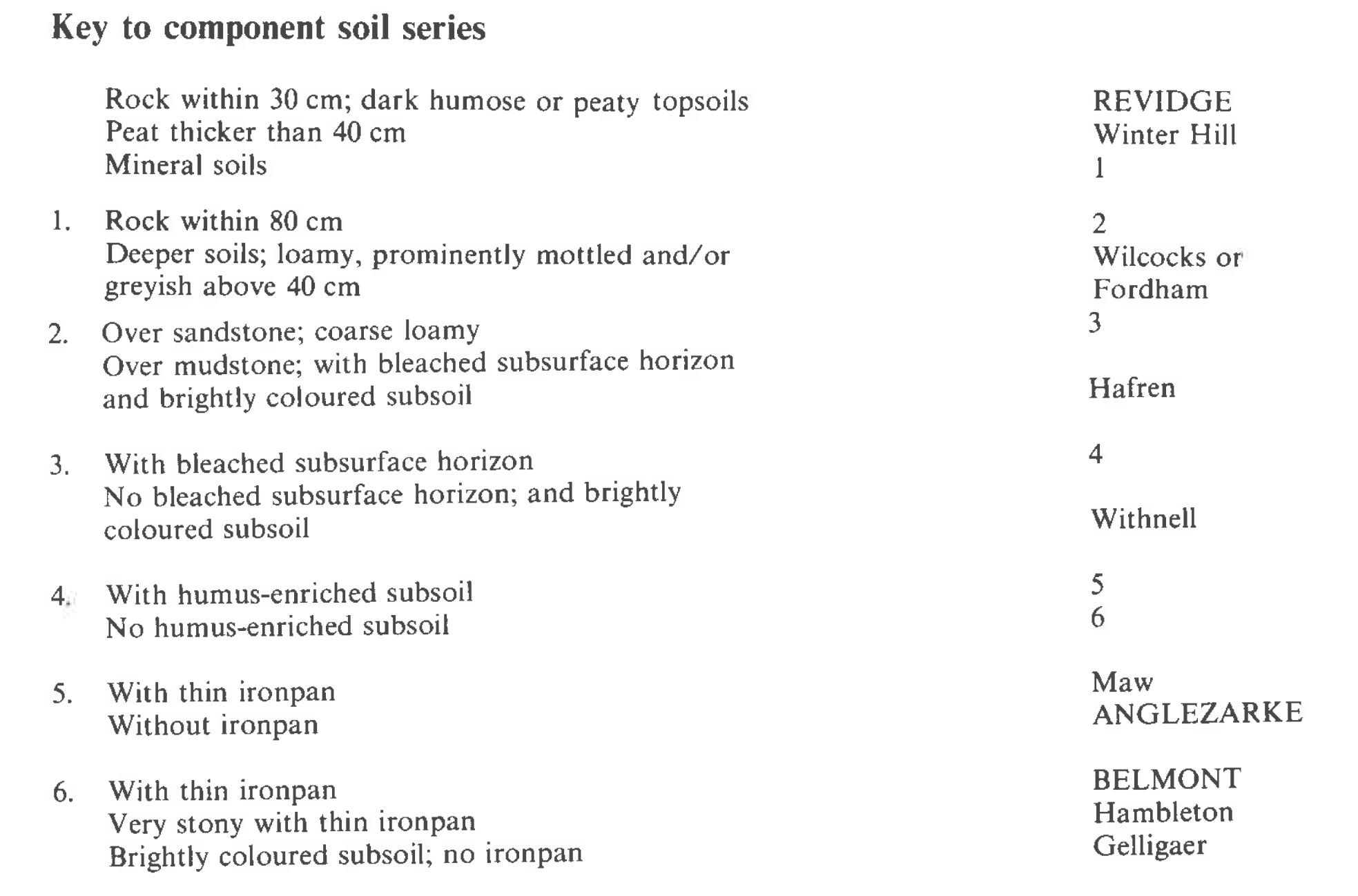
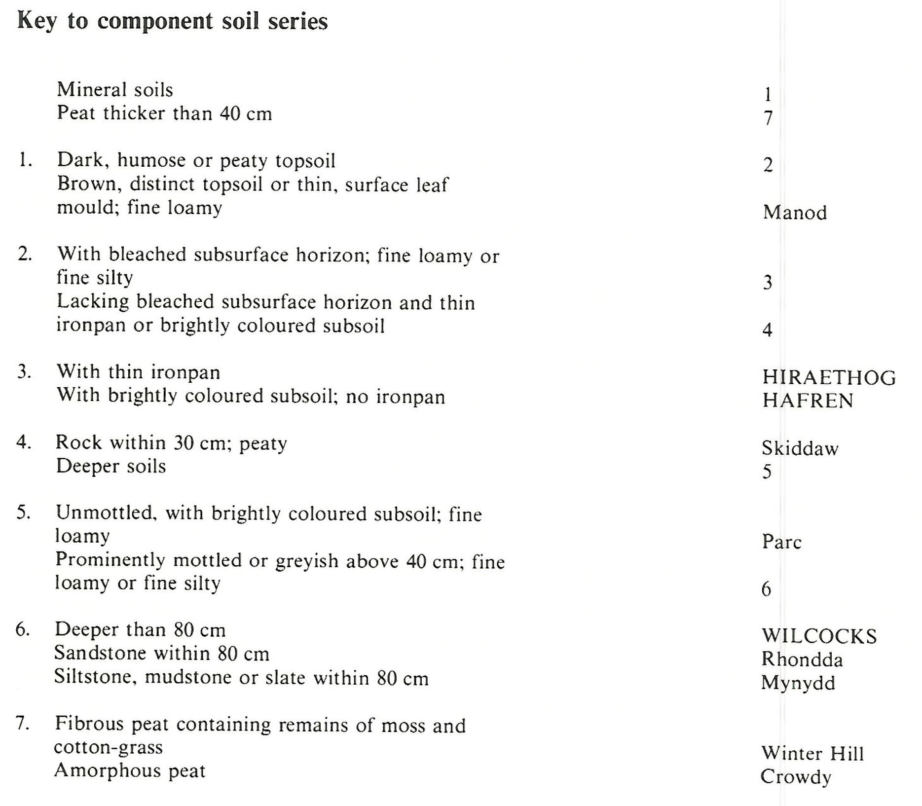
Keys to component soil series
Wales
 |
Midlands
 |
South Western Region
 |
Northern Region
 |
Typical Landscapes
Midlands
 |
Northern Region
 |
Northern Region
 |
Northern Region
 |
All information Copyright, Cranfield University © 2024
Citation: To use information from this web resource in your work, please cite this as follows:
Cranfield University 2024. The Soils Guide. Available: www.landis.org.uk. Cranfield University, UK. Last accessed 25/04/2024
