
Soil Associations
0712g RAGDALE
Soil and site characteristics
Slowly permeable seasonally waterlogged clayey and fine loamy over clayey soils. Some slowly permeable calcareous clayey soils especially on slopes.
Geology
Chalky till
Cropping and Land Use
Winter cereals in the Eastern Region; more stock rearing and dairying In the Midlands.
Component soil series
| Subgroup | Series name | Percentage | WRB 2006 link |
|---|---|---|---|
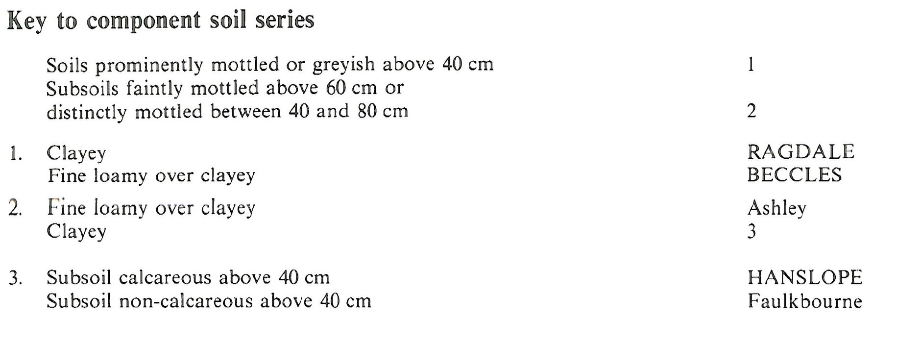
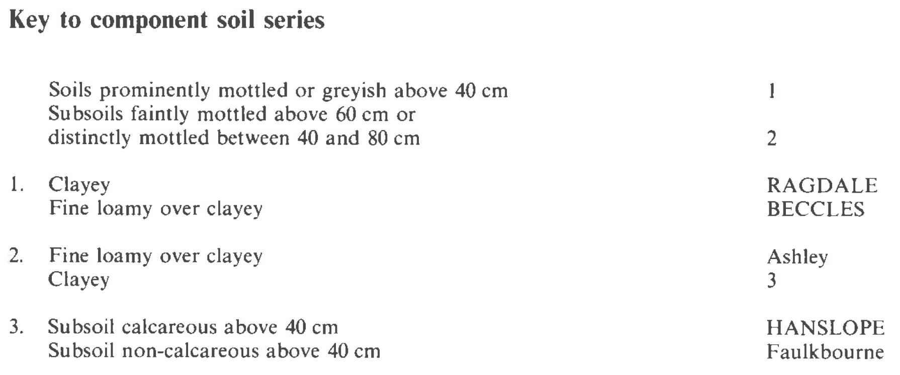
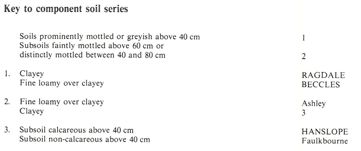
| 7.12 | RAGDALE | 40% | Eutric Luvic Stagnosols |
| 7.11 | BECCLES | 30% | Eutric Albic Luvic Stagnosols |
| 4.11 | HANSLOPE | 20% | Calcaric Stagnic Cambisols |
Covers 1291 km2 in England and Wales
Soilscapes Classification
| 18 |
Slowly permeable seasonally wet slightly acid but base-rich loamy and clayey soils |
0712g RAGDALE
Detailed Description
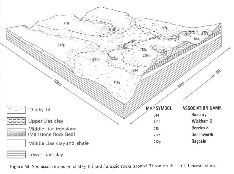
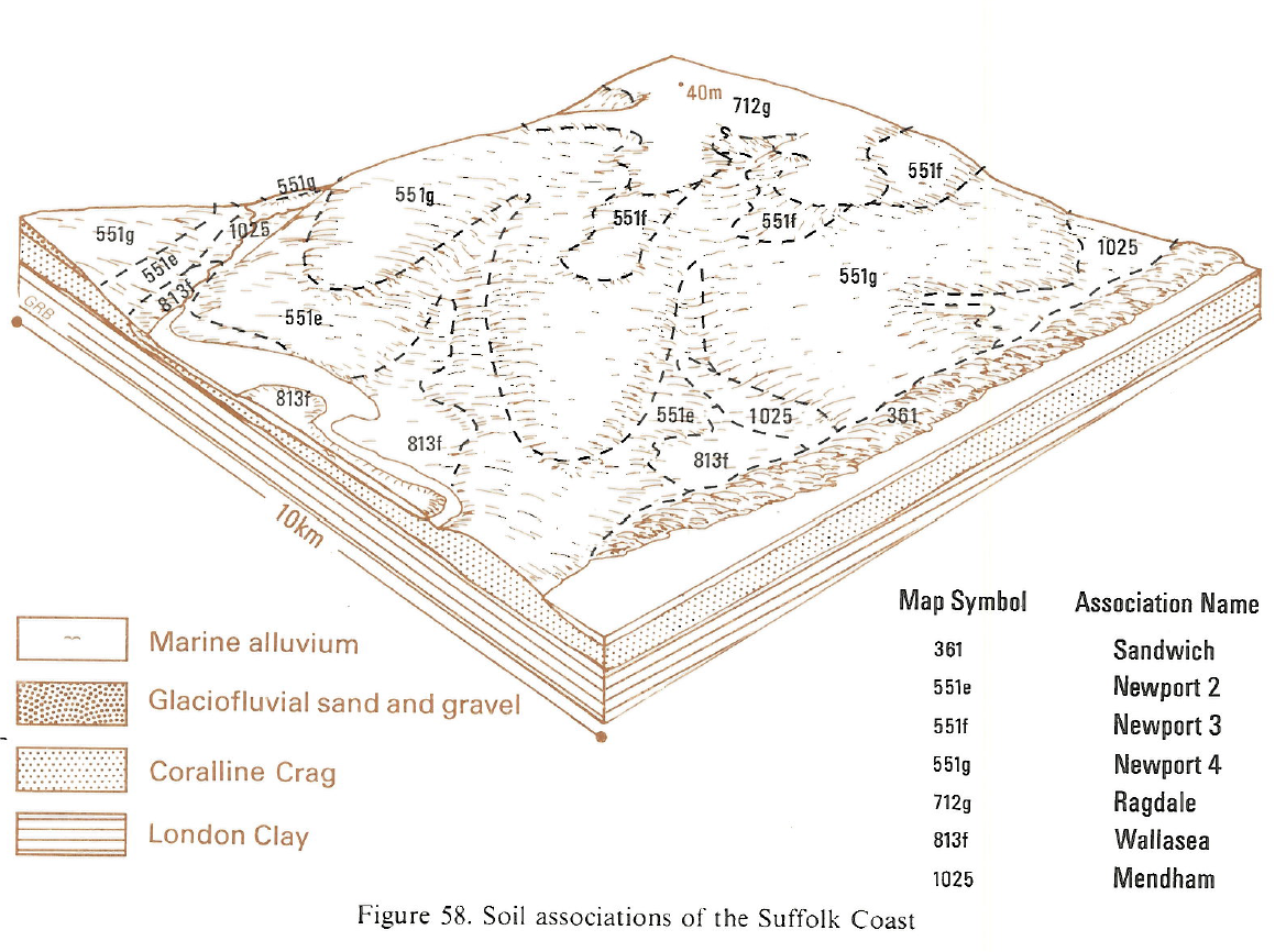
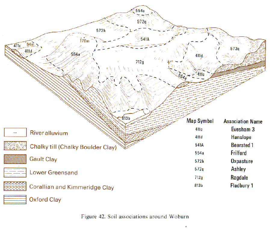
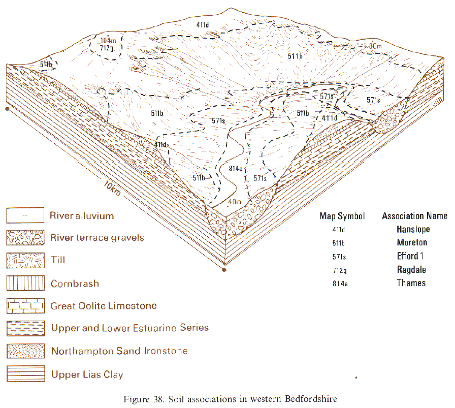
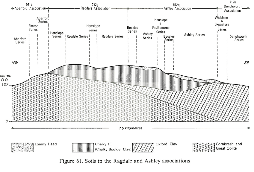
The Ragdale association covers 1,297 km² and is extensive on chalky till in Lincolnshire, Leicestershire and Northamptonshire and also occurs locally in Bedfordshire, Buckinghamshire, Warwickshire, Gloucestershire and Oxfordshire. It consists of clayey Ragdale series pelo-stagnogley soils, and Beccles series typical stagnogley soils, which together account for four-fifths of the land. The Ragdale and Beccles soils are developed in till which has a grey clayey matrix containing chalk stones, and some lenses of fine loamy material. Beccles soils have fine loamy upper horizons over clayey subsoils. Both series have mottled upper horizons and contain quartzite pebbles or flints. Chalk stones are usually found in the subsoil but are occasionally absent. Ashley, Hanslope and Faulkbourne soils also occur in places. In south Leicestershire, especially on the sides of valleys incised into the till plateau, some Salopand Flint soils occur where reddish till is close to the surface. Here there are small areas of Ashley soils where the till is covered by a thin layer of coarse loamy drift. In Warwickshire the association is found east of Coventry and in small patches north of Stratford upon Avon, near Moreton-in-Marsh, Lighthorne and Bishop's Itchington. Here as also near Oakham and Melton Mowbray the association is composed almost entirely of Ragdale series with a few Hanslope and Faulkbourne soils but Beccles soils are absent. In general there are fewer Beccles soils in the Midlands than further east in Cambridgeshire and Norfolk.
The association ranges from 8 m O.D. east of Lincoln to over 170 m O.D. in Northamptonshire. In Cambridgeshire and Bedfordshire it occurs sporadically whereas in east Suffolk, Northamptonshire and Lincolnshire it covers large areas on wide, level and gently sloping plateaux. Beccles soils cover almost half of the land in parts of Lincolnshire. East of Lincoln, some of the Ragdale soils have reddish as well as greyish clay in the subsoil. Where the association is mapped in Moreton Vale, Ragdale soils make up about half of the land, the remainder being mainly Beccles and Ashley soils in roughly equal proportions. Hanslope series, a common associate elsewhere is absent.
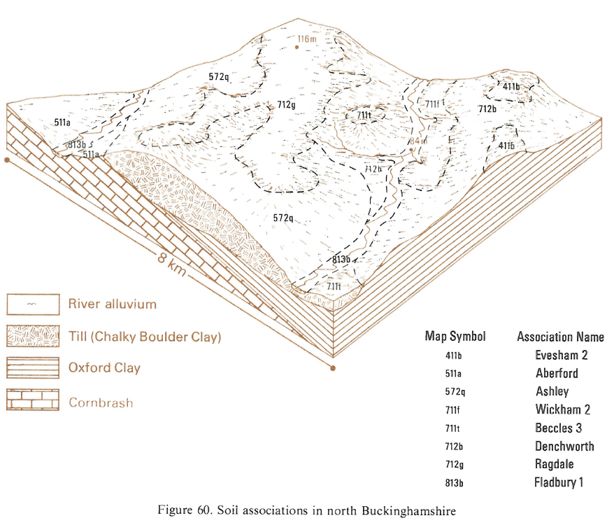
In north Buckinghamshire the association occurs on the southern limits of the chalky till usually as small patches capping interfluves. It is most extensive on land near Buckingham and west and north of Leighton Buzzard. Here, Ragdale soils cover three-quarters of the land, the remainder consisting of Beccles and Ashley soils. Hanslope soils are usually confined to convex slopes where the calcareous till is near the surface.
Soil Water Regime
The dense, clayey slowly permeable subsoils restrict vertical water movement so Ragdale, Beccles and Faulkbourne soils- are seasonally waterlogged (Wetness Class III and IV) their water regimes varying with climate and the efficiency of drainage measures. Hanslope and Ashley soils are less frequently waterlogged (Wetness Class II and III). There is rapid run-off of surplus rainfall during winter.
Cropping and Land Use
The soils are difficult to cultivate because of their slowly permeable clayey and fine loamy horizons. Spring cultivations are particularly hazardous, especially on the Ragdale series, because of wetness. This restricts arable cropping largely to winter cereals with oilseed rape as a break crop. Although some sugar beet and potatoes are grown there are harvesting difficulties in wet years. When cultivations are carried out under wet conditions, the resulting structural damage reduces the already low porosity and causes prolonged waterlogging, often above the soil surface, and the death or retardation of seedlings due to lack of soil oxygen. Ragdale and Beccles soils may be direct drilled but rarely in spring because of wetness. Because of the compaction which occurs under continuous arable cropping, particularly after harvesting and cultivations in wet conditions, the Ragdale association benefits from periods under a grass ley to restore soil structure. Even then trafficability is low and poaching risk high on grassland. The component soils are classed as moderately droughty for grass because of their high clay content and low porosity, which restricts the available water capacity. Hanslope soils have similar profile available water values to the Ragdale series. There are scattered remnants of formerly extensive deciduous woodland.
0712g RAGDALE
Distribution Map
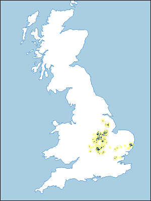 |
Note that the yellow shading represents a buffer to highlight the location of very small areas of the association.
Keys to component soil series
South Eastern Region
 |
Midlands
 |
Eastern Region
 |
Typical Landscapes
Midlands
 |
Eastern Region
 |
Eastern Region
 |
Eastern Region
 |
South Eastern Region
 |
South Eastern Region
 |
All information Copyright, Cranfield University © 2024
Citation: To use information from this web resource in your work, please cite this as follows:
Cranfield University 2024. The Soils Guide. Available: www.landis.org.uk. Cranfield University, UK. Last accessed 18/04/2024
