
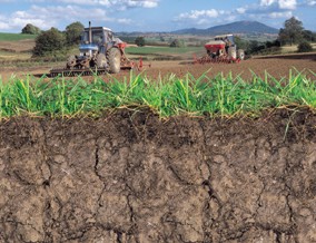
Soil Series Properties
HORIZON Fundamentals
Soil Series Horizon Summary Data
HORIZON Fundamentals is tabular data that can be used in conjunction with any of the NATMAP products, excepting NATMAP soilscapes.
HORIZON Fundamentals includes very detailed descriptions of the texture and other properties pertaining to the soils. This dataset provides the most detailed description of each horizon, or horizontal layer, determined for the soil series. It is based heavily on laboratory based analyses.
How much does this product cost?
You will need to lease this attribute product with a relevant NATMAP soil map dataset. For detailed pricing information, use our Quotation Advisor utility.
HORIZON Fundamentals data and description
The table below describes the various properties within this data product. Each table contains the information outlined below.
| Property | Example from data | Description |
|---|---|---|
| HORID | 1 | Unique Horizon Identifier (Defines one Horizon (depth range, series, landuse)) |
| SERIES | 17 | Soil series code for each series, this is a 4 digit numeric code |
| SERIES_NAME | ANGLEZARKE | Soil series name |
| LU_GROUP | PG | Landuse Group - AR (Arable) PG (Permanent Grass) LE (Ley Grassland) or OT (Other) |
| DESIGNATION | E | Layer Designation - At a basic level A (Topsoil) B (subsoil) C (Parent Material) E (Elluvial) O (Organic) |
| UPPER_DEPTH | 20 | Horizon upper depth in cm (<0 indicated litter layer) |
| LOWER_DEPTH | 35 | Horizon lower depth in cm (999 implies that the depth was below the bottom of the profile) |
| SAND_TOTAL | 71 | Total sand (0.06-2.0mm, 60-2000μm) content (%) by weight |
| SAND_FINE | 38 | Fine sand (0.06-0.2mm, 60-200μm) content (%) by weight |
| SAND_MED | Medium sand content (%) by weight | |
| SAND_COARSE | Coarse sand content (%) by weight | |
| SILT | 28 | Silt content (%) including CaCO3sub>, (0.002 -0.06mm, 2-60μm) |
| CLAY | 1 | Clay content (%) including CaCO3sub> (<2μm) |
| CARBON | 1.5 | Organic Carbon % (by wt) |
| PH | 3.6 | pH of soil measure after shaking 10ml of soil for 15 minutes with 25ml of water |
| SAND_TOTAL_QA | NA | Quality Information relevant to the total sand value |
| SAND_FINE_QA | NA | Quality Information relevant to the fine sand value |
| SAND_MED_QA | ND | Quality Information relevant to the medium sand value |
| SAND_COARSE_QA | ND | Quality Information relevant to the coarse sand value |
| SILT_QA | NA | Quality Information relevant to the silt value |
| CLAY_QA | NA | Quality Information relevant to the clay value |
| OC_QA | EXPERT | Quality Information relevant to the organic carbon value |
| PH_QA | EXPERT | Quality Information relevant to the pH value |
Note: Quality information (*_QA) relevant to the texture, organic carbon and pH values is provided. Where the data is averaged from measured sample data the standard deviation is recorded unless their were too few samples in which case Not Applicable (NA) is entered. In some cases an expert soil scientist provided a meaningful value for the parameter in which case the value is labeled 'EXPERT'. Where no meaningful value is derivable a reason is given whether as a result of rock, rubble, ironpan or peat. The coarse and medium sand values have as yet only been derived for the 'A' horizons, therefore subhorizons are labeled 'ND' for Not Derived.
