
Soil Series Properties
SERIES Leacs
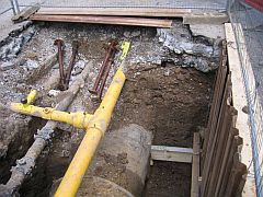
Soil Series - Leakage assessment due to Corrosivity and Shrinkage
SOILSERIES Leacs is tabular data that can be used in conjunction with any of the NATMAP products, excepting NATMAP soilscapes.
SOILSERIES Leacs provides information on the shrink-swell and corrosivity of the soil to Fe and Zn. This data set is widely used in the UK Water Utility sector - being used by most major water companies for the prediction of the corrosion rates on their underground pipe assets. It is also used for fracture potential modelling.
You may be interested in learning more about the background science behind SOILSERIES Leacs.
How much does this product cost?
You will need to lease this attribute product with a relevant NATMAP soil map dataset. For detailed pricing information, use our Quotation Advisor utility.
SOILSERIES Leacs data and description
The table below describes the various properties within this data product. Each table contains the information outlined below.
| Property | Example from data | Description |
|---|---|---|
| SERIES | 4 | Soil series code for each series, this is a 4 digit numeric code |
| SERIES_NAME | ADVENTURERS' | Soil series name |
| SHRINK_SWELL | 6 | Shrink-swell class, see Clayden and Hollis (1984, 33-35), Hollis (1991, unpubl), and Jones and Hollis (1996, unpubl) |
| CORR_FE | 4 | Corrosivity code for Fe, see Jarvis and Hedges (1994). If there is a '*' in this field, this indicates that there is likely to be a trace of sulphate present. If, on further investigation there is no sulphate, the class should be 1 lower. Conversely, if there is plenty of sulphate, add one to this class. |
| CORR_ZN | 3a1 | Corrosivity code for Zn, see Jarvis and Hedges (1994) |
