
Soil Associations
0343b ELMTON 2
Soil and site characteristics
Shallow well drained brashy calcareous fine loamy soils over limestone. Some deeper fine loamy or fine loamy over clayey soils.
Geology
Jurassic limestone sandy limestone
Cropping and Land Use
Cereals and short term grassland with stock rearing and dairying.
Component soil series
| Subgroup | Series name | Percentage | WRB 2006 link |
|---|---|---|---|
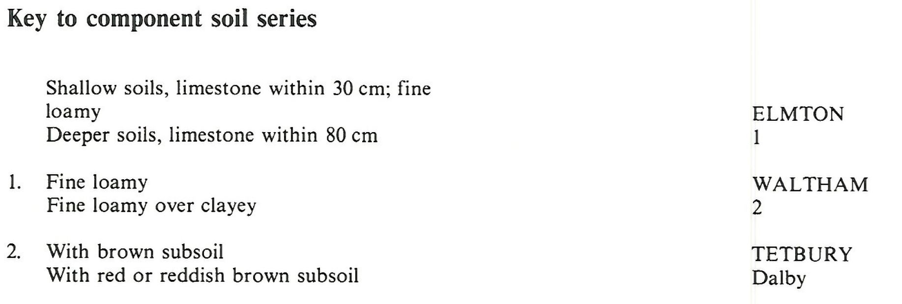
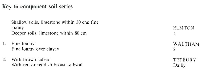
| 3.43 | ELMTON | 55% | Calcaric Leptosols |
| 5.71 | TETBURY | 35% | Endoleptic Luvisols |
| 5.41 | WALTHAM | 10% | Eutric Endoleptic Cambisols |
Covers 342 km2 in England and Wales
Soilscapes Classification
| 3 |
Shallow lime-rich soils over chalk or limestone |
0343b ELMTON 2
Detailed Description
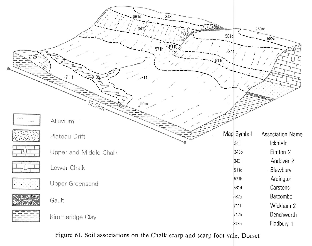
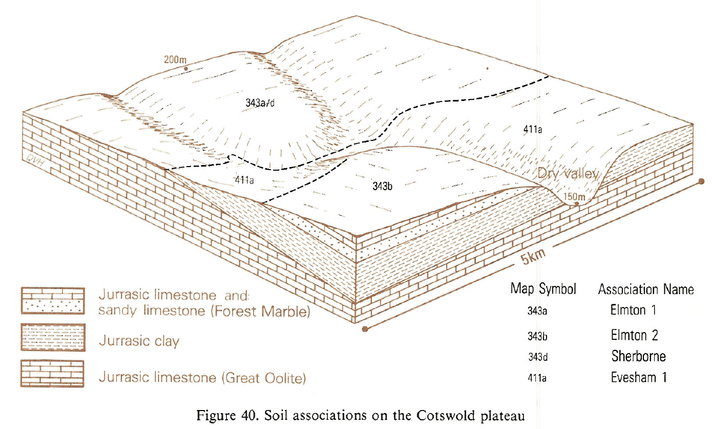
This association includes well drained soils overlying limestone at various depths, located mainly in the West Country and on the North York Moors. Its main members are fine loamy and fine silty shallow stony Elmton soils, typical brown rendzinas on Jurassic limestone. They are associated with Waltham series, stoneless deeper fine loamy typical brown earths, and Tetbury series, typical argillic brown earths with a thicker and distinctly clayey subsoil. The latter occurs where sandy limestone and limestone with thin sandy layers partly replace the usual purer limestone . In places Dalby series is recognized where the soils have clayey reddish subsoils and other features indicative of long-term weathering. Stony shallow clayey Sherborne soils and the deeper stoneless clayey Shippon series are minor constituents where there are clay bands in the limestones or colluvial deposits in depressions and valley bottoms. The land is much used for cereal growing, or is in mixed farming with arable crops and ley grassland. It rises generally to around 200 m O.D., rarely to over 300 m O.D., and is flat to gently sloping but dissected by shallow dry valleys.
The main occurrence in the region is in the Cotswolds from south of Bath to Cirencester in the north. In this narrow discontinuous strip of country, dividing the higher brashy land from the more clayey lower dipslope, the Forest Marble formation contains sandy limestones and thin layers of sand. The sand fraction includes much very fine sand which gives the whole suite of soils a particle-size range from fine loamy to fine silty. The proportions of the three main soils are not easily assessed as there is little to distinguish them at the land surface, one merging into another with no change in landform. Patches of the deeper Waltham and Tetbury soils may be located in arable land by their stoneless surface and within these the Tetbury series is distributed as a mosaic related to solution hollows in the underlying limestone in which pockets of brown clay are found.
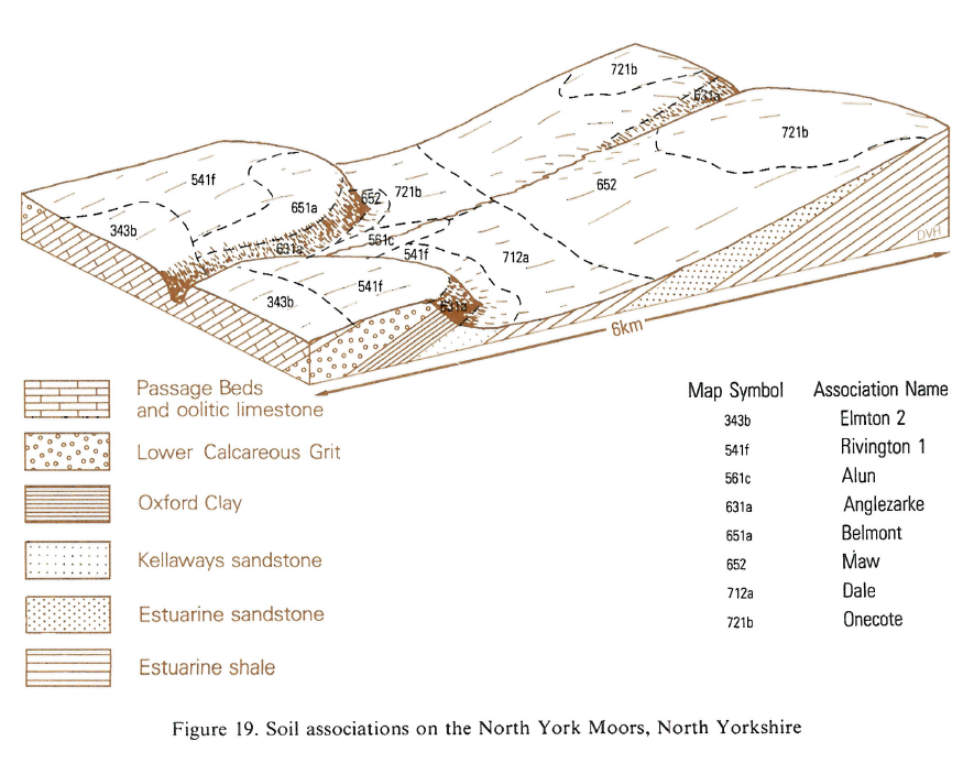
The association extends across the gently sloping plateau of Corallian rocks in the North York Moors, from Sutton Bank to Scarborough. It is generally at 70 to 215 m O.D., but rises in the Hambleton Hills to 350 m O.D. Most land is used for mixed farming, but it is predominantly arable on the more subdued Howardian Hills between Hovingham and Malton. Proportions of the main soils are not easily assessed and no clear relation exists between soil depth and slope or other landscape features. The shallow and stony fine loamy Elmton soils predominate, with Waltham series locally developed on sandy limestone. Pockets of deeper soil contain a reddish mottled clayey subsoil characteristic of the Dalby series . The Aberford series is less common, occurring where the limestone is soft and, on the Hambleton Hills, in patches of silty drift. Leaching is most intense at the highest locations, where there are profiles of the Crwbin series, which is normally on harder massive limestone. In the Howardian Hills there are occasional coarse loamy Marcham soils.
In South East England, the association is found only in a small area east of Chipping Norton where sandy limestones outcrop. The fine loamy soils contain much very fine sand, and are mostly shallow and stony Elmton series. Waltham soils can be identified in arable land where the surface is less stony, and within these there are deeper Tetbury soils, with brown clayey subsoils.
Soil Water Regime
Because of the permeable substratum at shallow depth, winter rain is readily absorbed. Run-off is slight but, where clayey subsoils are thickest and prolonged arable cultivation has produced weak structure and plough pan, permeability may be reduced and run-off increased. This has resulted in some erosion on slopes. Elmton soils are moderately droughty for cereals and other field crops, but for grass they are very droughty.
Cropping and Land Use
There is a marked emphasis on cereal cropping. Barley acreage exceeds wheat (3:1) and in recent years autumn-sown barley has largely replaced spring varieties. Long periods are available for landwork on the loamy well drained Elmton soils which dry quickly, but the presence of a clayey subsoil in Tetbury soils reduces springtime working days somewhat. The deeper stoneless Tetbury and Waltham soils have the advantage of more available water than Elmton soils for the established crop, but germination may be put at risk by working them when conditions are judged suitable for the more quickly drying brashy soils. A further limitation of the inclusions of Waltham and Tetbury soils is their tendency to become acid in contrast to Elmton soils which do not require liming; this can result in patchy growth in cereals. Waltham and Tetbury soils are well suited to potato growing because they are stone free and have an appreciable depth of workable soil. Though small stones are absent, large slabs of limestone rock are not uncommon at shallow depth and can cause unexpected damage to machinery. Elmton soils are droughty for grass and this is probably the major reason for expansion of cereal growing in the last 40 years. Dairy herds are few and sheep or beef cattle are better able to utilise the grass over a longer grazing period as out-wintering is possible with little risk of poaching except in the wettest years. Permanent grassland is confined to dry valley slopes and old parkland. Short ley grassland has tended to decline in extent because of the switch from spring-sown barley which was often undersown with grass, and also because the costs of grassland reseeding have escalated. Newly established grassland tends to remain open and patchy because of stones on the surface.
These soils are too shallow and droughty for vigorous growth of softwoods and because of their calcareous nature conifers show chlorosis. In Hambleton, Rievaulx and Dalby Forests the soils are planted with mixtures of hybrid and European larch, and of Scots pine with beech. Young trees suffer check from drought but this is usually less where the topsoil was not inverted when planting. There is no clear response to fertilizers. Scots pine is grown on a short rotation as a nurse crop to beech and extracted before disease becomes a serious risk.
0343b ELMTON 2
Distribution Map
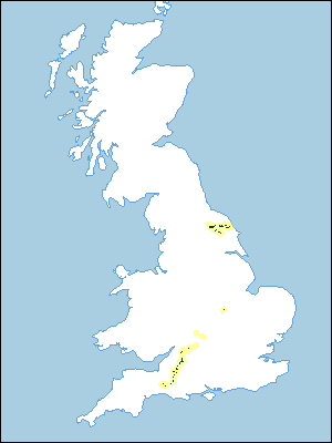 |
Note that the yellow shading represents a buffer to highlight the location of very small areas of the association.
Keys to component soil series
South Western Region
 |
Northern Region
 |
Typical Landscapes
South Western Region
 |
South Western Region
 |
South Western Region
 |
Northern Region
 |
All information Copyright, Cranfield University © 2024
Citation: To use information from this web resource in your work, please cite this as follows:
Cranfield University 2024. The Soils Guide. Available: www.landis.org.uk. Cranfield University, UK. Last accessed 26/04/2024
