
Interpretations of the National Soil Map of England and Wales
Crop Available Water
NATMAPavailablewater
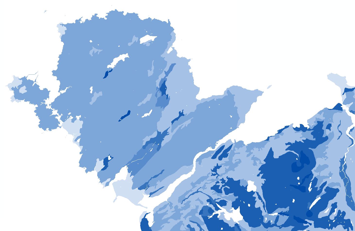
The Crop Available Water map is a new product derived from the National Soil Map it shows the average crop-adjusted available water capacity of the soils across England and Wales.
Key Facts and Statistics about NATMAPavailablewater
- Simplified rendition of the national soil map;
- Water availability for 4 crop rooting models - grassland, cereal, potatoes and sugar beet
Who and what is this useful for?
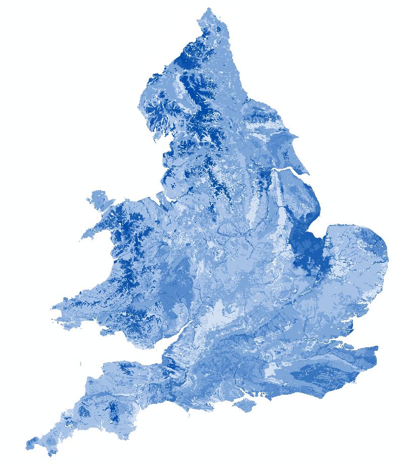
NATMAPavailablewater is useful for agronomists and in the assessment of drought as the water available in the soil offsets the water balance between rainfall and evapotranspiration. Crop adjusted available water is used in the assessment of Agricultural Land Classification
How was this map derived?
The total amount of soil water available to plants (TAv) is considered to be the volumetric soil water content between 0.05 and 15 bar suction or, in the case of sands and loamy sands, 0.10 and 15 bar suction. These suctions approximate to the conditions of field capacity, when all excess water has drained away under the influence of gravity, and wilting point, when the plants can extract no more moisture from the soil. The amount of soil water that is available to a growing crop depends on both soil properties and crop rooting patterns. The rooting models used to assess Crop-Adjusted Available Water capacity are based on those of Thomasson (1979). These suggest that, under favourable conditions, cereals will root to about 120 cm, whereas potato roots rarely extend below 70 cm. However, the root systems of cereals are less well developed below 50 cm and their ability to extract water below this depth is thus diminished. Below 50 cm therefore, the model for calculating cereal available water capacity uses only the volume of ‘easily available water' (EAv) held in the soil between 0.05 and 2.0 bar suction. The proportion of stones in each horizon is also used to adjust the available water. See Appendix 4 in Agricultural Land Classification of England and Wales for a more complete discription of the methodology. The depth limits used for each crop were:
| Crop | Depth (cm) | Suction (bar) |
|---|---|---|
| Available Water Content (AWC) | 0 - 100 | 0.05 - 15 |
| Cereals (wheat/barley and ley grass) | 0 - 50 | 0.05 - 15 |
| 50 - 120 | 0.05 - 2 | |
| Potatoes | 0 - 70 | 0.05 - 15 |
| Sugar beet | 0 - 80 | 0.05 - 15 |
| 80 - 140 | 0.05 - 2 | |
| Permanent Grass | 0 - 70 | 0.05 - 15 |
| 70 - 100 | 0.05 - 2 |
For each soil series represented on the National Soil Map the total and easily available water is calculated for each horizon from the HORIZONhydraulics dataset and totalled for the series following the crop rooting pattern models. To interpret this on a soil association basis the mean of the crop adjusted available waters for each component series was calculated, weighted by the proportion of each series in the soil association.
How much does this product cost?
- £250 per 1,000 km2.
- Significant discounts apply for larger areas.
- If NATMAPvector and HORIZONhydraulics are ordered at the same time then a discount of 90% will be applied.
For detailed pricing information, use our Quotation Advisor utility.
Crop adjusted available water data and description
The table below describes the various properties within this data product. Each polygon contains the information outlined below.
| Property | Example from data | Description |
|---|---|---|
| AP_CEREAL | 132 | The water available to cereal crops in the polygon (mm) |
| AP_GRASS | 122 | The water available to grassland crops in the polygon (mm) |
| AP_SB | 156 | The water available to sugar beet in the polygon (mm) |
| AP_POT | 96 | The water available to maincrop potatoes in the polygon (mm) |
| AWC | 133 | The water available to 1m depth in the polygon (mm) |
| SHAPE | 2 | Feature ID code which links with the spatial description of the data within a geodatabase |
