Interpretations of the National Soil Map of England and Wales
NATMAP Topsoil Texture
Topsoil Texture Map
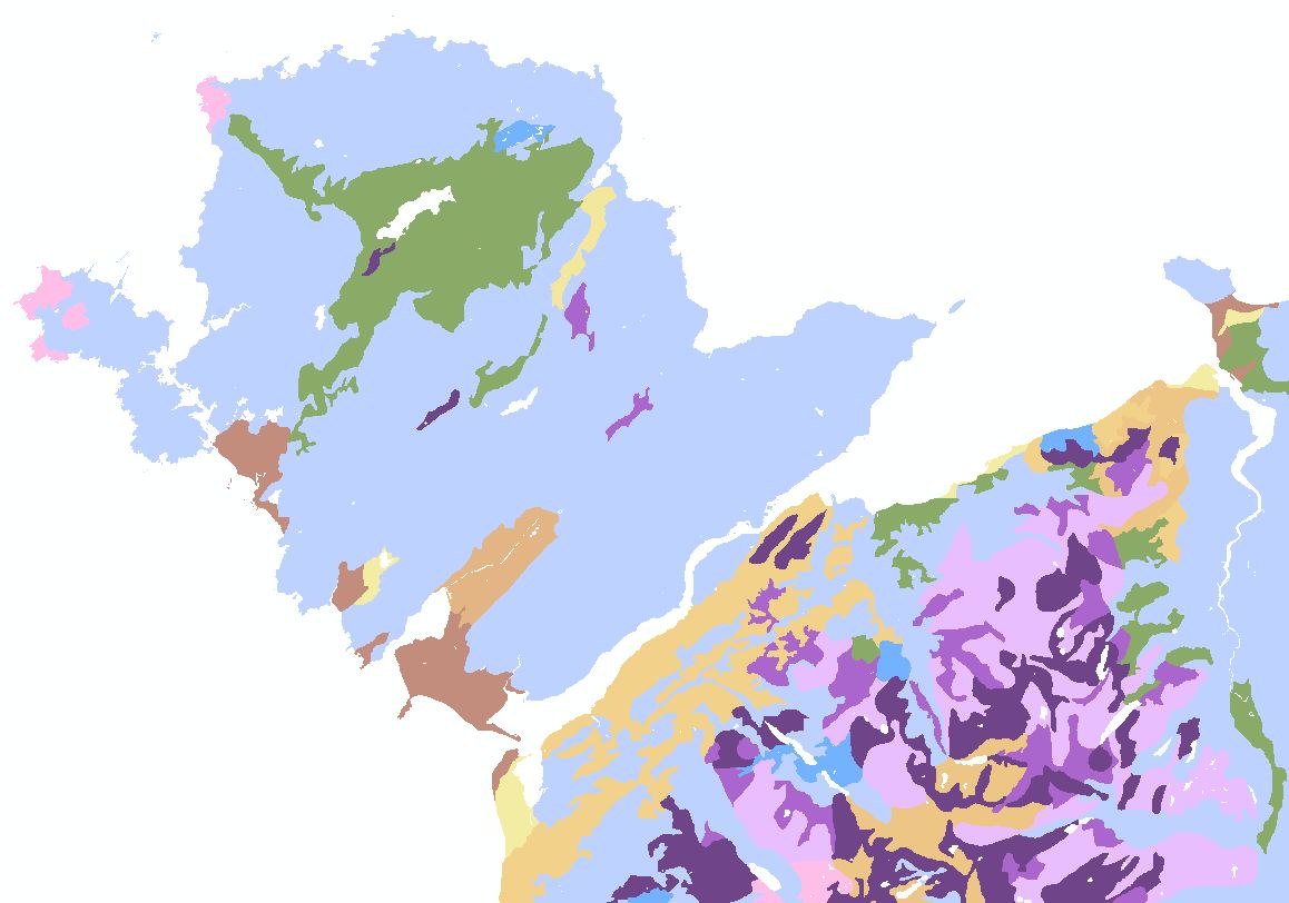
NATMAPtopsoiltexture is a new product derived from the National Soil Map. It provides users with a useful, concise, easily interpreted and applicable description of the range of texture classes typical across England and Wales.
Key Facts and Statistics about NATMAPtopsoiltexture
- Simplified rendition of the national soil map;
- 21 distinct classes
Who and what is this useful for?
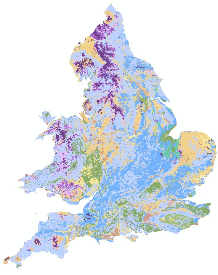
NATMAPtopsoiltexture is useful for anyone wanting generalised and simple-to-understand information of the topsoil soil texture at a 1:250,000 scale. The topsoil texture dataset allows the user to explore the likely spatial variation of the dominant and subdominant texture classes across England and Wales. This variation can be used as input into environmental models which are influenced by the textural composition of the soil matrix. As this is a simplified dataset, it may or may not represent the soil texture at any given location.
How was this map derived?
For each soil series represented on the National Soil Map the topsoil texture class was determined from the particle size distribution and organic carbon data held in the HORIZONfundamentals dataset. This data was then compared to the definition of each soil series given in TM17 "Criteria for differentiating soil series" as the topsoil texture is a defining characteristic of soil series. Where differences between the defined topsoil texture and the calculated class arose these were examined by a soil expert and where necessary the calculated classes were altered to better reflect the known properties of the soil series. Once each soil series was assigned to a topsoil texture class the proportions of each soil series within the soil associations represented on the National Soil map was used to determine the dominant soil texture and the proportions of each texture class.
How much does this product cost?
- £250 per 1,000 km2.
- Significant discounts apply for larger areas.
For detailed pricing information, use our Quotation Advisor utility.
NATMAP topsoil texture data and description
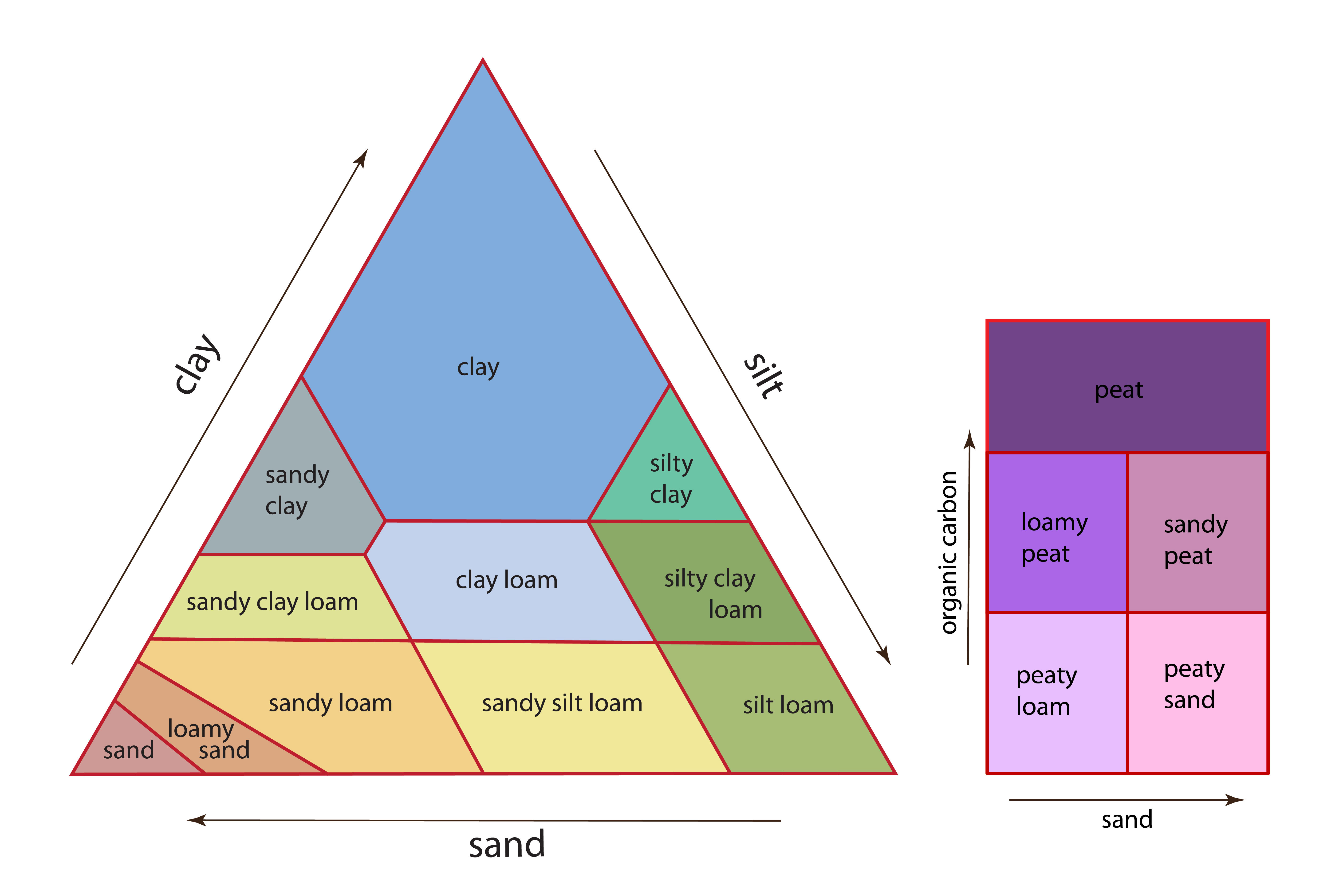
Soil Texture Triangle showing legend colours
The table below describes the various properties within this data product. Each polygon contains the information outlined below.
| Property | Example from data | Description |
|---|---|---|
| TEXTURE | silty clay loam | The dominant Texture Class in the polygon |
| C | 0 | Percentage of the polygon under clay |
| CL | 35 | Percentage of the polygon under clay loam |
| ZC | 0 | Percentage of the polygon under silty clay |
| ZCL | 50 | Percentage of the polygon under silty clay loam |
| SCL | 0 | Percentage of the polygon under sandy clay loam |
| CSL | 0 | Percentage of the polygon under coarse sandy loam |
| MSZL | 0 | Percentage of the polygon under medium sandy silt loam. |
| CSZL | 0 | Percentage of the polygon under coarse sandy silt loam |
| ZL | 0 | Percentage of the polygon under silt loam |
| SCL | 0 | Percentage of the polygon under sandy clay loam |
| FSL | 0 | Percentage of the polygon under fine sandy loam |
| MSL | 0 | Percentage of the polygon under medium sandy loam |
| FSZL | 0 | Percentage of the polygon under fine sandy silt loam |
| LFS | 0 | Percentage of the polygon under loamy fine sand |
| LMS | 0 | Percentage of the polygon under loamy medium sand |
| LCS | 0 | Percentage of the polygon under loamy coarse sand |
| FS | 10 | Percentage of the polygon under fine sand |
| MS | 10 | Percentage of the polygon under medium sand |
| LP | 0 | Percentage of the polygon under loamy peat |
| PL | 0 | Percentage of the polygon under peaty loam |
| PS | 0 | Percentage of the polygon under peaty sand |
| P | 0 | Percentage of the polygon under peat |
| SHAPE | 2 | Feature ID code which links with the spatial description of the data within a geodatabase |
Find out nore about soil texture.
