Lowland Peat in England and Wales
Information on the Lowland Peat data products
The Lowland Peat project describes the peat soils and surface peat deposits of lowland England and Wales, below 200 m O.D. Peat is a fragile natural resource that takes as much as 2,000 years to build up to a metre in thickness. However, when claimed for use by man, peatlands are rapidly destroyed. Lowland peatlands form prime agricultural land when drained and peat itself is in increasing demand for composts and soil conditioners by gardeners and the horticultural industry.
The Soil Survey of England and Wales, since its inception in 1939, classified and mapped soils formed in peat as part of its various mapping programmes. Early surveys conducted of the East Anglian fens and the Lancashire mosslands (e.g. Hall and Folland, 1967; Hodge and Seale, 1966) are today dated, partly by changes in the classification of peat soils, but mainly because of destruction and wastage of the peat. A survey of the Somerset Moors (Cope and Colborne, 1981), based on grid sampling with deep bores, provided maps showing the thickness and types of peat and the thickness of clay over peat.
Strongly acid peat soils around Woodwalton Fen, Cambridgeshire were described by Burton and Seale (1981). During this work the soils were sampled for pH using a grid sampling network. Investigations of these soils by Bloomfield (1981) showed that the acidity was largely caused by oxidation of sulphides, formed originally in the deposits under brackish tidal water conditions. With drainage for agriculture, such soils become the acid sulphate soils that present special problems to farm management and pollute the natural environment. Similar grid sampling was used during survey in the Norfolk Broads (Price, 1980) to distinguish areas of soil with the potential to become strongly acid should the drainage be improved. Because of interest in these earlier soil surveys and the many pressures on our rapidly dwindling peatlands, the National Inventory of Peat was commissioned by MAFF (now Defra) in the late 1980s.
In the Archive at Cranfield University, many paper maps and soil survey record cards are held from the various survey programmes referenced. These historical records provide a unique and valuable resource in the assessment of how the lowland peat areas in England and Wales have changed in the intervening period. A recent data collection programme was instigated to capture in digital form much of this raw survey material. This material is now made available for lease from Cranfield University under our standard data lease Terms and Conditions.
Lowland Peat Soil Series
Three classes of lowland 'peat' soils are recognised:
Deep Peats
All series in Major Group '10'
Over peaty
Soil series: APPLEDORE, BRIMPTON, DOWELS, FAIRFIELD, HATFORD, MIDELNEY, TREGARON, WALKERITH, WENSUM, WILLINGHAM, WINDRUSH
'Skirt' soils
Soils fringing areas of deeper peat: All series in Subgroups: 3.52, 8.51, 8.52, 8.61, 8.71, 8.72, 8.73
See the Soils Guide for details of these series
Available Data
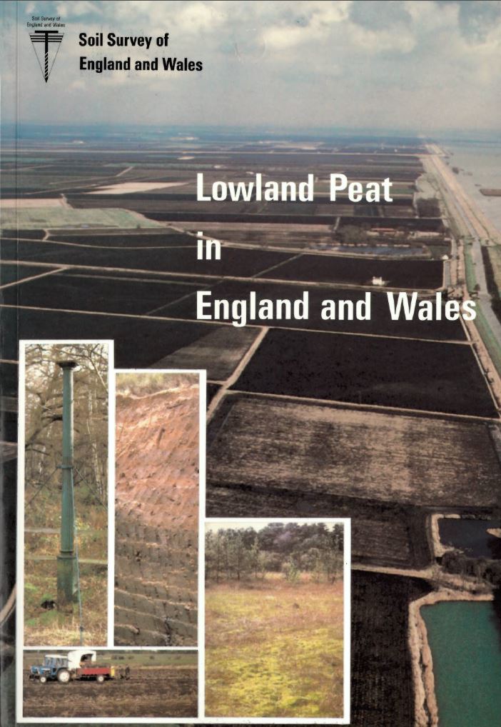
Lowland Peat in England and Wales - Special Survey No. 15
Special Survey No.15 "Lowland Peat in England and Wales" was published by SSEW in 1987. The book and accompanying map have now been scanned and had optical character recognition (OCR) appled. The materials are made available in both PDF and Microsoft Word format, and the table of sites has been captured as a Microsoft Excel spreadsheet.
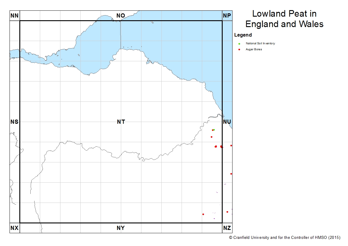
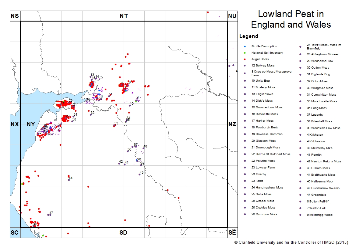
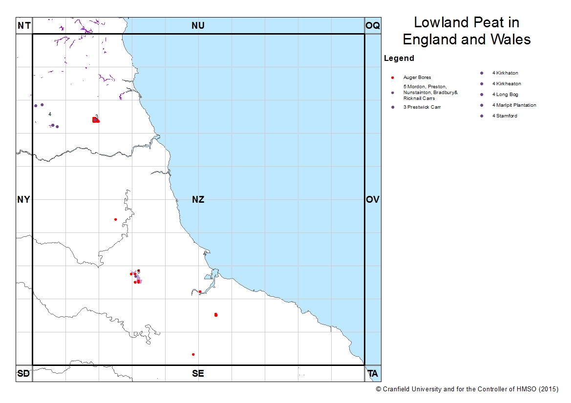
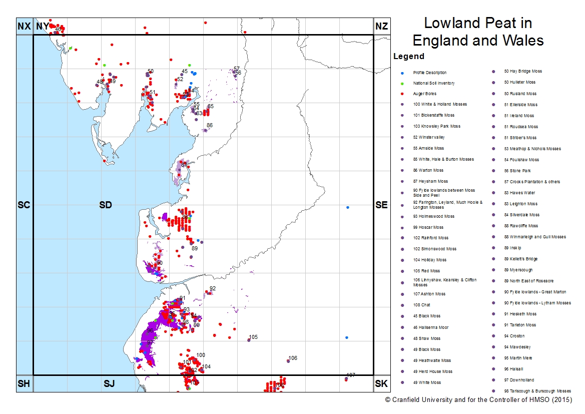
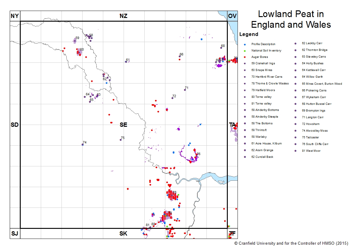
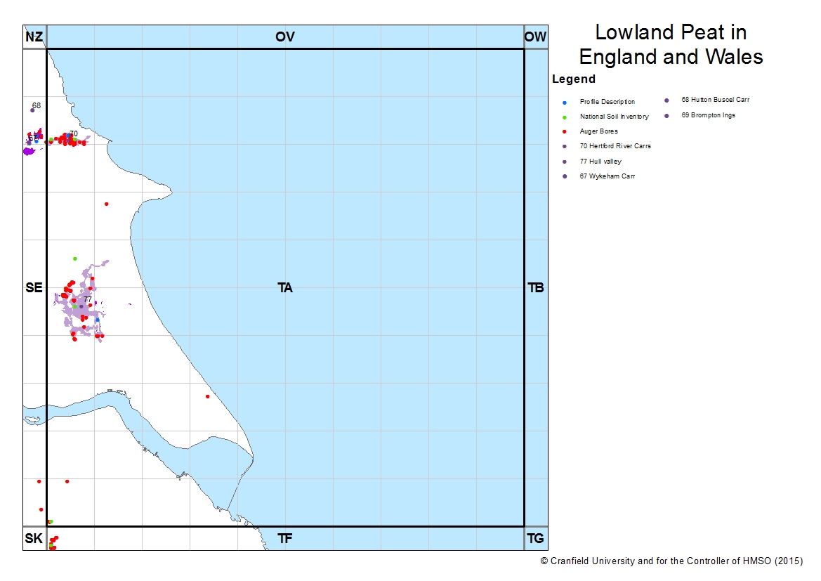
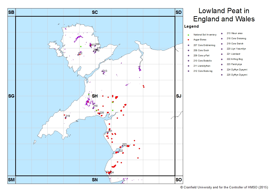
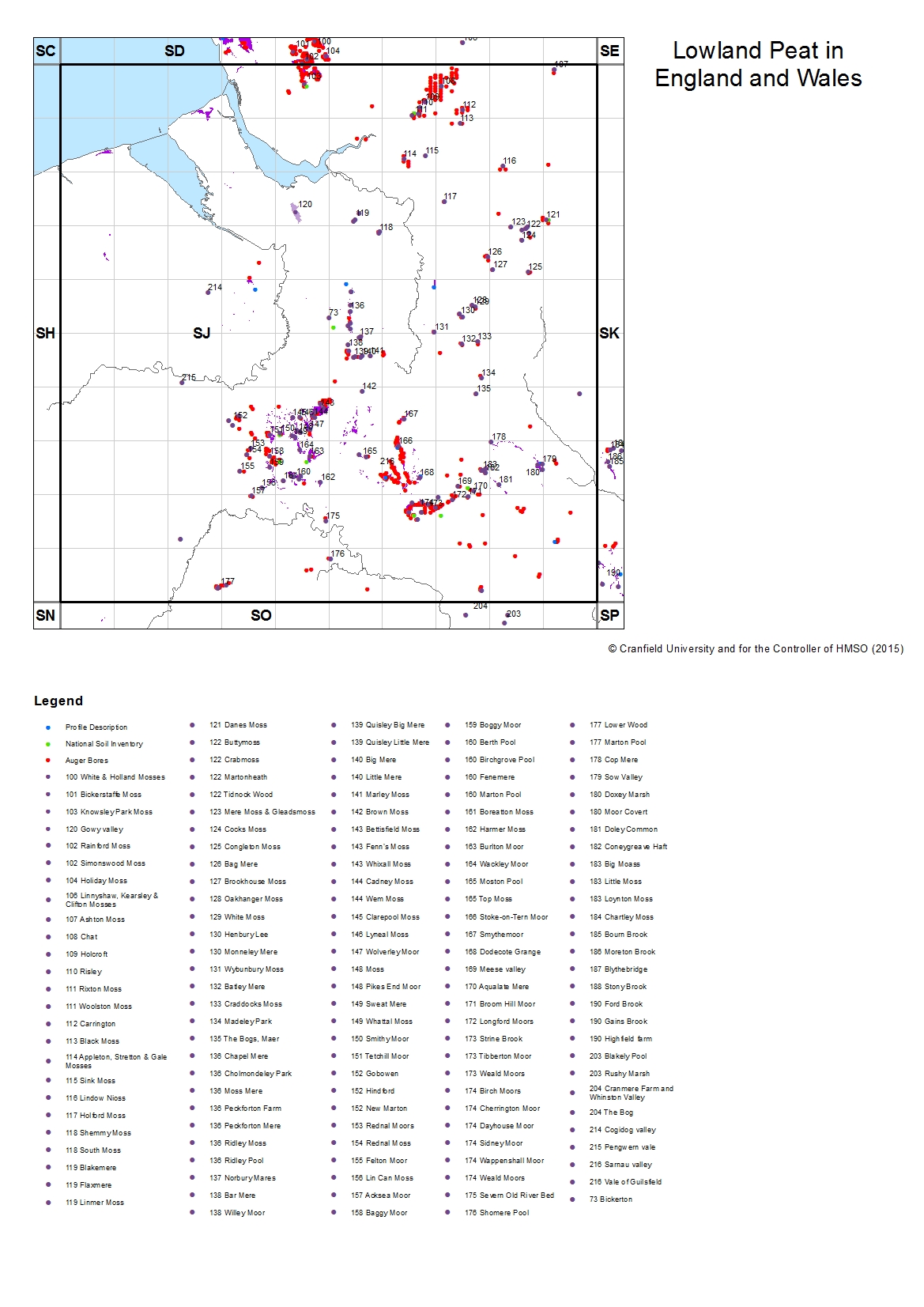
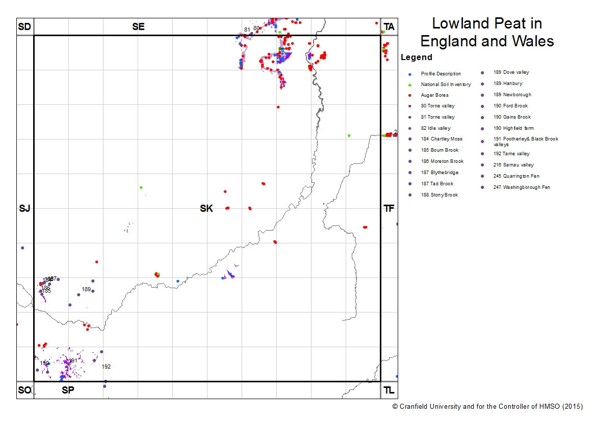
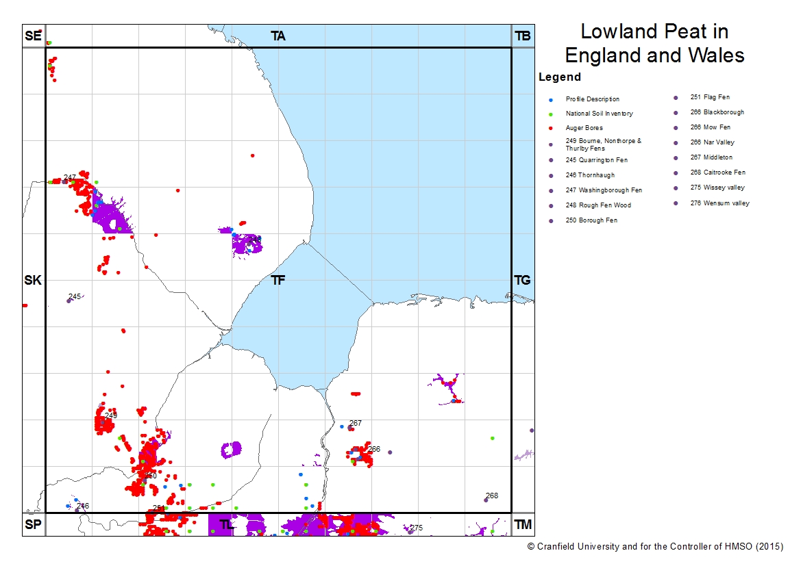
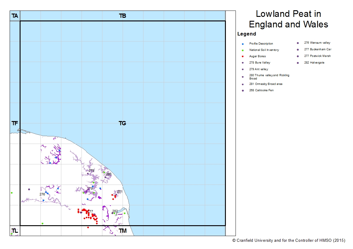
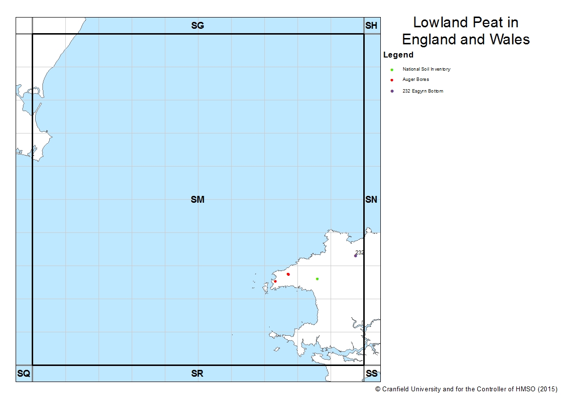
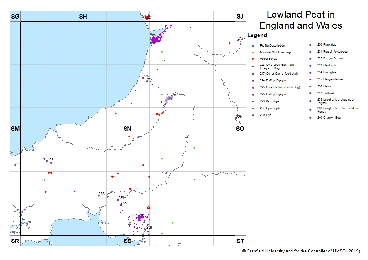
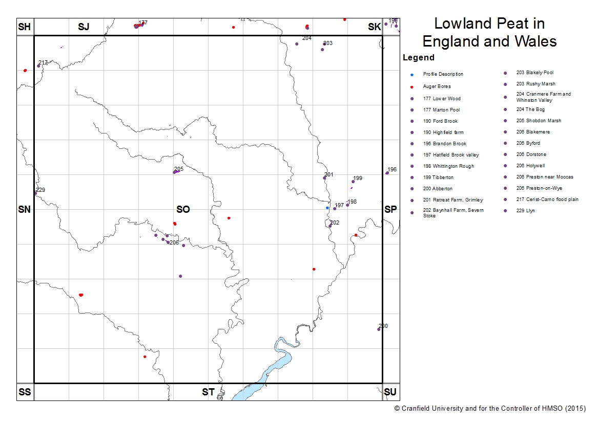
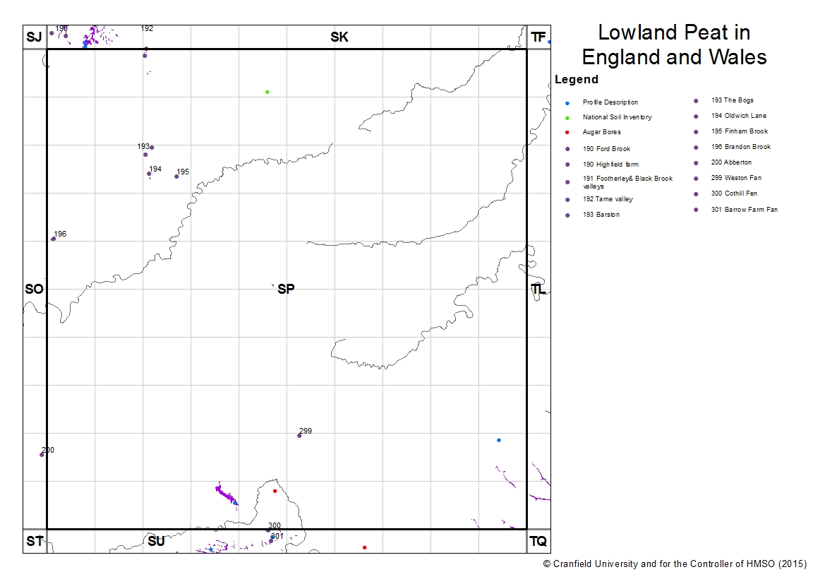
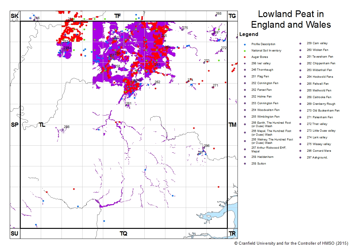
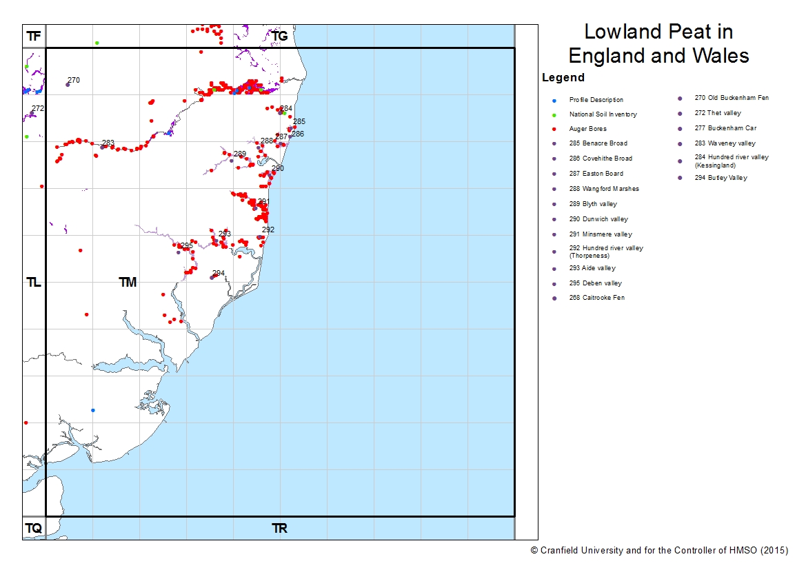
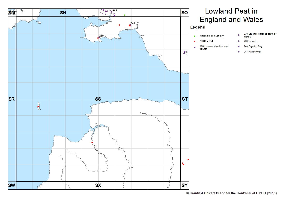
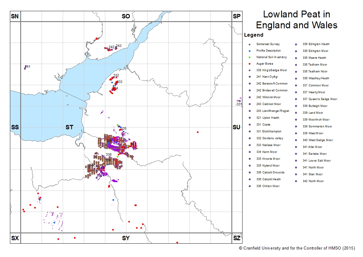
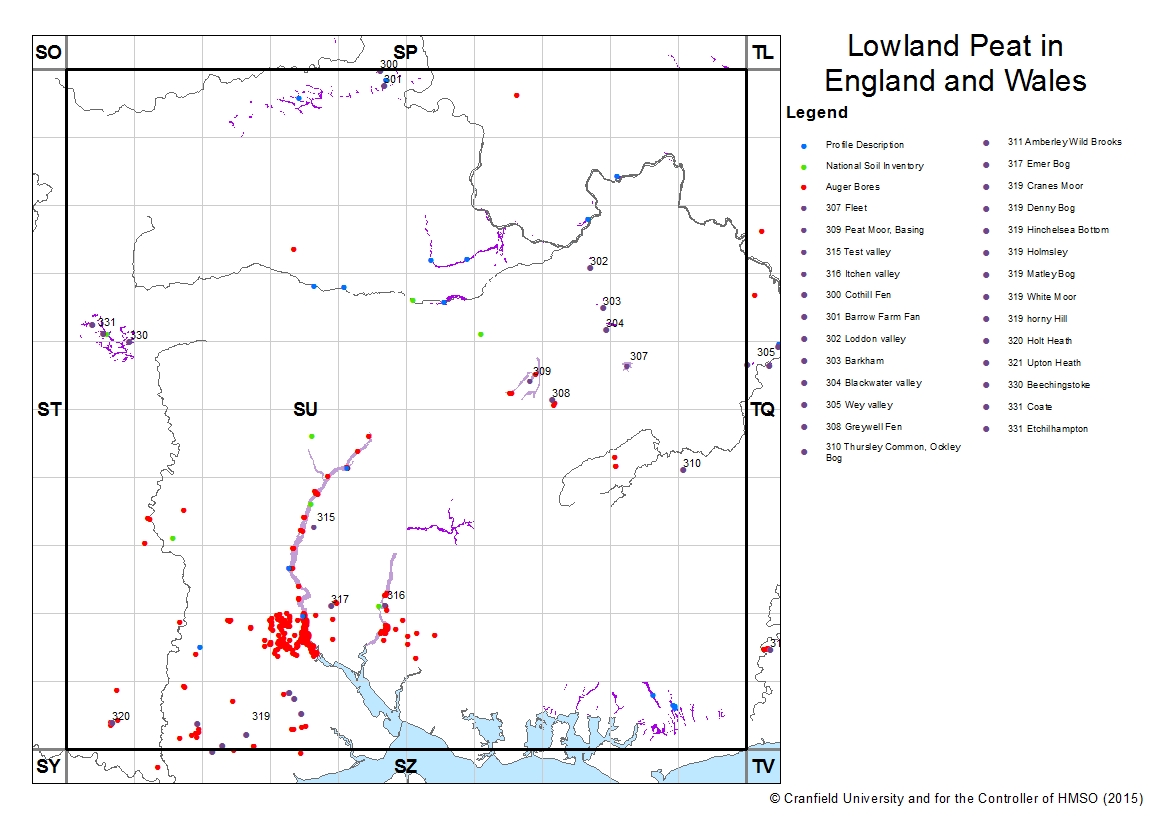
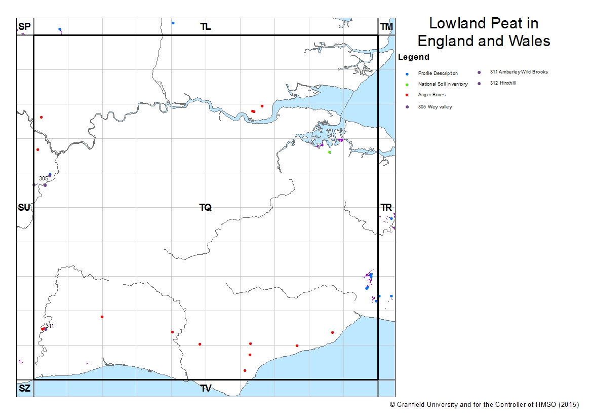
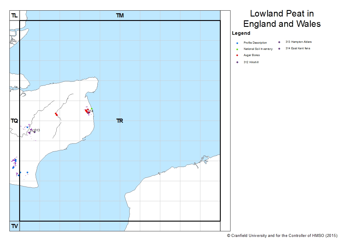
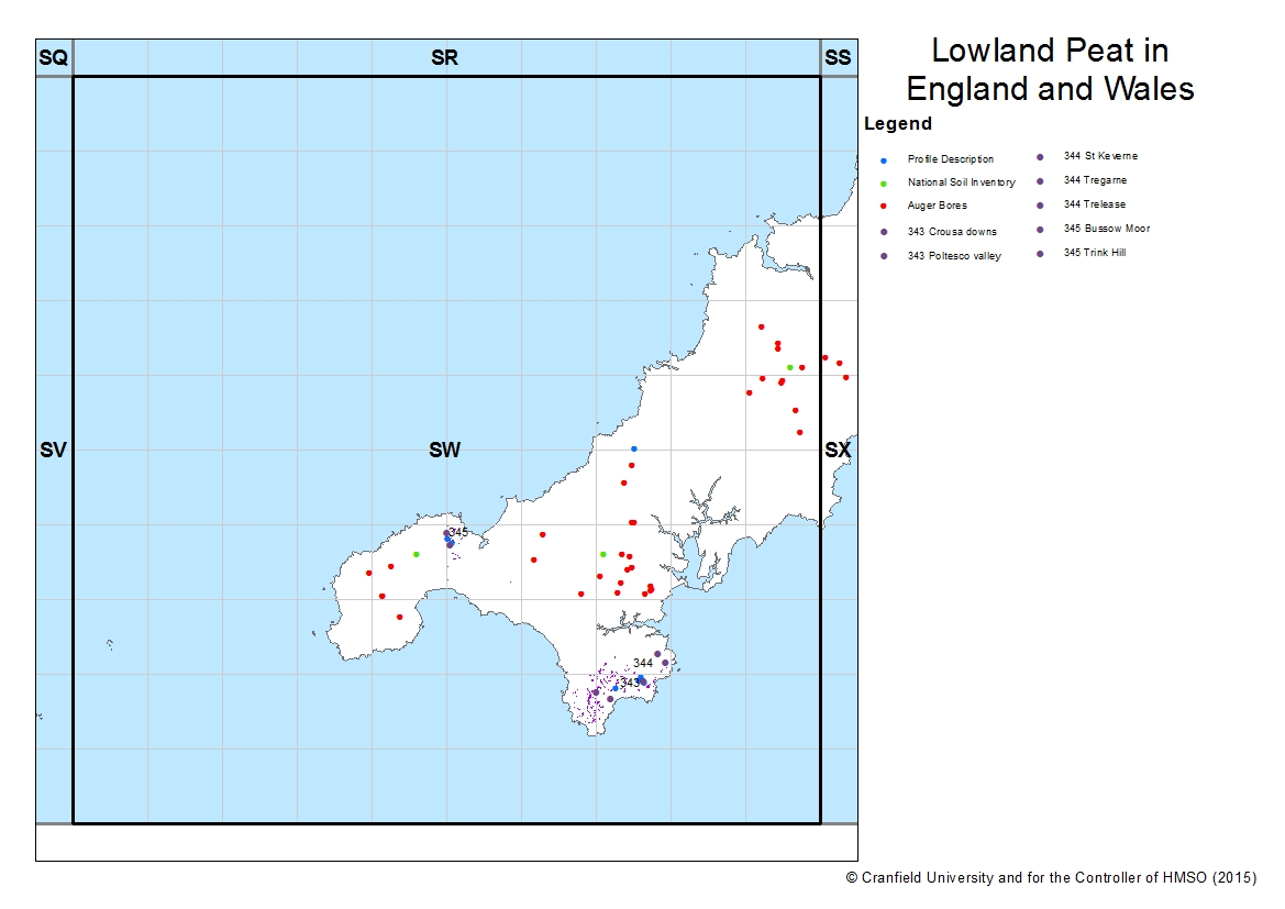
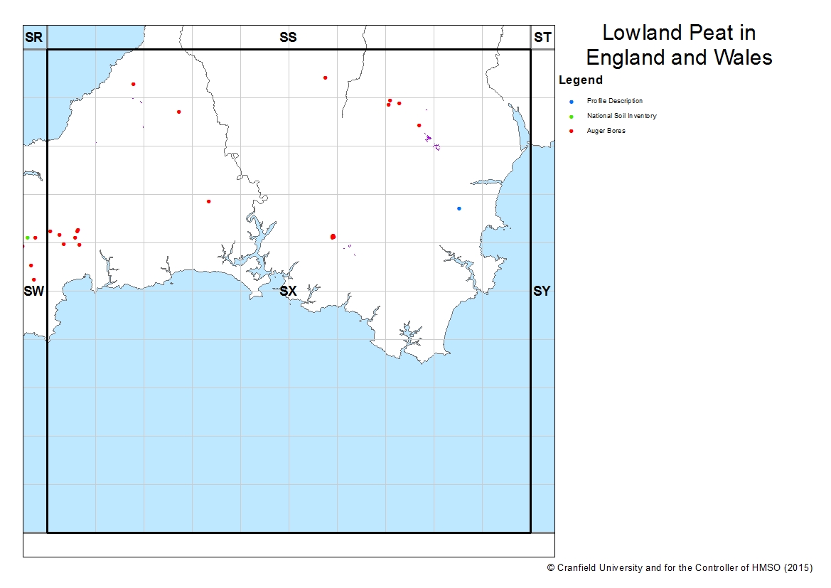
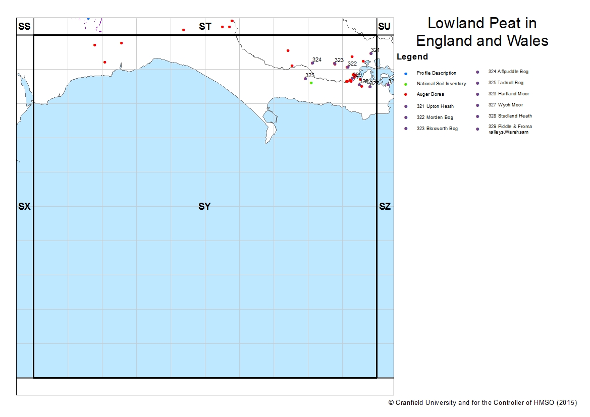
Distribution of Lowland Peat sites
Select a 100km2 tile to zoom in.
 |
 |
||||
 |
 |
||||
 |
 |
 |
 |
 |
 |
 |
 |
 |
 |
 |
 |
 |
 |
 |
 |
 |
 |
 |
|
 |
 |
 |
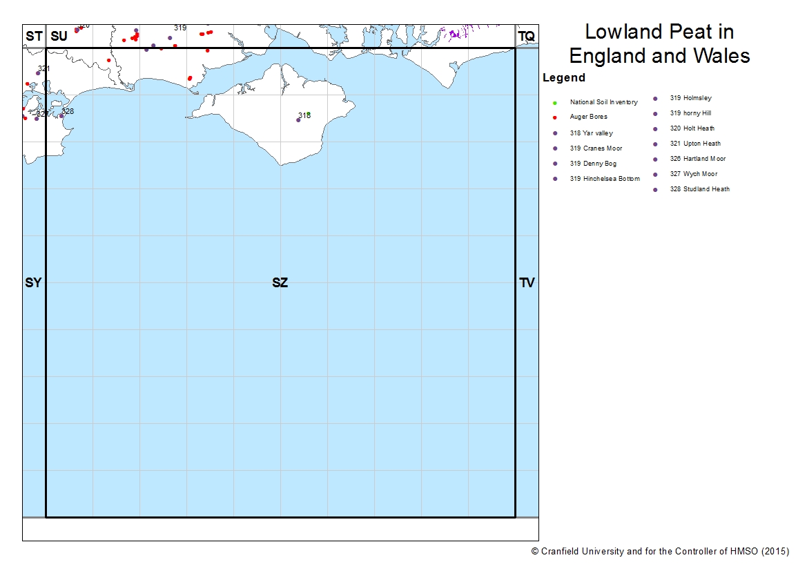 |
Auger Bores
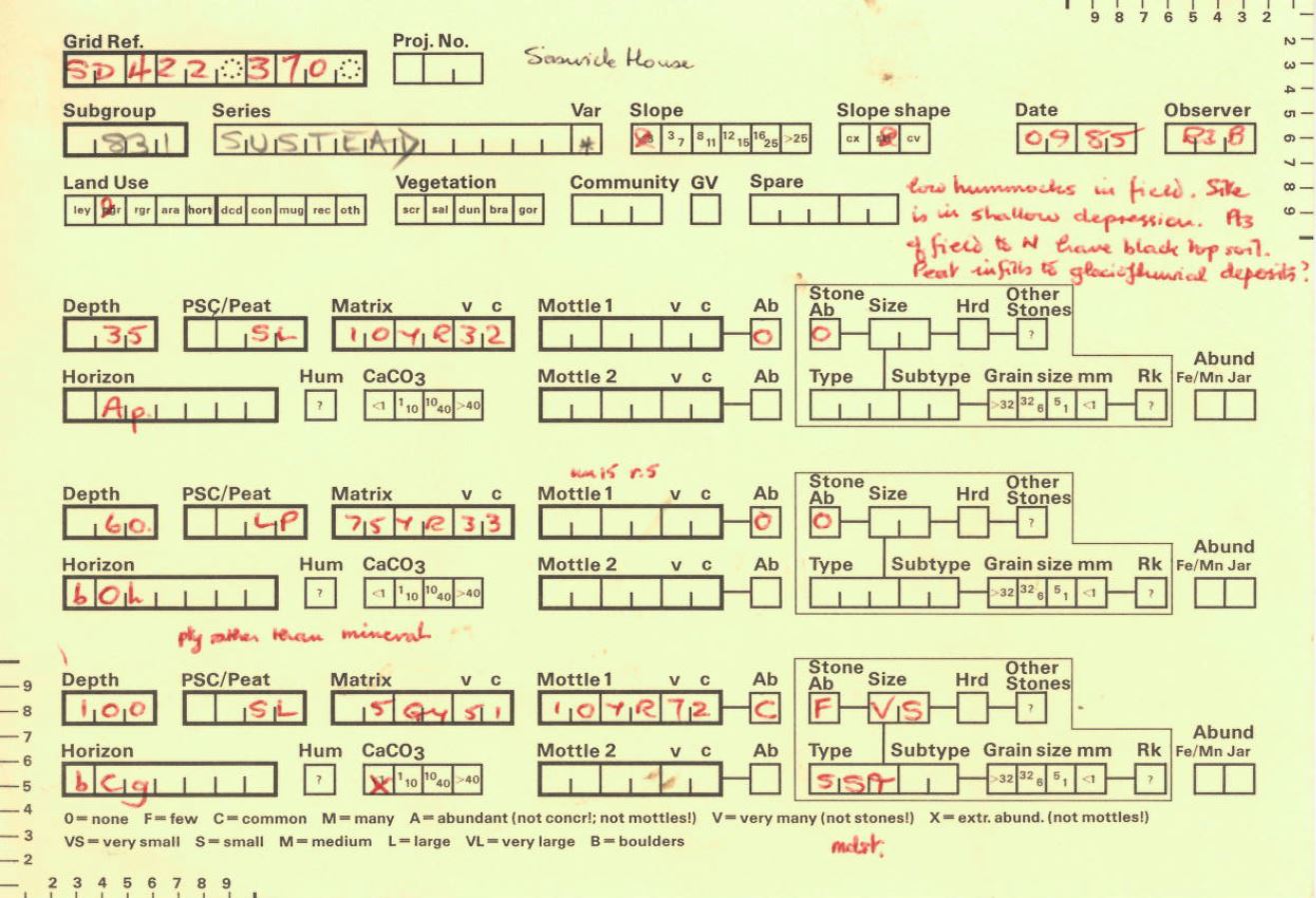
LandIS contains more than 150,000 auger bores (representing >450,000 horizons) made during various mapping projects. Over 4,000 of these have been classified as belonging to the "lowland peat" soil series defined above.
Instructions for filling in the Auger cards (known as 'RUFFS' cards) are available here
Somerset Moors
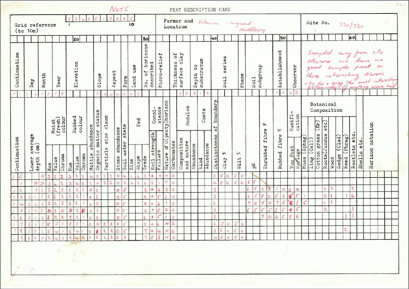
Between 1978 and 1979, David Cope and Graham Colborne surveyed the Somerset moors on a fairly regular grid. Some 270 of these cards have been captured and translated and loaded into LandIS.
pH Records
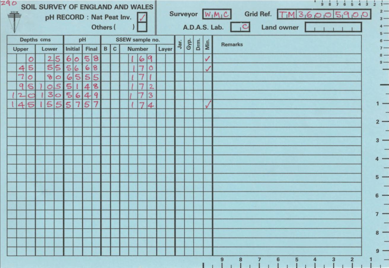
During the Lowland Peat Inventory pH was also measured at most of the auger bore locations. The pH data from 2,304 sites have been captured.
Field Sheets
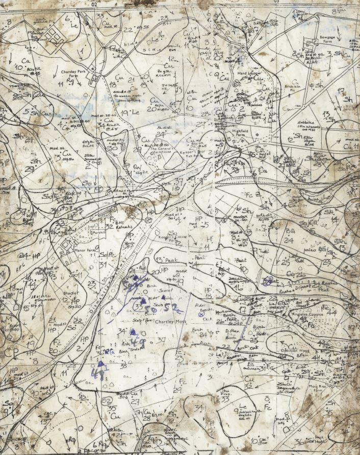
During the Lowland Peat Survey project, the soil surveyors created working ‘folders’, now held in our archive. These folders are organised either on a 10x10km square basis, or by specific area in the case of certain of the larger peat zones. Each folder contains documents describing each of the sites in the area. The descriptions in these folders represent primary data, and are far more detailed than those appearing in the final published book. This information has been captured by scanning and provided in an appropriate electronic format as required. Over 900 items have been captured in this way.
References
BURTON,R.G.O. and HODGSON, J.M. (1987). Lowland Peat in England and Wales. Soil Survey Special Survey No. 15. Soil Survey of England and Wales, Harpenden
BLOOMFIELD, C. (1981). Sulphate and pyritic sulphur contents of peat and underlying clay from Wood Walton and Conington Fens. In: Soils in Cambridgeshire I: Sheet TL18E/28W (Stilton) (ed. R.G.O. Burton and R.S. Seale). Soil Surv. Rec. No.65.
COPE, D.W. and COLBORNE, G.J.N. (1981). Thickness of peat in the Somerset Moors. Map at scale 1:50,000. Soil Survey of England and Wales, Harpenden.
HALL, B.R. and FOLLAND, C.J. (1970). Soils of Lancashire. Bull. Soil Surv. GtBr.
HODGE, C.A.H. and SEALE, R.S. (1966). The soils of the district around Cambridge. Mem. Soil Surv. Gt.Br.
PRICE, J.R. (1980). Acid sulphate and potential acid sulphate soils in the peatlands of Norfolk. Unpublished Report. Soil Survey of England and Wales.
Soil Survey publications are available from Cranfield University Here
