Interpretations of the National Soil Map of England and Wales
NATMAP Wetness
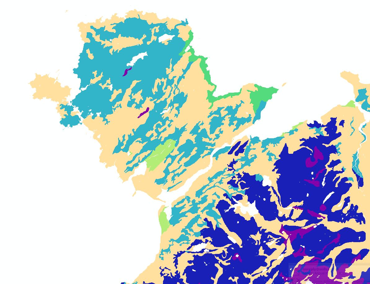
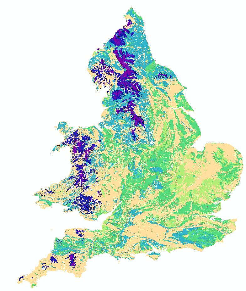
National Soil Wetness Map
NATMAP Wetness is a new product derived from the National Soil Map. It provides users with a useful, concise, easily interpreted and applicable description of the range of soil wetness regimes typical across England and Wales.
Key Facts and Statistics about NATMAP Wetness
- Simplified rendition of the national soil map;
- 6 distinct soil wetness classes
- influenced by climate
Who and what is this useful for?
NATMAP wetness is useful for anyone wanting generalised and simple-to-understand information on soil wetness and drainage at a 1:250,000 scale.
Soil Wetness Class is one of the criteria used in the assessment of Agricultural Land Classification and also in the latest definition of Areas Facing Natural Constraints (ANC) (previously known as Less Favoured Areas (LFA)).
How was this map derived?
The soil experts in Cranfield's Centre for Environmental & Agricultural Informatics (CAEI) have assessed all the soil series represented in the National Soil Map to determine their wetness class within 11 different climate zones in England and Wales. This map combines the national soil map with a climate zone map and the soil series within each soil association are each assigned to one of the six wetness classes and the percentage of each wetness class within the polygon is determined. The final map therefore shows the dominant wetness class plus a breakdown of the percentage coverage of the six individual classes.
How much does this product cost?
- £250 per 1,000 km2.
- Significant discounts apply for larger areas.
- This product is Half price when purchased with NATMAPvector.
For detailed pricing information, use our Quotation Advisor utility.
NATMAP Wetness data and description
The table below describes the various properties within this data product. Each polygon contains the information outlined below.
| Property | Example from data | Description |
|---|---|---|
| WC | III | The dominant Wetness Class in the polygon |
| WC_I | 0 | Percentage of the polygon in Wetness Class I where the soil profile is not wet within 70 cm depth for more than 30 days in most years |
| WC_II | 25 | Percentage of the polygon in Wetness Class II where the soil profile is wet within 70 cm depth for 31-90 days in most years or, if there is no slowly permeable layer within 80 cm depth, it is wet within 70 cm for more than 90 days, but not wet within 40 cm depth for more than 30 days in most years. |
| WC_III | 75 | Percentage of the polygon in Wetness Class III where the soil profile is wet within 70 cm depth for 91-180 days in most years or, if there is no slowly permeable layer within 80 cm depth, it is wet within 70 cm for more than 180 days, but only wet within 40 cm depth for between 31 and 90 days in most years. |
| WC_IV | 0 | Percentage of the polygon in Wetness Class IV where the soil profile is wet within 70 cm depth for more than 180 days but not within 40 cm depth for more than 210 days in most years or, if there is no slowly permeable layer within 80 cm depth, it is wet within 40 cm depth for 91-210 days in most years. |
| WC_V | 0 | Percentage of the polygon in Wetness Class V where the soil profile is wet within 40 cm depth for 211- 335 days in most years. |
| WC_VI | 0 | Percentage of the polygon in Wetness Class VI where the soil profile is wet within 40 cm depth for more than 335 days in most years. |
| WC_NA | 0 | Percentage of the polygon where classification of wetness is not applicable for example rivers or lakes. |
| SHAPE | 2 | Feature ID code which links with the spatial description of the data within a geodatabase |
