Cranfield Mapshop
The Cranfield Mapshop is a web portal managed and operated by Cranfield Innovative Manufacturing Ltd. Using this website allows you to purchase high quality, up-to-date geographical data, including soils maps, interpreted soil maps, aerial photography and height data. Other datasets and types of data are continually added to the website so it is always worth coming back to see what's new.
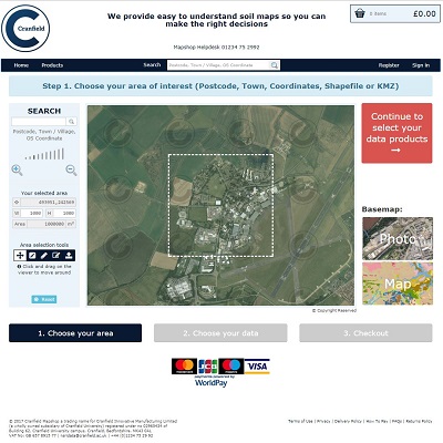
The Cranfield Mapshop offers the ability to search and view your area of interest then purchase digital maps, orthorectified aerial photography. It also offers digital height data in the form of Digital Terrain and Surface Models. The digital products can be downloaded from our secure server.
The system is only available for purchases of around 3000 km2 or less.
Bona-fide researchers and Charities are able to purchase the data with a 99% reduction on the royalty cost. If you register as a bona-fide researcher, please provide details of the research and project you require the data for each time, as we need to authorise such purchases.
If you require other products not available here or areas over 3000 km2 you will have to go through our normal licencing process as described here. Please read the Terms and Conditions and Cranfield Licence carefully at checkout.
For further information on this service visit the FAQ
The exact price of the data for your selected area of interest is calculated and displayed within the digital map shop application. Note any discounts that apply may not be applied until the final checkout.
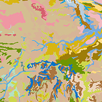
National Soil Map (including Soilscapes)
The National Soil Map is the flagship soil data product from Cranfield University.
It is a 1:250,000 scale map of England and Wales, showing the locations of the 297 distinct soil associations wherever they occur within the countries. The types of soil are described, along with attributes such as the soil fertility and drainage. General descriptions of the underlying geology and typical cropping and landuse are also provided. A URL link to extremely detailed supplementary soil information is also included.
Enhanced Natural Perils data
Cranfield University have developed an easy-to-use and unique suite of geohazard datasets, the Natural Perils Directory (NPD), to assist the insurance market with risk-management decisions on multi-hazard subsidence, flood and wind. Their data is derived from the UK Government recognised National Soils Data and Land Information System (LandIS).
The enhanced Natural Perils Dataset benefits from the addition of highly detailed and accurate tree location data uniquely provided by Bluesky International. Including all trees in England and Wales over 3 metres in height, it enables an unprecedented level of risk assessment for subsidence.
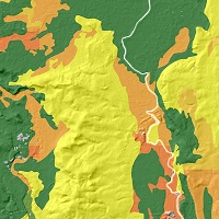
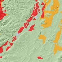
Shrink Swell
Many people don't know how much the soil can move. This interpreted 6 class soil map classifies the soils into those that can shrink (subside) and swell throughout the year. Soil related ground movement can lead to pipe failures, road cracking and house subsidence.
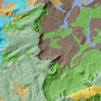
Hydrology of Soil Types
The Hydrology of Soil Types (HOST) classification describes the dominant pathways of water movement through the soil and, where appropriate, the underlying substrate. Eleven drainage models are defined according to the permeability of the soil and its substrate and the depth to a groundwater table, where one is present. These are further subdivided into 29 HOST classes to which all soil series have been assigned. These classes identify the way soil water flows are partitioned, with water passing over, laterally through, or vertically down the soil column. Analysis of the river hydrograph and the extent of soil series for several hundred gauged catchments allowed mean values for catchment hydrological variables to be identified for each HOST class.
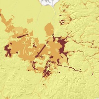
Carbon Stock
The Carbon Stock map is derived from the National Soil Map. It provides users with a summary of the stock of organic carbon by unit area in the soils across England and Wales at three layer depths 0-30 cm, 30-100 cm and 100-150 cm.
Auger Bores
The Soil Survey of England and Wales surveyed many sites during its active years between 1939 and 1987.
During the National Soil mapping programme a large number of auger borings were taken and a standardised form was devised to capture this information.
LandIS contains more than 150,000 auger bores (representing >450,000 horizons) made during various mapping projects.
The data provided via the Cranfield Mapshop is in ESRI shapefile (.shp) or MAPINFO (.tab) format. It is designed to use in a GIS application.
You can load the shapefiles into various free applications to view the linework and interrogate the properties. You could try Google Earth or QGIS.
For example Instructions for importing shapefiles into google earth are available here.
For shapefiles a very simple no frills viewer is available at https://mapshaper.org. Just drag the .shp, .shx, .dbf and .prj files from each map into the viewer.
Instructions for importing shapefiles into Mapshaper tool are available here.
Alternatively, you could order a Soil Site Report if you want the information in a PDF document.