
World Reference Base Soil Map of England and Wales - NATMAP wrb
NATMAP wrb
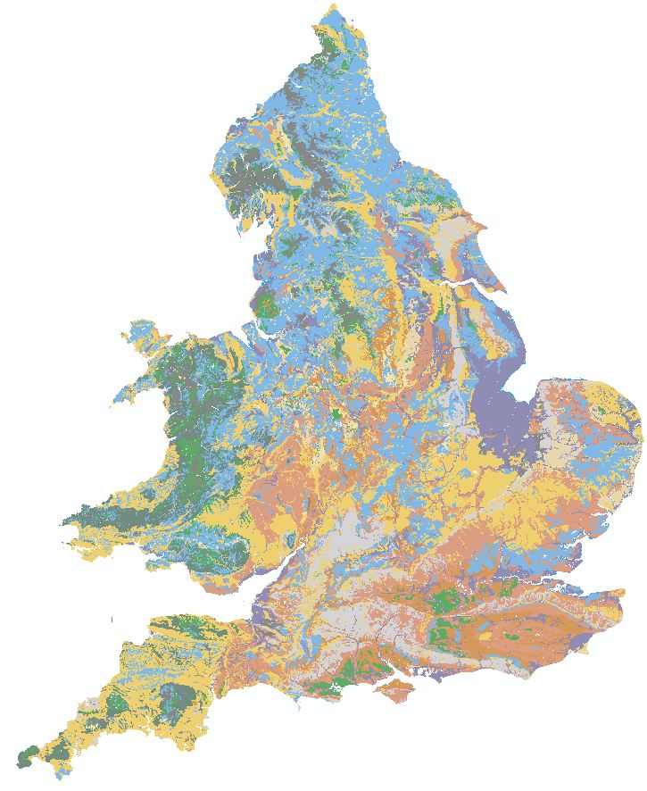
National Soil Map - World Reference Base 2006 Version
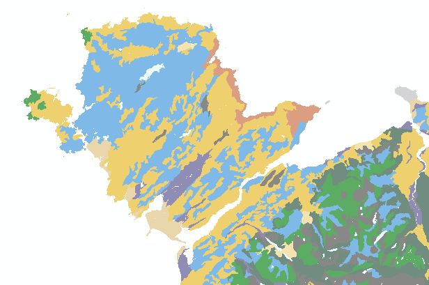
NATMAP wrb is a new soil data product from the CSAI. It is derived from the National Soil Map at 1:250,000 scale map of England and Wales, showing the locations of 113 distinct soil classes wherever they occur within the countries. The dominant soil series in each soil association has been classified to show the equivalent soil class in the World Reference Base classification system of 2006 as defined in World Soil Resources reports No. 103. The WRB Soil Reference Groups which are recognised in England and Wales are described here
Key Facts and Statistics about NATMAP wrb
- 1:250,000 scale digitised National Soil map with 1:50,000 registered linework
- Coastal and inland water bodies registered to 1:50,000 scale
- Soils are classified into level 1 soil groups with up to 4 additional prefixes
- 113 distinct map classes (to level 3 of the WRB classification)
- Classification of only the dominant soil series from each soil association
Who and what is this useful for?
- NATMAP wrb is useful for anyone wanting soil information for England and Wales using an international standard classification system at 1:250,000 scale.
How much does this product cost?
- £400 per 1000km2.
- Significant discounts apply for larger areas.
For detailed pricing information, use our Quotation Advisor utility.
NATMAP wrb data and description
The table below describes the various properties within this data product. Each polygon contains the information outlined below.
| PROPERTY | Example from data | Description |
|---|---|---|
| WRB_L3 | Arenic | Level 3 prefix(es) for WRB class |
| WRB_L2 | Mollic | Level 2 prefix(es) for WRB class |
| WRB_L1 | Gleysols | Level 1 Soil Group of the WRB class |
| WRB06 | Arenic Mollic Gleysols | complete classification in WRB 2006 |
| WRBCODE | GL | Two letter code for the main level 1 soil group for linking to WRB legend |
| UF_L2 | Acid and neutral sands | User friendly description of the class with level 2 prefixes included |
| UF_L1 | Soils with seasonal high Groundwater | User friendly description of the soils at level 1 (soil group) |
| SHAPE | 2 | Feature ID code which links with the spatial description of the data within a geodatabase |
Additional WRB Dataset
The following table is provided FREE on leasing NATMAP wrb.
WRB Legend data (*FREE with NATMAP wrb) RGB colours provided to match the classification provided in the Soil Atlas of the Northern Circumpolar Region
| Property | Example from data | Description |
| WRBCODE | AR | 2 letter WRB level 1 code |
| WRB_L1 | Arenosol | Name of the WRB level 1 class |
| RED | 233 | RGB value for colour display (RED) |
| GREEN | 215 | RGB value for colour display (GREEN) |
| BLUE | 171 | RGB value for colour display (BLUE) |
