
Soil Series Properties
Information on Soil Series data products
For Soil Series, or Soil Types
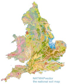
'Soil series' are the taxonomic names given to the various types of soil recognised by CSAI within England and Wales. You can find out more here about the soil classification system used. Each of these soil series, or types, has a whole set of field and laboratory measurements for a broad range of characteristics - physical, chemical and bio-indicative. Some of the measurements are also discriminated by the horizons, or horizontal layers, recorded. When all these properties are combined with the National Soil Map it is possible to create complex thematic maps and modelled outputs. In effect together, these data provide for a national three-dimensional map of representative soil characteristics across England and Wales.
SOILSERIES and HORIZON data products are tabular data that can be used in conjunction with any of the NATMAP products except NATMAP Soilscapes. There are multiple attribute datasets, which are outlined below. Each is used in assessing or modelling the capability or vulnerability of land. SOILSERIES Info provides basic information on the soil series, including the modern definition of the soil. SOILSERIES Pesticides includes information useful for pesticide control such as pesticide leaching and runoff classes. SOILSERIES Hydrology provides extensive information (17 properties) on the water regime, moisture release and hydrology of each soil. SOILSERIES Leacs provides information on the shrink-swell and corrosivity of the soil to Fe and Zn. HORIZON Fundamentals includes very detailed descriptions of the texture and structure of each soil horizon, while HORIZON Hydraulics provides a range of hydraulic properties, for example water content for each of these layers.
This page outlines the data contained within the following products:
- SOILSERIES Info
- SOILSERIES Hydrology
- SOILSERIES Agronomy
- SOILSERIES Pesticides
- SOILSERIES Leacs
- HORIZON Fundamentals
- HORIZON Hydraulics
SOILSERIES data is provided for the customisation of all the NATMAP datasets, excepting NATMAP Soilscapes (which has a different data structure). The range of information within this dataset can seem overwhelming, so we have broken it down into numerous products, and these are outlined on the other pages in this section. Click the links above to navigate to more detailed desciptions of each of the various datasets.
