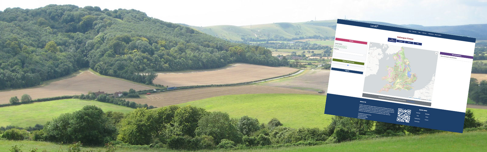
Soilscapes Viewer
What is the Soilscapes Viewer?
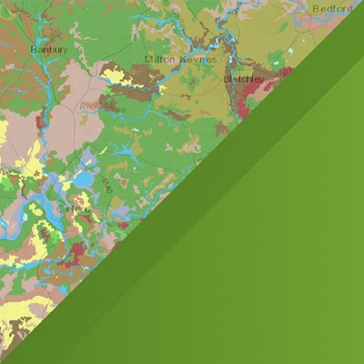
The Soilscapes dataset
The Soilscapes Viewer is a free, easy-to-use, online soil reporting tool which produces summary soils information for a specific location, based upon the “Soilscapes” soil thematic dataset.
Soilscapes is a 1:250,000 scale, simplified soils dataset covering England and Wales. It was created from the far more detailed National Soil Map (NATMAP Vector) held by Cranfield University, with the purpose of communicating effectively a general understanding of the variations which occur between soil types, and how soils affect the environment and landscape of the two countries. Soil exerts a strong influence on our whole ecosystem, being the foundation for many of the ecosystem services and functions recognised, and is a fragile resource that needs to be understood and protected.
Soilscapes is one of our most popular datasets - and to encourage a wider understanding of soils, web access to this data is now made freely accessible. Soilscapes does away with confusing terminology, enabling informed decision-making by non-soil scientists who need to understand soil and how it affects broad landscapes. Using the Soilscapes viewer, it is simple to build up a good understand of many fundamental soil-landscape processes for any region across England and Wales. The Soilscapes dataset is also available separately to lease as one of the Cranfield soil data products.
What does the Soilscapes Viewer show?
The on-screen output
The free Soilscapes viewer provides a summary description of the soils at specified locations across England and Wales. The map displays the soilscapes and soil descriptions for the specified location, as well as a number of the more interesting soil characteristics, including summary soil texture, drainage status, soil fertility, and commonly associated habitat and landcover. Also provided is a useful statistical presentation displaying how common the soils at the location are when compared to the national stock of soils of England and Wales.
Tools are provided to allow the user to navigate around the map, to change the scale of view, to pan the view, to query the information at a given specified point and finally to produce printed output.
How should Soilscapes be used?
Limitations of the dataset
Cranfield University has the responsibility for holding and disseminating soils information in England and Wales. Soil mapping has been conducted across these countries over many decades and there are accordingly a broad range of soil information maps, reports and surveys now available. Our most detailed national soil mapping dataset is termed NATMAP Vector. This seeks to reflect in a coherent and harmonised way a national picture of our soils. However, this detailed dataset adopts a classification scheme that can be hard for non-experts to interpret and understand. As a result, the soil scientists at Cranfield produced Soilscapes, seeking to find a means to convey effectively a summary of the broad regional and sub-regional differences in our soil landscapes. Soilscapes is therefore intended to educate and inform those interestedin soil
Soilscapes conveys a summary of the broad regional differences in the soil landscapes of England and Wales. Soilscapes is not intended as a means for supporting detailed assessments, such as land planning applications or site investigations; nor should it be used to support commercial activities. For such applications, Cranfield have a parallel service termed Soils Site Reporter that provides a comprehensive report of all the soils data we hold for specific locations, and it is this report that is designed for use in support of more localised interests. More detailed paper-based resources are also available from Cranfield.