
Soil Associations
0343i ANDOVER 2
Soil and site characteristics
Shallow well drained calcareous silty soils over chalk. Associated with deeper non-calcareous variably flinty well drained fine silty and fine silty over clayey soils.
Geology
Chalk and Clay-with-flints
Cropping and Land Use
Winter cereals; cereal and grassland rotations with dairying and stock rearing; woodland.
Component soil series
| Subgroup | Series name | Percentage | WRB 2006 link |
|---|---|---|---|
| 3.43 | ANDOVER | 40% | Calcaric Leptosols |
| 5.71 | GARSTON | 30% | Siltic Chromic Endoleptic Luvisols |
| 5.81 | CARSTENS | 15% | Profundic Chromic Luvisols |
| 5.71 | CHARITY | 15% | Chromic Luvisols |
Covers 416 km2 in England and Wales
Soilscapes Classification
| 3 |
Shallow lime-rich soils over chalk or limestone |
0343i ANDOVER 2
Detailed Description
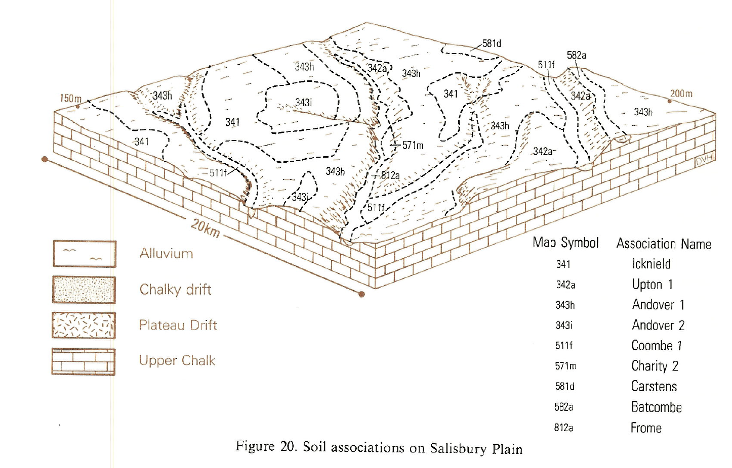
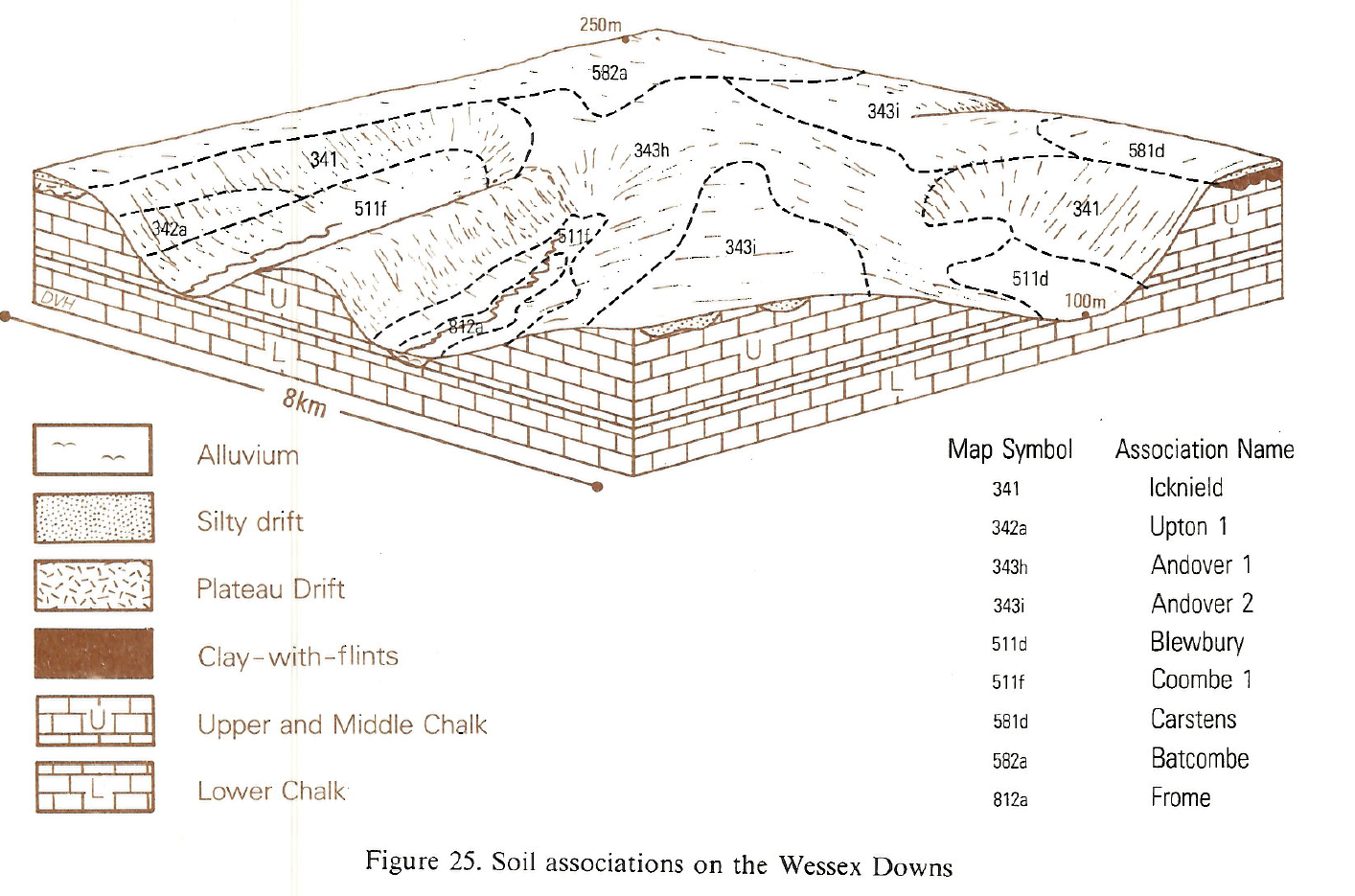
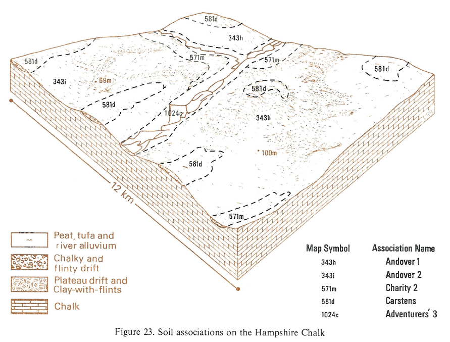
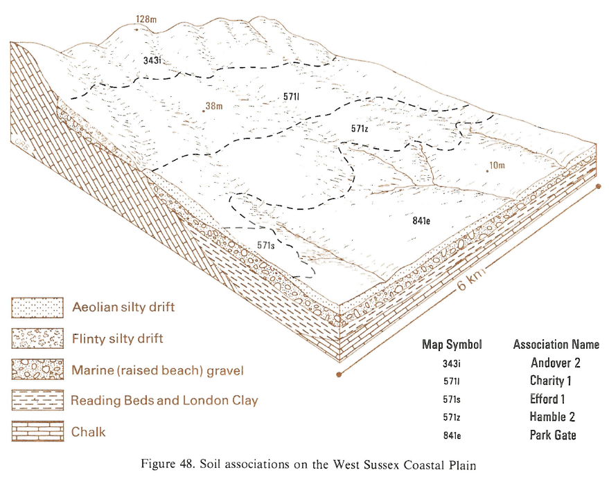
This association is extensive on gentle slopes on the rolling chalkland of Dorset, Wiltshire and the South Downs, and is also found on the Wolds of Humberside. The soils are all permeable and well drained, being mainly in thin silty drift overlying chalk. There is some variation in soil depth, the shallower calcareous Andover soils, brown rendzinas, for instance are mixed with deeper fine silty typical argillic brown earths of the Garston series and fine silty over clayey paleo-argillic brown earths of the Porton series . Deep flinty silty drift and Clay-with-flints give rise to fine silty Charity soils, typical argillic brown earths, and fine silty over clayey typical paleo-argillic brown earths of the Carstens series. There are smaller inclusions of Wallop, Panholes, Upton and Coombe soils.
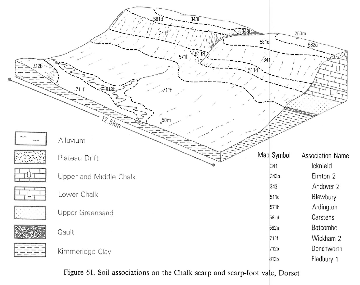
In Dorset and Wiltshire the association occupies plateau sites and extends down the chalk dipslope to flat or gently sloping ground. Apart from the dominant Andover and Garston soils, Carstens and similar Porton soils are found on remnants of Clay-with-flints. Shallow calcareous Wallop soils cap ridge tops where erosion has removed much of the original Clay-with-flints and overlying silty drift. Chalky Upton soils cover the slopes of minor dipslope valleys, the floors of which contain calcareous brown earths of the Coombe and Panholes series. Non-calcareous Charity soils, which like the Garston series have brown subsoil horizons enriched with translocated clay, are found in thick flinty silty drift in shallow valleys, cols and valley heads. Charity soils are most common in Dorset on the lower part of the Chalk dipslope. Both Andover and Garston soils can be particularly flinty on high flat summits and upper slopes. Many brown Andover soils have chalk fragments as well as flints, and in places chalk stones outnumber flints.
In Yorkshire fine silty Andover and non-calcareous Garston soils are most extensive but there are patches of Clay-with-flints which support non-calcareous fine silty over clayey Carstens soils, paleo-argillic brown earths, often on narrow ridge crests. Calcareous silty clay loams of the Panholes series have chalk within 80 cm depth and are common on lower slopes and in the bottoms of minor valleys.
On the upper dipslopes of the South Downs of Hampshire and West Sussex, Andover and Garston soils occupy flat or gently sloping land. Carstens soils are relatively unimportant but Porton soils are found on remnants of Clay-with-flints. Shallow calcareous Wallop soils occur on some ridge tops where erosion has removed much of the original drift. Chalky Upton soils cover the slopes of minor valleys cut into the dipslope, the floors of which contain Panholes and Coombe series. Non-calcareous Charity soils, like the Garston series, have brown subsoil horizons enriched with translocated clay and are found where the flinty silty drift is thick in shallow valleys and some col sites. The association extends some way down the chalk dipslope in places. Both Andover and Garston soils can be particularly flinty on high flat summits and on upper slopes. Elsewhere, chalk stones outnumber flints in Andover soils.
Soil Water Regime
All the soils are permeable and well drained (Wetness Class I) and winter rainfall is readily absorbed. Although most soils are shallow there is evidence that crops can extract sufficient water from the underlying chalk.
Cropping and Land Use
The component soils have moisture retentive topsoils and there are long periods when they can be worked without damage to structure. The calcareous soils can be worked over a wider range of moisture conditions than the non-calcareous silty clay loamy which are more weakly structured, tend to slake, and are sticky when wet. Only after particularly heavy rainfall is there any working restriction on Andover soils which normally dry rapidly after rain and have fairly stable structure. Flintiness often makes cultivations difficult, increases tyre and implement wear and restricts mechanical harvesting of root crops. Cropping is usually cereals with ley grassland, although increasingly there is continuous cropping with winter barley and wheat and to a lesser extent spring barley and wheat. Grass yields are limited slightly on all soils by summer drought but access is easy and the soils rarely poach. Wind exposure is a hazard on the highest ground. Phosphorus and potassium levels of shallow chalk soils have been raised by fertilizer dressings whilst lime is only required on deeper soils that have not been heavily chalked in the past. Available magnesium levels are often low in all these soils and deficiency symptons occur in both crops and livestock. Applications of magnesium to cereals may be ineffective. Symptoms attributable to copper and cobalt deficiencies in cattle have been reported on Andover soils. Remnants of semi-natural grassland are mainly confined to the Imber and Larkhill military training ranges where various types of grassland represent stages of reversion from arable. The vegetation is often extremely rank.
Much of the southern chalkland is or was under estate ownership and woodland, which is still common, is mostly used for sporting purposes. The shallow calcareous soils are limited for forestry by high pH which restricts the range of suitable species. Deficiencies in potassium and nitrogen are common. In contrast, the range of suitable species for the deep non-calcareous soils is large and yields are good. Exposure and windthrow may be problems in some sites where rooting is restricted by compact subsoils or shallowness.
0343i ANDOVER 2
Distribution Map
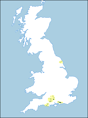 |
Note that the yellow shading represents a buffer to highlight the location of very small areas of the association.
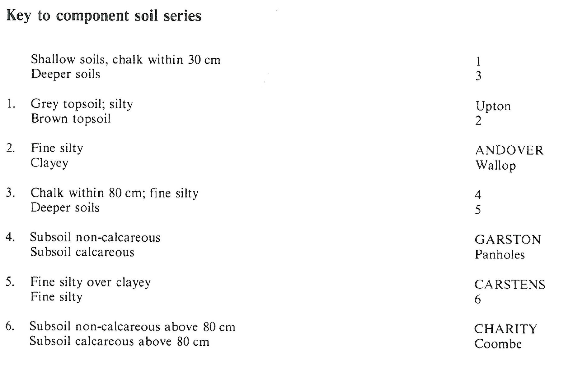
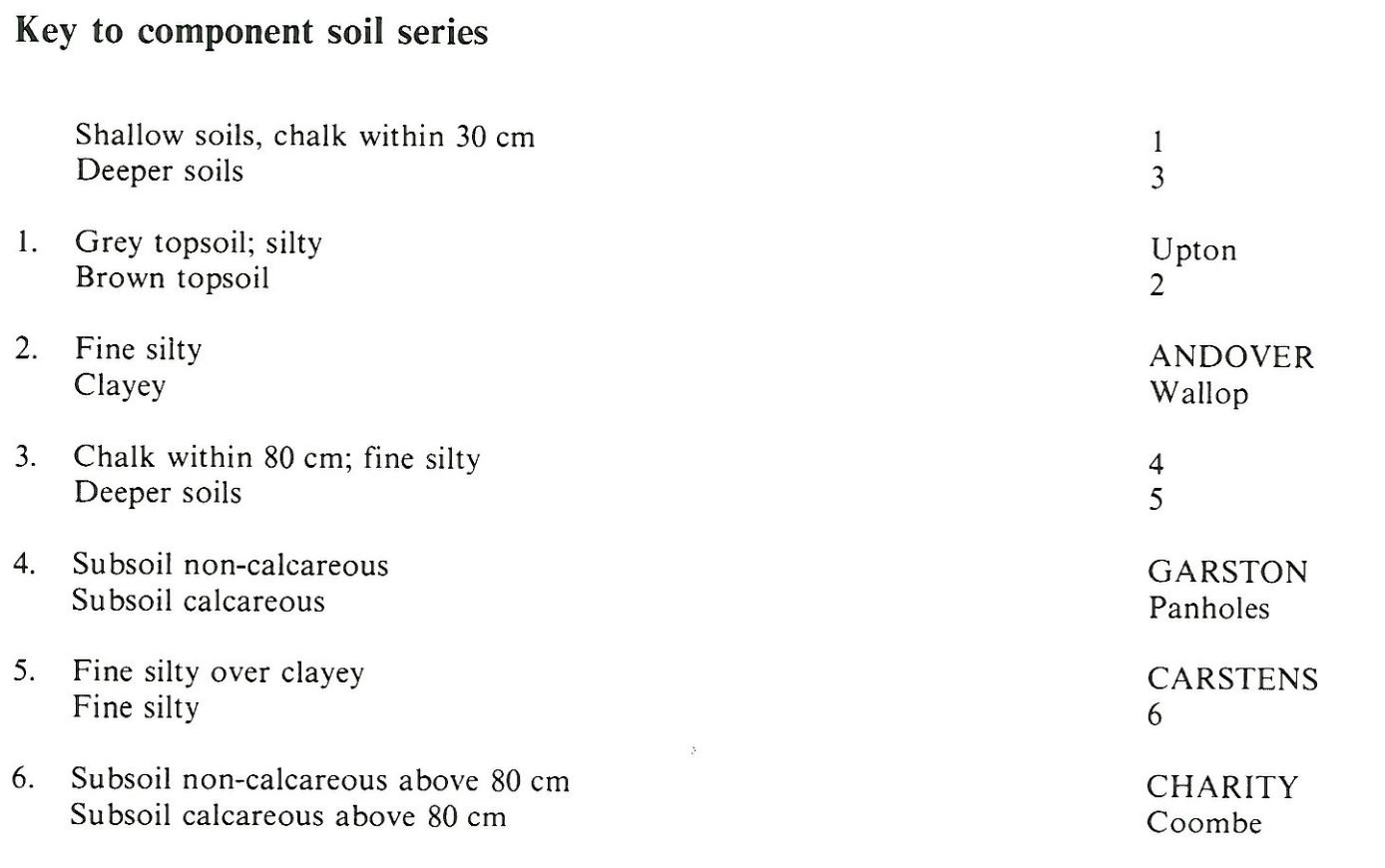
Keys to component soil series
South Eastern Region
 |
South Western Region
 |
Typical Landscapes
South Western Region
 |
South Western Region
 |
South Western Region
 |
South Eastern Region
 |
South Eastern Region
 |
All information Copyright, Cranfield University © 2024
Citation: To use information from this web resource in your work, please cite this as follows:
Cranfield University 2024. The Soils Guide. Available: www.landis.org.uk. Cranfield University, UK. Last accessed 26/04/2024
