Soil Associations
0421b HALSTOW
Soil and site characteristics
Slowly permeable clayey soils often over shale. Some well drained fine loamy soils.
Geology
Carboniferous shale
Cropping and Land Use
Permanent and short term grassland with dairying and stock rearing; some winter cereals.
Component soil series
| Subgroup | Series name | Percentage | WRB 2006 link |
|---|---|---|---|
| 4.21 | HALSTOW | 40% | Endoleptic Stagnic Cambisols |
| 7.12 | HALLSWORTH | 20% | Clayic Eutric Stagnosols |
| 7.12 | TEDBURN | 20% | Clayic Eutric Stagnosols |
| 5.41 | DENBIGH | 10% | Eutric Endoleptic Cambisols |
Covers 280 km2 in England and Wales
Soilscapes Classification
| 8 |
Slightly acid loamy and clayey soils with impeded drainage |
0421b HALSTOW
Detailed Description
This association of clay soils comprises non-calcareous pelosols of the Halstow series and pelo-stagnogley soils of the Tedburn and Hallsworth series. Halsow series is slightly mottled above 40 cm, contrasting with Hallsworth and Tedburn soils which are often gleyed to the surface. Topsoils are clay, silty clay loam or clay loam, each series being most clayey in the immediate subsoil, with clay content declining below about 60 cm as weathering decreases. Fragments of hard sandstone are usually present in the upper horizons, the parent shale, known as "shillot" in Devon and Cornwall, having weathered to clay near the surface. All the component soils are waterlogged for long periods in winter because of the slowly permeable clayey subsoils. The association, mapped on ridge crests and gentle or moderate slopes over Carboniferous shale, extend westward from Exeter to the Atlantic coast south of Bude at heights between 20 and 230 m O.D. Small inclusions of Denbigh and Cherubeer series are present.
Halstow, Hallsworth and Tedburn series occur in roughly equal proportions in an intricate pattern. Many of the included Hallsworth and Tedburn soils are less gleyed than those in the adjacent Hallsworth associations, having browner topsoils and strong brown or yellowish brown matrix colours in the subsoil. However, on some wider ridges and in basins, markedly gleyed Hallsworth and Tedburn profiles are present. In a few places where a thicker surface horizon of clay loam is developed, Halstow series grades into Cherubeer series. Well drained Denbigh soils are found on steep slopes (formerly mapped as Dunsford series) as well as on relatively level ground where the shaly parent rock has been sheared and is less weatherable. Red soils otherwise similar to Halstow series are included north of Crediton, around Exeter and in Ashclyst Forest. The distribution pattern of soils over Carboniferous shale is a function of faster weathering of shale to clay on relatively level, less well-drained ground. The soils occur in a hydrological sequence. On either side of the Tamar Valley, between Launceston and Holsworthy the soil pattern is slightly modified, most ridge crests there carrying brown soils of the Neath association.
Soil Water Regime
Movement of water through these clayey soils is very slow. Undrained the Halstow series has Wetness Class IV while inclusions of Tedburn and Hallsworth series are usually wet into the growing season (Class V); with effective drainage each series can be improved by one class. In general winter run-off is rapid, being most marked on Hallsworth and Tedburn soils and on slopes. In drier districts near Exeter, Halstow soils are moderately droughty for grass and slightly droughty for barley. Further west droughtiness lessens.
Cropping and Land Use
Most of the Halstow association is in grassland supporting dairy and beef cattle and sheep, but some cereals are grown, often for farm consumption. Pastures are productive but can be damaged by stock and machines during much of the growing season when the soils are wet. Grassland is mostly of better quality and more intensively used than that on the related, and often adjacent, Hallsworth 1 association. In recent years the proportion of winter cereals has increased in the rainshadow north-east of Dartmoor. Only autumn cultivation is possible without serious damage and the ground is waterlogged for long periods in winter, so crops are patchy and return only modest yields. Even near Exeter, soils and weather for autumn landwork are unreliable, which partly explains cereal performance, particularly as the effect of damage from one ill-timed cultivation on such land can persist for several seasons.
0421b HALSTOW
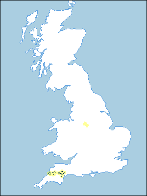
Distribution Map
 |
Note that the yellow shading represents a buffer to highlight the location of very small areas of the association.
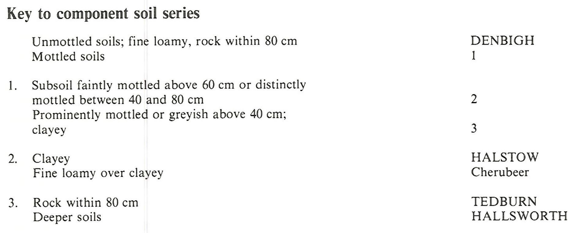
Keys to component soil series
Northern Region
 |
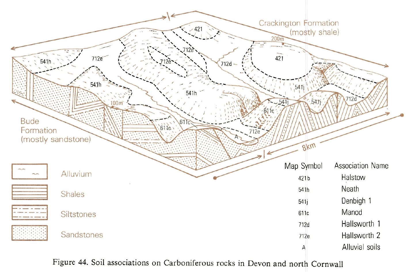
Typical Landscapes
South Western Region
 |
All information Copyright, Cranfield University © 2024
Citation: To use information from this web resource in your work, please cite this as follows:
Cranfield University 2024. The Soils Guide. Available: www.landis.org.uk. Cranfield University, UK. Last accessed 26/04/2024
