Soil Associations
0542 NERCWYS
Soil and site characteristics
Deep fine loamy soils with slowly permeable subsoils and slight seasonal waterlogging. Associated with similar slowly permeable seasonally waterlogged soils.
Geology
Till from Palaeozoic and Mesozoic sandstone and shale
Cropping and Land Use
Stock rearing and dairying; some cereals.
Component soil series
| Subgroup | Series name | Percentage | WRB 2006 link |
|---|---|---|---|
| 5.42 | NERCWYS | 50% | Eutric Stagnic Cambisols |
| 7.13 | BRICKFIELD | 30% | Eutric Stagnosols |
Covers 463 km2 in England and Wales
Soilscapes Classification
| 8 |
Slightly acid loamy and clayey soils with impeded drainage |
0542 NERCWYS
Detailed Description
The Nercwys association consists of deep stony fine loamy soils in drift derived mainly from Carboniferous sandstones and shales. It is mapped in Clwyd, Devon, Derbyshire, North Yorkshire, Durham, Cleveland and Northumberland. The main soil is the Nercwys series of fine loamy stagnogleyic brown earths in drift with siliceous stones. It covers approximately half the land and usually occupies shedding sites or those where permeable bedrock occurs at between 1 and 2 m depth. The associated Brickfield series, fine loamy cambic stagnog]ey soils, occupies one-third of the area and is found mainly where the substratum is less permeable so soil conditions are wetter. The landscape is gently rolling but locally there are slopes up to 11 degrees. In Clwyd, the association occurs south-west of Wrexham where the till, up to 30 m thick, mainly derived from the underlying Carboniferous sandstone and mudstone, includes a little material brought in by Irish Sea ice. Both the Nercwys and Brickfield soils contain lenses of coarse loamy or sandy material formed by weathering of stones. Coarse loamy Wick soils occur on isolated deposits of glaciofluvial material. Further north, the association occupies slopes running down to the Dee at Holywell, where Nercwys and Neath series have been mapped by Thompson (1978). In Radnor there are Nercwys soils near Gladestry.
The association occupies about 8 km² in Devon, principally in the Bovey Basin on gentle slopes where Head, derived from Paleozoic shales and slates, has spread over the Oligocene ball clays. These soils were mapped as Stover series. There is a small separate at the confluence of the Exe and Culm just north of Exeter which includes other soils described by Clayden as Woodrow Complex.
The association is found in five localities, covering 400 km². Between Berwick-Upon-Tweed and Alnwick it is on the low undulating Northumberland coastal plain, in till underlain by permeable Carboniferous sandstones, and coincides with the renowned Belford fattening pastures. Some of the sandstones are reddish and give rise to reddish till, with soils such as the Salwick series. Near Hexham and in the North Tyne Valley around Bellingham, slopes may be as much as 11 degrees and the till is underlain in places by Carboniferous limestone. Near Sedgefield, the till is underlain by Magnesian Limestone at less than 2 m depth and there are occasional Aberford soils, in which limestone occurs at less than 80 cm depth. Fringing the North York Moors are areas dominated by Nercwys soils, on steep slopes and with Jurassic sandstones close to the surface, in association with Rivington soils. In the lower parts of Swaledale, Wensleydale and Teesdale the association is on gently undulating land, with either limestone or sandstone at 1 to 2 m depth. Some subsoils are more clayey and Kearby and Dunkeswick soils are included.
Soil Water Regime
Waterlogging in winter months, above the slowly permeable subsoil places Nercwys soils in Wetness Class II or III, depending on the thickness of permeable upper horizons and the existence of artificial drainage. While Brickfield soils are in Wetness Class IV, or V if undrained, Neath profiles are permeable (Wetness Class I). Nercwys soils can be slightly droughty for grass but not for cereals or potatoes.
Cropping and Land Use
Dairying is the main source of income, the soils being mostly in grass on short and long term rotations. Poaching risk restricts winter use, particularly on the wettest soils. Cereal crops, mostly barley, are most common where either a coarse loamy topsoil affords better conditions for cultivation or the climate is drier. Autumn cultivations can be made over several weeks but the soils are mostly too wet in spring, when occasional days following dry spells will afford the only opportunities for landwork if compaction is to be avoided. There is some woodland, oak being the main species.
0542 NERCWYS
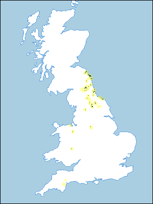
Distribution Map
 |
Note that the yellow shading represents a buffer to highlight the location of very small areas of the association.
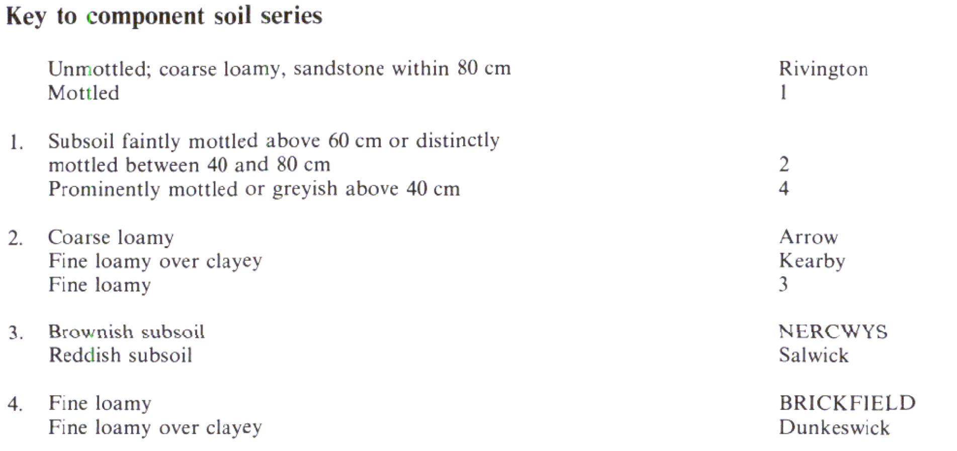
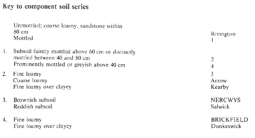
Keys to component soil series
Wales
 |
Northern Region
 |
All information Copyright, Cranfield University © 2024
Citation: To use information from this web resource in your work, please cite this as follows:
Cranfield University 2024. The Soils Guide. Available: www.landis.org.uk. Cranfield University, UK. Last accessed 26/04/2024
