Soil Associations
0551e NEWPORT 2
Soil and site characteristics
Deep well drained sandy often ferruginous soils. Risk of wind and water erosion.
Geology
Glaciofluvial drift over Cretaceous sand or Crag
Cropping and Land Use
Cereals, sugar beet and peas and beans.
Component soil series
| Subgroup | Series name | Percentage | WRB 2006 link |
|---|---|---|---|
| 5.51 | NEWPORT | 30% | Eutric Lamellic Arenosols |
| 5.54 | LYNN | 25% | Arenic Chromic Luvisols |
| 5.51 | COTTENHAM | 20% | Eutric Rubic Arenosols |
Covers 145 km2 in England and Wales
Soilscapes Classification
| 10 |
Freely draining slightly acid sandy soils |
0551e NEWPORT 2
Detailed Description
This association of deep well drained sandy soils covers 152 km², mostly in Suffolk on gentle and moderate slopes below the coastal plateau between Ipswich, Aldeburgh and Felixstowe, but there are small areas south of King's Lynn in Norfolk. In Suffolk the association occurs on Crag and thin glaciofluvial sands that cover it. In Norfolk similar thin drift overlies Carstone. Three soil series cover three-quarters of the land. The most extensive soil, the Newport series, belongs to the typical brown sands. The associated similar but ferruginous Cottenham series, also typical brown sands, is noticeably browner and less flinty. Lynn series, argillic brown sands, is also brown and ferruginous but the deep subsoil is clay-enriched. Other component soils include the Worlington series and near Felixstowe, Wighill and Ludford series, developed in loamy Head over London Clay outcropping from beneath the Crag.
In Suffolk the soils occur in an irregular catenary sequence with Newport series occurring on the highest ground and Lynn series extending on to low ground. Locally on the footslopes, rendzinas, brown calcareous earths and argillic brown sands to which soil series names have not been given are formed directly in shelly Crag. They form a complex pattern. In west Norfolk, Newport soils are again mainly found on crests and upper slopes with Lynn series on lower ground. Near Hilgay and Downham Market Worlington series is found on chalky drift.
Soil Water Regime
The Newport, Cottenham and Lynn series, and the minor soils except Wighill series, are permeable and well drained (Wetness Class I). On the flat or gently sloping ground, winter rainfall is readily absorbed. The climate is relatively dry so all the soils are moderately droughty for cereals, sugar beet and oilseed rape and very droughty for grass and potatoes, the Lynn series being the least droughty.
Cropping and Land Use
There are ample opportunities on these easy working soils for autumn and spring cultivations, which are best done by traditional mould-board ploughing. As they dry out within a day or two of rain, they can be worked throughout most of the year although care must be taken during winter cultivations and late harvesting of sugar beet to avoid compaction by working whilst too wet, especially on Wighill soils. Barley, wheat and sugar beet are the main crops on these poor soils, which are naturally acid and need frequent additions of lime. Rye and, where irrigation is available, potatoes, including second earlies, are also grown. The Lynn series, with sandy loam subsoils, and the associated soils on Crag on low ground are higher yielding than Newport and Cottenham soils. Some of the higher ground and steeper slopes are under woodland or heath. There is a risk in dry springs of seedbeds being destroyed by strong winds, and a risk of rill erosion on the steeper slopes, while these are still bare.
0551e NEWPORT 2
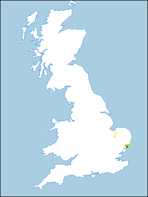
Distribution Map
 |
Note that the yellow shading represents a buffer to highlight the location of very small areas of the association.
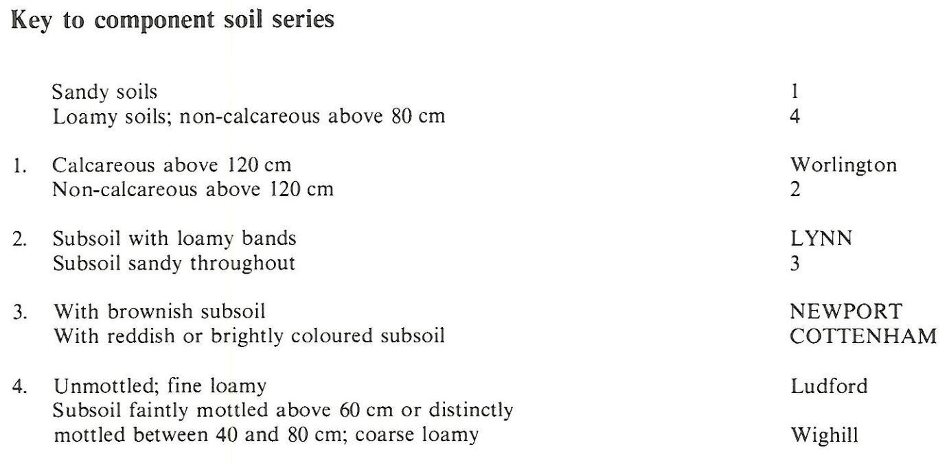
Keys to component soil series
Eastern Region
 |
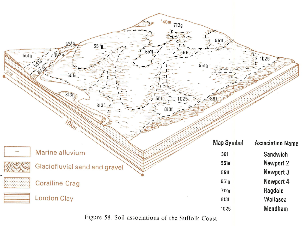
Typical Landscapes
Eastern Region
 |
All information Copyright, Cranfield University © 2024
Citation: To use information from this web resource in your work, please cite this as follows:
Cranfield University 2024. The Soils Guide. Available: www.landis.org.uk. Cranfield University, UK. Last accessed 27/04/2024
