
Soil Associations
0342a UPTON 1
Soil and site characteristics
Shallow well drained calcareous silty soils over chalk. Mainly on moderately steep, sometimes very steep land. Deeper fine silty calcareous soils in coombes and dry valleys.
Geology
Chalk
Cropping and Land Use
Permanent grassland rough grazing and woodland on scarps; cereals and short term grassland on gentle slopes; recreation.
Component soil series
| Subgroup | Series name | Percentage | WRB 2006 link |
|---|---|---|---|
| 3.42 | UPTON | 45% | Rendzic Leptosols |
| 3.43 | ANDOVER | 15% | Calcaric Leptosols |
| 3.41 | ICKNIELD | 15% | Rendzic Leptosols |
| 5.11 | PANHOLES | 10% | Calcaric Endoleptic Cambisols |
| 5.11 | COOMBE | 5% | Calcaric Cambisols |
Covers 798 km2 in England and Wales
Soilscapes Classification
| 3 |
Shallow lime-rich soils over chalk or limestone |
0342a UPTON 1
Detailed Description
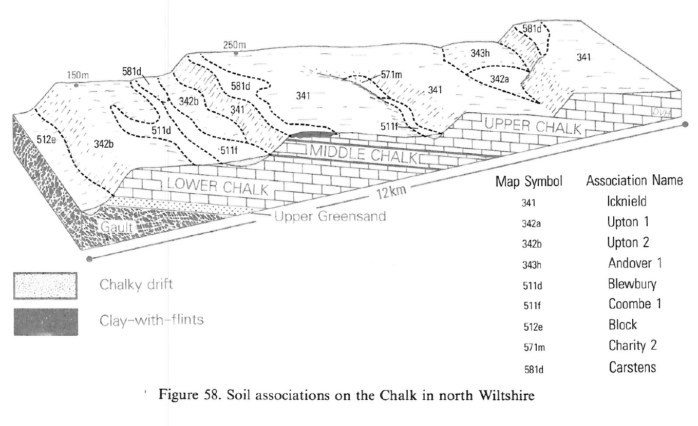
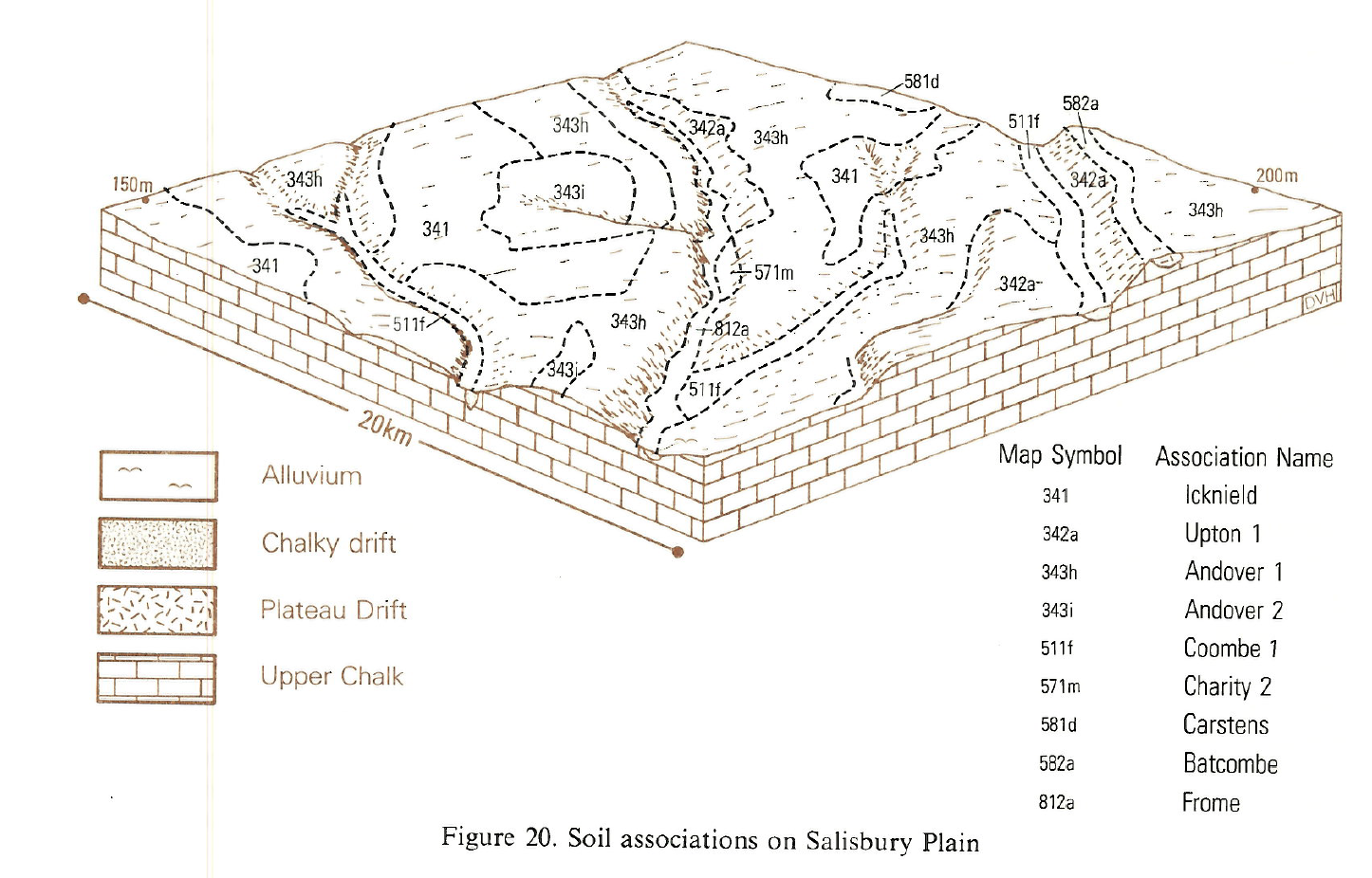
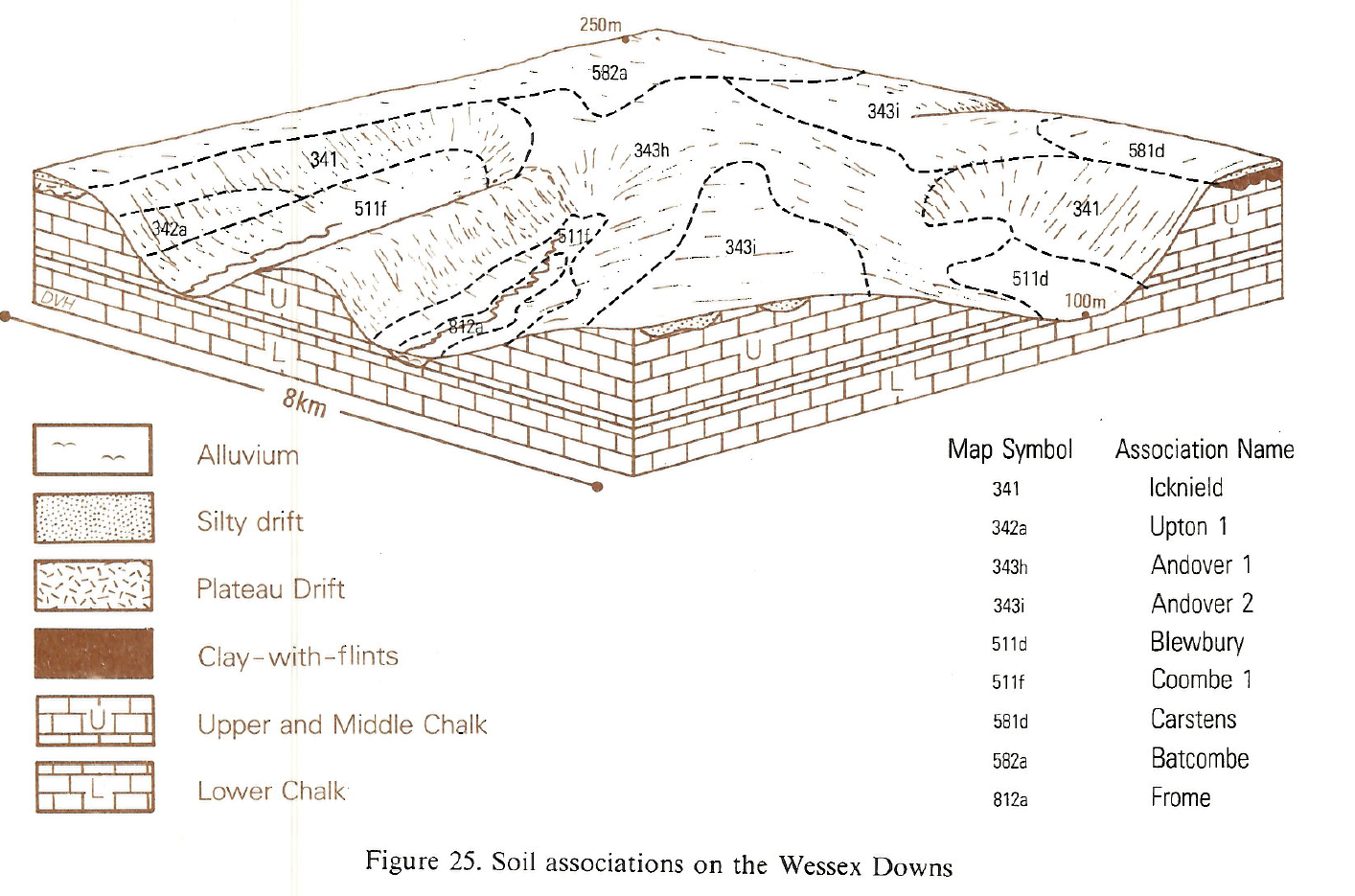
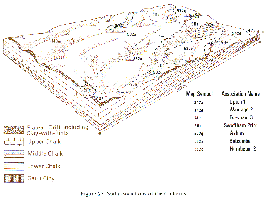
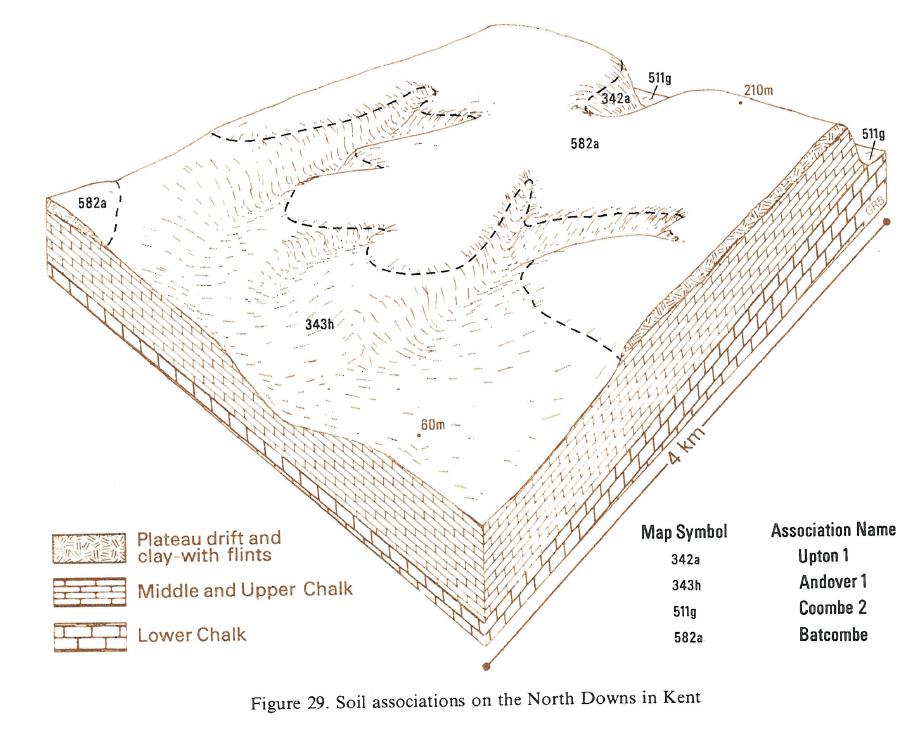
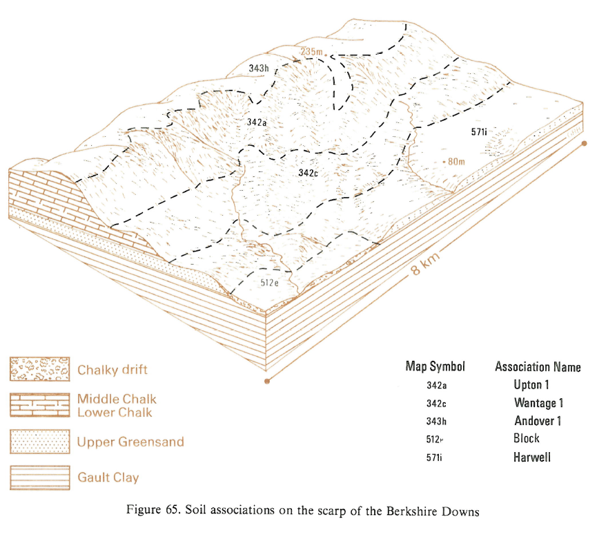
This association is found on the Chalk mainly on escarpments and other steeply sloping land but it occurs locally on gentler slopes. It is widespread from Dorset through Wiltshire eastwards to Sussex and Kent and north-eastwards to Cambridgeshire, the Lincolnshire Wolds and Yorkshire. It consists of shallow, well drained, silty soils with chalk or chalk rubble at less than 30 cm depth, usually overlying Middle and Upper Chalk but in places developed on Lower Chalk. The principal soils, Upton series, are shallow, often extremely calcareous grey rendzinas with many chalk and flint stones. The associated Andover soils are shallow, flinty, less calcareous brown rendzinas and Icknield soils are shallow, dark coloured humic rendzinas. The deeper fine silty Panholes and Coombe soils, typical brown calcareous earths, are developed in the chalky and flinty drift. Upton soils are most common on cultivated eroded sites. Andover soils which include some drift material, are often found on less eroded sites. Icknield soils are uncommon and absent in Lincolnshire but are found locally under old grassland or woodland, their persistence depending on past land use. The chalk beneath these shallow rendzinas is shattered to varying depths, the thickness of broken chalk usually being greatest on gentle and moderate slopes and least on steep slopes, but this is not a consistent sequence; chalk rubble, in places more than a metre thick, is commonly found on slopes of up to 30 degrees. Panholes and Coombe series occur mostly on lower slopes of the Chalk escarpment or on concave slopes in coombes and dry valleys where drift has accumulated. Small patches of Gore and Millington soils are found in colluvium, chiefly in dry valley bottoms.
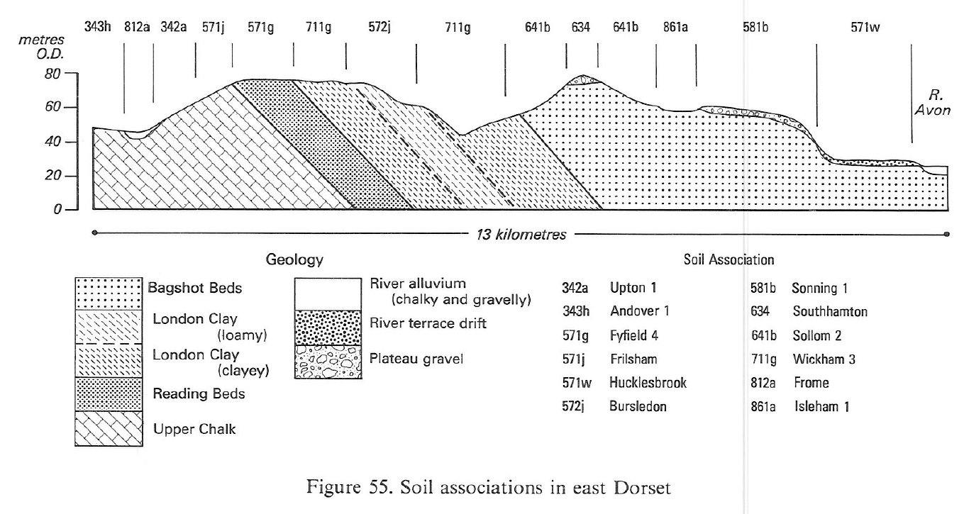
In Cambridgeshire and Hertfordshire the association occurs mainly on gently undulating land. North-east of Hitchin and Baldock coarse and fine loamy soils belonging to Swaffham Prior and Soham series, become increasingly common and in general Upton and Andover soils are less silty than elsewhere. In east Dorset the association occurs on the gentle slopes of the lower dipslope where there are no Icknield soils.
The association is found on the north-facing escarpment of the Wolds overlooking the Vale of Pickering, on the west-facing escarpment of the Chalk south of the Humber near Caistor, and on more gently sloping country on Lower Chalk east of Pocklington. Upton series is most common on cultivated eroded sites. Andover series is often found on less eroded ground where the soils include some drift. Icknield soils are uncommon but are found locally under old grassland or woodland, their persistence depending on past land use. The chalk beneath these shallow rendzinas is shattered to varying depth, the thickness of broken chalk usually being greatest on gentle and moderate slopes and least on steep slopes, but this is not consistently so; chalk rubble, in places more than a metre thick, is commonly found on slopes of up to 30 degrees. Panholes and Coombe series occur mostly on lower slopes of the Chalk escarpment or on concave slopes in dry valleys where drift has accumulated. Small patches of Gore and Millington soils are found in colluvium, chiefly in dry valley bottoms.
In South East England the association is mostly confined to the Chalk escarpments and steep slopes elsewhere in strongly dissected chalkland, as on the Isle of Wight. The land was previously mapped in Berkshire and in Kent. Small patches of Panholes and Coombe series are common in scarp-face coombes and, on the North Downs, Panholes series occurs locally on slopes of up to 30 degrees. West of Petersfield and east of Guildford, small areas of slumped Plateau Drift are included giving Carstens and Marlow soils espectively. Between Guildford and Reigate, Newmarket, Rudham and Andover soils are more common than elsewhere, the result of additions of material from nearby sandy Plateau Drift.
Soil Water Regime
The main soils are well drained (Wetness Class I) and excess winter rain is readily absorbed. The amount of available water in these soils is difficult to predict since the weakly shattered chalk is penetrated by roots to varying depths and plants extract water from the porous chalk.
Cropping and Land Use
Cultivated land occurs mainly on convex, moderate slopes; steep land remains under downland or woodland. The soils have fine stable soil structure, are easy to work and cultivations are rarely restricted in autumn, but there are few suitable days in wet springs. Some long-cultivated soils, low in organic matter, compact readily if cultivated when too wet. On steep slopes improvement of the grassland is difficult to achieve and there is a risk of erosion on heavily grazed land. Germination is often poor on the chalkiest soils and where, as is often the case, these are on exposed brows, shallow-rooted plants are further retarded by the drying effect of strong winds in spring. Cereal yields are therefore often smaller than on the similar Andover series. Upton soils are relatively flint-free, compared with other chalk soils, so there is less implement wear. Phosphorus and potassium levels have been increased by fertilizers, but magnesium levels are low and deficiency can occur in cereals and livestock.
There are several ecologically interesting grasslands in Wiltshire usually on steep, often heavily grazed land such as Starveall Down, Stony Hill, Scratchbury Hill, Woodminton Down and Bulford Down, or on strongly sloping ground as on Summer Down and Porton Down. Most sites have Festuca ovina-F.rubra grassland with Carex humilis grassland on south and south-west aspects around Starveall and Woodminton Downs.
Herb rich calcareous grassland and woodland survive mainly on slopes too steep for other uses. Grazed swards consist mainly of sheep's fescue (Festuca ovina) and red fescue (F. rubra) with many herbs such as birdsfoot-trefoil (Lotus corniculatus), salad burnet (Sanguisorba minor), wild thyme (Thymus praecox), ribwort (Plantago lanceolata) and various orchids. Where undergrazed, the species become fewer and vigorous grasses including upright brome (Bromus erectus) and for grass (Brachypodium pinnatum) take over. Eventually scrub and woodland develops. The dominant scrub species are hawthorn and dogwood with juniper, box, spindle-tree and yew locally. Woodlands are usually of beech with hazel, field maple and ash.
0342a UPTON 1
Distribution Map
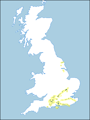 |
Note that the yellow shading represents a buffer to highlight the location of very small areas of the association.
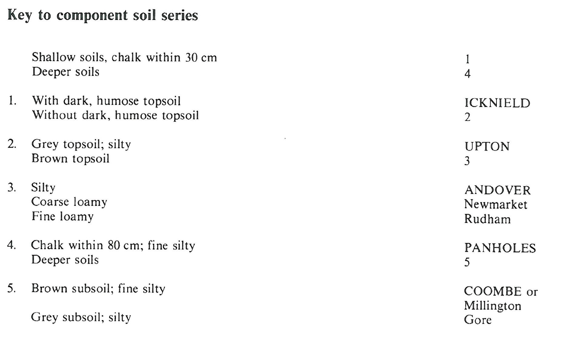
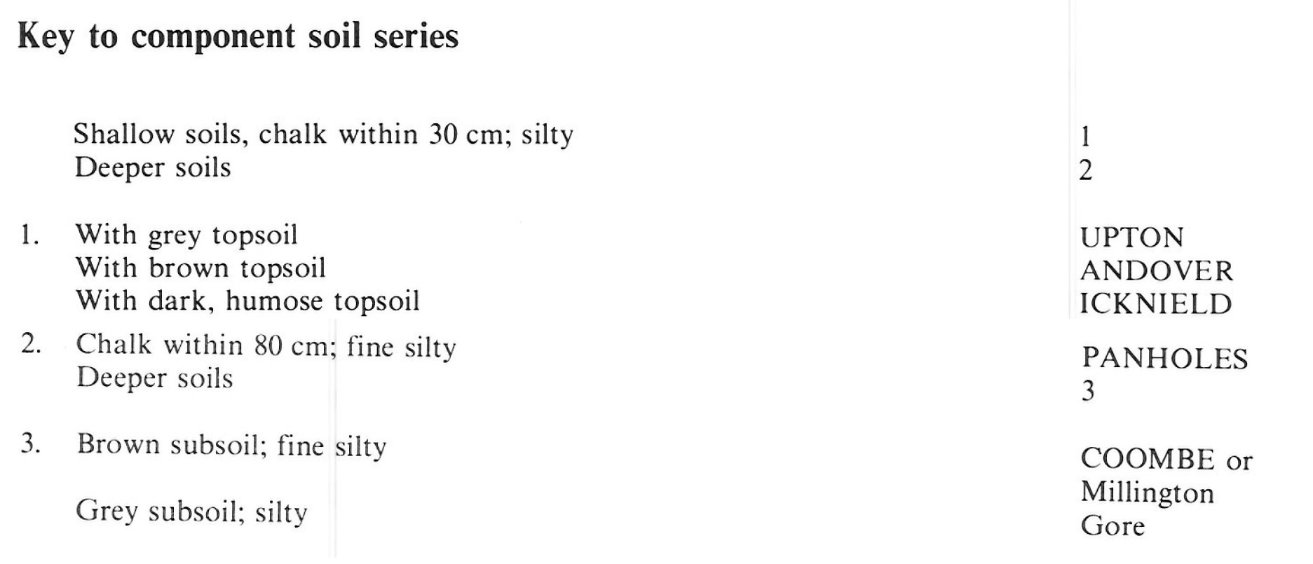
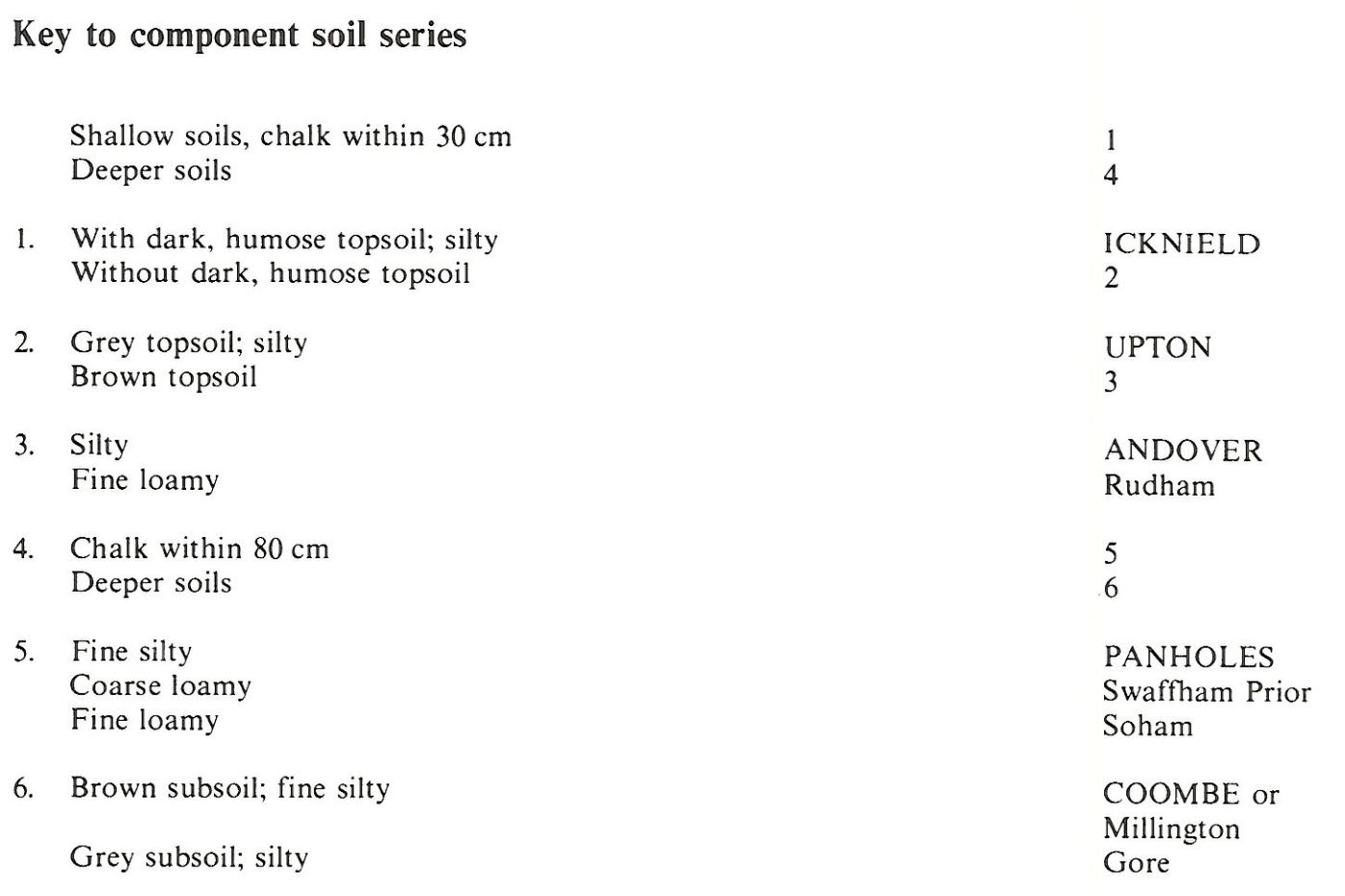
Keys to component soil series
South Eastern Region
 |
South Western Region
 |
Eastern Region
 |
Typical Landscapes
South Western Region
 |
South Western Region
 |
South Western Region
 |
South Western Region
 |
Eastern Region
 |
South Eastern Region
 |
South Eastern Region
 |
All information Copyright, Cranfield University © 2025
Citation: To use information from this web resource in your work, please cite this as follows:
Cranfield University 2025. The Soils Guide. Available: www.landis.org.uk. Cranfield University, UK. Last accessed 25/04/2025
