Soil Associations
0342c WANTAGE 1
Soil and site characteristics
Well drained calcareous silty soils, in places shallow over argillaceous chalk.
Geology
Chalk
Cropping and Land Use
Winter cereals, cereal and grassland rotations with dairying.
Component soil series
| Subgroup | Series name | Percentage | WRB 2006 link |
|---|---|---|---|
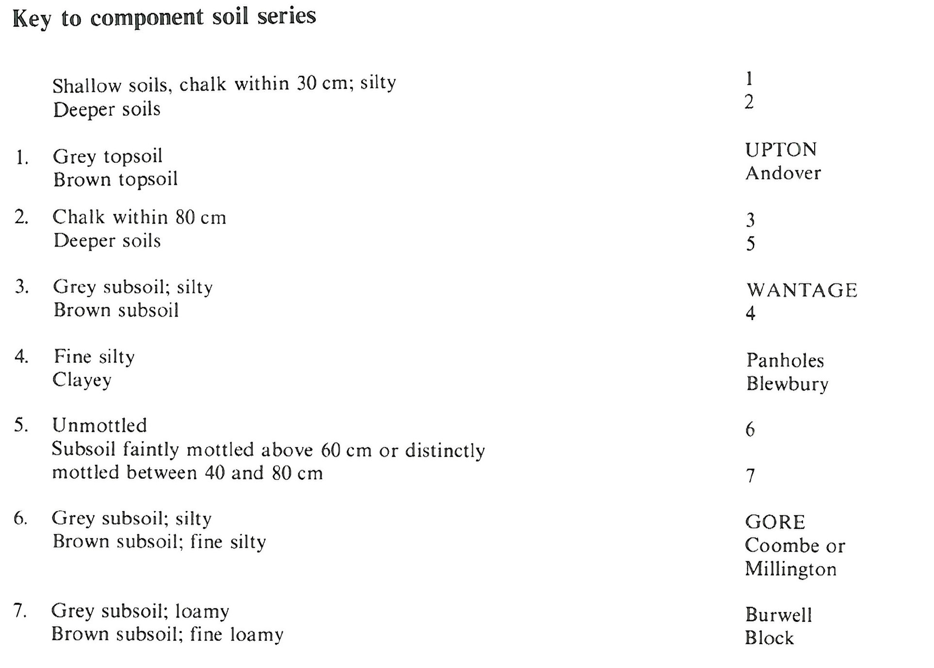
| 3.42 | WANTAGE | 70% | Rendzic Leptosols |
| 3.44 | GORE | 10% | Calcaric Colluvic Regosols |
| 3.42 | UPTON | 10% | Rendzic Leptosols |
Covers 89 km2 in England and Wales
Soilscapes Classification
| 3 |
Shallow lime-rich soils over chalk or limestone |
0342c WANTAGE 1
Detailed Description
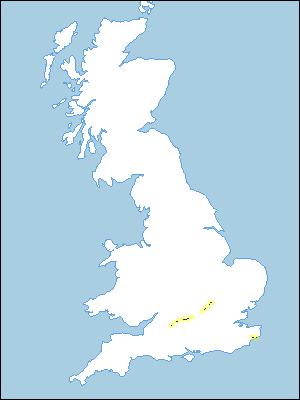
This association consists of greyish, well drained silty soils on the Lower Chalk mainly in south Oxfordshire, north Wiltshire, Kent and Buckinghamshire. In Bedfordshire, Hertfordshire, and Cambridgeshire the association occurs in small patches. North of Luton it forms a narrow strip of gently sloping land at the foot of the chalk escarpment. Near Luton the soils form the side of a ridge and the association continues sporadically to the south-west, fronting the Chiltern Hills. The principal soil is Wantage series, loamy grey rendzinas with an extremely calcareous silty clay loam subsoil and chalk at moderate depth. The land is affected locally by springs and winterbournes so Burwell soils are found on valley floors and on gentle slopes. Shallow Upton soils, grey rendzinas, are confined to convex valley sides below the main Chalk scarp.
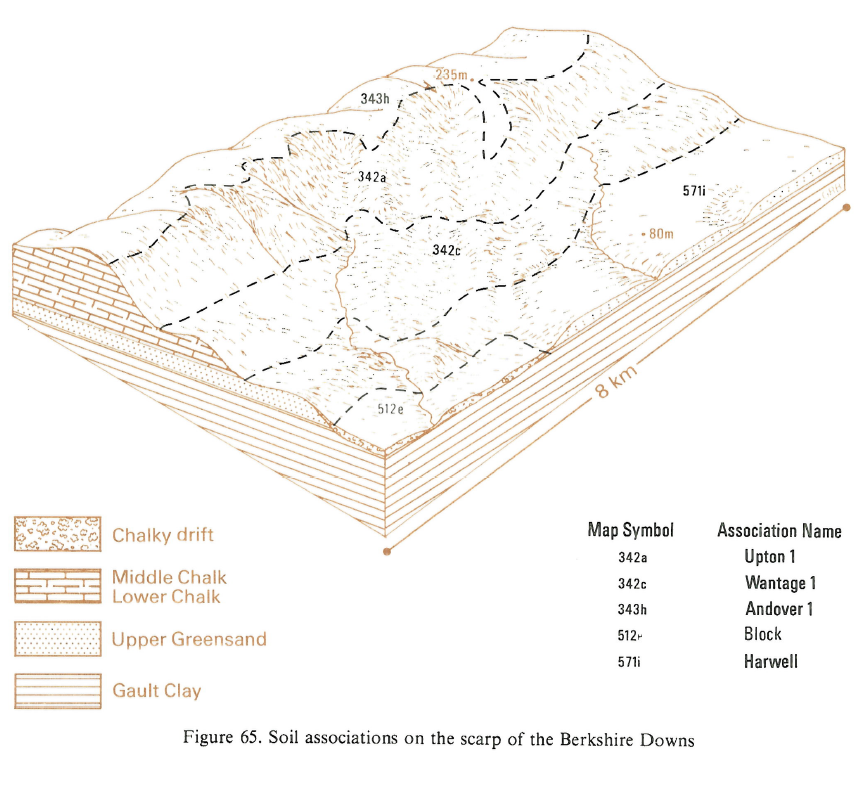
These soils are mapped on the gently to moderately sloping Lower Chalk overlooking the Vale of White Horse in south Oxfordshire. Although Wantage soils are dominant here, Upton and Gore soils are common on upper slopes. Panholes, Coombe and Charity soils are found on some valley floors and footslopes in drift from higher land nearby. In the Vale of Aylesbury, the land has been mapped in detail. In east Kent, where the soils occur on the North Downs scarp, they were included in the Andover association.
Soil Water Regime
The soils of the association are predominantly well drained (Wetness Class I), but there are patches of less permeable Burwell soils on some valley floors and flat valley sides which when field drainage is effected are largely well drained (Wetness Class I).
Cropping and Land Use
The main crops are cereals, grown continuously or in rotation. Yields of winter wheat are consistently high and those of spring barley about average. The soils are easy to work and any surface capping usually breaks up as the soil dries. There is adequate time for autumn and spring landwork. There is little risk of poaching in grassland but there is some drought limitation on the shallowest soils.
0342c WANTAGE 1
Distribution Map
 |
Note that the yellow shading represents a buffer to highlight the location of very small areas of the association.
Keys to component soil series
South Eastern Region
 |
Typical Landscapes
South Eastern Region
 |
All information Copyright, Cranfield University © 2025
Citation: To use information from this web resource in your work, please cite this as follows:
Cranfield University 2025. The Soils Guide. Available: www.landis.org.uk. Cranfield University, UK. Last accessed 25/04/2025
