
Soil Associations
0361 Sandwich
Soil and site characteristics
Mainly deep well drained calcareous and non-calcareous sandy soils. Some sparsely vegetated unstable soils. Waterlogged soils in hollows locally. Shingle bars and spits locally extensive. Risk of wind erosion.
Geology
Dune sand and marine shingle
Cropping and Land Use
Sand dune and some wetland habitats; recreation; very limited agriculture and coniferous woodland; some gravel extraction in the South East Region.
Component soil series
| Subgroup | Series name | Percentage | WRB 2006 link |
|---|---|---|---|
| 3.61 | SANDWICH | 55% | Calcaric Arenosols |
| 1.1 | RAW SANDS | 20% | Dystric Protic Arenosols |
| 3.21 | BECKFOOT | 10% | Dystric Arenosols |
| 8.21 | FORMBY | 10% | Arenic Eutric Gleysols |
Covers 399 km2 in England and Wales
Soilscapes Classification
| 4 |
Sand dune soils |
0361 Sandwich
Detailed Description
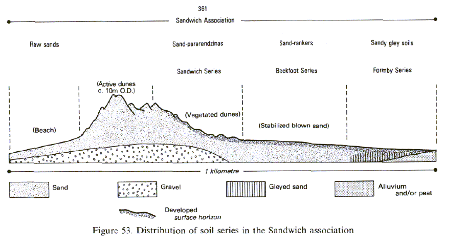
The Sandwich association consists of deep calcareous and non-calcareous sandy soils on sand dunes, marine shingle and related beach deposits . The dunes, which rise to over 25 m O.D., are unstable in places. The association occurs in all regions and contains a wide variety of soils. It is exposed everywhere to sea winds. Soil development on the dunes largely depends on the vegetation and the degree to which this has stabilized the dune system. The most extensive soil is the Sandwich series, typical sand pararendzinas, found on fixed dunes, usually over 100 years old and often considerably older. Here the vegetation is dominated by herbs, brambles, grasses and deciduous scrub. Younger, unstable dunes, particularly those nearest the sea, are unvegetated or only thinly colonized by marram grass (Ammophila arenaria) and lyme grass (Leymus arenarius). Their shape constantly alters as a result of wind erosion and deposition and raw sands predominate there. Soils of the Beckfoot series, typical sand-rankers, occur on stabilized non-calcareous dunes. Wind erosion ceases only when the land surface nearly reaches groundwater level, at which stage small hollows (slacks) are formed. Larger elongated depressions (swales) result from the enclosure of lengths of beach by a newly-formed line of dunes. Typical sandy gley soils, Formby series, occur in wet hollows among the dunes. As sand is often blown on to fixed dunes, buried topsoils are widespread and it is common for several to occur in one profile where they form distinctive organic-rich layers. Many of the dune systems have developed on the lee side of shingle bars or spits formed by tidal or other currents. There is great variety in their length, shape and age, and they have often been breached and re-formed in historical times.
Apart from Talacre Warren on the north-eastern tip of Wales, sand dunes are in three groups. On the south-west coast of Anglesey there are dunes at Newborough, Valley and Aberffraw. Ranwell (1959) has described the history and vegetation of Newborough Warren, considering it to be Boreal or earlier in origin. The sand at Valley extends more than one kilometre inland and, although construction of the airfield has destroyed most of the dunes, there are large expanses of stabilized dunes and wet slacks. There is a protecting seaward wall of high dunes colonized by marram grass, many of which are suffering erosion as a consequence of human trampling. Around Cardigan Bay there are narrower dune systems. At Morfa Harlech, dunes protect extensive alluvial and sandy gley soils. These dunes also support marram grass but some form more stable herb-rich fescue grassland. Willow scrub grows in slacks and parts have been afforested. Similar dunes lie seaward of the airfield at Morfa Dyffryn and further south at Tywyn and Ynyslas. On the south coast the largest system is at Pembrey (19 km²) flanking the Tywi estuary. There are also extensive dunes at Freshwater West, Pendine, Kenfig Burrows and Merthyr Mawr, with smaller areas elsewhere. Most of the dunes have sufficient shell material to be calcareous although older dunes become acid through leaching. Raw sands, on unstable dunes, and the Sandwich series are the main soils, both on dunes and in dry slacks. Wet slacks have sandy gley soils. Coniferous plantations cause more rapid leaching of carbonates than natural vegetation, and the Beckfoot series is more commonly formed under them. Slightly podzolized soils are found under old plantations at Pembrey and Harlech.are surrounded by younger marine alluvium of the Agney association.
The association occupies 31 km² in Eastern England. Much of it lies between Hunstanton and Sheringham, especially at Blakeney Point, at Hemsby, north of Great Yarmouth, and at Hollesley Bay and Orford Ness, Suffolk. The Dungeness series on shingle and raw alluvial soils occupy about half of the association.
In Lincolnshire there are narrow strips of dunes south of Skegness and around Donna Nook. At North Somercotes old eroded dunes
In South West England the association is mapped on Dawlish Warren, a complex sand spit, the seaward margin of which has been considerably eroded during the last forty years. Most of the land above high water mark is occupied by stabilized sand now used as a golf course. The flat floor of a drained tidal creek that formerly separated the Outer from the Inner Warren carries Sandwich, Beckfoot and Formby series. The sand is coarse and is probably derived mainly from the sandstone cliffs to the south-west.
Extensive dunes are found along the exposed north Cornish coast and in north Devon at the mouth of the Taw-Torridge estuary. There are large dunes at St Ives Bay, where they are up to 1 to 2 km wide, at Penhale Sands where they rise to 90 m O.D., and at Braunton Burrows. The sands are usually extremely calcareous and consist mainly of shell fragments. The dunes are mostly stable and carry Towans soils but unstable dunes carry raw sands. Small alluvial tracts in dune slacks have the extremely calcareous Loggans series. Where sand has been blown further inland the association includes Phillack series. On Tresco in the Isles of Scilly, there is a mixture of acid Beckfoot series and raw sands under marram grass and heath.
In Dorset, at Studland Bay, a complex of recent and old stabilized dunes carry mainly Beckfoot series. Here wet hollows contain Formby series and typical humic-sandy gley soils. There are patches of raw oligo-amorphous peat soils. At Chesil Beach bare shingle, with little sand, has been included within the association.
Dunes also extend along the Severn Estuary from Sand Bay and Brean Down to Berrow and Burnham, where they locally rise above 15 m O.D. Between Steart and Stolford, dune sand overlies shingle. The main soils belong to Towans series, while small patches of shingle carry Dungeness series. Some sand-rendzinas and raw alluvial soils occur near the Parrett estuary at Bridgwater.
The association, which covers 48 km², is found on the west coast at Walney Island, around Ravenglass and to the south of Silloth. In the east it occurs at several places between Scremerston and Seaton Sluice along the Northumbrian coast, at Tees Bay and at Spurn Head. Locally the soils include profiles of the Towans and Loggans series, in extremely calcareous, often shelly, material. At Spurn Head the association is dominated by calcareous soils, some extremely so, there being relatively few non-calcareous soils. There has been much disturbance from military activity during two world wars and from attempts to prevent coastal erosion.
Soil Water Regime
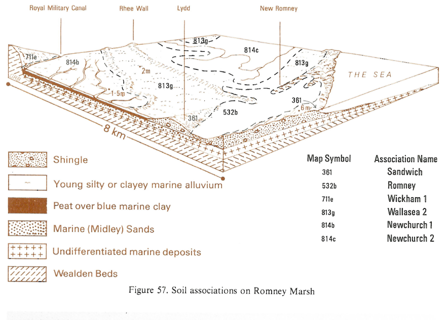
In Kent, Sandwich soils are developed in dunes near Greatstone and also occur locally with decalcified sandy Beckfoot soils on old dunes near New Romney. Sandwich soils also occupy sparsely vegetated, locally unstable, dunes on the coast near Sandwich Bay. Between there and Deal, stable dunes occur over shingle, now mostly golf links. Sand and shingle merge northward into low ridges with thin calcareous and decalcified sandy soils over shingle. Similar shallow soils occur on the narrow shingle spit extending from Ebbsfleet to Great Stonar. On the shingle promontory of Dungeness the main soils belong to the Dungeness series which occurs in narrow strips corresponding to former beach ridges. These soils support acid heathland with gorse (Ulex europaeus), foxglove (Digitalis purpurea) and other species, some with roots capable of reaching moisture below 1 m depth, and which contribute organic litter for soil development. Dungeness soils form an intricate pattern with barren or sparsely vegetated loose shingle. The inland, often irregular, margins of the shingle ridges carry other, very stony raw alluvial soils mapped as the Beach Bank series, where fine alluvial material has covered the shingle and filled the interstices. Inland, around Lydd and New Romney, sand and shingle are mixed, giving thin decalcified soils in pebbly sand with similar thin mineral soils over shingle.
Near Winchelsea Beach and Rye Harbour, there are mainly raw alluvial soils and Dungeness series on the storm beach shingle, with raw sands and Sandwich series on the dunes around Rye golf links. The dunes illustrate the typical processes of dune fixation and carry a rich flora and insect fauna. From Langney Point towards Pevensey Bay, The Crumbles are formed from beach gravels and there are associated Dungeness and raw alluvial soils. Much of the area is being exploited for gravel, with subsequent landfill opportunities but it is also important for wildlife and recreation.
Cropping and Land Use
The land is rarely used for agriculture because the soils are droughty, and unstable when ploughed. Topography, exposure and local salinity also help to limit land use to recreation (mainly golf courses) and amenity use, nature reserves or military training. There is some rough grazing in the moist hollows and on stabilized dunes. Because there is little clay and organic matter, even in the surface horizons, the soils are easily eroded. Disturbance along paths and tracks through the dunes, usually to the beaches beyond, increases vulnerability to erosion, which is common during strong winds. Blown sand sometimes reaches agricultural land or forms new, mobile dunes further inland. Attempts at stabilization by replanting with marram grass or laying brushwood are only successful where they are comprehensive and fenced off from the public. Walkways to the beach, fenced on either side, are sometimes necessary, supplemented by planking in the worst cases.
Plantations, both pure and in mixed stands, of Scots pine (Pin us sylvestris), Corsican pine (Pin us nigra var. maritima) and Austrian pine (Pinus nigra var. austriaca) have been established with some success on fixed dunes by the Forestry Commission and private landowners. The effect of exposure is well demonstrated by the severe wind-pruning and premature death of trees on the seaward side of the plantations.
0361 Sandwich
Distribution Map
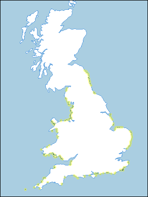 |
Note that the yellow shading represents a buffer to highlight the location of very small areas of the association.
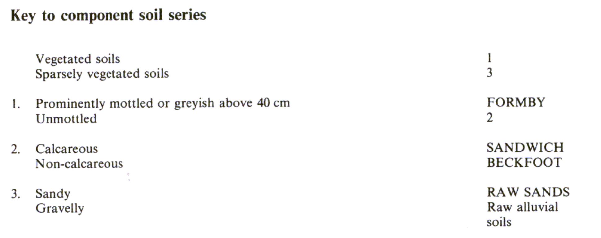
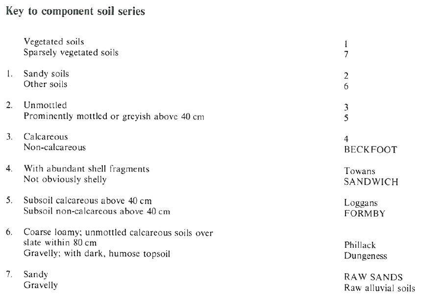
Keys to component soil series
Wales
 |
Northern Region
 |
Typical Landscapes
Wales
 |
Midlands
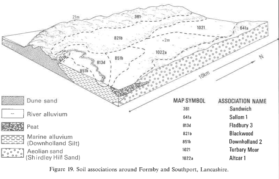 |
Eastern Region
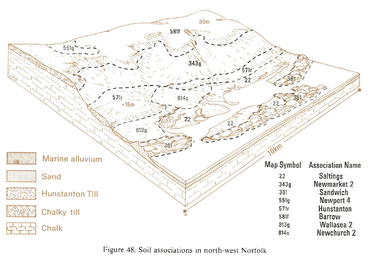 |
Eastern Region
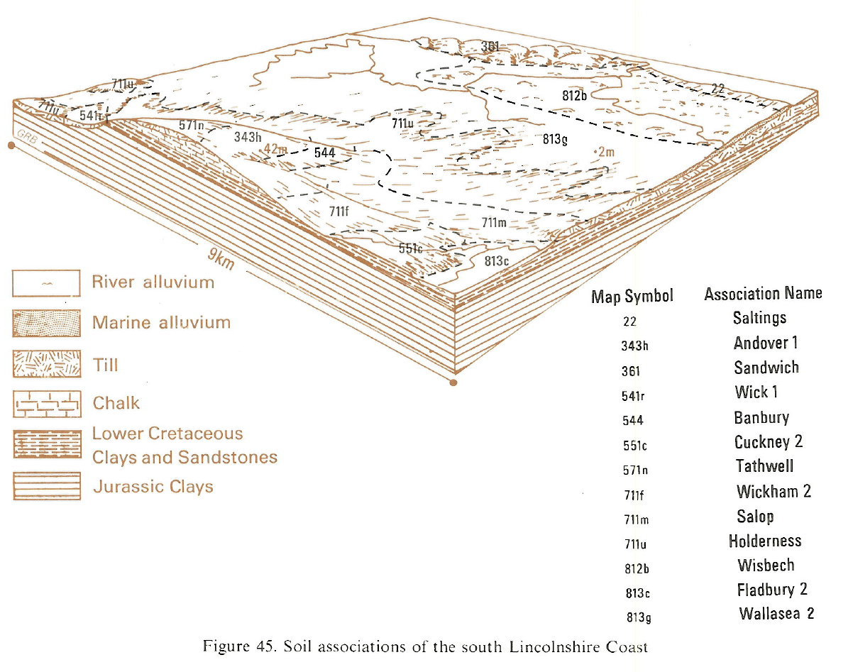 |
Eastern Region
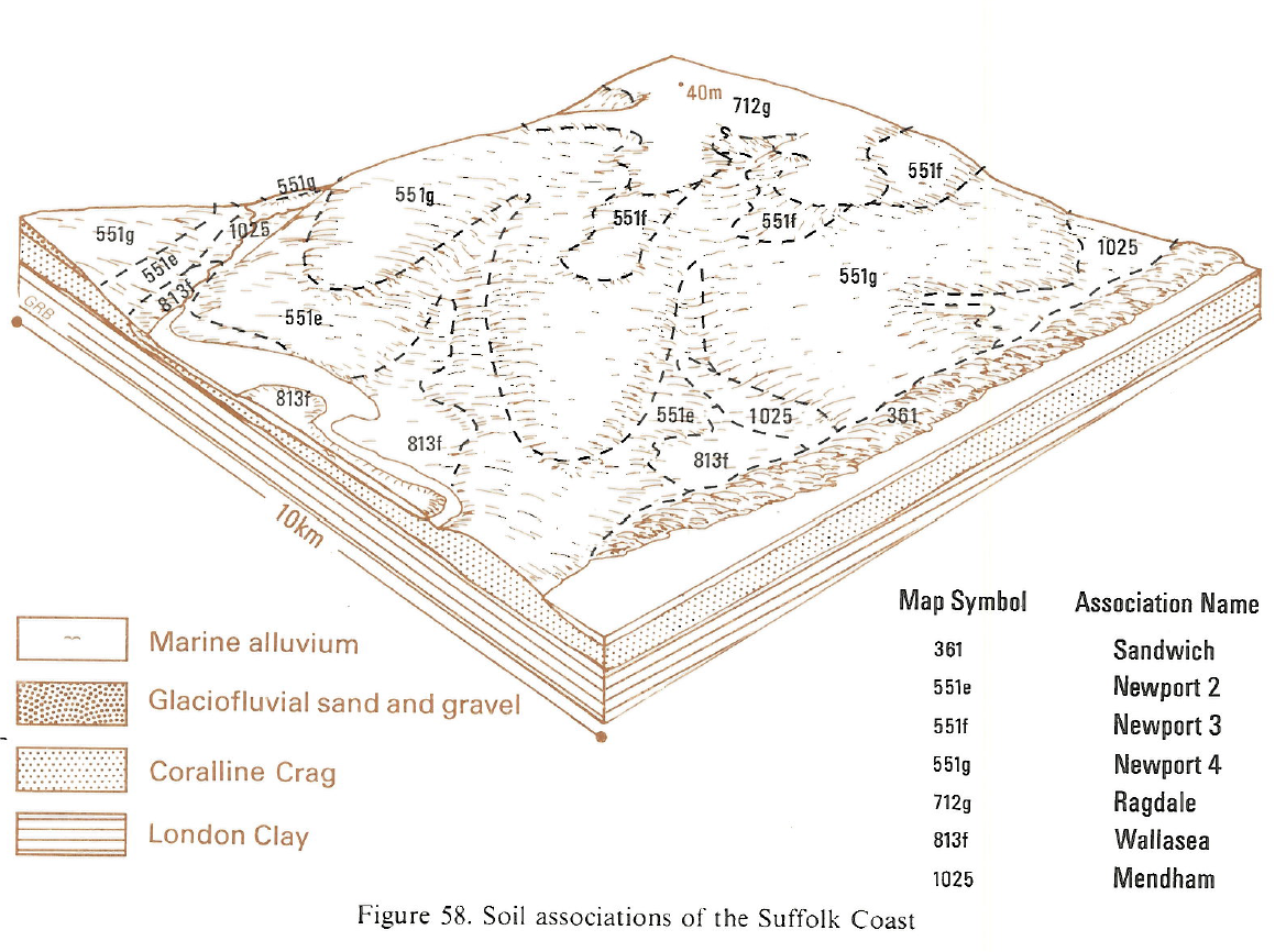 |
South Eastern Region
 |
All information Copyright, Cranfield University © 2025
Citation: To use information from this web resource in your work, please cite this as follows:
Cranfield University 2025. The Soils Guide. Available: www.landis.org.uk. Cranfield University, UK. Last accessed 25/04/2025
