
Soil Associations
0511d Blewbury
Soil and site characteristics
Well drained calcareous clayey and fine silty over clayey soils over argillaceous chalk. Some fine silty over clayey soils with slowly permeable subsoils and slight seasonal waterlogging.
Geology
Chalk
Cropping and Land Use
Cereals and short term grassland with dairying and stock rearing.
Component soil series
| Subgroup | Series name | Percentage | WRB 2006 link |
|---|---|---|---|
| 5.11 | BLEWBURY | 35% | Calcaric Endoleptic Cambisols |
| 5.72 | WINTERBOURNE | 25% | Endostagnic Endoleptic Luvisols |
| 5.11 | YATESBURY | 10% | Calcaric Endoleptic Cambisols |
| 3.42 | WANTAGE | 10% | Rendzic Leptosols |
Covers 218 km2 in England and Wales
Soilscapes Classification
| 5 |
Freely draining lime-rich loamy soils |
0511d Blewbury
Detailed Description
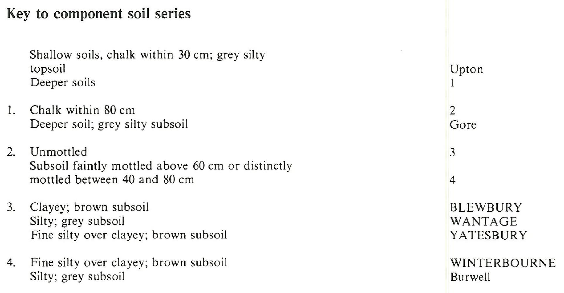
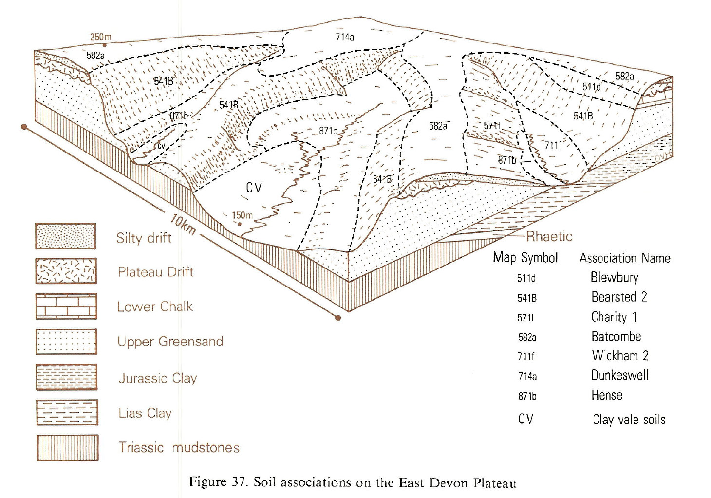
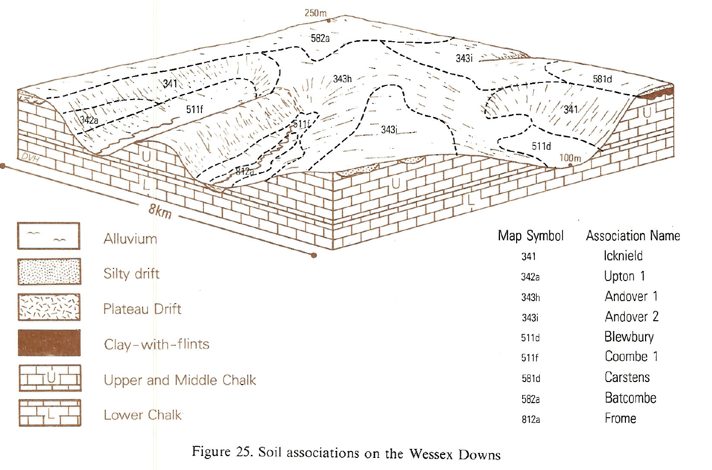
The Blewbury association is confined to the greyish argillaceous Lower Chalk of Wiltshire, Dorset and Hampshire. Most component soils are naturally well drained but some soils suffer winter waterlogging. On gently sloping benches and footslopes there are well drained typical brown calcareous earths of the Blewbury and Yatesbury series. These olive-brown clayey and fine silty over clayey soils are sticky when wet and less calcareous than soils on white chalk. In basins and on occasional flat sites there are fine silty over clayey stagnogleyic brown calcareous earths, Winterbourne series, and extremely calcareous gleyic rendzinas, Burwell series. Clayey Thames soils are found near small streams. Wantage and Upton soils occur only on convex brows and Gore soils are in extremely calcareous colluvium below the chalk scarp. Brief profile descriptions of the main soils are given below.
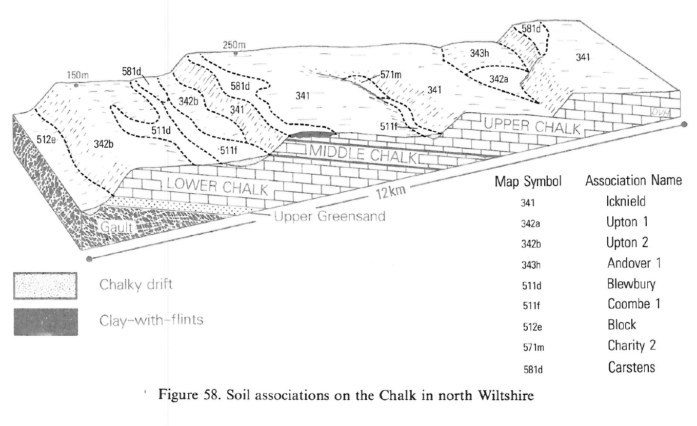
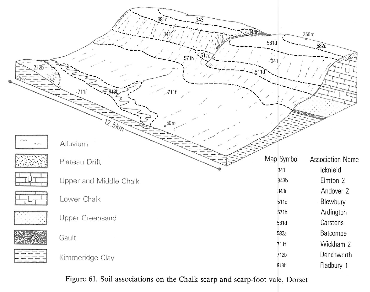
The association covers most of the wide Lower Chalk bench between Avebury and Chisledon and around Warminster. In these places the Blewbury series is accompanied by Yatesbury and Upton series and by wetter Winterbourne and Burwell soils, with some Thames soils adjacent to streams. In the Vale of Pewsey the Blewbury series is accompanied by Upton and Wantage series. From the Nadder valley south-west to Iwerne Courtney and Maiden Newton, the association includes some argillic brown earths and surface-water gley soils, together with Wantage and Upton soils on convex bluffs below the Middle Chalk. Gore soils occur in places at the foot of the main chalk scarp in the Vale of Pewsey, the Nadder valley and around Hambledon Hill.
In Hampshire this association is found on Lower Chalk near East Meon and Corhampton, along the edge of the Weald south of Alton and near Midhurst, and also near Kingsclere. Around East Meon and Corhampton, gently sloping valley sides and broad footslopes are covered by clayey Blewbury and fine silty over clayey Yatesbury soils, typical brown calcareous earths. Similar Winterbourne soils, stagnogleyic brown calcareous earths, also occur. Wantage series, grey rendzinas, and Upton soils are found on breaks of slope and scarps. Near to streams there are slowly permeable but well structured calcareous clayey soils in stoneless drift together with some poorly structured mainly non-calcareous silty over clayey and clayey Foggathorpe soils. South of Alton the association is dominated by similar calcareous and non-calcareous soils in slowly permeable drift but near Kingsclere most soils are in calcareous drift.
Soil Water Regime
The predominant soils, Blewbury and Yatesbury series are naturally well drained (Wetness Class I) and water passes readily downward through the soil and chalk below. Winterbourne soils are seasonally waterlogged because water is held up by slowly permeable chalk (Wetness Class III). Narrow strips of clayey Thames soils near streams are influenced by groundwater (Wetness Classes III and IV). The soils are only slightly droughty for cereals and most are moderately droughty for grass.
Cropping and Land Use
In Wiltshire most of the association is under continuous cereals though some of the wetter soils have leys in rotation. Blewbury and Yatesbury soils are relatively easily worked but the clayey topsoil of the Blewbury series dries out rather slowly, often forming a cloddy tilth. The slowly permeable Winterbourne, Burwell and Thames soils drain less readily and are not so accessible, with a moderate risk of poaching especially where undrained. Cultivations need to be carefully timed to avoid compacting upper soil layers especially in large fields with a varied soil pattern. In the higher rainfall of west Dorset there are fewer opportunities for landwork and much of the land is under ley grassland on which there is a moderate risk of poaching.
0511d Blewbury
Distribution Map
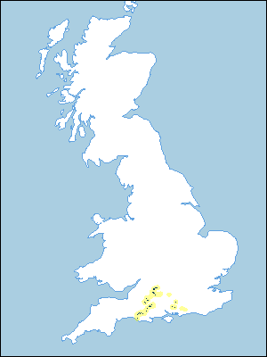 |
Note that the yellow shading represents a buffer to highlight the location of very small areas of the association.
Keys to component soil series
South Western Region
 |
Typical Landscapes
South Western Region
 |
South Western Region
 |
South Western Region
 |
South Western Region
 |
All information Copyright, Cranfield University © 2025
Citation: To use information from this web resource in your work, please cite this as follows:
Cranfield University 2025. The Soils Guide. Available: www.landis.org.uk. Cranfield University, UK. Last accessed 25/04/2025
