Soil Associations
0512c RUSKINGTON
Soil and site characteristics
Deep permeable calcareous coarse and fine loamy and sandy soils affected by groundwater. Flat land.
Geology
Glaciofluvial sand and gravel
Cropping and Land Use
Cereals, sugar beet and potatoes; some field vegetables.
Component soil series
| Subgroup | Series name | Percentage | WRB 2006 link |
|---|---|---|---|
| 5.12 | RUSKINGTON | 26% | Calcaric Endogleyic Cambisols |
| 5.12 | ICKFORD | 24% | Calcaric Endogleyic Endoskeletic Cambisols |
| 5.22 | NEWSLEAFORD | 15% | Arenic Calcaric Endogleyic Cambisols |
Covers 60 km2 in England and Wales
Soilscapes Classification
| 5 |
Freely draining lime-rich loamy soils |
0512c RUSKINGTON
Detailed Description
The Ruskington association consists of Ruskington and Ickford series, gleyic brown calcareous earths, and Newsleaford series, gleyic brown calcareous sands. These soils on glaciofluvial sand and gravel have a calcareous substrate containing limestone stones, flints and quartzite pebbles. An undulating clay substratum at depth causes some local waterlogging in winter, but the coarse loamy or sandy soils are rarely waterlogged for long periods. The association occurs on flat land mainly in south-central Lincolnshire near Sleaford and includes small areas of St Lawrence, Earith and in places Badsey, Gubblecote and Quorndon soils.
In north Lincolnshire there is a larger proportion of wet soils than in the main areas of south-central Lincolnshire and loamy gravelly Gubblecote soils are dominant near the Ancholme valley. The association also fringes extensive but isolated patches of glaciofluvial deposits east of Newark. Some humose soils with calcareous subsoils are included in the Slea valley near Sleaford.
Soil Water Regime
Most of the soils have been artificially drained so are now only occasionally waterlogged in winter (Wetness Class II) as they respond well to drainage. Locally, however, where there is hard ironpan or an undulating, slowly permeable clay substratum the soils lie wet for longer. Ruskington, Ickford and Newsleaford soils with their permeable subsoils readily accept surplus winter rainfall. The soils are slightly droughty for cereals and sugar beet, moderately droughty for potatoes and very droughty for grass.
Cropping and Land Use
The main soils have permeable loamy topsoils and rapid subsoil permeability so after drainage are easy to work. Locally, wet patches cause some, usually short, delays in field operations though the average field capacity period is less than 130 days and there is an adequate number of days suitable for landwork in autumn and spring. Yields of direct drilled cereals are similar to those sown conventionally. The main crops are sugar beet, potatoes and winter cereals but near Sleaford, field vegetables, including carrots, onions and brassicas and flower bulbs are grown using irrigation. There is little grassland because of droughtiness.
0512c RUSKINGTON
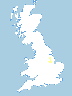
Distribution Map
 |
Note that the yellow shading represents a buffer to highlight the location of very small areas of the association.
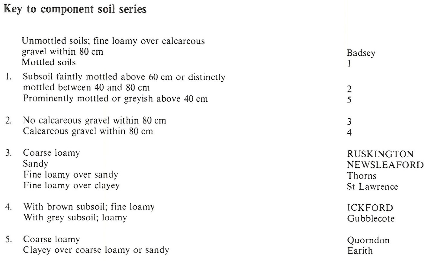
Keys to component soil series
Eastern Region
 |
All information Copyright, Cranfield University © 2025
Citation: To use information from this web resource in your work, please cite this as follows:
Cranfield University 2025. The Soils Guide. Available: www.landis.org.uk. Cranfield University, UK. Last accessed 25/04/2025
