
Soil Associations
0552b Ollerton
Soil and site characteristics
Deep permeable sandy and coarse loamy soils affected by groundwater. Some coarse loamy soils with slowly permeable subsoils and slight seasonal waterlogging.
Geology
Glaciofluvial drift and chalky till
Cropping and Land Use
Cereals, sugar beet and peas and beans, some coniferous woodland.
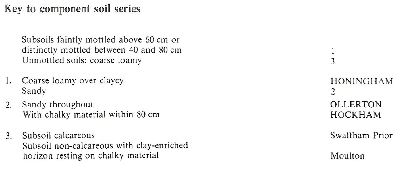
Component soil series
| Subgroup | Series name | Percentage | WRB 2006 link |
|---|---|---|---|
| 5.52 | OLLERTON | 41% | Eutric Endogleyic Arenosols |
| 5.72 | HONINGHAM | 39% | Ruptic Endostagnic Luvisols |
| 5.55 | HOCKHAM | 20% | Arenic Ruptic Endostagnic Luvisols |
Covers 35 km2 in England and Wales
Soilscapes Classification
| 10 |
Freely draining slightly acid sandy soils |
0552b Ollerton
Detailed Description
The Ollerton association consists of mainly permeable sandy and coarse loamy soils influenced to varying degrees by groundwater. It covers only 34 km² mostly in north-east Breckland but there is a small area near Botesdale in Suffolk. The gently undulating landscape in Breckland is drained by the headwaters of the river Thet and a tributary of the Wissey. The gentle slopes flanking the wide valley bottoms are underlain by a white chalky till with a loamy matrix, which is associated with patches of glaciofluvial gravels, but the surface horizons of the soils are largely developed in locally-derived aeolian sand. Ollerton, Hockham and Honingham series are co-dominant and randomly mixed. Ollerton series, which belongs to the gleyic brown sands, is developed in thick sand and Hockham series, gleyic argillic brown sands, occurs where chalky till is at relatively shallow depth. Hockham and Ollerton soils frequently have coarse loamy topsoils. Where the till is clayey and less permeable, coarse loamy Honingham series, stagnogleyic argillic brown earths, are found together with similar soils with loamy subsoils. All these soils have ochreous mottled subsoils caused by past or present seasonal waterlogging. Moulton and Swaffham Prior soils are also included on higher drier ground, where they alternate in a striped pattern. Honingham soils are most common on the northern Breckland margin near Watton where the ground rises towards the till plateau. Elsewhere the parent till is mainly fine loamy or coarser in texture. In Suffolk between Botesdale and Diss there are ancillary Bentley soils and Honingham soils occur mainly around the margins of the mapped area.
Soil Water Regime
The soils are naturally seasonally waterlogged (Wetness Class II and III), but with field ditches most of them are now well drained (Wetness Class I), although Honingham soils are occasionally waterlogged (Wetness Class II). The component sandy soils have a small available water capacity and, unless groundwater is available, they are moderately droughty for most crops, though Honingham soils being more water-retentive are only slightly droughty. All the main soils are very droughty for grass.
Cropping and Land Use
The sandy Ollerton and Hockham soils are easily worked and, if efficiently drained, there is little restriction on cultivations. There are few opportunities for cultivations on Honingham soils in wet springs, but there are good opportunities for autumn working. The chief crops are barley and sugar beet.
0552b Ollerton
Distribution Map
 |
Note that the yellow shading represents a buffer to highlight the location of very small areas of the association.
Keys to component soil series
Eastern Region
 |
All information Copyright, Cranfield University © 2025
Citation: To use information from this web resource in your work, please cite this as follows:
Cranfield University 2025. The Soils Guide. Available: www.landis.org.uk. Cranfield University, UK. Last accessed 25/04/2025
