Soil Associations
0571a STON EASTON
Soil and site characteristics
Well drained fine silty over clayey soils on limestone. Some shallow calcareous soils.
Geology
Jurassic and Carboniferous limestone
Cropping and Land Use
Dairying and cereals; more cereals in drier coastal districts of Glamorgan.
Component soil series
| Subgroup | Series name | Percentage | WRB 2006 link |
|---|---|---|---|
| 5.71 | STON EASTON | 40% | Endoleptic Luvisols |
| 5.81 | NORDRACH | 15% | Chromic Endoleptic Luvisols |
| 4.31 | HORNTON | 15% | Vertic Endostagnic Endoleptic Luvisols |
| 3.43 | SHERBORNE | 10% | Calcaric Leptosols |
| 5.71 | TETBURY | 10% | Endoleptic Luvisols |
Covers 169 km2 in England and Wales
Soilscapes Classification
| 7 |
Freely draining slightly acid but base-rich soils |
0571a STON EASTON
Detailed Description
The Ston Easton association is extensive over Lower Lias limestone in the Vale of Glamorgan and is also found in the eastern Mendips and the Forest of Dean. It consists mainly of fine silty over clayey typical argillic brown earths on limestone (Ston Easton series). Thin shale partings are usually present in the limestone sequence. Profiles are stony and seldom deeper than 60 cm and are decalcified in the fine earth. The upper profile consists of a greyish brown topsoil over a yellowish brown horizon of silty clay loam. Below is a clayey, yellowish brown or strong brown argillic horizon which rests on and often infills cracks in the limestone bedrock. In places, often where the soils are deeper than 60 cm the clayey subsoil is reddish and these soils are classed as paleo-argillic brown earths (Nordrach series). Tetbury soils are also present; they, like the Ston Easton series, are typical argillic brown earths but less silty. Argillic pelosols of the Hornton series which are common locally were originally mapped as Sigingstone series. Some profiles have no clay increase with depth and these typical brown earths belong to the fine silty Malham and fine loamy Waltham series. Inclusions of stony calcareous soils less than 30 cm deep are brown rendzinas belonging to the Sherborne series; these were mapped as Somerton series. Similar, but decalcified clayey brown rankers of the Torbryan series occur rarely. In Wales the parent material is of mixed origin, the soils being only partly derived from the strata below. The soils include stones that indicate a contribution from Irish Sea drift. Mineralogical studies suggest some addition of sand blown from coastal dunes, There is also variation in the distribution of soils within the Vale of Glamorgan. Profiles are generally shallower and more clayey in the east, where the Sherborne series is common on ridge crests, while the Nordrach series occurs throughout the Vale as isolated caps on the plateaux.
In Somerset, where Sherborne series is the main associate soil, the association is confined to small areas of massive, Lower Lias limestone on the northern and southern edges of the Mendips around Ston Easton and East Harrington. West of the Forest of Dean in Gloucestershire, the Ston Easton and Tetbury series, and fine loamy over clayey paleo-argillic brown earths are mapped on Carboniferous limestone south of St Briavels.
Soil Water Regime
All the soils of the association except Hornton series are permeable and well drained (Wetness Class I) and readily absorb winter rain.
Cropping and Land Use
The Vale of Glamorgan with about 1,000 mm of rainfall annually is one of the driest parts of Wales and Ston Easton soils are naturally fertile and highly valued for agriculture. Inland they are used for mixed farming with an emphasis on dairying. More corn, mainly winter wheat and spring barley, is grown in the drier coastal areas. Return to field capacity is in early October in most years and field capacity ends in early May. that on the Ston Easton and other well drained soils the greatest opportunities for cultivation are in the autumn. On the wetter Hornton series only autumn cultivation is advisable. Maximum soil moisture deficits of about 100 mm indicate that all the soils are to some degree droughty for grass particularly those which are shallow. For cereals drought restriction in average years is slight. There is little risk of poaching on grassland except on Hornton series.
0571a STON EASTON
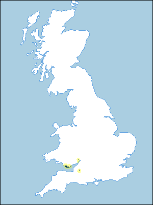
Distribution Map
 |
Note that the yellow shading represents a buffer to highlight the location of very small areas of the association.
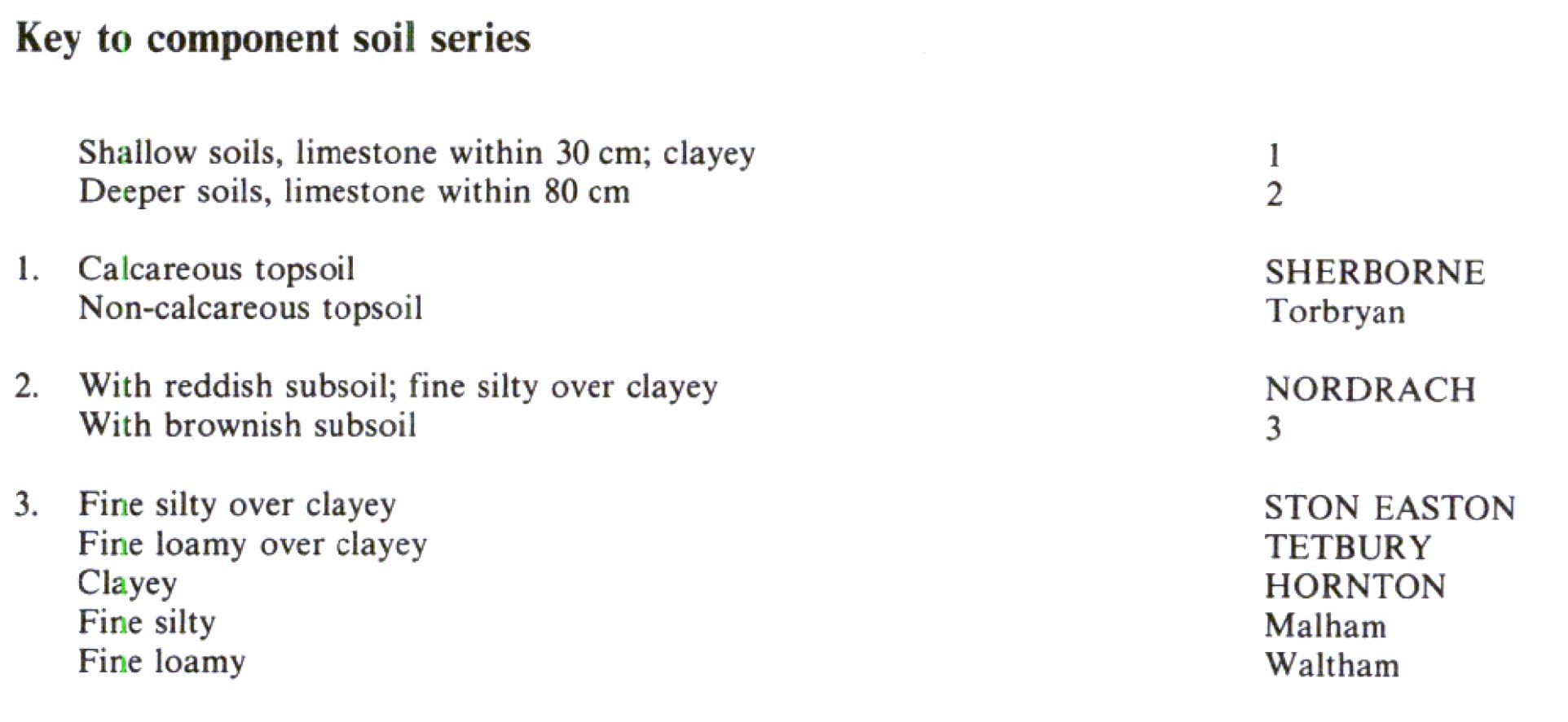
Keys to component soil series
Wales
 |
All information Copyright, Cranfield University © 2025
Citation: To use information from this web resource in your work, please cite this as follows:
Cranfield University 2025. The Soils Guide. Available: www.landis.org.uk. Cranfield University, UK. Last accessed 25/04/2025
