Soil Associations
0571n TATHWELL
Soil and site characteristics
Well drained reddish fine loamy over clayey soils and similar fine loamy soils with slowly permeable subsoils and slight seasonal waterlogging. Some shallow calcareous silty soils.
Geology
Till over chalk
Cropping and Land Use
Winter cereals with sugar beet and potatoes.
Component soil series
| Subgroup | Series name | Percentage | WRB 2006 link |
|---|---|---|---|
| 5.71 | TATHWELL | 75% | Chromic Luvisols |
| 3.43 | ANDOVER | 10% | Calcaric Leptosols |
| 5.72 | BURLINGHAM | 10% | Endostagnic Luvisols |
Covers 37 km2 in England and Wales
Soilscapes Classification
| 7 |
Freely draining slightly acid but base-rich soils |
0571n TATHWELL
Detailed Description
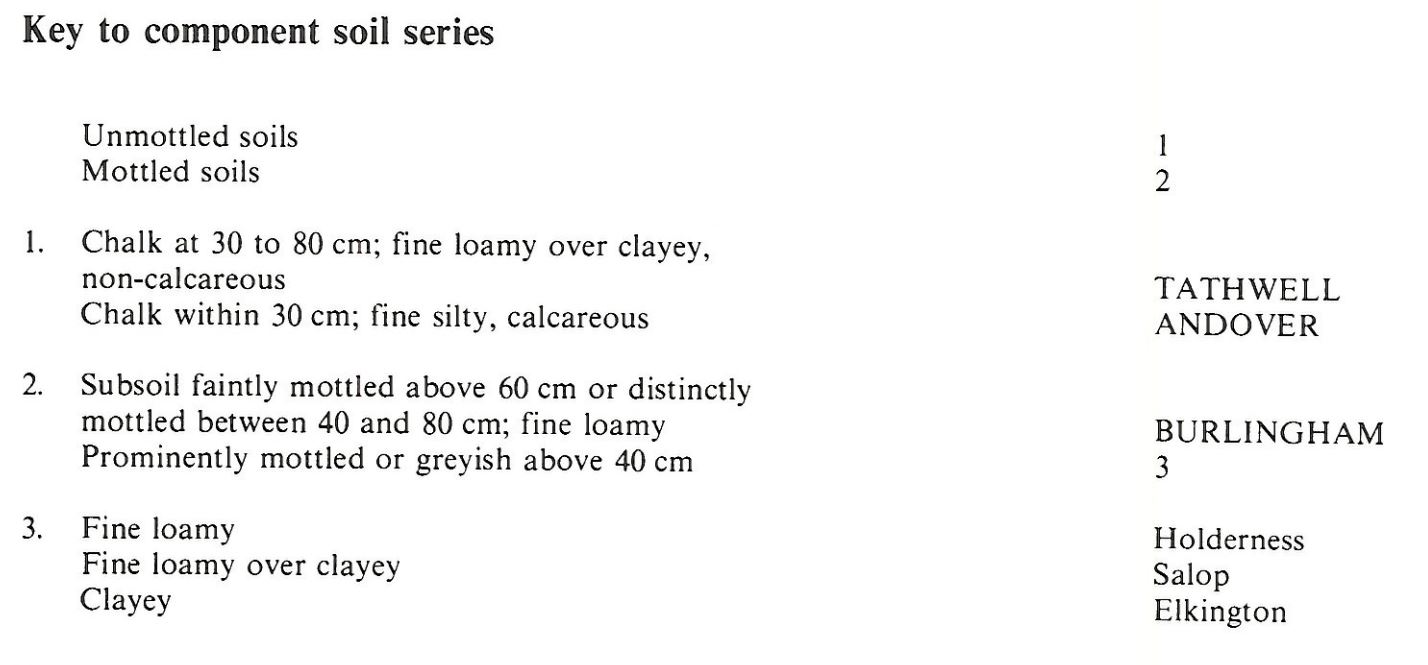
This association covers 36 km² mainly in north and central Lincolnshire on plateaux where the chalk is thinly covered by Devensian till at altitudes of 60-100 m O.D. It is mainly composed of Tathwell series, typical argillic brown earths, Burlingham series, stagnogleyic argillic brown earths, and Andover series, brown rendzinas. Tathwell and Burlingham soils have brown fine loamy horizons overlying a reddish brown clayey subsoil which is mottled in Burlingham soils. The Devensian till varies in thickness, and the depth to chalk in Tathwell soils ranges from 50-100 cm. Where the till is thickest, percolation of water is sufficiently slow to cause periodic waterlogging and Burlingham soils occur. Both soils are slightly stony and contain far-travelled igneous and metamorphic stones as well as flints. Andover soils have a thin calcareous fine silty topsoil over chalk within 30 cm depth and occur either on gentle slopes fringing the till or locally elsewhere in patches where the till is absent. Small areas of Salop, Holderness and Elkington series also occur.
The association is most varied near Louth where Salop, Elkington and Holderness series are included adjoining the Salop association. South of Louth the till is thin and patchy and the proportion of Tathwell soils increases, and Andover series becomes the main associate soil. To the north, where the till is thick, Burlingham soils are more common, particularly near the Burlingham 2 association.
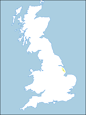
The association covers less than 5 km² near Wold Newton, south Humberside. Tathwell and Burlingham soils predominate, with small areas of Andover soils on slopes.
Soil Water Regime
Tathwell and Andover soils are well drained (Wetness Class I) but Burlingham soils are occasionally waterlogged because of slowly permeable lower layers (Wetness Class II). Arable crops on the deeper soils rarely suffer from drought because of the relatively high rainfall on the Wolds (approximately 700 mm annually), but those on Andover soils suffer slightly from droughtiness. All the soils are moderately droughty for grass.
Cropping and Land Use
Tathwell and Andover soils are easy to work although the surface stoniness of the latter hinders seed-placement and the harvesting of root crops. Normally there are adequate periods in autumn and spring for cultivating both soils. Burlingham soils are moderately easy to work and have adequate periods for autumn cultivation, but there are few suitable days in spring especially in wet years. The land is mostly in arable use with winter cereals and oilseed rape dominant and smaller areas of sugar beet and potatoes. Yields from direct drilling of autumn and spring-sown crops are similar to those from conventional techniques. The soils are suited to grassland with the slight limitation of droughtiness restricting autumn growth. There is little risk of poaching damage to the sward.
0571n TATHWELL
Distribution Map
 |
Note that the yellow shading represents a buffer to highlight the location of very small areas of the association.
Keys to component soil series
Eastern Region
 |
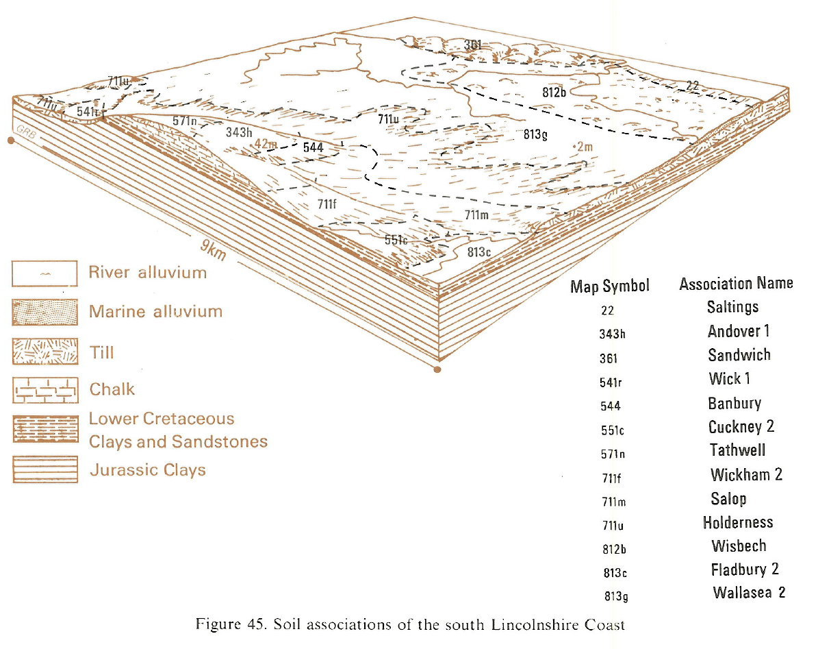
Typical Landscapes
Eastern Region
 |
All information Copyright, Cranfield University © 2025
Citation: To use information from this web resource in your work, please cite this as follows:
Cranfield University 2025. The Soils Guide. Available: www.landis.org.uk. Cranfield University, UK. Last accessed 25/04/2025
