Soil Associations
0571r HUNSTANTON
Soil and site characteristics
Deep well drained often reddish fine and coarse loamy soils. Some similar calcareous soils over chalk.
Geology
Till and glaciofluvial drift over chalk
Cropping and Land Use
Cereals, potatoes and sugar beet; some field vegetables.
Component soil series
| Subgroup | Series name | Percentage | WRB 2006 link |
|---|---|---|---|
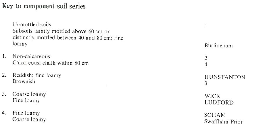
| 5.71 | HUNSTANTON | 50% | Haplic Luvisols |
| 5.71 | LUDFORD | 15% | Haplic Luvisols |
| 5.41 | WICK | 15% | Eutric Cambisols |
| 5.11 | SOHAM | 15% | Calcaric Endoskeletic Cambisols |
Covers 167 km2 in England and Wales
Soilscapes Classification
| 7 |
Freely draining slightly acid but base-rich soils |
0571r HUNSTANTON
Detailed Description
The Hunstanton association is dominated by well drained fine and coarse loamy, often reddish soils in loamy till. Chalk occurs at depth, but rarely at less than one metre. The association is found between the chalk upland and the marshland along the north Norfolk coast, and on undulating ground along the eastern footslopes of the Wolds in Humberside. Altitude varies from below 15 m O.D. in Norfolk to 130 m O.D. on the Yorkshire Wolds. The two most important soils are the freely drained, fine loamy Hunstanton and Ludford series. Both are typical argillic brown earths, differentiated by the reddish colour of the former. Ludford soils often have a sandy loam topsoil. The Wick series, typical brown earths, is in deeper coarse loamy glaciofluvial drift, and Soham series, typical brown calcareous earths, has fine loamy material over chalk.
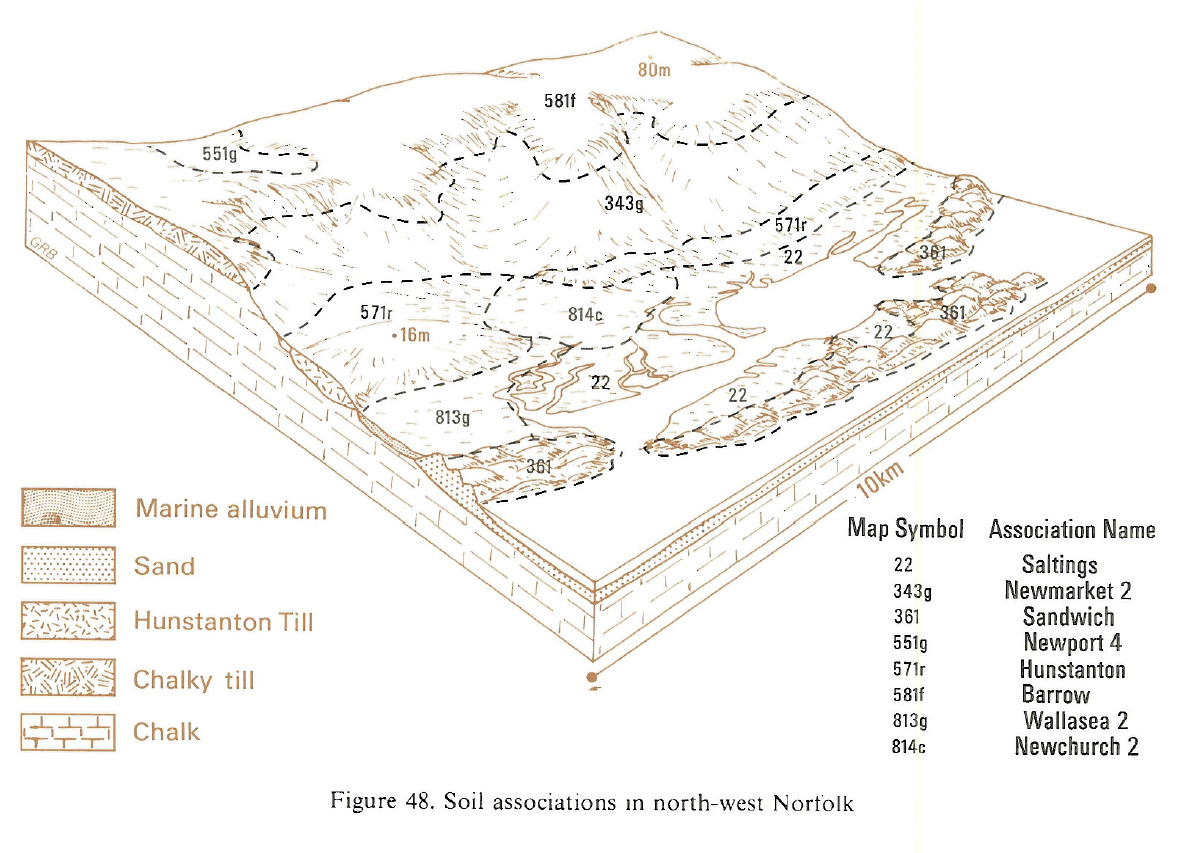
In Norfolk, the association has a simple pattern, dominated by the reddish Hunstanton series. Wick series and Newport series occur on small thin cappings of gravel. Young (1804) described this narrow strip along the north coast as follows: "Along the coast, from Holkham, westward, towards Hunston, there is a tract between the marshes and the sand, from half a mile to a mile broad, of a singularly fertile sandy loam: it has tenacity sufficient to adhere into clods easily broken, and to produce great crops of vegetables demanding the richest soils; at the same time it has that dryness and friability which renders it excellent turnip-land. It may let at about 20s. an acre; whoever views it will not think the rent high".
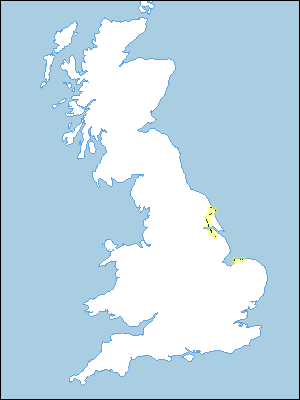
The association occurs at the thin western edge of the Holderness till, between North Ferriby and Lund and between Great Driffield and Bridlington. A smaller area extends up the slope of the Wolds near Hun manby. South of the Humber the association occurs in similar country on the Wolds between Barton-Upon-Humber and Melton Ross. Hunstanton and Ludford profiles occur randomly together in almost equal quantities. The Wick series is important locally whilst Soham soils occur on higher land on the Wolds where the drift is thinner. The Swaffham Prior series is found locally, particularly south of the Humber, and the Burlingham series is common in wetter sites.
Soil Water Regime
The soils are well drained (Wetness Class I) and subsoiling is sufficient to control surface wetness resulting from compaction. Winter rainwater is quickly absorbed with negligible run-off. For arable crops, soil water reserves are only slightly less than the potential soil moisture deficit and the soils are slightly droughty. They are, however, moderately or even very droughty under grass, especially in dry years.
Cropping and Land Use
With its coarse loamy topsoils, this land is well suited to general arable cropping. Cereals, oilseed rape, field vegetables and potatoes are easily grown. Cereals are dominant at present but oilseed rape, vining peas and winter brassicas are increasingly grown. The soils are easy to work with ample time for autumn landwork even in wet years. Spring cultivation periods are shorter, though adequate in an average year. Direct drilling of autumn-sown crops gives yields similar to those from well managed conventionally cultivated soils. All the soils have good natural levels of fertility which are easily maintained with suitable ferilizers, although regular liming is needed to combat acidity.
0571r HUNSTANTON
Distribution Map
 |
Note that the yellow shading represents a buffer to highlight the location of very small areas of the association.
Keys to component soil series
Northern Region
 |
Typical Landscapes
Eastern Region
 |
All information Copyright, Cranfield University © 2025
Citation: To use information from this web resource in your work, please cite this as follows:
Cranfield University 2025. The Soils Guide. Available: www.landis.org.uk. Cranfield University, UK. Last accessed 25/04/2025
