
Soil Associations
0582a BATCOMBE
Soil and site characteristics
Fine silty over clayey and fine loamy over clayey soils with slowly permeable subsoils and slight seasonal water logging. Some well drained clayey soils over chalk. Variably flinty.
Geology
Plateau drift and clay-with-flints
Cropping and Land Use
Cereals, permanent grassland and deciduous woodland in the South East Region; cereals and dairying in Devon and Dorset.
Component soil series
| Subgroup | Series name | Percentage | WRB 2006 link |
|---|---|---|---|
| 5.82 | BATCOMBE | 50% | Profundic Chromic Endostagnic Luvisols |
| 5.82 | HORNBEAM | 15% | Profundic Chromic Endostagnic Luvisols |
| 5.81 | CARSTENS | 10% | Profundic Chromic Luvisols |
| 5.81 | WINCHESTER | 5% | Clayic Chromic Endoleptic Luvisols |
Covers 1188 km2 in England and Wales
Soilscapes Classification
| 8 |
Slightly acid loamy and clayey soils with impeded drainage |
0582a BATCOMBE
Detailed Description
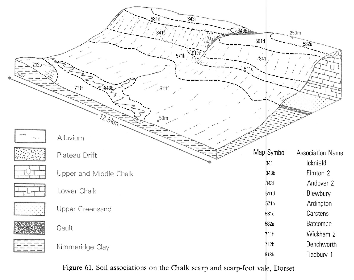
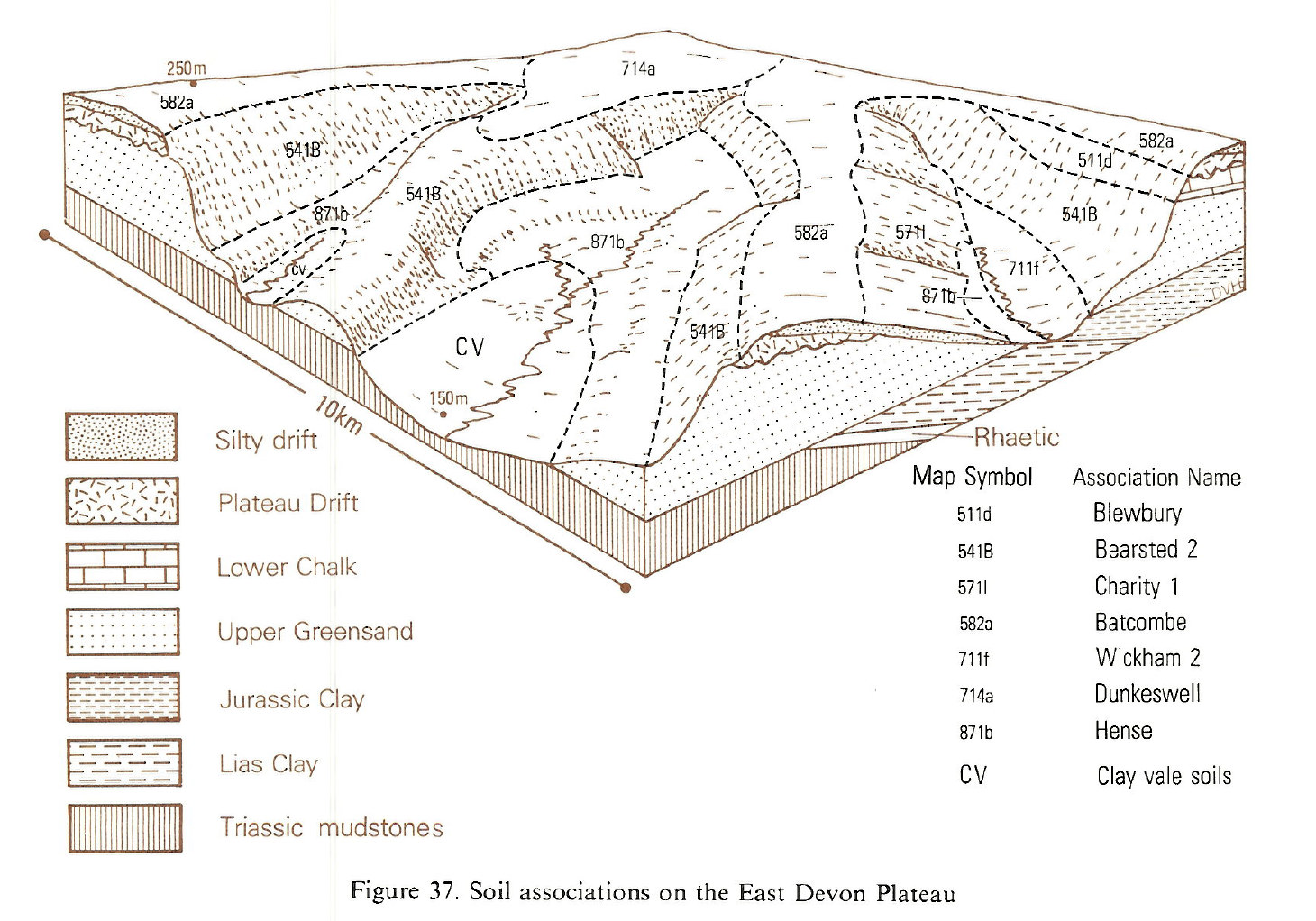
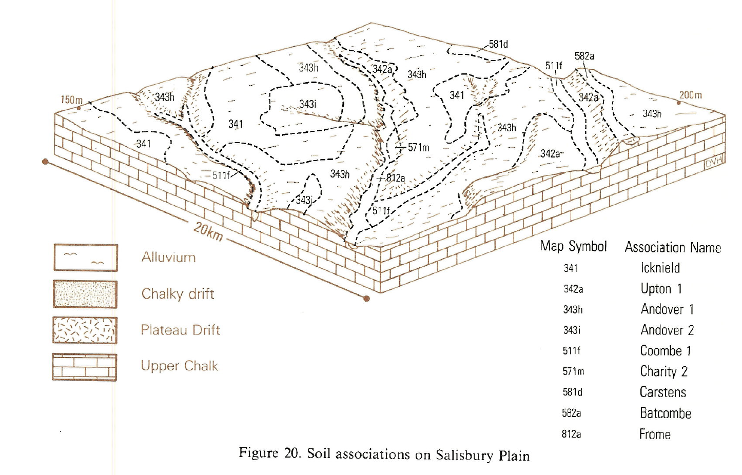
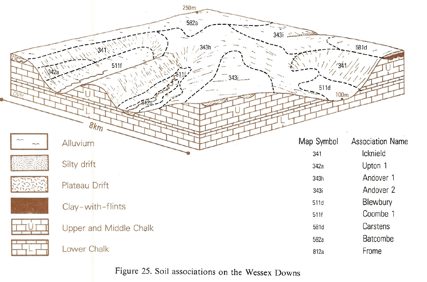
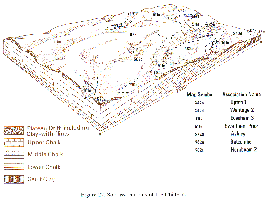
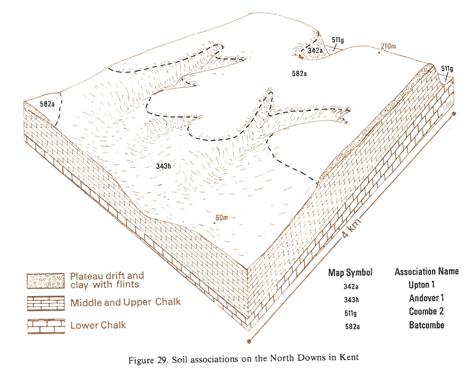
This association is extensive in east Devon, Somerset, Dorset, Wiltshire, Berkshire, Oxfordshire, Buckinghamshire, Surrey, Kent, Hertfordshire and Bedfordshire. The soils are developed in Plateau Drift and Clay-with-flints which cap chalk plateaux at 90 to 250 m O.D. Most of the association is on level or gently sloping ground but slopes are steeper and convex near the margins of the drift outcrops.
Variably flinty fine silty and fine loamy over clayey Batcombe and Hornbeam soils, stagnogleyic paleo-argillic brown earths, with grey mottled subsoils dominate the association. The ancillary Carstens soils, typical paleo-argillic brown earths, are fine silty over clayey and are less mottled in the subsoil with no greyish colours. Winchester series is similar to Carstens series but is clayey throughout as it is developed wholly in Clay-with-flints and is generally shallower to chalk than the other component soils. All the soils have reddish or red-mottled subsoils. The local proportions of Batcombe, Carstens and Hornbeam soils depend on the relative influences of silty aeolian drift and remnants of Tertiary (Neogene and Palaeogene) deposits on the composition of the Plateau Drift. Fine silty over clayey Batcombe and Carstens soils are dominant. Where Hornbeam and Marlow soils occur, there are often associated Berkhamsted soils which, in some places, have many small rounded flint pebbles from the Tertiary beds. Winchester and Givendale soils occur where the uppermost silty drift thins over Clay-with-flints. Locally, narrow dry valleys cut through to the Chalk and there are small inclusions of Andover and Charity soils. In Hertfordshire and Bedfordshire the association is mainly on high ground. There is a tendency for the soils to become less silty south-eastwards.
In the South West, associated soils vary with climatic wetness, with the thickness and composition of the drift, and the nature of the underlying sediments. Carstens soils are important on the Downs in Dorset and Wiltshire, but along with other well-drained soils, are rare in east Devon. Hornbeam and Marlow soils have fine loamy rather than silty upper horizons, reflecting the mixing of aeolian silts with sandy and sometimes pebbly components from Plateau Drift or Tertiary deposits. Similarly there are pebbly and coarse loamy layers in the Berkhampstead series (Clayden and Hollis 1984). Where the Clay-with-flints is free from silty drift, clayey Givendale and Winchester soils are present, the latter in thin clay over Chalk. Around Chard on convex ridges there are similar clayey soils which formed when the upper silty layers of Batcombe profiles were eroded away. Pockets of deep silty drift carry Charity soils where stony, and Hook series where stoneless. On some valley sides there are shallow calcareous Andover soils over chalk. Over the higher parts of the East Devon Plateau, Dunkeswell soils are common associates, along with some Oak soils. Dunkeswell soils are also present where Plateau Drift lies on the Lower Chalk around Evershot. Soils of the association are particularly stony between Cattistock and Blandford and along the coastal stretches of the East Devon Plateau.
In east Kent, small areas of thick silty drift give Hamble and Hook soils. North of Folkestone and Hythe, patches of deep fine and coarse loamy material within the Plateau Drift giving Sheldwich and Maxted soils were mapped as the former Sheldwich association in their survey of Kent. Near Folkestone, these soils have many ironstone fragments and some Fernhill soils are present where ferruginous sands occur in the Plateau Drift. In places the Plateau Drift rests on relatively unaltered Tertiary material, especially on the Chilterns and the western end of the North Downs, giving Dunkeswell, Oak and Wickham soils. West of Henley-on-Thames and between Princes Risborough and Hemel Hempstead, there are small inclusions of St Albans, Bockmer and other soils.
Soil Water Regime
Batcombe and Hornbeam soils have moderately permeable clayey subsoils and, where underlain at no great depth by chalk, are only occasionally waterlogged (Wetness Class II). Most excess winter rain drains vertically down to the unsaturated Chalk and any water moving laterally over the clay enters the Chalk at the margins of the Plateau Drift. Carstens and Winchester soils are well drained (Wetness Class I) with well-structured clayey subsoils through which water drains rapidly. Unless very stony, Batcombe, Hornbeam and Carstens soils have moderate reserves of water. Because the soils usually occur on high ground with relatively high rainfall and small soil moisture deficits they are rarely more than slightly droughty for any of the main crops, although the soils are moderately droughty for grass.
Cropping and Land Use
There are long periods in autumn and spring when the soils can be safely cultivated though opportunities for the tillage of Batcombe and Hornbeam soils may be restricted in wet springs.The fine silty topsoils of Batcombe and Carstens series are easily damaged if cultivated when too wet and such structural damage will reduce the yield of subsequent crops. The soils are variably flinty and cultivation is hindered and implement wear greatly increased on the more stony soils. Much of the land is woodland, especially on the Chilterns. Cereals and ley grassland are the most common arable crops. Exposure to strong winds is a limiting factor for sensitive crops on higher ground, but vegetables and fruit are grown locally in sheltered places where the soils are not too stony and there is good depth of fine silty or fine loamy material over the clayey subsoil. Despite moderate available water reserves summer growth of grass is limited in this region and the soils rarely poach. The soils are inherently acid and regular liming is needed. In the South West there is a slight risk of poaching in most districts but the risk is greater in wetter localities such as east Devon.
Much of the land remains in woodland of various kinds, especially on the Chilterns and on the North Downs. Cereals and ley grassland are the most common arable crops. Exposure to strong winds is a limiting factor for sensitive crops on higher ground, but vegetables and fruit are grown locally in sheltered places where the soils are not too stony and there is a good depth of fine silty or fine loamy material over the clayey subsoil. Moderate available water reserves mean that grass growth is seriously checked in summer in the drier districts on the Chilterns and the North Downs. Here there is only very slight risk of poaching. On the wetter South Downs and in Hampshire, grass growth continues for much of the summer, though the risk of poaching is somewhat greater. The soils are inherently acid and need regular liming.
The principal soils are highly productive and, except on exposed sites, most forest trees grow well. The soils seldom suffer from drought because of their moisture-retentive subsoils, and the presence of chalk at depth ensures that Carstens and Winchester soils are well drained. Corsican pine, European larch, Norway spruce and Western hemlock all grow well. Beech yields particularly well and oak is also well suited.
Old semi-natural woodland is widely distributed and often extensive, particularly on the North Downs and the Chilterns where beech woodland and mixed oak woodland both occur. In the latter, pedunculate oak is often accompanied by ash and beech standards usually over hazel coppice with bramble (Rubus spp.) and bluebell (Hyacinthoides non-scripta) in the field layer. In some places, for example in Upper Grove Wood, Oxfordshire, there is a wider range of species including small-leaved lime (Tilia cordata), gean (Prunus avium), hornbeam and herb paris (Paris quadrifolia). Beech woods are particularly common on the Chilterns. Many of them, for example, Naphill Common and Bradenham Wood in Buckinghamshire, have a calcifuge flora including wood-sorrel (Oxalis acetosella), bracken (Pteridium aquilinum), ling (Calluna vulgaris), foxglove (Digitalis purpurea) and common tormentil (Potentilla erecta). Where base-rich soils occur, species such as field maple, whitebeam, wayfaring tree (Viburnum lantana) and guelder rose (V. opulus) are common.
0582a BATCOMBE
Distribution Map
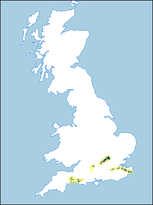 |
Note that the yellow shading represents a buffer to highlight the location of very small areas of the association.
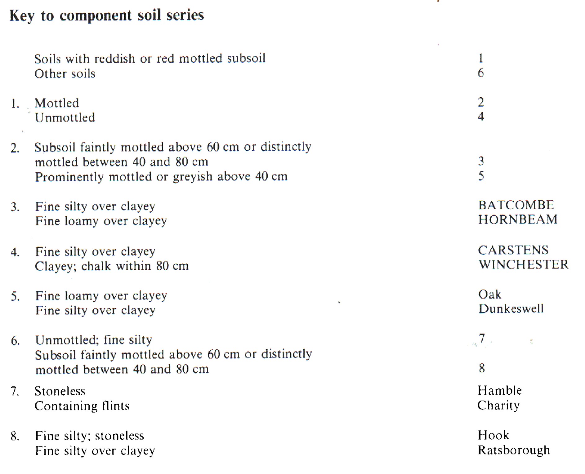
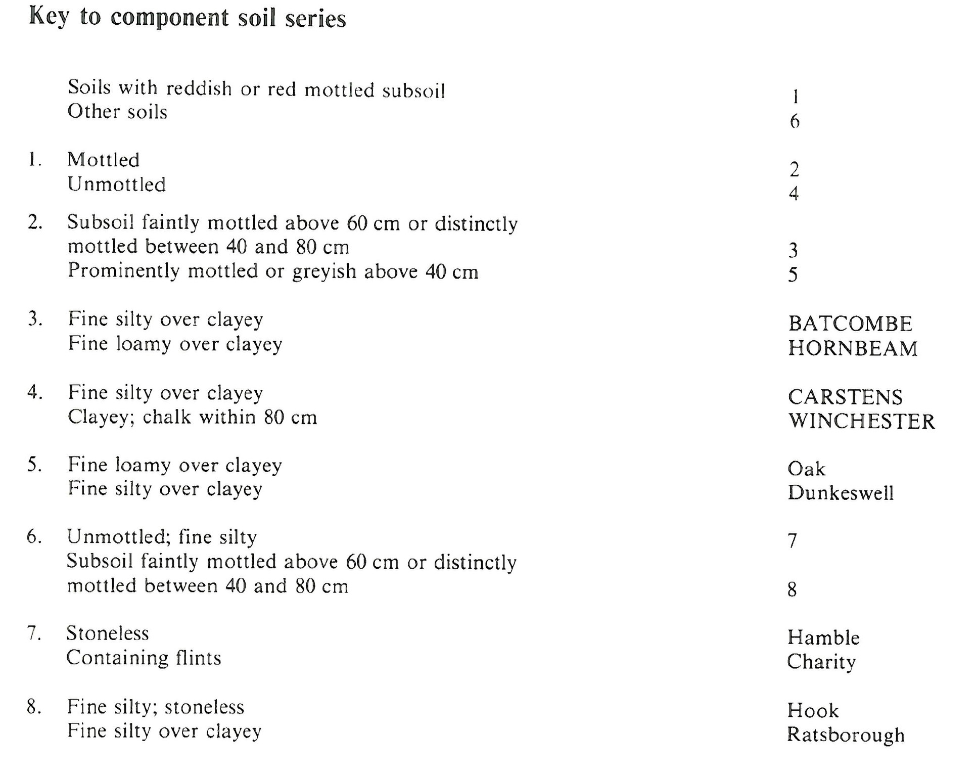
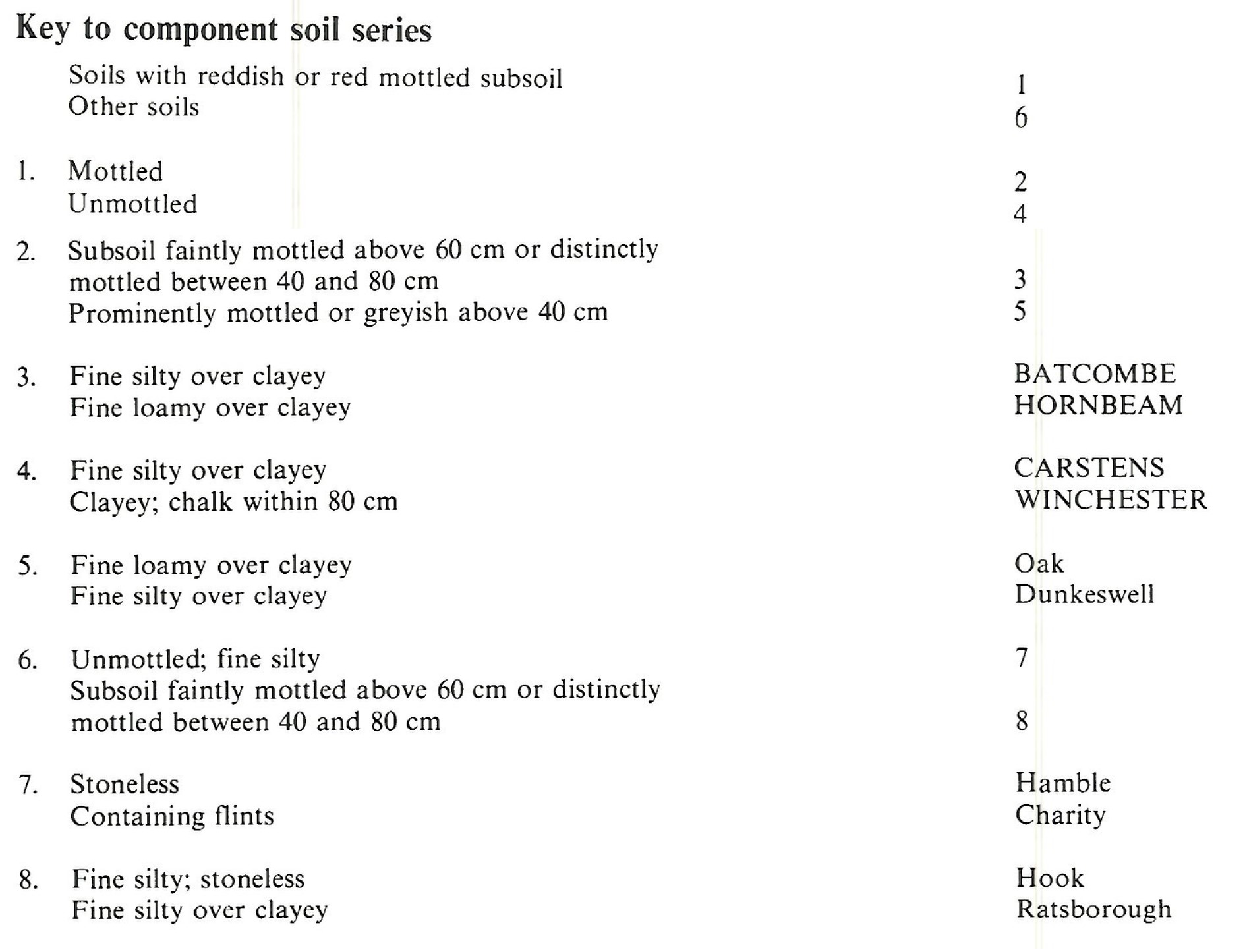
Keys to component soil series
Eastern Region
 |
South Eastern Region
 |
South Western Region
 |
Typical Landscapes
South Western Region
 |
South Western Region
 |
South Western Region
 |
South Western Region
 |
Eastern Region
 |
South Eastern Region
 |
All information Copyright, Cranfield University © 2025
Citation: To use information from this web resource in your work, please cite this as follows:
Cranfield University 2025. The Soils Guide. Available: www.landis.org.uk. Cranfield University, UK. Last accessed 25/04/2025
