Soil Associations
0611d WITHNELL 1
Soil and site characteristics
Well drained loamy soils over sandstone usually on steep slopes. Some fine loamy soils with slowly permeable subsoils and slight seasonal waterlogging. Bare rock locally.
Geology
Palaeozoic sandstone
Cropping and Land Use
Acid grassland habitats of good grazing value in uplands; coniferous woodland; some permanent grassland and cereals on lower ground.
Component soil series
| Subgroup | Series name | Percentage | WRB 2006 link |
|---|---|---|---|
| 6.11 | WITHNELL | 40% | Chromic Endoleptic Umbrisols |
| 5.41 | NEATH | 15% | Eutric Endoleptic Cambisols |
| 6.11 | LOXHORE | 15% | Chromic Endoleptic Umbrisols |
| 5.42 | NERCWYS | 10% | Eutric Stagnic Cambisols |
| 5.41 | RIVINGTON | 10% | Eutric Endoleptic Cambisols |
Covers 638 km2 in England and Wales
Soilscapes Classification
| 13 |
Freely draining acid loamy soils over rock |
0611d WITHNELL 1
Detailed Description
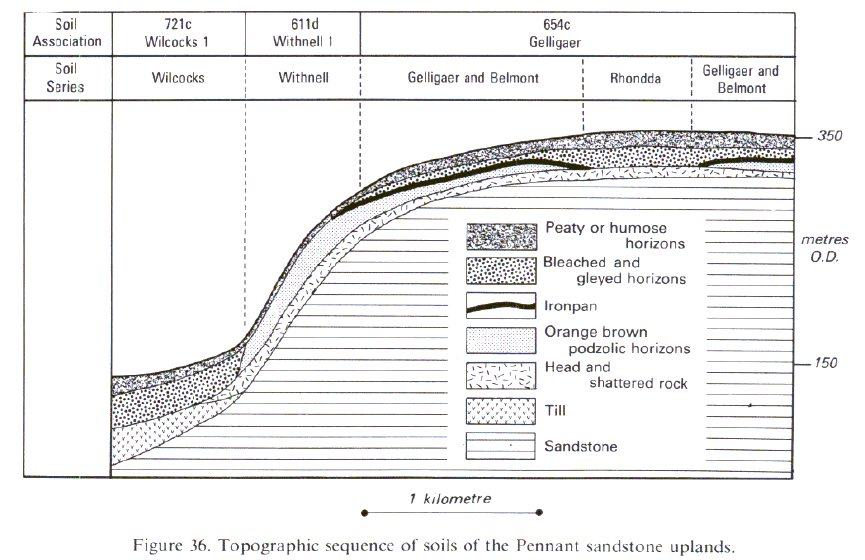
The Withnell association consists mainly of loamy, typical brown podzolic soils over sandstone, often on steep slopes up to about 350 m O.D. It is most extensive in south Wales, but is also mapped in the Forest of Dean and north Staffordshire. The soils are predominantly coarse loamy (Withnell series) but fine loamy profiles (Loxhore series) also occur where there are thin beds of shale or the sandstone contains an appreciable proportion of silt and clay. Beneath the topsoil, which is often thin in uncultivated soils, there is a bright ochreous subsoil over sandstone or very stony Head usually within 50 to 80 cm depth; the deeper profiles generally occurring on lower slopes. There are some typical brown earths with duller, yellowish brown subsoils. Both the fine loamy Neath and the coarse loamy Rivington series occur, mainly on cultivated gentle slopes at low altitudes. Stagnogleyic brown earths (Nercwys series) are locally common in patches of thick, slowly permeable drift, while brown rankers (Newtondale series) occur sporadically around rock outcrops. The soils are usually stony with large stones widespread in topsoils. The association is extensive on the Pennant sandstone of the south Wales coalfield. Most of the land is steep, but above 150 m O.D. these soils are also found on gentle slopes. There is a small area on Silurian sandstone in the upper Conwy valley.
The association occupies around 40 km² in the Forest of Dean on the Pennant sandstone, typically on steep valley sides, but occasionally on gentler slopes. The soils were described as the Withnell and Garth series, but the latter has now been merged with Withnell series. In Devon the association is found over Carboniferous sandstones, and Oligocene sands and gravels of the Bovey Beds, around Newton Abbott. The soils were formerly described as Milber and Ugbrooke series.
Soil Water Regime
The brown earths and brown podzolic soils are permeable and rarely wet (Wetness Class I) and readily absorb winter rain.
Cropping and Land Use
The climate is wet, much of the land having more than 1500 mm of rainfall annually with a field capacity period of more than 250 days. A large part of the land is under acid, bent-fescue pasture which provides good grazing except where there is a dense bracken cover, but on high ground there is poorer, Nardus grassland. Most of the improved grassland is on slopes of less than 15 degrees but even here stones can hinder cultivation. There is little risk of poaching because the soils drain freely and topsoils retain little water. Nevertheless grazing sheep cause the soil to move on very steep slopes so forming terracettes. Where neither slope nor stoniness is limiting, these soils provide some of the most useful farmland in country where agriculture is generally constrained by topography, poor soil drainage and a wet climate. About a quarter of the land is afforested, Japanese larch being the preferred species. Old scrub and woodland survives on a few steep valley sides. The industrial character of south Wales and the nearby presence of the Brecon Beacons National Park means that the land is little used for recreational activity, except where forest walks and drives are provided.
0611d WITHNELL 1
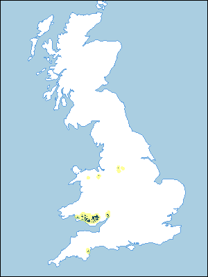
Distribution Map
 |
Note that the yellow shading represents a buffer to highlight the location of very small areas of the association.
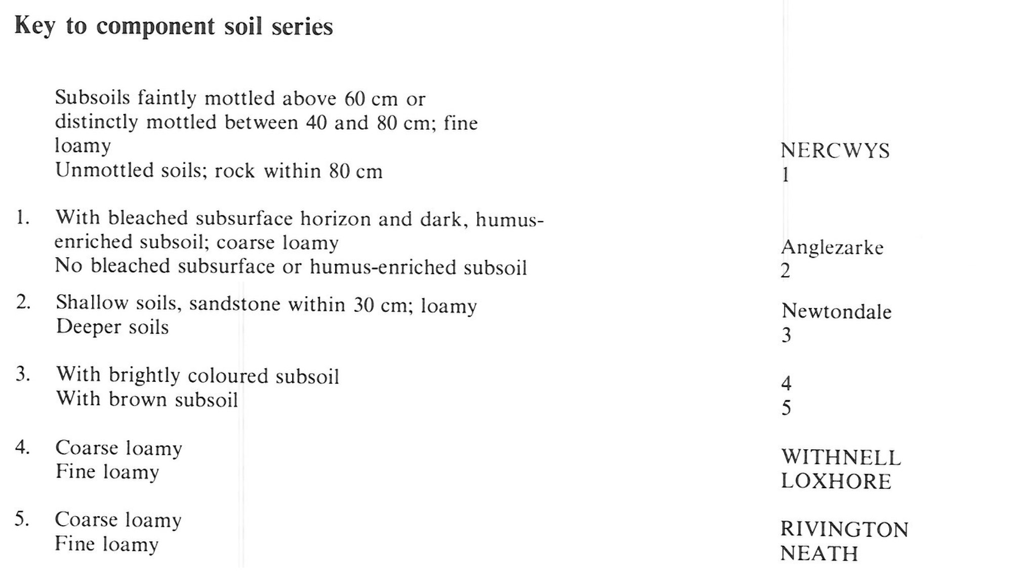
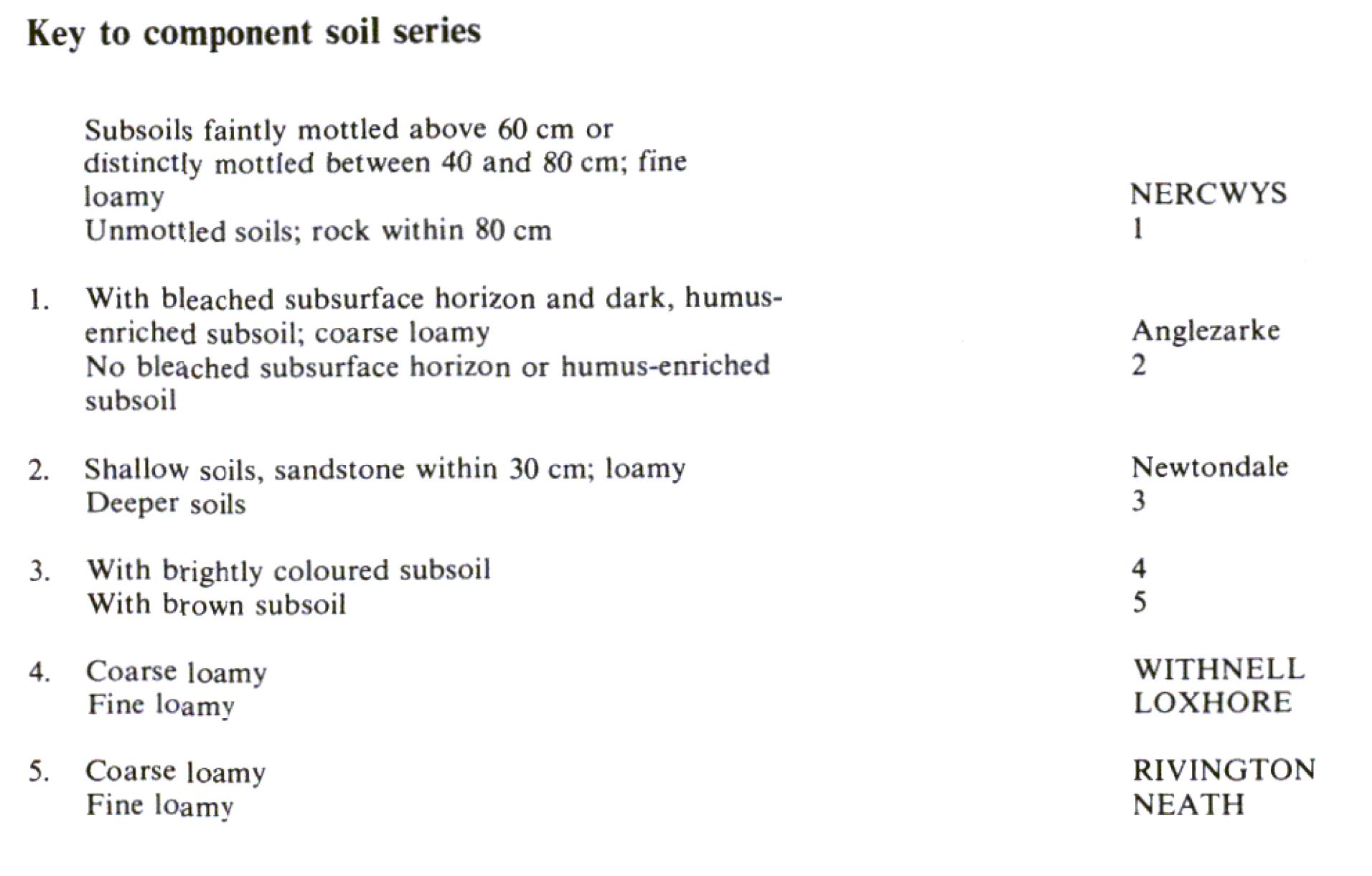
Keys to component soil series
South Western Region
 |
Wales
 |
Typical Landscapes
Wales
 |
All information Copyright, Cranfield University © 2025
Citation: To use information from this web resource in your work, please cite this as follows:
Cranfield University 2025. The Soils Guide. Available: www.landis.org.uk. Cranfield University, UK. Last accessed 25/04/2025
