Soil Associations
0612a PARC
Soil and site characteristics
Well drained loamy soils over rock with a humose or peaty surface horizon. Some peaty topped slowly permeable seasonally waterlogged loamy soils.
Geology
Palaeozoic slaty mudstone and siltstone
Cropping and Land Use
Dairying and stock rearing, some arable in Dyfed; dry acid grassland habitats in the South West.
Component soil series
| Subgroup | Series name | Percentage | WRB 2006 link |
|---|---|---|---|
| 6.12 | PARC | 60% | Humic Endoskeletic Umbrisols |
| 7.21 | WILCOCKS | 15% | Umbric Stagnosols |
| 6.54 | HAFREN | 10% | Endoskeletic Histic Stagnic Albic Podzols |
Covers 146 km2 in England and Wales
Soilscapes Classification
| 13 |
Freely draining acid loamy soils over rock |
0612a PARC
Detailed Description
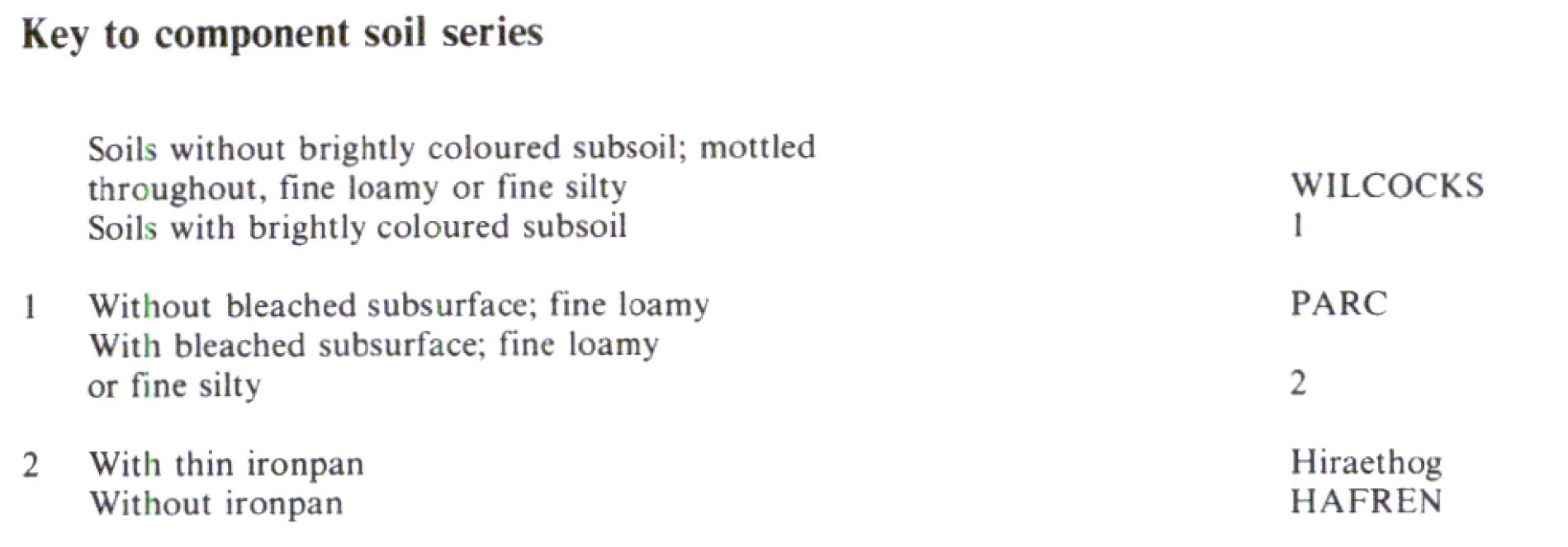
This association consists mainly of fine loamy humic brown podzolic soils on mudstone, shale and sandstone (Parc series) with similar fine silty soils. It is mapped on gentle to moderate slopes on plateaux at 130 to 300 m O.D. in south-west Wales and on steep slopes of north-west Dartmoor where slates are also a parent material. Many Parc soils appear to have formed through cultivating stagnopodzols (Hafren and Hiraethog series) which occur within the association on uncultivated land such as commons. Parc soils are permeable, well drained (Wetness Class I) and readily accept winter rain. They have dark, humose topsoils about 25 cm thick over brightly-coloured subsoils, passing to loose stony Head or deeply shattered shale or mudstone locally with sandstone. The associated Hafren series is similar but has a bleached and gleyed horizon directly beneath the humose topsoil, while the Hiraethog series also has a thin ironpan. Cambic stagnohumic gley soils (Wilcocks series) in slowly permeable drift occupy wet depressions with rushes and purple moor-grass, and have a peaty top over a strongly gleyed, compacted subsoil. Stones in all the soils are mostly shale, mudstone and sandstone but in places large angular quartz boulders, of residual rather than glacial origin are scattered over the surface of fields or along the field boundaries to where they have been moved. Some Parc subsoils show grey mottling superficially like that associated with wetness but structure faces are generally aerobic and the colours are thought to be related to podzolization. Dipwell measurements confirm that such profiles are not significantly wetter than ungleyed soils. The association includes soils similar to Parc series but developed in pockets of till or on sandstone. The Wilcocks series is a common associate on the higher land east of the Preseli hills but it disappears almost entirely elsewhere.
Soil Water Regime
Parc soils are permeable, well drained (Wetness Class I) and readily accept winter rain.
Cropping and Land Use
The climate is generally wet with about 1,500 mm rainfall and a field capacity period usually more than 250 days per year. Grass is therefore the main crop but swards are readily damaged by poaching because the humose topsoils retain much water. The grazing period is restricted and careful management is required. The proportions of ley grassland and cereals increase westwards on lower ground where rainfall is less and there are sufficent days in autumn and spring which are dry enough to allow cultivations without damage to the soil. On undergrazed commonland there is heather moor and small areas are afforested
0612a PARC
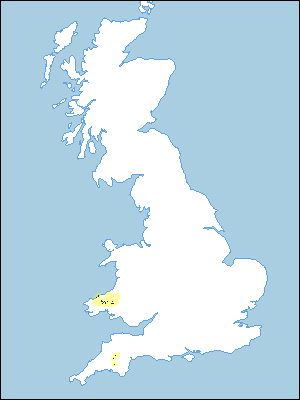
Distribution Map
 |
Note that the yellow shading represents a buffer to highlight the location of very small areas of the association.
Keys to component soil series
Wales
 |
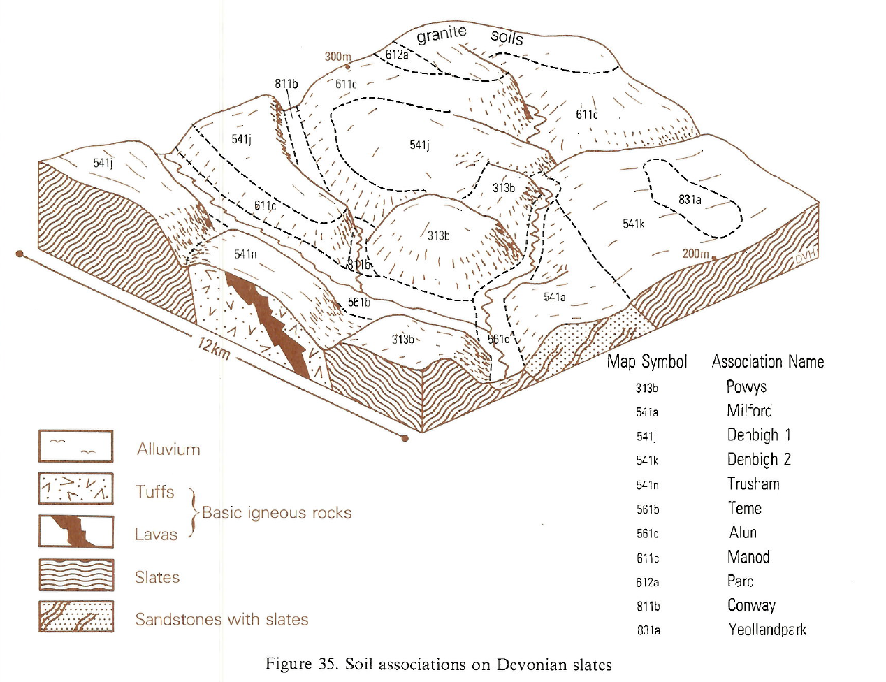
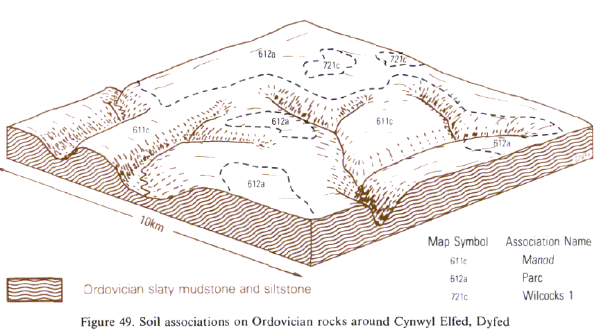
Typical Landscapes
South Western Region
 |
Wales
 |
All information Copyright, Cranfield University © 2025
Citation: To use information from this web resource in your work, please cite this as follows:
Cranfield University 2025. The Soils Guide. Available: www.landis.org.uk. Cranfield University, UK. Last accessed 25/04/2025
