Soil Associations
0643d Felthorpe
Soil and site characteristics
Sandy naturally very acid soils with a bleached subsurface horizon, some with a slowly permeable subsoil, some affected by groundwater. Associated with deep less acid sandy soils affected by groundwater.
Geology
Glaciofluvial drift and till
Cropping and Land Use
Coniferous and deciduous woodland some lowland heath habitats; some cereals and sugar beet.
Component soil series
| Subgroup | Series name | Percentage | WRB 2006 link |
|---|---|---|---|
| 6.43 | FELTHORPE | 30% | Ruptic Stagnic Albic Podzols |
| 8.21 | BLACKWOOD | 25% | Arenic Mollic Gleysols |
| 6.42 | LAKENHEATH | 20% | Umbric Endogleyic Albic Podzols |
Covers 23 km2 in England and Wales
Soilscapes Classification
| 15 |
Naturally wet very acid sandy and loamy soils |
0643d Felthorpe
Detailed Description
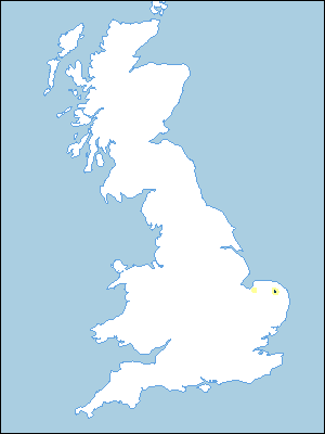
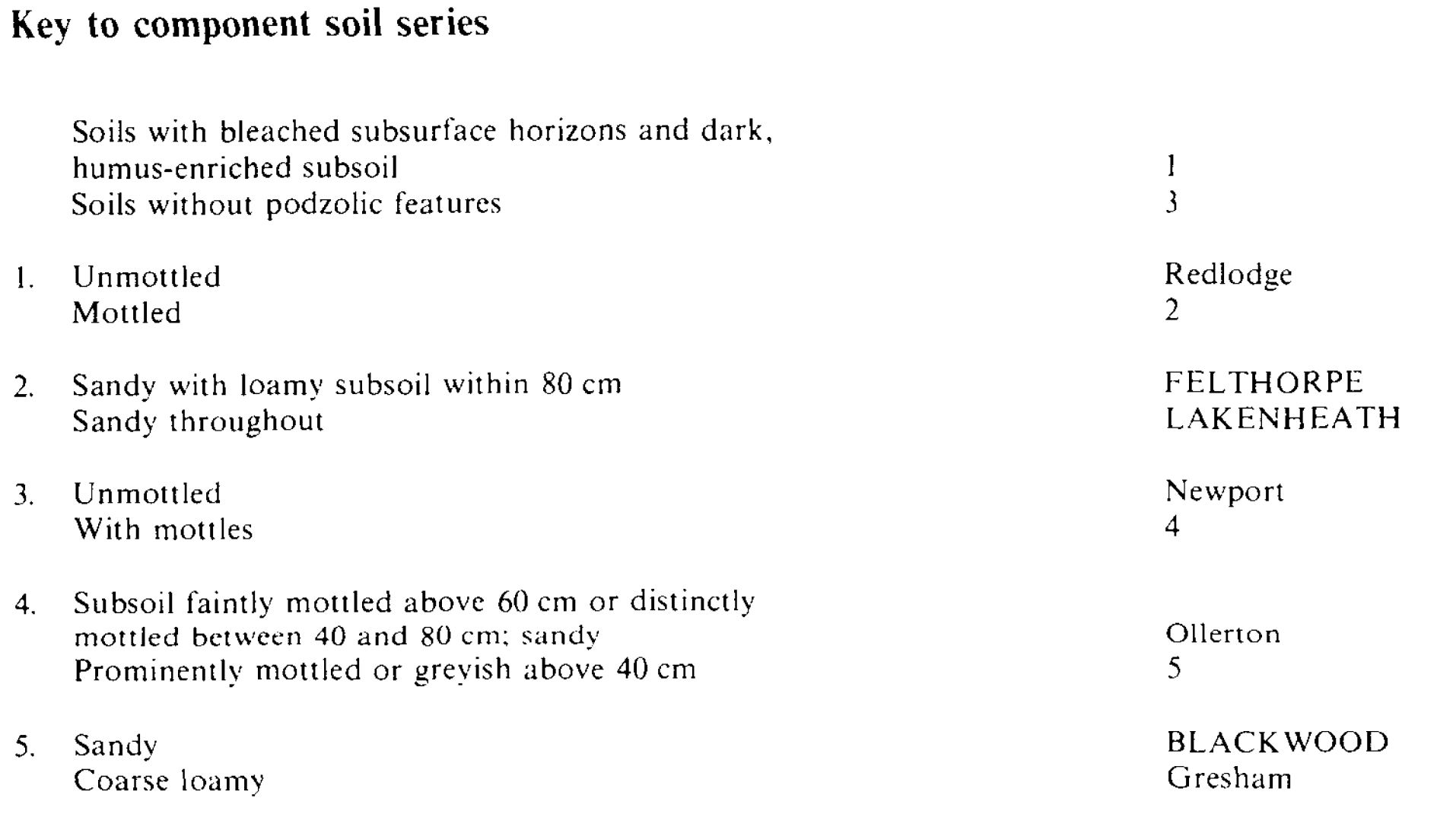
The Felthorpe association consists mainly of sandy, often very acid soils either with moderately permeable subsoils or affected by seasonally high groundwater. It covers 23 km² north of Norwich and there is a small area at Roydon north-east of King's Lynn. Near Norwich it occurs on gentle slopes in a flat landscape with a local relief of about 10 m. The soils are formed in glaciofluvial sands or, on lower ground, sands partly derived from Norwich Crag. The stoneless Norwich Brickearth, a till, underlies the glaciofluvial sands and forms the deep subsoil of the Felthorpe series, the main soil of the association. Felthorpe soils, stagnogley podzols, are accompanied by Lakenheath series, humo-ferric gley-podzols, and Blackwood series, typical sandy gley soils, which occur on the deeper sands as also does Redlodge series. The component podzols (Felthorpe, Lakenheath and Redlodge series) all have a dark, slightly cemented, humus-enriched, subsurface layer. Felthorpe series has a moderately permeable subsoil and Lakenheath soils are affected by groundwater but Redlodge soils are well drained. Other soils include the coarse loamy Gresham series which contains some aeolian silty drift in upper horizons and is associated locally with Felthorpe soils. Ollerton and Newport series also occur.
Soil Water Regime
The main soils, Felthorpe, Lakenheath, Blackwood, Ollerton and Gresham series are seasonally waterlogged, the Blackwood for long periods in winter (Wetness Class Ill and IV). The small areas of Redlodge and Newport soils are well drained (Wetness Class I).
Cropping and Land Use
Over much of the land the drainage is unimproved because the lack of fall has prevented a systematic lowering of the groundwater. As the soils are very acid and are droughty if drained, there has been little incentive for improvement. The association is mainly coniferous woodland, and heath used for rough grazing. There is a little arable on these easily cultivated soils especially on the better soils of the Gresham series.
0643d Felthorpe
Distribution Map
 |
Note that the yellow shading represents a buffer to highlight the location of very small areas of the association.
Keys to component soil series
Eastern Region
 |
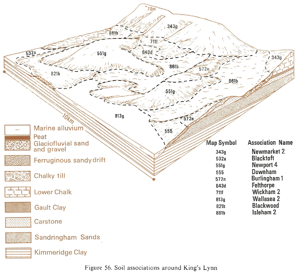
Typical Landscapes
Eastern Region
 |
All information Copyright, Cranfield University © 2025
Citation: To use information from this web resource in your work, please cite this as follows:
Cranfield University 2025. The Soils Guide. Available: www.landis.org.uk. Cranfield University, UK. Last accessed 25/04/2025
