Soil Associations
0651b HEXWORTHY
Soil and site characteristics
Gritty loamy very acid soils with a wet peaty surface horizon, thin ironpan often present. Bare rock and boulders locally. Some steep slopes.
Geology
Granite and other acid igneous rock
Cropping and Land Use
Wet moorland habitats of moderate and poor grazing value; recreation; coniferous woodland; dairying on improved ground; military use.
Component soil series
| Subgroup | Series name | Percentage | WRB 2006 link |
|---|---|---|---|
| 6.51 | HEXWORTHY | 35% | Placic Endoskeletic Histic Stagnic Albic Podzols |
| 6.52 | TRINK | 20% | Endoskeletic Placic Stagnic Podzols |
| 6.54 | ROUGH TOR | 20% | Endoskeletic Histic Stagnic Podzols |
| 7.21 | PRINCETOWN | 10% | Dystric Histic Stagnosols |
Covers 373 km2 in England and Wales
Soilscapes Classification
| 16 |
Very acid loamy upland soils with a wet peaty surface |
0651b HEXWORTHY
Detailed Description
This association consists mostly of podzolic soils and extends over the granite outcrop of South West England from 510 m O.D. on Dartmoor to sea level on the Isles of Scilly. Smaller areas are found over granite on the Cheviot Hills and on microgranite and rhyolite in North Wales. In Devon and Cornwall most of the soils are coarse loamy and developed in gritty granitic Head though on the Isles of Scilly some of the component soils are in silty drift overlying granitic Head. In Wales bedrock is usually closer to the surface and much of the land is rocky and bouldery. Over half the soils are ironpan stagnopodzols, Hexworthy series, and ferric stagnopodzols, Rough Tor series. Cambic stagnohumic gley soils of the Princetown series and humus-ironpan stagnopodzols, Trink series, are the main associates though there is considerable variation from place to place in the proportions of component series. Locally Laployd series, Moor Gate series, Bangor series, Cucurrian series and Crowdy series occur. There is much lateral variation over short distances, for instance the depth of the ironpan in Hexworthy soils fluctuates and they grade into the Trink series where organic matter has accumulated above the pan. In places organic matter masks the characteristics of eluvial horizons. In North Wales, these soils occur over rhyolite on Garnedd-goch, Moel Tryfan, and the north slopes of Snowdon, on microgranite at Blaenau Ffestiniog and on the mixed acid and basic pyroclastic rocks of Arenig Fawr. The land is rocky and boulder-strewn and the soils are in stony sometimes skeletal material with bedrock normally within profile depth. Rock outcrops and shallow humic rankers are found on ridges while freely drained Moor Gate series cover steep slopes and screes. Humic gley soils of the Laployd and Fordham series occur on relatively flat ground with some deeper peat soils of the Crowdy series in basin and flush sites. Rough Tor series is widespread, most extensively on Garnedd-goch and near Blaenau Ffestiniog.
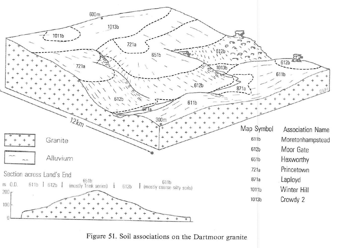
On Dartmoor the association occurs at heights of 200 to 500 m O.D. on gently or moderately sloping land along the eastern margin of the peat-covered northern plateau, with smaller patches around the southern plateau. Princetown series is common on the higher ground. On Bodmin Moor, large parts of which have been reclaimed, and near St Austell, stagnopodzols occupy most of the high ground and Princetown soils are less extensive. On drier granite outcrops on lower ground in west Cornwall Trink soils are widespread under heath and Cucurrian soils are common on steep slopes. On the Isles of Scilly soils similar to Trink series are found in silty drift.
Soil Water Regime
Cropping and Land Use
The land is open heather moorland with mire vegetation on wetter soils. The grazing is poor because of the low fertility of the acid soils, and the rocky mountainous terrain makes improvements uneconomic. None is afforested; deep ploughing to break the ironpan is largely precluded by rockiness and the risk of windthrow is considerable because the land is exposed. Lodgepole pine is the most suitable species but Sitka spruce is a better choice for the more sheltered, less rocky sites.
In west Cornwall the soils are mostly unreclaimed because of steep slopes or bouldery ground, and within the Dartmoor National Park conservation and amenity aspects are over-riding. On Bodmin Moor, as elsewhere, the potential for agricultural improvement is limited by waterlogging caused by ironpans or other slowly permeable upper horizons restricting the movement of water into more permeable material below. Mechanical disruption of these layers by subsoiling improves the natural drainage. Unreclaimed Hexworthy soils have very low winter rain acceptance potential but after subsoiling winter rain penetrates more readily. After reclamation, grassland requires careful grazing and regular use of lime and fertilizer to prevent reversion to rushes. The large retained water capacity of humose or peaty topsoils makes them susceptible to poaching and traffic damage during wet periods. With the generally high rainfall in the uplands they are suitable for seasonal grazing only. The semi-natural vegetation on Dartmoor is predominantly moist atlantic heather moor of low grazing value, with Molinia grassland of moderate value in wetter parts. On southern parts of the moor better acid bent-fescue grassland is common. The heavier grazing pressure on Bodmin Moor has suppressed much of the heather and encouraged Molinia or acid bent-fescue grassland. Much of the forestry on the granite uplands of Devon and Cornwall is on this association. The soils have been deeply ploughed and subsoiled to encourage deep rooting and so counteract windthrow on exposed sites. Sitka spruce and some Lodgepole pine have been planted as the most suitable species for the climate. The soils have low reserves of phosphorus and require fertilizer applications for adequate growth.
0651b HEXWORTHY
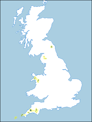
Distribution Map
 |
Note that the yellow shading represents a buffer to highlight the location of very small areas of the association.
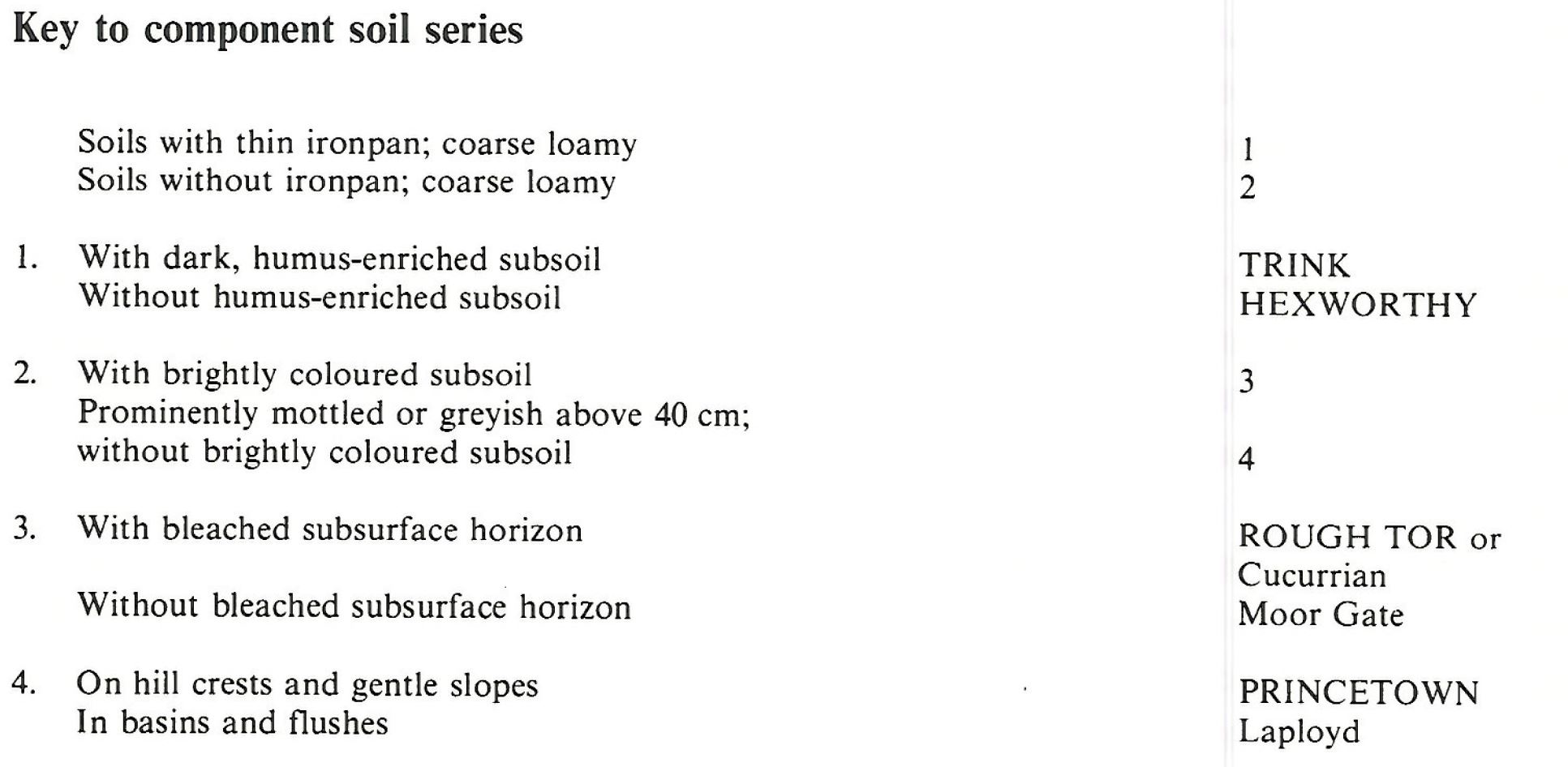
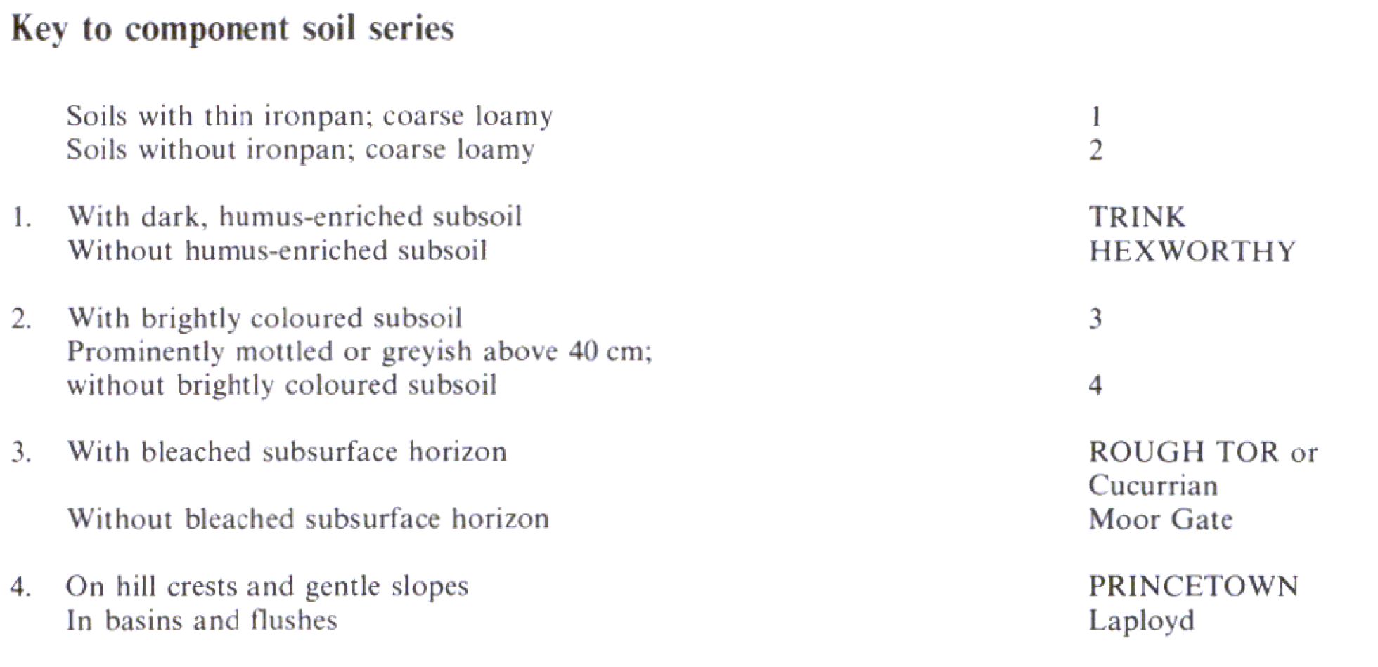
Keys to component soil series
South Western Region
 |
Wales
 |
Typical Landscapes
South Western Region
 |
All information Copyright, Cranfield University © 2025
Citation: To use information from this web resource in your work, please cite this as follows:
Cranfield University 2025. The Soils Guide. Available: www.landis.org.uk. Cranfield University, UK. Last accessed 25/04/2025
