
Soil Associations
0711t BECCLES 3
Soil and site characteristics
Slowly permeable seasonally waterlogged fine loamy over clayey soils and similar soils with only slight seasonal waterlogging. Some calcareous clayey soils especially on steeper slopes.
Geology
Chalky till
Cropping and Land Use
Winter cereals; some short term grassland.
Component soil series
| Subgroup | Series name | Percentage | WRB 2006 link |
|---|---|---|---|
| 7.11 | BECCLES | 60% | Eutric Albic Luvic Stagnosols |
| 5.72 | ASHLEY | 25% | Endostagnic Luvisols |
| 4.11 | HANSLOPE | 15% | Calcaric Stagnic Cambisols |
Covers 567 km2 in England and Wales
Soilscapes Classification
| 18 |
Slowly permeable seasonally wet slightly acid but base-rich loamy and clayey soils |
0711t BECCLES 3
Detailed Description
This association consists mainly of typical stagnogley soils of the Beccles series and similar stagnogleyic argillic brown earths of the Ashley series. Clayey and calcareous Hanslope series, typical calcareous pelosols, is a common associate locally. All three soils have slowly permeable subsoils and are extensive on chalky till in Eastern England and the Midlands. Clayey Ragdale soils have a limited distribution and coarse loamy Wick and Arrow soils are mainly asociated with sands and gravels in the Midlands.
The association covers about 145 km² around Lutterworth, south and east of Leicester, near Warwick and Moreton-in-Marsh on plateaux above about 90 m O.D. Where the ground is much dissected by the river Avon and its tributaries, the association occurs only as isolated caps on interfluves. Wick and Arrow soils are included where interglacial sands and gravels outcrop below the till. Across the main watershed of the Trent and Avon the landscape is broad and featureless except near Leicester where it is more dissected. Here Wick and Arrow soils occur on the highest ground where thin gravelly outwash covers the chalky till. Hanslope soils are confined to small knolls or at the margins of delineations where, because of erosion, the till is calcareous near to the surface.
The association occurs mainly in Suffolk, Lincolnshire and Northamptonshire. It covers 66 km² in Lincolnshire mostly around Heckington where it occupies flat land at about 10 m O.D. a little above the Fens to the east. Hanslope soils are uncommon but calcareous fine loamy over clayey Eyeworth soils are present locally. Where the till thins along the Fen edge some Wickham soils on Jurassic clay shales are included. North of Sleaford the association occurs on broken ground as isolated caps to small interfluves. In mid-Suffolk between Hadleigh and Stowmarket it covers 88 km² on a broad plateau at about 75 m O.D. Here Beccles and Ashley soils are co-dominant. Hanslope soils are restricted to convex eroded slopes mainly at the edges of the plateau. West of the river Lea in Hertfordshire the association occurs on a narrow ridge and small patches are found between Theydon Bois and Chigwell.
In South West England the association covers only 2 km² on a remnant of till on flat terrace-like land south of Moreton-in-Marsh. It consists principally of Beccles soils, but also includes some fine loamy over clayey soils on reddish till, Salop series. There are few Hanslope, Ashley and rarer Ragdale soils.
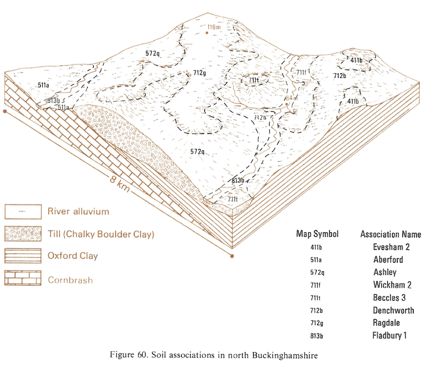
Beccles soils cover most of the area in north Buckinghamshire and Ashley profiles are generally limited to gentle convexities where drainage is better. Hanslope soils occur only on steep convex slopes along the edge of the plateau, and there are a few Ragdale profiles. There is a small patch east of the Evenlode valley in north Oxfordshire where the association includes some Salop soils.
Soil Water Regime
All the soils have slowly permeable subsoils which cause waterlogging for much of the winter (Wetness Class III and IV). Because of this they have a limited winter rainfall acceptance potential and most surplus water is shed laterally as surface run-off.
Cropping and Land Use
Land use is more or less equally divided between cereals and grass although oilseed rape is being increasingly grown. Weak surface structure and soil wetness restrict the opportunities for cultivation particularly in spring so spring crops are rarely sown. The soils are slightly droughty for cereals and moderately droughty for grass. While grass yields are moderate the risk of poaching restricts early spring and late autumn grazing. Most component soils are naturally acid, but Hanslope soils are commonly neutral. Phosphorus levels are low, but potassium is readily available and sufficient for the needs of most crops.
0711t BECCLES 3
Distribution Map
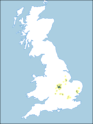 |
Note that the yellow shading represents a buffer to highlight the location of very small areas of the association.
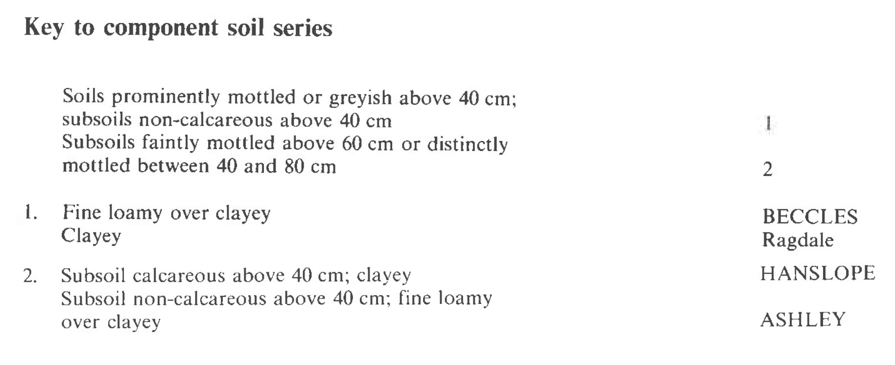
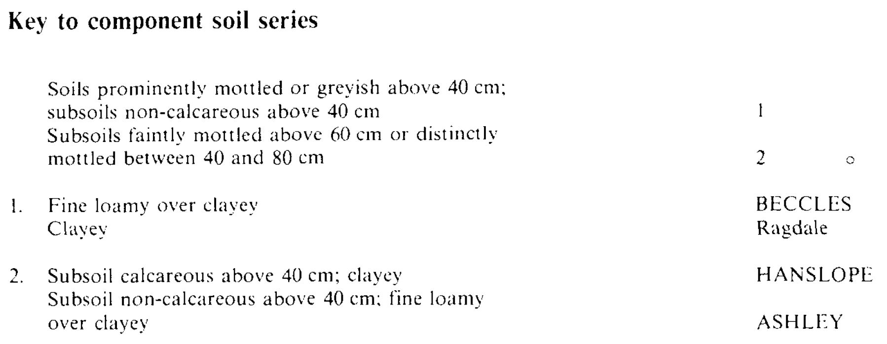
Keys to component soil series
Midlands
 |
Eastern Region
 |
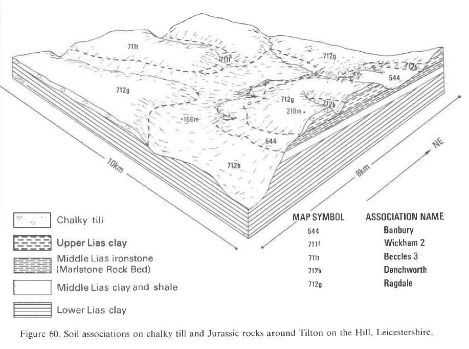
Typical Landscapes
Midlands
 |
South Eastern Region
 |
All information Copyright, Cranfield University © 2025
Citation: To use information from this web resource in your work, please cite this as follows:
Cranfield University 2025. The Soils Guide. Available: www.landis.org.uk. Cranfield University, UK. Last accessed 25/04/2025
