
Soil Associations
0712e HALLSWORTH 2
Soil and site characteristics
Slowly permeable seasonally waterlogged clayey, fine loamy and fine silty soils.
Geology
Drift from Carboniferous sandstone and shale
Cropping and Land Use
Permanent grassland, stock rearing and dairying; some coniferous and deciduous woodland and wet moorland habitats.
Component soil series
| Subgroup | Series name | Percentage | WRB 2006 link |
|---|---|---|---|
| 7.12 | HALLSWORTH | 31% | Clayic Eutric Stagnosols |
| 7.13 | BRICKFIELD | 29% | Eutric Stagnosols |
| 7.13 | CEGIN | 10% | Dystric Stagnosols |
| 7.12 | TEDBURN | 10% | Clayic Eutric Stagnosols |
Covers 461 km2 in England and Wales
Soilscapes Classification
| 17 |
Slowly permeable seasonally wet acid loamy and clayey soils |
0712e HALLSWORTH 2
Detailed Description
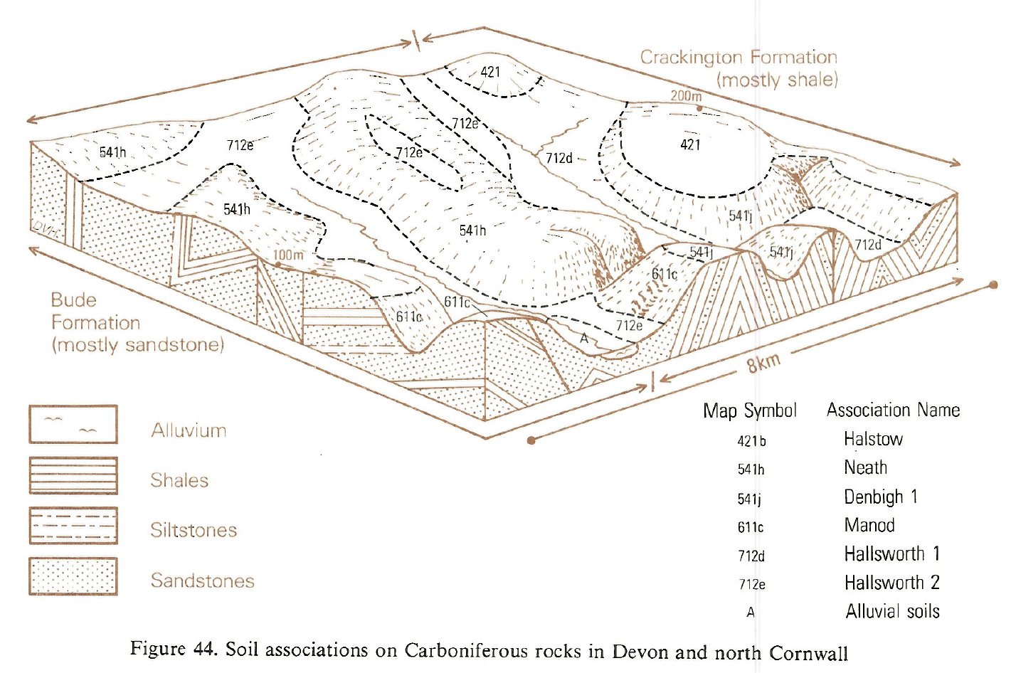
This association of stagnogley soils exhibits much variation in texture, including clayey, fine loamy and fine silty soils, though soil colour and structure are relatively uniform. Surface horizons are greyish with prominent rusty mottling and overlie strongly mottled clay or clay loam horizons with prismatic structure. The main soils are clayey Hallsworth and fine loamy Brickfield series. The association extends from the Atlantic coast across Devon to Wellington in Somerset. It overlies Carboniferous rocks of the Bude Formation, fine sandstones with subsidiary siltstones and shales, though the soils are formed in a mantle of Head and not directly on rock. Typical sites are shallow valleys and depressions backed by drier rising ground, but in places the association extends upslope onto broad ridge crest. Elevations are from sea level along the estuaries of the Taw and Torridge to about 260 m O.D. between South Molton and Bampton. Associated stagnogley soils, accounting for about a third of the unit, include the clayey Tedburn, fine silty Cegin, and fine loamy over clayey Greyland series. There are also Onecote soils, stagnohumic gley soils with a humose surface. The variation of soil texture in this association, as colour and structure remain constant, is illustrated by Harrod in describing the Tedburn/Brickfield map unit. Observations at very close intervals indicated no clear pattern, most of the ground having haphazard soil distribution, though some trends take place across the association. or example, the proportion of silty over clayey profiles increases eastward, outnumbering clayey soils around Tiverton, and the coarse loamy Huby series noted as a minor component around Holsworthy has not been observed east of the Torridge. While mottled dark grey topsoils are most common in all series, some surface horizons in districts with lower rainfall are browner and less mottled. Reddened variants occur patchily close to the red rocks east of Hatherleigh and around Hartland. Onecote and other similar stagnohumic gley soils are found only in wetter districts where rainfall exceeds 1,200 mm, as in the upper Torridge valley. Neath association which occupies the drier convex ground on the Bude Formation is closley intermingled with Hallsworth 2 association and small discrete areas of Neath soils have been included. Boundaries between the two associations are often abrupt and their preferred east to west and south-east to north-west alignments reflect strike and fault directions in the underlying rocks.
Soil Water Regime
All the constituent soils, apart from Onecote series, are severely waterlogged (Wetness Class V) in the undrained state. Surface wetness is attributable to the slowly permeable, dense and coarsely structured subsoils. In stony basal layers of Head beneath these horizons are discontinuous bodies of groundwater which locally break out as springs. Other springs appear along the upslope boundaries where the association meets drier land of the Neath association.
Run-off of winter rain is rapid with most excess rainfall dispersing laterally and close to the surface. However, as noted above, some percolation feeds deeper groundwater.
Profile available water estimates suggest that grass suffers droughtiness in most summers, at least in drier districts such as Winkleigh. However restricted percolation of summer rain accounts for the rare droughtiness of pasture on these soils. Even where drained, the large retained water capacity of topsoils exceeds the plastic limit so any stocking and movement of vehicles while the soils are at field capacity will cause damage.
Cropping and Land Use
Most of the unit is under ley or permanent pasture, often rushy, and the remainder bears coniferous forest, scrubby deciduous woodland, or Molinia moor. In many years summer reseeding is interrupted by wet weather. These soils are potentially productive for grassland as there is little loss of yield from summer drought. They are however readily poached and pastures deteriorate rapidly if grazed too often when wet. The limitations on agriculture make forestry an alternative use. Sitka spruce grows well if helped on establishment by drainage and application of phosphorus fertilizer, but the dense subsoils restrict rooting and windthrow is a risk. The landscape has little amenity value, but interesting habitats are associated with unmanaged deciduous woodland and Molinia moors.
0712e HALLSWORTH 2
Distribution Map
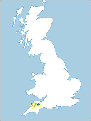 |
Note that the yellow shading represents a buffer to highlight the location of very small areas of the association.
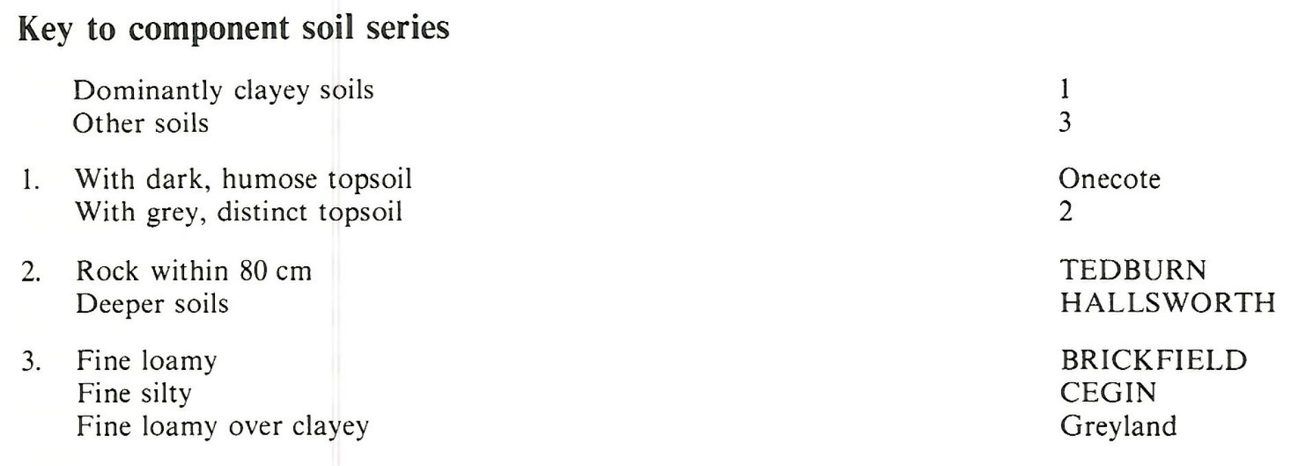
Keys to component soil series
South Western Region
 |
Typical Landscapes
South Western Region
 |
All information Copyright, Cranfield University © 2025
Citation: To use information from this web resource in your work, please cite this as follows:
Cranfield University 2025. The Soils Guide. Available: www.landis.org.uk. Cranfield University, UK. Last accessed 25/04/2025
