
Soil Associations
0713d CEGIN
Soil and site characteristics
Slowly permeable seasonally waterlogged fine silty and clayey soils. Some fine silty and fine loamy soils with slowly permeable subsoils and slight seasonal waterlogging on slopes. Well drained fine loamy soils over rock in places.
Geology
Drift from Palaeozoic slaty mudstone and siltstone
Cropping and Land Use
Stock rearing on permanent grassland dairying on lower ground.
Component soil series
| Subgroup | Series name | Percentage | WRB 2006 link |
|---|---|---|---|
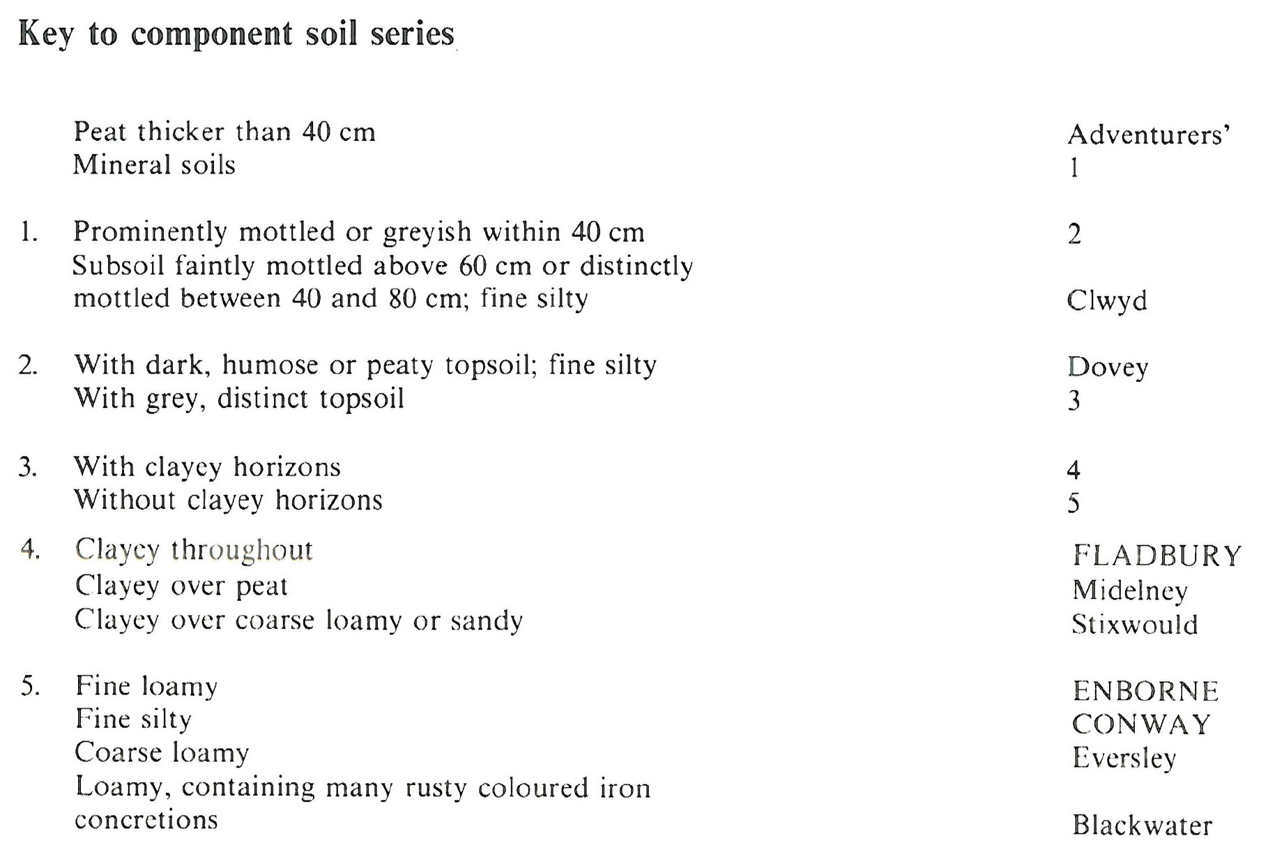
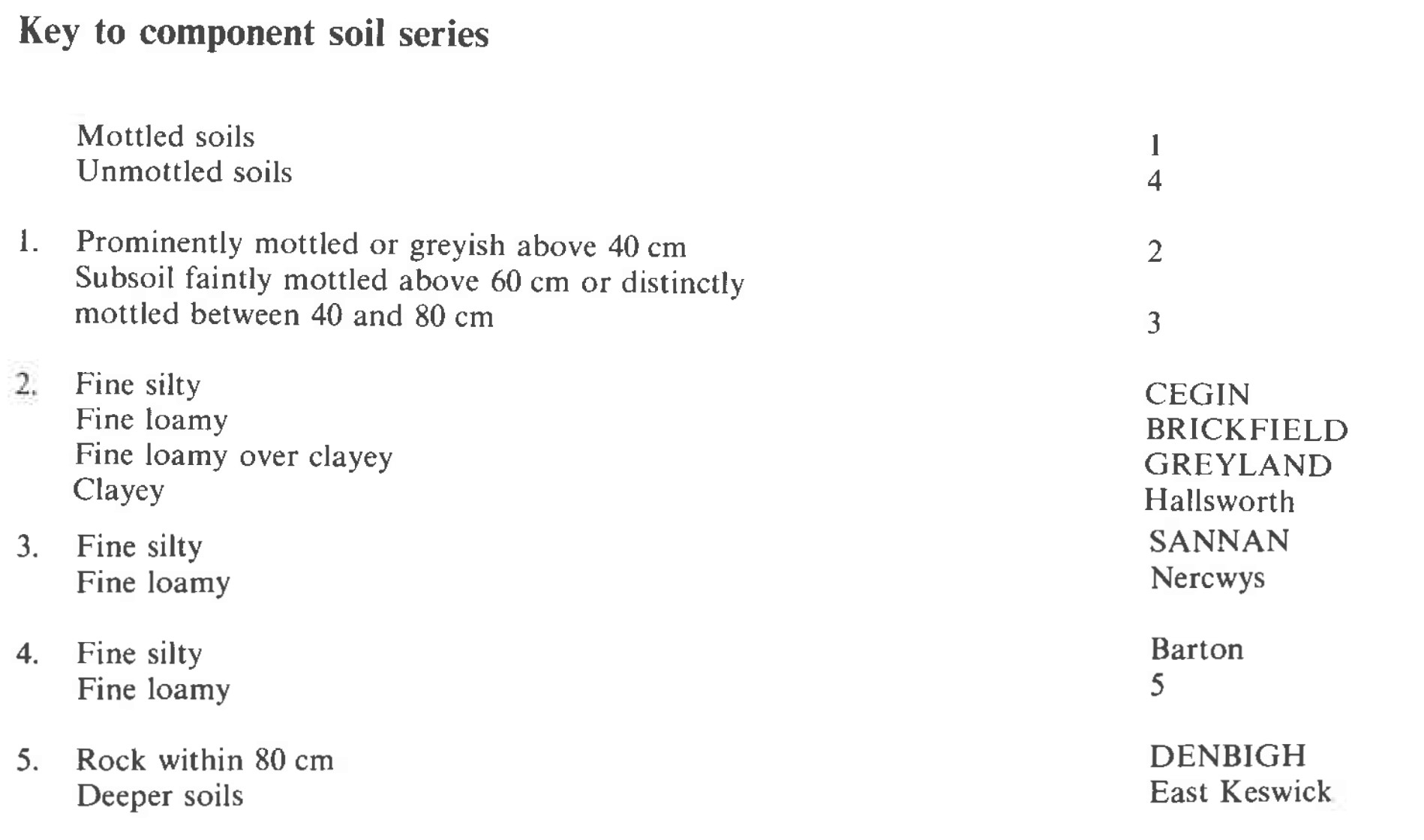
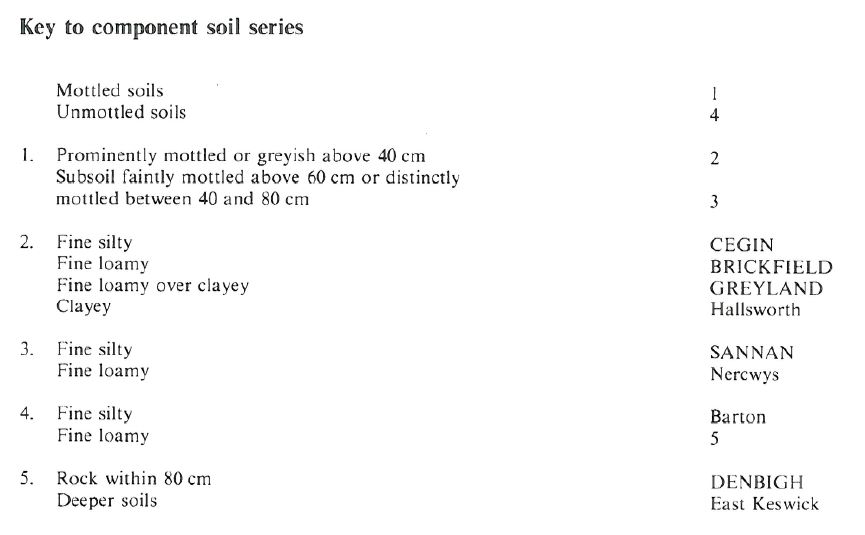
| 7.13 | CEGIN | 40% | Dystric Stagnosols |
| 7.13 | GREYLAND | 15% | Eutric Stagnosols |
| 7.13 | BRICKFIELD | 10% | Eutric Stagnosols |
| 5.42 | SANNAN | 10% | Eutric Endostagnic Cambisols |
| 5.41 | DENBIGH | 10% | Eutric Endoleptic Cambisols |
Covers 1602 km2 in England and Wales
Soilscapes Classification
| 17 |
Slowly permeable seasonally wet acid loamy and clayey soils |
0713d CEGIN
Detailed Description
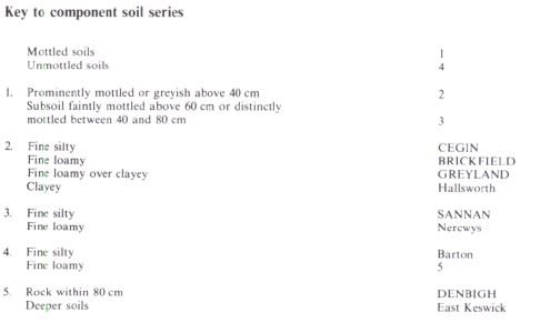
The Cegin association comprises seasonally waterlogged loamy and clayey cambic stagnogley soils belonging to the Cegin, Brickfield and Greyland series. They are intractable for much of the year unless artificially drained and their slowly permeable subsoils are coarsely structured and often compact at depth. Sannan and Denbigh series occur on steep slopes or where the drift is thin over bedrock giving good drainage. The association, which covers 1622 km², is widespread over Silurian and Ordovician sedimentary rocks in Wales but also occurs in the Midlands and Northern England, commonly on undulating till-covered lowlands or on footslopes and valley floors. Hallsworth, Nercwys, Barton and East Keswick series are minor components occurring locally.
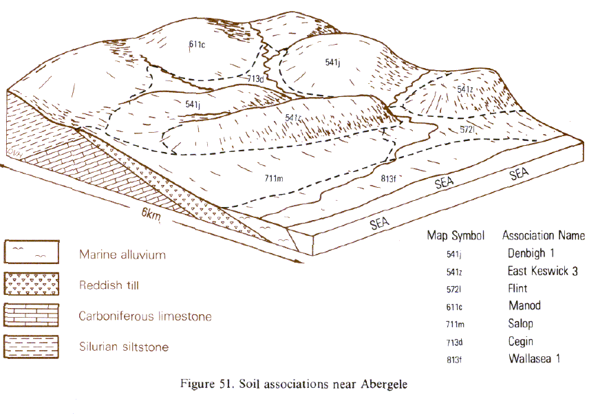
The association is restricted to western Shropshire, covering 65 km² on the till plain between 100 and 280 m O.D. to the west of Oswestry and north and south of the river Tanat near Llanyblodwel. Cegin and Brickfield series usually dominate but Pinder and Prolleymoor series are also present. The boundary between cambic and typical stagnogley soils on lowland plains in moist western districts is not clearly defined and probably gradual. This land lies on that boundary. On steep slopes, Sannan and Bishampton series are common, often occurring together with Denbigh and Barton series where the till is thin and bedrock exposed. This is the main association of stagnogley soils in Wales. It is most extensive around Newtown and Llandrindod Wells where it occupies hill and valley land. To the south it follows the Tywi valley (Wright 1980).
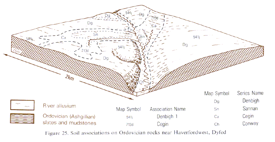
In west Dyfed it is in valleys and depressions affected by seepage. South of Aberystwyth it occupies drift covered plateaux and wet footslopes. In northern Anglesey thick drift and low relief combine to give an extensive uninterrupted area of the association. The nature of Cegin soils varies with topography and parent material (Thompson 1982). On convex hilltops compact slowly permeable material may be near the surface as a result of truncation. On footslopes, profiles have permeable finely structured upper horizons in colluvium overlying the more compact layers characteristic of stagnogley soils. In some Cegin soils there is a thin clayey horizon possibly formed by in situ weathering. Soils with thicker clayey horizons are classified as fine loamy over clayey Greyland series or similar unnamed fine silty over clayey stagnogley soils. These two soils are components of this association throughout Wales, being most prominent in eastern counties where bedrock is soft and more easily weathered, and over the mudstones of south Wales. Clayey Hallsworth soils (pelo-stagnogley soils) have a similar distribution. Brickfield soils are fine loamy throughout and are most common where more sandstone and gritstone are incorporated in the drift. Stagnogleyic brown earths of the Sannan series and well drained brown earths of the Denbigh, Barton or East Keswick series are most common on steeper slopes where topography varies rapidly over short distances.
In Cumbria the soils are mapped on drumlins near Kendal and along Lake District valleys where they are developed in slaty drift. In the Kendal drumlin field (Furness and King 1972) the Cegin series occupies the lower slopes, with Sannan and Denbigh soils on the higher slopes. In the Lune valley south of Tebay, on the northern shores of Ullswater and south of Ennerdale Bridge, where the soils are derived from slates of the Skiddaw Group, there are few clayey profiles.
Soil Water Regime
The Cegin association absorbs only a small proportion of winter rain. In wet districts Cegin, Brickfield and Greyland soils are waterlogged for long periods in the growing season (Wetness Class V) and even with artificial drainage they can remain wet throughout the winter (Wetness Class IV). Where the field capacity period is less than 200 days, the soils are naturally drier (Wetness Class IV) and their drainage regime can be improved to Wetness Class III. Denbigh soils are naturally well drained (Wetness Class I) and Sannan soils occasionally waterlogged (Wetness Class III).
Cropping and Land Use
Grass, much of it long-term, is the main crop but a little barley and roots are grown. Potential grass yields are large because growth is rarely or only slightly restricted by droughtiness but surface wetness can delay early fertilizer applications and the land may remain too wet for grazing cattle many weeks after growth starts. The autumn flush of growth potentially provides useful late grazing but it cannot always be used as the grazing season is several weeks shorter than the growing season. Grazing, silage harvesting and slurry spreading on wet land all lead to poaching or compaction of surface horizons with consequent deterioration of sward composition, soil drainage and yield. Land work is best done in autumn and, in normal years, opportunities for spring cultivation are very limited although some is carried out on adequately drained land. Cereal cropping is often affected by poor weather causing delays at harvest time. Late harvesting then prevents the land being worked when conditions are otherwise suitable. As with other wet soils, fungal diseases transmitted on stubble infect susceptible cereal crops and limit productivity.
In Wales and the North some of this land is afforested. For new coniferous plantations, the Forestry Commission recommends deep double mouldboard ploughing at 4 m spacing downslope with connecting cross drains before planting either Sitka or Norway spruce. Trees normally respond to phosphorus fertilizers given either at planting or as a subsequent top-dressing. Unless controlled, grass growth smothers young trees. These soils inhibit deep rooting so trees are liable to windthrow before reaching maturity. Where the climate is suitable most hardwoods will grow on this land and, in particular, there are notable stands of oak, which thrive in the poorly drained soils as at Crowther Coppice near Welshpool.
0713d CEGIN
Distribution Map
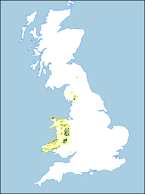 |
Note that the yellow shading represents a buffer to highlight the location of very small areas of the association.
Keys to component soil series
South Eastern Region
 |
Midlands
 |
Northern Region
 |
Wales
 |
Typical Landscapes
Wales
 |
Wales
 |
All information Copyright, Cranfield University © 2025
Citation: To use information from this web resource in your work, please cite this as follows:
Cranfield University 2025. The Soils Guide. Available: www.landis.org.uk. Cranfield University, UK. Last accessed 25/04/2025
