
Soil Associations
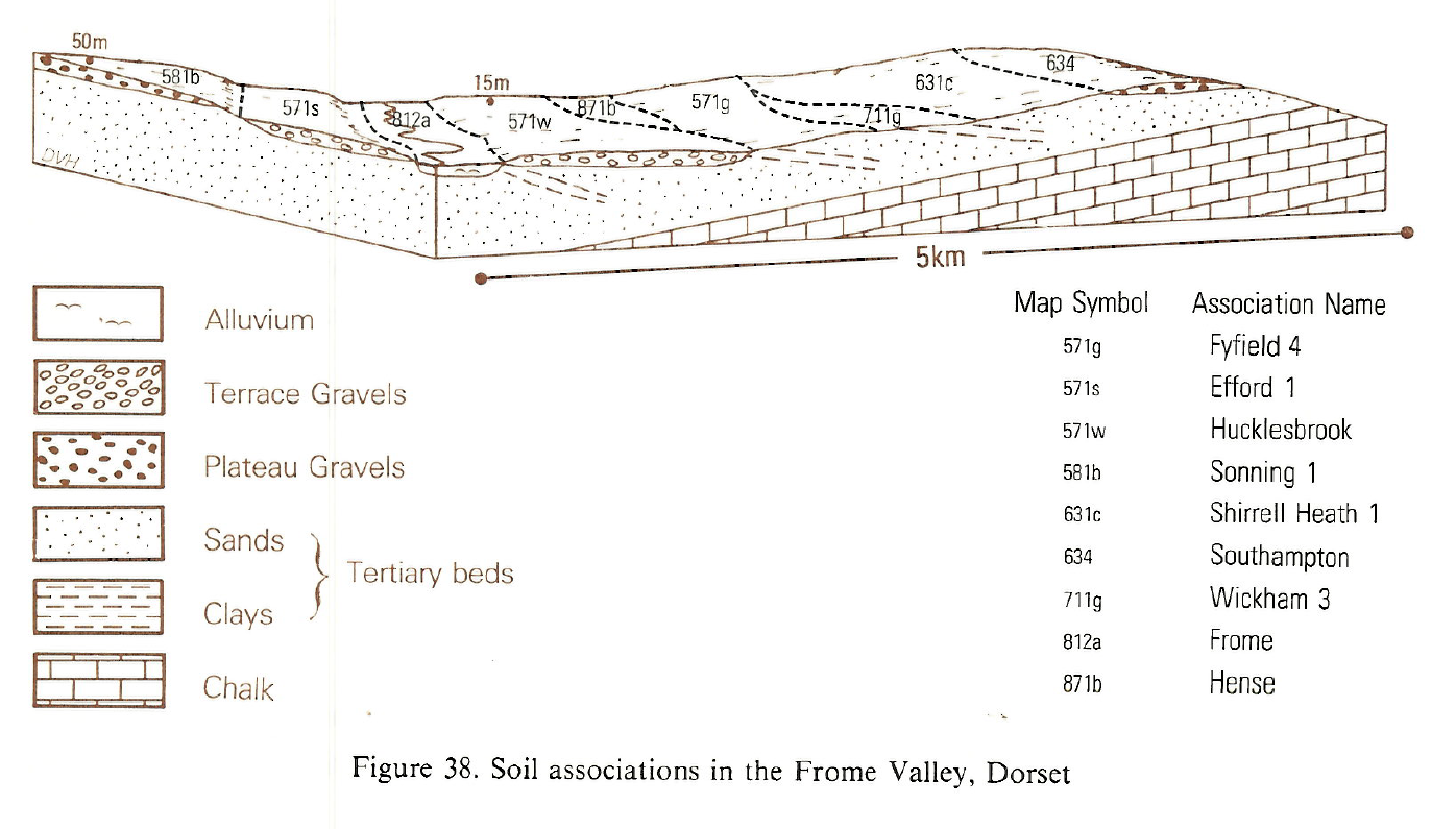
0812a FROME
Soil and site characteristics
Shallow calcareous and non-calcareous loamy soils over flint gravel affected by groundwater. Small areas of peat. Risk of flooding.
Geology
Chalky and gravelly river alluvium
Cropping and Land Use
Permanent grassland with dairying and stock rearing; some cereals and short term grassland; wetland habitats; recreation.
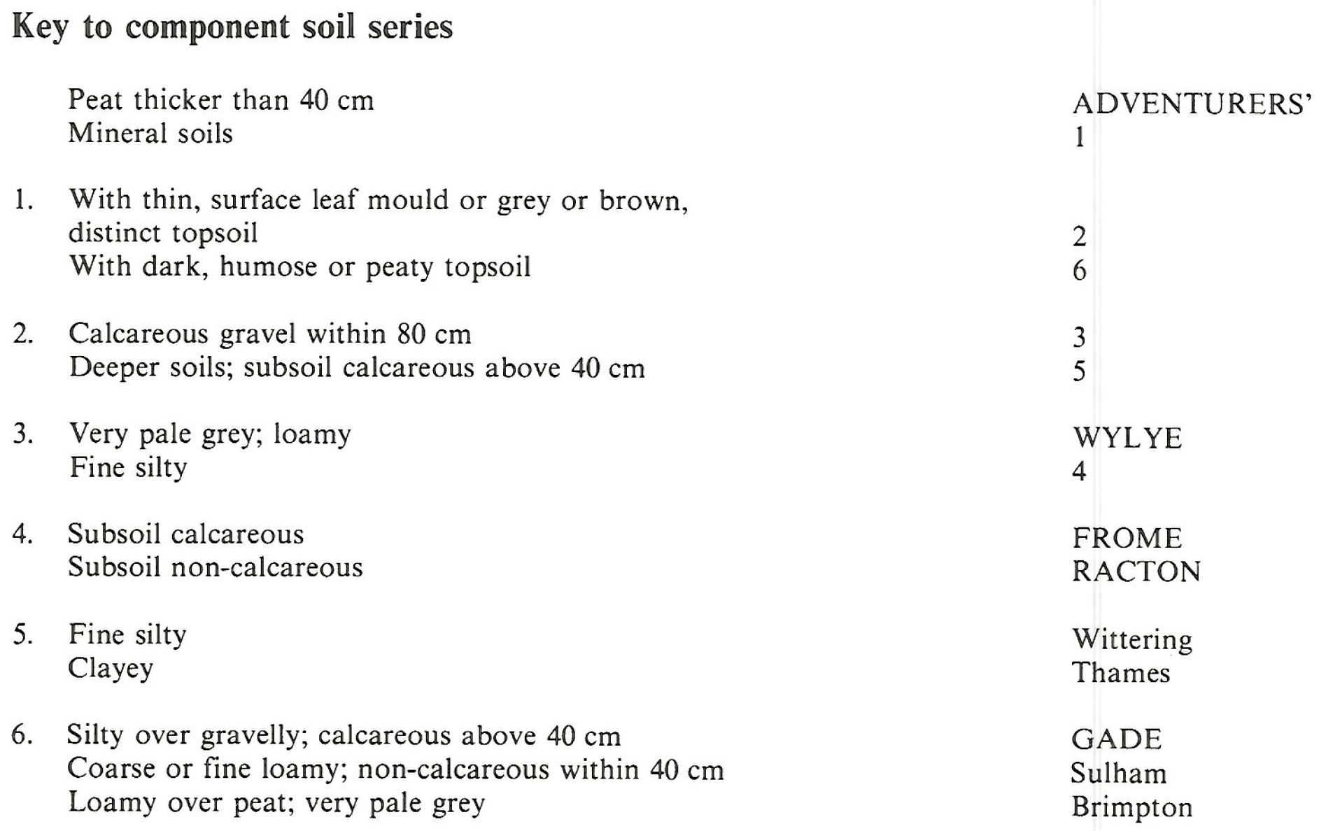
Component soil series
| Subgroup | Series name | Percentage | WRB 2006 link |
|---|---|---|---|
| 8.12 | FROME | 41% | Fluvic Calcaric Gleysols |
| 3.72 | WYLYE | 39% | Endoskeletic Fluvic Calcaric Gleysols |
| 8.11 | RACTON | 10% | Siltic Endoskeletic Eutric Gleysols |
| 10.24 | ADVENTURERS' | 5% | Drainic Rheic Sapric Histosols |
| 8.52 | GADE | 5% | Endoskeletic Calcaric Mollic Gleysols |
Covers 239 km2 in England and Wales
Soilscapes Classification
| 20 |
Loamy and clayey floodplain soils with naturally high groundwater |
0812a FROME
Detailed Description
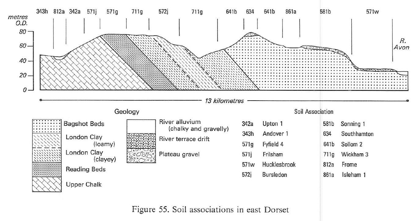
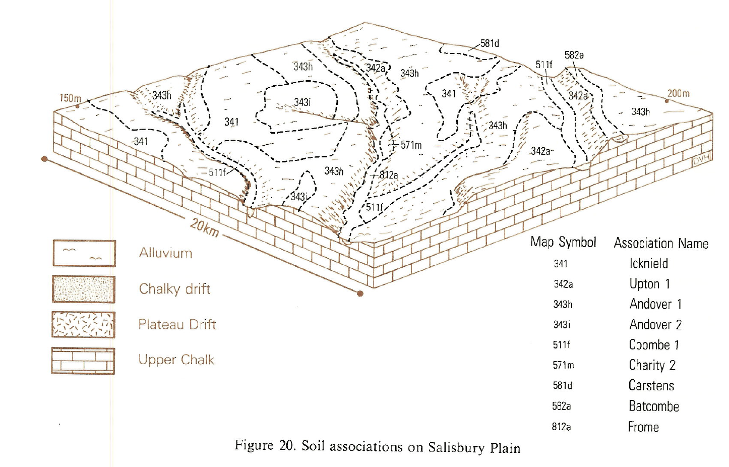
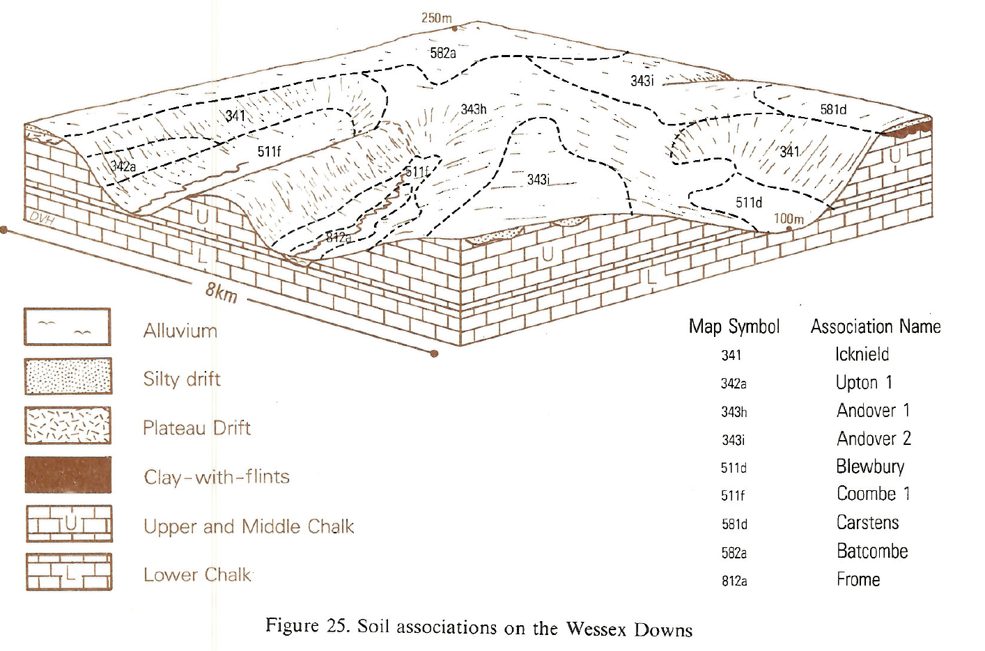
The Frome association includes soils in chalky and gravelly alluvium along streams draining the Chalk and adjacent formations. The thickness of alluvium varies but in most valleys fine textured deposits rest on flint and/or chalk gravel. Calcareous marl and peat bands within the soils occur locally. The soil patterns are commonly complex and the proportions of different kinds of soil vary. Calcareous alluvial gley soils of the Frome series are common to most valleys. These are grey and mottled silty clay barns affected by high groundwater with calcareous flint and/or chalk gravel at relatively shallow depth. Associated Racton soils, typical alluvial gley soils, are similar but non-calcareous. Extremely calcareous, mottled Wylye soils, gleyic rendzina-like alluvial soils, and Gade series, typical humic alluvial gley soils, with humose topsoils over mottled calcareous silty subsoils, are extensive in some valleys where calcareous gravel occurs within 80 cm of the surface. In Hertfordshire, chalky and flinty alluvium is extensive in narrow valleys, which drain the Chilterns including those of the Chess, Misbourne, Gade and Bulbourne. Some of the land was mapped by Avery (1964) as the Gade complex. The soils are very varied in character, the streams being flanked by Wylye, Gade, Wittering and some Frome soils, while Adventurers' peat soils and soils with humose surface horizons are locally common.
In Wiltshire and parts of Dorset, the alluvium is generally extremely calcareous and Wylye soils are common together with deeper Colthrop soils. There are patches of similar soils with humose topsoils locally. In some of the small valleys flint gravels lie close to the surface, giving shallow stony soils. Abrupt lateral changes in the thickness of the alluvium give complex soil patterns. Peat accumulation is relatively inextensive compared with some Hampshire valleys but locally there are earthy eutro-amorphous peat soils of the Adventurers' series. The large alluvial tracts of the lower Avon, on the Dorset/Hampshire border, and in the Frome and Piddle valleys include a wider range of less calcareous soils. Here some material is derived from nearby Tertiary formations and Frome and the deeper Wittering soils are common but Gade, Racton and very gravelly soils are locally important. Base-rich peat soils of the Adventurers' series are also present in some sections of these valleys. Clayey Thames and Fladbury soils become more extensive downstream along some rivers and are present in some headwaters like the Avon's source in the Vale of Pewsey, where the sediment is derived from adjacent clayey formations.
In Humberside, chalky and flinty gravel from the Wolds is extensive along the upper reaches of the river Hull and its tributaries east and south-east of Great Driffield. These spring-fed streams are flanked by Frome, Wylye and Wittering series, and Adventurers' and Bressington soils are locally common. Complex soil patterns, based on contrasting patches of deep peat and chalky gravel, are characteristic.
Racton soils are dominant in Chiltern valleys north of Slough, though Colthrop and Wylye soils are common locally. Sulham and Gade soils characterize the Pang valley, whereas Brimpton, Gade and Broadmoor are the main soils along the Kennet. In Kent and parts of Hampshire, for example, the upper Test and Itchen valleys, Gade soils are mixed with Adventurers' peat soils, some of which have gravel at moderate depth. The Whitewater near Hook in Hampshire is flanked by Gade and Racton soils.
Soil Water Regime
There is much variation in water regime even among soils with the same gley morphology. Most soils show some evidence, in the form of grey and ochreous mottling, of periodic or prolonged waterlogging by groundwater. Field observations suggest that mottled soils with humose topsoils may be waterlogged for part of the growing season (Wetness Class IV or V) whilst non-humose alluvial gley soils are wet mainly in winter (Wetness Class III to IV). Where pump or arterial drainage schemes operate, waterlogging is reduced in winter (Wetness Class III). A modern border-dyke irrigation system has been installed at one site in Wiltshire on an experimental basis.
Cropping and Land Use
Much of the land is under grassland but an appreciable portion has been disturbed by gravel workings. Some valleys provide valuable wetland habitats. Where pump drainage or flood protection schemes operate some arable. crops are grown, chiefly winter cereals. Even where former water meadows have been improved there are still patches of peat filling old ditches which poach easily and have little bearing strength. Though grass grows well, poor trafficability and risk of poaching restricts the land to seasonal use where undrained. Some valleys provide valuable wetland habitats, while the rivers themselves are valued as fisheries.
0812a FROME
Distribution Map
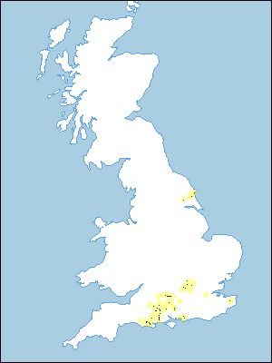 |
Note that the yellow shading represents a buffer to highlight the location of very small areas of the association.
Keys to component soil series
South Western Region
 |
South Eastern Region
 |
Typical Landscapes
South Western Region
 |
South Western Region
 |
South Western Region
 |
South Western Region
 |
All information Copyright, Cranfield University © 2025
Citation: To use information from this web resource in your work, please cite this as follows:
Cranfield University 2025. The Soils Guide. Available: www.landis.org.uk. Cranfield University, UK. Last accessed 26/04/2025
