
Soil Associations
0813b FLADBURY 1
Soil and site characteristics
Stoneless clayey soils, in places calcareous variably affected by groundwater. Flat land Risk of flooding.
Geology
River alluvium
Cropping and Land Use
Stock rearing on permanent grassland; cereals where flood risk low.
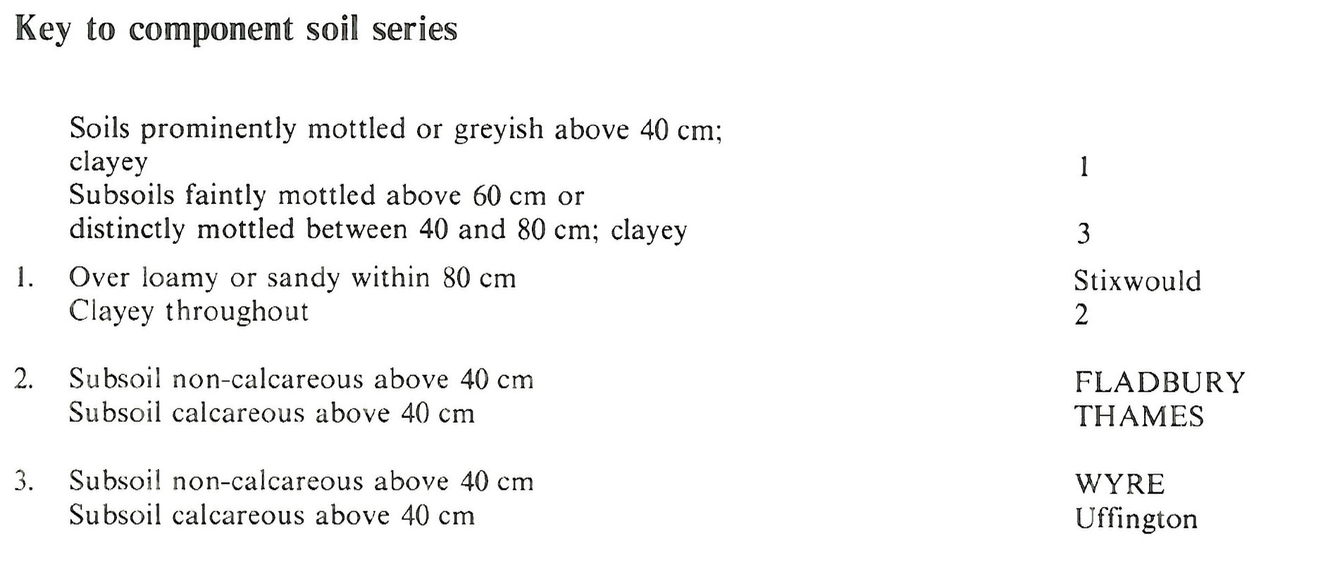
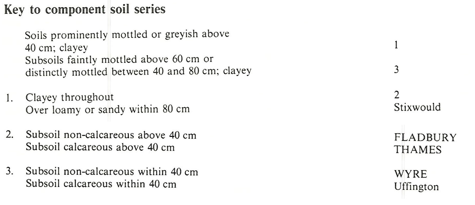
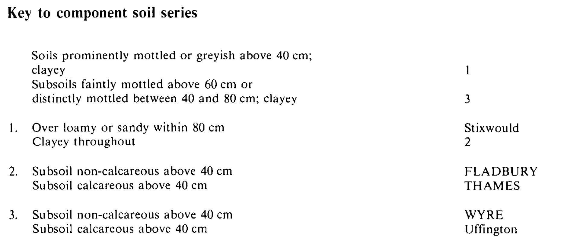
Component soil series
| Subgroup | Series name | Percentage | WRB 2006 link |
|---|---|---|---|
| 8.13 | FLADBURY | 70% | Clayic Fluvic Eutric Gleysols |
| 5.63 | WYRE | 15% | Clayic Fluvic Eutric Gleysols |
| 8.14 | THAMES | 15% | Clayic Fluvic Calcaric Gleysols |
Covers 821 km2 in England and Wales
Soilscapes Classification
| 20 |
Loamy and clayey floodplain soils with naturally high groundwater |
0813b FLADBURY 1
Detailed Description
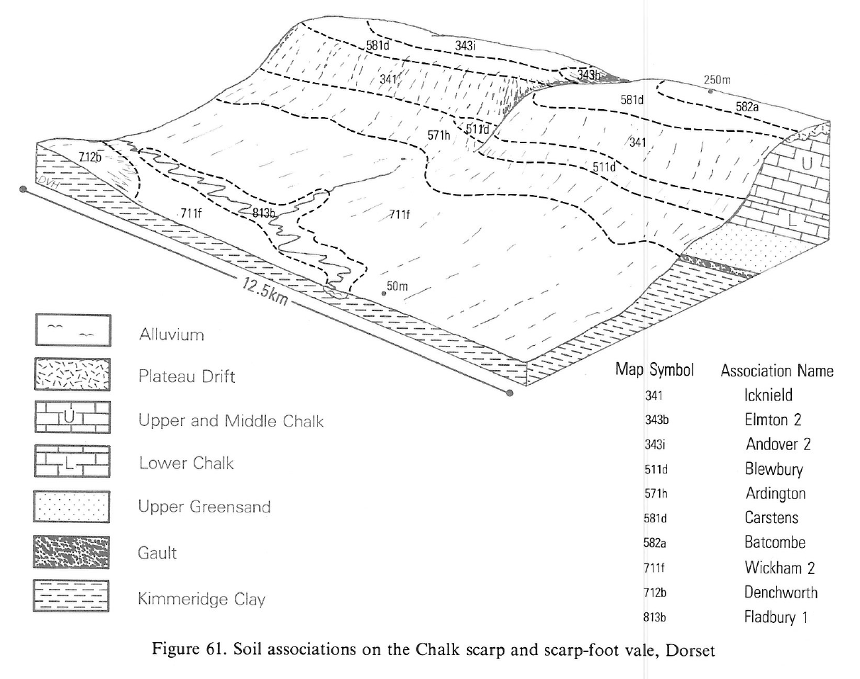
The deep clayey alluvial soils of this association are widespread on flat valley floors in the Midlands and South West England and occur to a limited extent in Cambridgeshire, Buckinghamshire, Essex and South Glamorgan. They often flank rivers draining catchments of Jurassic rocks and hence occur mainly on or near the broad Jurassic outcrop from east Nottinghamshire to south Somerset. Fladbury soils, pelo-alluvial gley soils, are clayey throughout and prominently mottled directly below the topsoil. The presence and proportions of the subsidiary Wyre and Thames soils varies not only between river systems but also along the rivers themselves, reflecting changes in sedimentary regime, catchment lithology and influence of tributaries. Thames series, pelo-calcareous alluvial gley soils, are similar to Fladbury series but calcareous and are most common where limestones are extensive in the catchment. Wyre soils, pelogleyic calcareous alluvial soils, occur on levees, or on other slightly elevated floodplain sites, and on narrow tracts of alluvium. They have a brown subsoil without grey mottles above 40 cm depth.
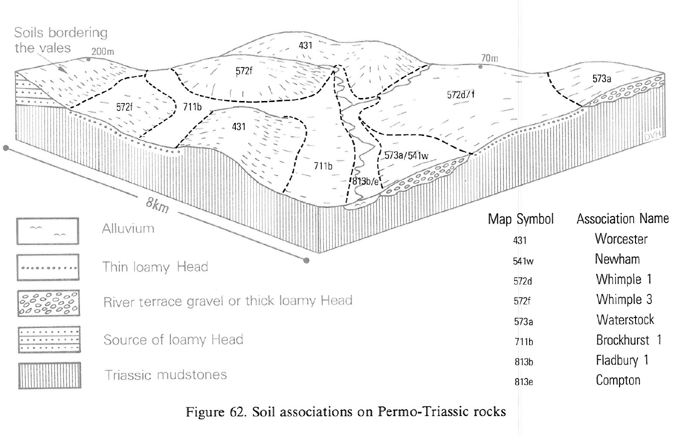
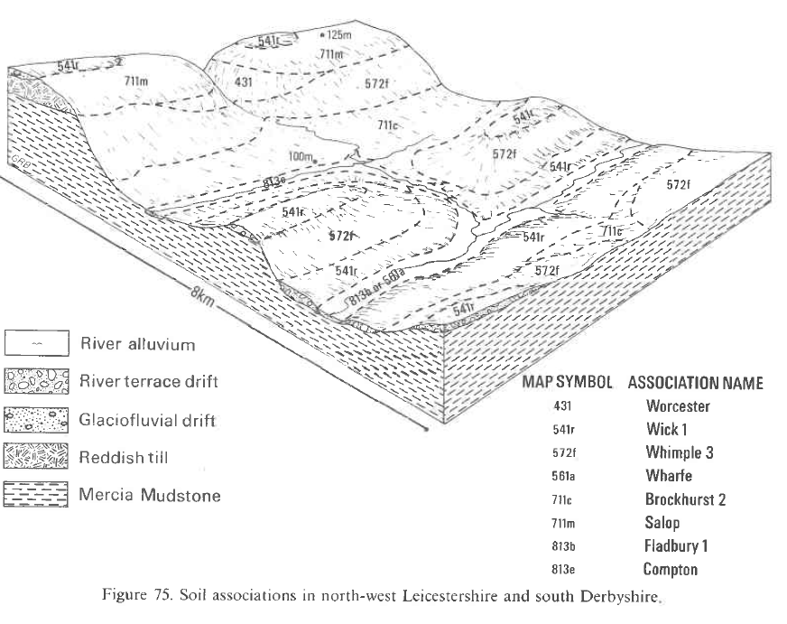
This association covers just over 180 km² in Nottinghamshire, Leicestershire, Warwickshire and Worcestershire alongside the Devon, Soar, Welland, Avon and their tributaries. Extensive tracts are Fladbury series with Wyre or Thames series only locally significant, as in the lower reaches of the Avon. Small areas of Stixwould soils are present where the alluvium thins over loamy and sandy glaciofluvial deposits, particularly towards the margins of the floodplains and in certain valleys such as that of the Wreake. Midelney soils are encountered occasionally where peat underlies alluvium at shallow depth.
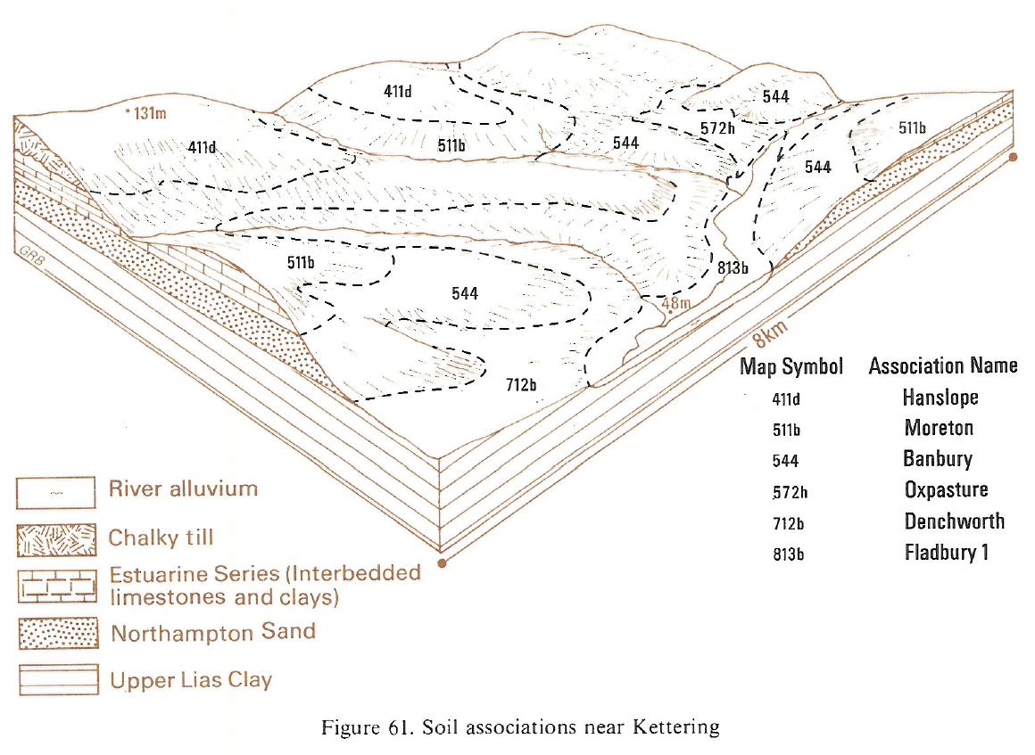
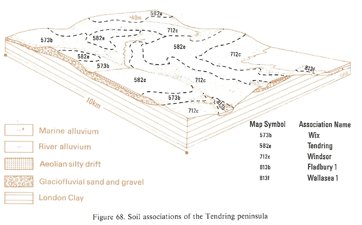
In Eastern England The association occurs along the middle and upper reaches of the Welland and Nene, on the Great Ouse near Huntingdon and to a limited extent in the valleys of the Stour, Chelmer, Blackwater, Roding and Holland Brook in Essex. Typically about half the land is of Fladbury series with less than a quarter each of Wyre and Thames series. Along some rivers, for example the Nene, there are more Thames soils, and elsewhere, as along the Welland, Thames soils are rare. On the Great Ouse it is common to find Fladbury soils above the weirs and Wyre soils below them. Wyre and Uffington soils become dominant in places as the floodplains narrow upstream. Midelney and Windrush soils are common beside the Stour but otherwise are rare.
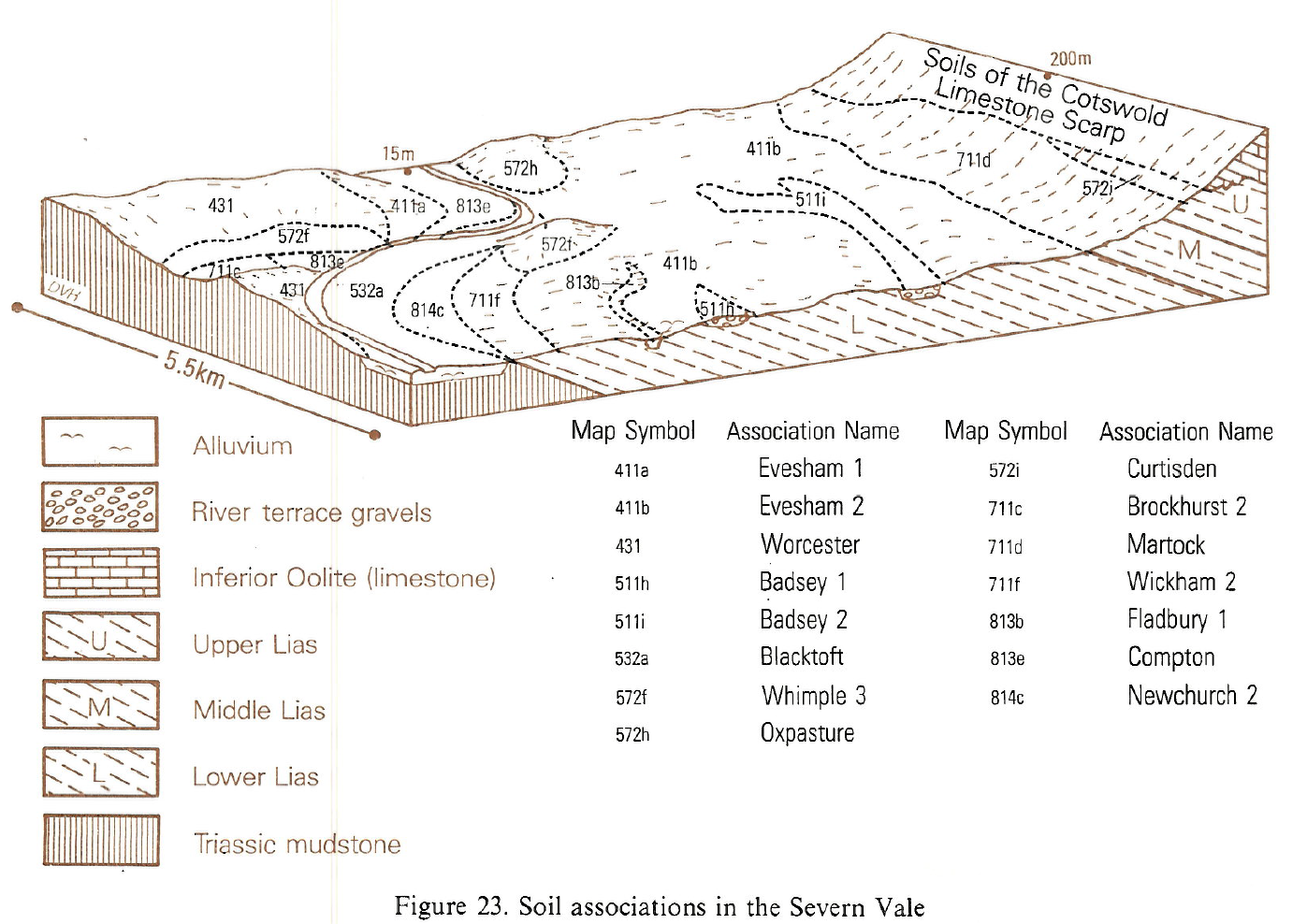
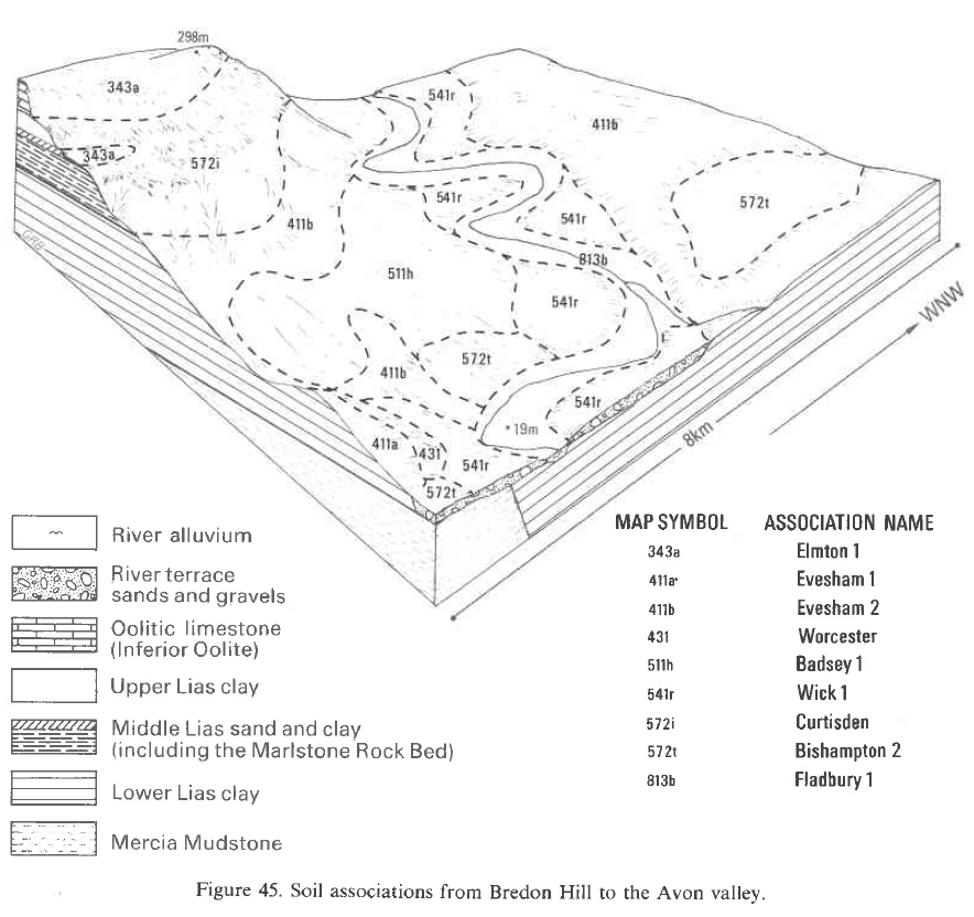
These soils are mapped along the Bristol Avon and Nadder in Wiltshire, along the Stour in Dorset, and in Somerset where the rivers Yeo, Tone, Isle, Brue, Cary and Axe enter the Levels. They also occur along the Rivers Leadon, Frome, Laddon and Chelt in Gloucestershire, and the Otter, Yarty, Axe and Alphin Brook in Devon. Fladbury soils are the main soils on most of these river floodplains, with Wyre and Thames soils occupying small areas where the groundwater is lower or the alluvium calcareous. Wyre soils are most extensive on the floodplain of the Bristol Avon. Other soils of local significance include Uffington; Conway, and Compton series, for example on Tibberton Meadows, and loamy typical and gleyic brown alluvial soils in Devon. In the Somerset Moors some Fladbury clays overlie peat within 1 metre and pass into Midelney soils where the clay is thinner than 80 cm.
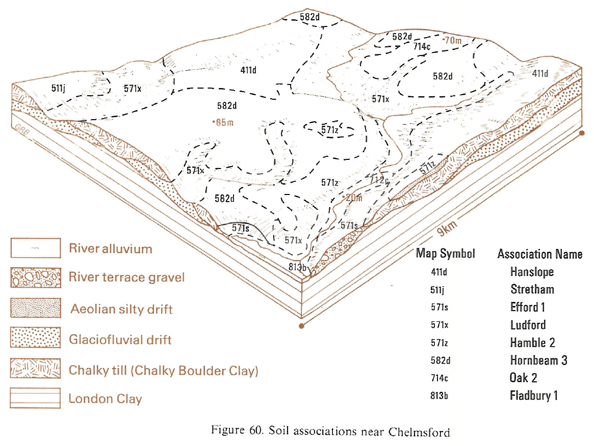
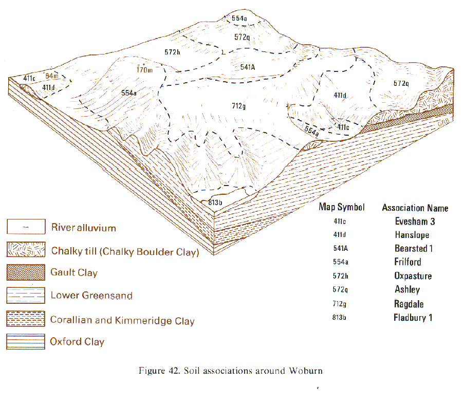
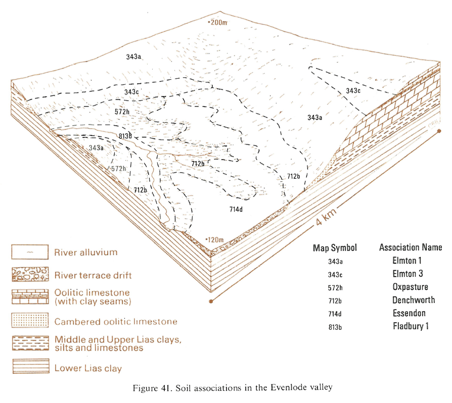
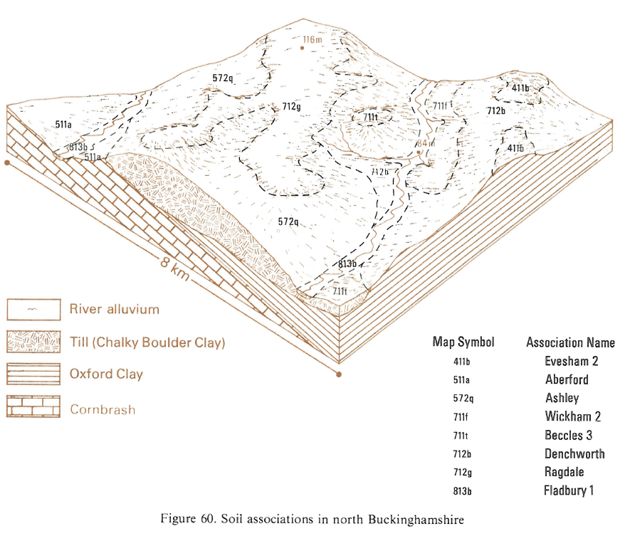
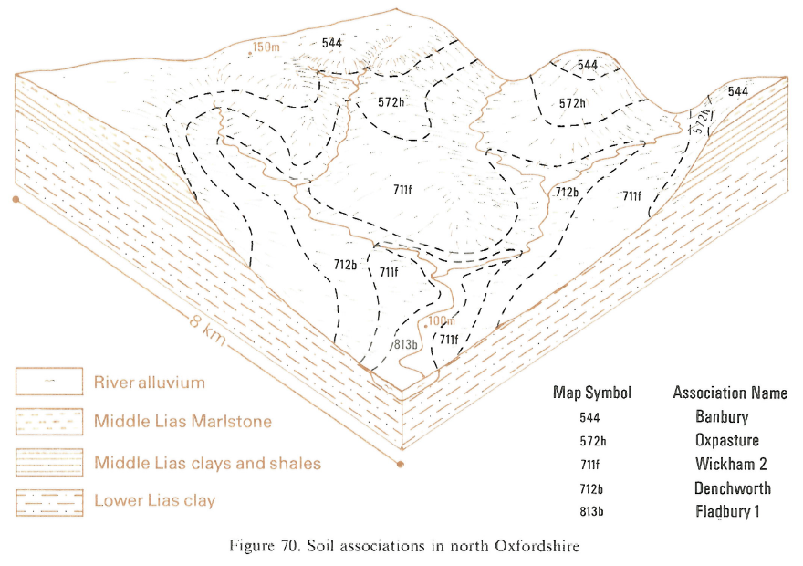
This association is found in South East England on the alluvium of the Great Ouse in Buckinghamshire and in the Cherwell, Evenlode, Thame, Cole and Ock valleys in Oxfordshire. In the last three valleys, Wyre soils are rare but Thames soils account for up to one-fifth of the area. Some reaches of the Evenlode floodplain are dominated by Wyre series and others have inclusions of Usher series on levees. Small outliers of low gravel terrace carry patches of Kelmscot soils.
Soil Water Regime
Fladbury, Wyre and Thames subsoils are usually slowly permeable. However, the primary source of waterlogging is groundwater which fluctuates seasonally with changes in the river level. The duration of waterlogging is often related to elevation. In winter months, a water-table is at shallow depth for long periods in many Thames and Fladbury soils (Wetness Class IV) and locally they suffer prolonged waterlogging (Wetness Class V). Thin peaty topsoils occur in some low-lying areas. On raised areas of the floodplain, where the waterlogging is less frequent, Wyre soils (Wetness Class II or III) are found. Flooding is a perennial problem, its frequency and distribution depending on rainfall, catchment configuration and flood control measures. Many areas suffer partial inundation two or three times annually although, except in backswamps, duration is short.
Cropping and Land Use
These soils are predominantly under permanent grassland or long leys and rushes infest the wettest sites. Because of a large retained water capacity, there is a serious risk of poaching and the risk of flooding further curtails winter grazing. Nevertheless, the soils support good summer fattening pasture and mowing grass, growth being maintained during all but the driest periods by the large amount of available water (170 mm) and perhaps some additional moisture in spring from the groundwater-table. The short field capacity period in east Nottinghamshire and parts of Leicestershire not only allows a long grazing season but also some arable use. Cereals are most often grown; they are sown in autumn where there is little flood risk, but elsewhere are spring-sown into ground cultivated the previous autumn. Roots are occasionally grown in the Devon valley but wetness causes harvesting difficulties. Thames soils are naturally calcareous but Fladbury and Wyre soils are neutral or slightly acid in reaction. In the west, these soils are predominantly under permanent grassland or long leys and rushes infest the wettest sites. Because of a large retained water capacity, there is a serious risk of poaching. Flooding further curtails late autumn and spring grazing, although flood control measures in recent years have considerably reduced the risk. Nevertheless, the soils support good summer fattening pasture and mowing grass, and growth is maintained during all but the driest periods. There is some arable land in Northamptonshire but it is more common in the drier areas of Cambridgeshire and Essex where there is more opportunity for tillage and where summer grass yields are reduced by drought. Cereals are the main crop, spring sowing being preferred where there is risk of winter flooding. Frost-weathering of winter cultivations on this heavy land provides a good seed bed for spring sowings. Cereal crops are little affected by drought. Thames soils are naturally calcareous but Fladbury and Wyre soils are neutral or slightly acid in reaction. All three soils contain good reserves of potassium but are inherently poor in phosphorus, its level depending on recent fertilizer use. Manganese deficiencies are common in grass herbage and cereals.
In a few places, for example, on Ot Moor, the water-table is controlled by pump drainage and the land is used for winter cereals. The soils are difficult to manage, however, and as there are few opportunities in spring for landwork, timely autumn cultivation is essential. Arable cropping is also possible where Wyre and Usher soils are extensive.
0813b FLADBURY 1
Distribution Map
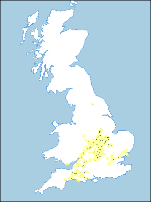 |
Note that the yellow shading represents a buffer to highlight the location of very small areas of the association.
Keys to component soil series
South Eastern Region
 |
South Western Region
 |
Eastern Region
 |
Typical Landscapes
South Western Region
 |
South Western Region
 |
South Western Region
 |
Midlands
 |
Midlands
 |
Eastern Region
 |
Eastern Region
 |
Eastern Region
 |
Eastern Region
 |
South Eastern Region
 |
South Eastern Region
 |
South Eastern Region
 |
All information Copyright, Cranfield University © 2025
Citation: To use information from this web resource in your work, please cite this as follows:
Cranfield University 2025. The Soils Guide. Available: www.landis.org.uk. Cranfield University, UK. Last accessed 25/04/2025
