
Soil Associations
0813g WALLASEA 2
Soil and site characteristics
Deep stoneless clayey soils. Calcareous in places. Some deep calcareous silty soils. Flat land often with low ridges giving a complex soil pattern. Groundwater controlled by ditches and pumps.
Geology
Marine alluvium
Cropping and Land Use
Winter cereals and some sugar beet, potatoes, cereals and field vegetables.
Component soil series
| Subgroup | Series name | Percentage | WRB 2006 link |
|---|---|---|---|
| 8.13 | WALLASEA | 55% | Clayic Fluvic Eutric Gleysols |
| 8.14 | NEWCHURCH | 15% | Clayic Fluvic Calcaric Gleysols |
| 5.32 | BLACKTOFT | 12% | Calcaric Fluvic Endogleyic Cambisols |
| 8.12 | WISBECH | 12% | Fluvic Calcaric Gleysols |
Covers 1238 km2 in England and Wales
Soilscapes Classification
| 21 |
Loamy and clayey soils of coastal flats with naturally high groundwater |
0813g WALLASEA 2
Detailed Description
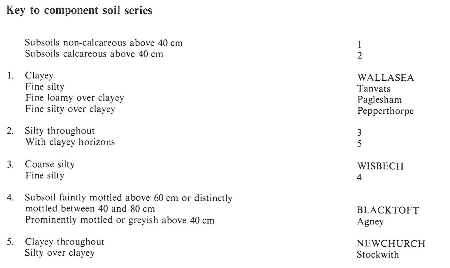
This association is extensive on reclaimed marine alluvium in the marshlands of Lincolnshire, Cambridgeshire and Norfolk, and is also present in Romney Marsh, the Essex marshes and in Holderness. The land is generally level but there are occasional ridges on the sites of former creeks. The soils are mainly Wallasea series, pelo-alluvial gley soils; Newchurch series, pelo-calcareous alluvial gley soils; Blacktoft series, gleyic brown calcareous soils; and Wisbech series, calcareous alluvial gley soils. Wallasea and Newchurch soils are clayey with a greyish brown topsoil over greyish or grey and ochreous mottled subsurface horizons; Newchurch series is calcareous. Blacktoft soils are calcareous and fine silty with grey colours and mottling in the subsoil. Wisbech soils are also calcareous, but have greyish and mottled coarse silty horizons below the plough layer, often with sedimentary laminations. Wallasea series predominates and Newchurch, Blacktoft and Wisbech soils are common. Dymchurch, Snargate, Agney, Stockwith, Tanvats and Paglesham series also occur.
Wallasea soils consistently constitute over half of the association, but the proportion of other soils varies widely throughout the country. Generally, Wisbech and Blacktoft series are found on or near former creeks (rodhams), with Wallasea and Newchurch soils in the intervening areas. The incidence of creek ridges, and so the proportion of coarser soils, increases seawards where Blacktoft soils cover a third of the land, except in Lincolnshire where the similar Agney series is more common. The proportion of the less common Wisbech soils also increases seawards. Inland towards high ground, clayey soils are predominant, Wallasea soils being most common in Lincolnshire and Cambridgeshire, but in Norfolk, Newchurch and Wallasea soils are co-dominant. In places in Lincolnshire, Wallasea soils have developed from former Downholland soils from which topsoil organic matter has been lost by oxidation. Wisbech soils are rare in north Lincolnshire and non-calcareous soils, including Pepperthorpe and Tanvats series, become more common. Near Huttoft, where islands of Devensian till rise through the alluvium, some Holderness soils are included. Creek ridges are uncommon in Essex and Wisbech soils are rare. Calcareous fine silty Agney soils cover one sixth of the land and non-calcareous Tanvats and Paglesham soils also occur. Locally there are a few saline soils and, where leaching has occurred, subsoil structure has deteriorated causing silting of drains, waterlogging and reduced crop yields.
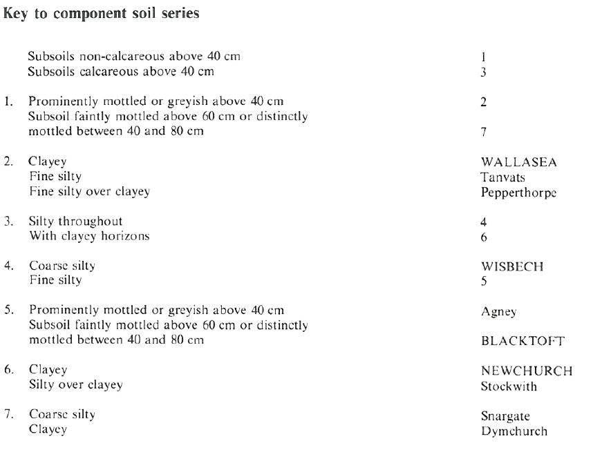
As there are very few creek ridges near the Humber, Wallasea soils predominate over large areas, with Newchurch and rarer Dymchurch soils occurring randomly. Blacktoft soils are found round the edges of the delineations, and, less commonly, Burlingham soils are included where the association adjoins soils on Devensian till. It occurs in Humberside between Sunk Island and the Holderness till plain; in Cleveland along the tidal reaches of the Tees; and in Northumberland in two very small areas near Alnmouth Bay and Beadnell Bay.
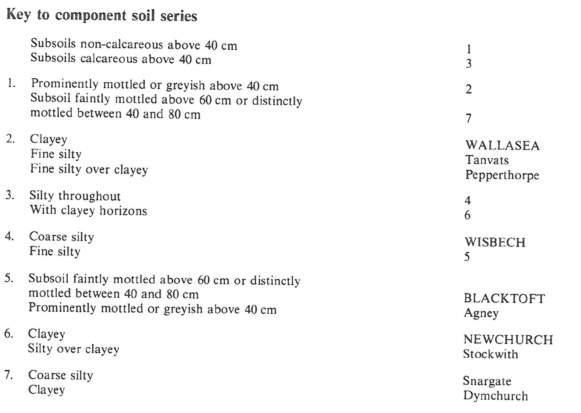
In the central part of Romney Marsh in Kent, the association corresponds to the land type with creek ridges on decalcified "Old" marshland. On creek ridges on either side of the Rhee Wall, non-calcareous coarse silty Snargate soils are dominant, with finer textured Tanvats soils, formerly part of the Finn series, towards their margins. Wallasea series is the main soil of the pool areas between the creek ridges with subsidiary Dymchurch and Pepperthorpe soils. In the west of the Marsh, calcareous Wisbech, Blacktoft and Agney soils are locally common and in the north-east where creek ridges are few and narrow, Wallasea, Pepperthorpe and Newchurch soils dominate, with Tanvats series as the main soil on creek ridges.
Soil Water Regime
Most of the land is pump-drained and the more permeable Blacktoft and Wisbech soils are well drained (Wetness Class I). Wallasea and Newchurch soils are less permeable but respond to underdrainage; drained soils are occasionally waterlogged (Wetness Class II) but undrained soils are waterlogged for long periods in winter (Wetness Class III or IV). Droughtiness assessments for selected crops are given in Table 38. Droughtiness slightly restricts the growth of arable crops in Wallasea and Newchurch soils. Wisbech soils have large available water reserves and are non-droughty whilst Blacktoft soils are intermediate in droughtiness. Grassland suffers from drought on all soils in south Lincolnshire, Norfolk and Essex but growth is less restricted in the higher rainfall area of north Lincolnshire.
Cropping and Land Use
With adequate underdrainage, Wallasea and Newchurch soils are moderately easy to work. There are adequate days for safe cultivation in autumn and spring, but in north Lincolnshire the moist climate reduces the opportunity for spring cultivation, particularly in wet years, and the soils are marginal for spring-sown crops. The land is generally used for winter cereals and ley grassland, but sugar beet, peas and field brassicas are grown in the drier districts. The use of heavy machinery often causes topsoil compaction and surface wetness on the heavier soils especially Wallasea series though they can be direct drilled very successfully if subsoiled periodically. Newchurch soils which are calcareous have a more stable structure. Wisbech and Blacktoft soils are less suitable for direct drilling because of the problems associated with this system on silty soils.
0813g WALLASEA 2
Distribution Map
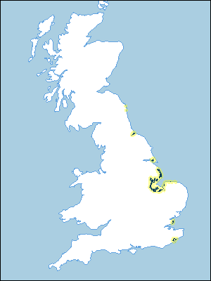 |
Note that the yellow shading represents a buffer to highlight the location of very small areas of the association.
Keys to component soil series
South Eastern Region
 |
Eastern Region
 |
Northern Region
 |
Typical Landscapes
Eastern Region
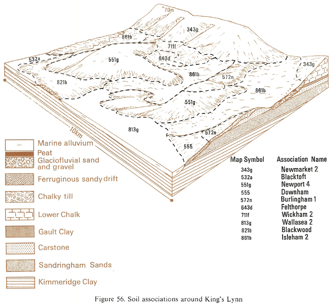 |
Eastern Region
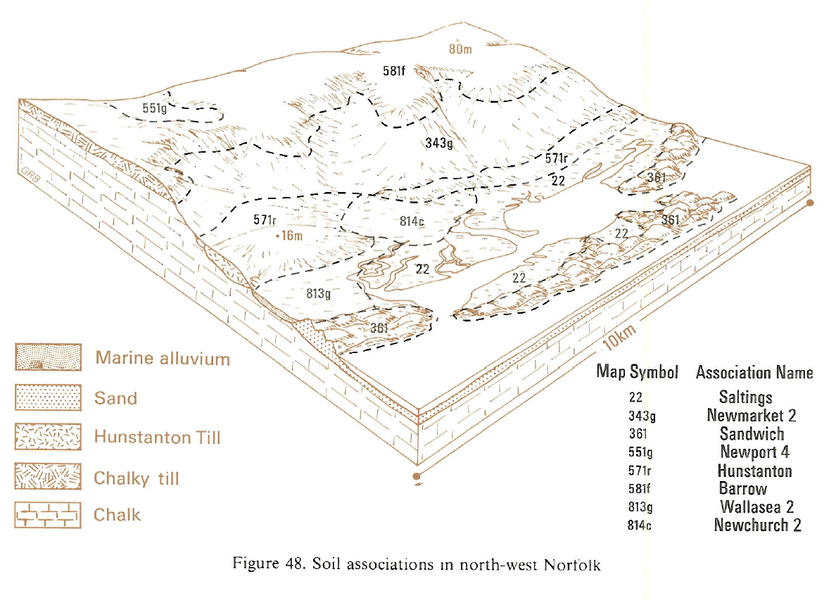 |
Eastern Region
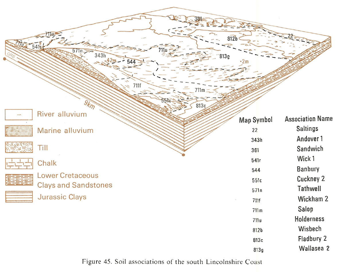 |
South Eastern Region
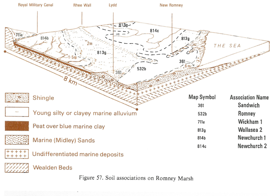 |
All information Copyright, Cranfield University © 2025
Citation: To use information from this web resource in your work, please cite this as follows:
Cranfield University 2025. The Soils Guide. Available: www.landis.org.uk. Cranfield University, UK. Last accessed 25/04/2025
