
Soil Associations
0541c EARDISTON 1
Soil and site characteristics
Well drained reddish coarse loamy soils over sandstone, shallow in places especially on brows. Some reddish fine silty soils over shale and siltstone. Risk of water erosion.
Geology
Devonian and Permo-Triassic reddish sandstone silty shale and siltstone
Cropping and Land Use
Cereals, potatoes, some field vegetables and orchards; grassland with stock rearing in Welsh Borderland.
Component soil series
| Subgroup | Series name | Percentage | WRB 2006 link |
|---|---|---|---|
| 5.41 | EARDISTON | 45% | Eutric Chromic Endoleptic Cambisols |
| 5.71 | BROMYARD | 12% | Chromic Luvisols |
| 5.41 | BROMSGROVE | 10% | Eutric Chromic Endoleptic Cambisols |
Covers 505 km2 in England and Wales
Soilscapes Classification
| 6 |
Freely draining slightly acid loamy soils |
0541c EARDISTON 1
Detailed Description
This association consists of reddish well drained coarse loamy and fine silty soils over hard sandstones interbedded with thin siltstones and silty shales. The sandstones are fine to medium grained, micaceous, and often slightly calcareous where unweathered. The association occurs on the Devonian outcrop of the Welsh Borderland, Wales and South West England and on Permo-Triassic sandstones in west Cumbria. The two main soil series are coarse loamy typical brown earths which differ in their depth to bedrock. The more extensive Eardiston series has hard sandstone between 40 and 80 cm depth whereas Bromsgrove soils are deeper. Reddish fine silty Bromyard soils are common on silty shales and siltstones, while in thick drift, often on footslopes, the coarse loamy Oglethorpe series is present. Shallow brown rankers, Newtondale series, occur on some ridges, convex brows and broader hilltops. In places, thinly bedded sandstones and silty shales have weathered to give fine loamy profiles of the Milford series. Most soils are slightly stony near the surface but become more stony with depth. The unit is mapped in Hereford and Worcester and south Shropshire and the proportions of associate soils vary with the lithology of the bedrock. The Brownstones around Ross-on-Wye contain more soft sandstones than the hard Dittonian sandstones of south Shropshire and north Hereford and Worcester. Thus the low-lying ground, with little relief, typical of the Brownstones, has Bromsgrove series as the most important subsidiary soil and there are few Bromyard soils. Coarse loamy Sellack series , having thin mudstone horizons above and interbedded with the sandstone, and typical argillic brown earths over sandstone, Lilleshall series, are locally important. Many narrow valleys on the Brownstones are floored by colluvial brown earths of the Newent series (formerly described as Biddlestone series).
The association is mapped on the hard Dittonian sandstones which flank the Clee Hills in Shropshire and form the foothills of the Black Mountains in western Herefordshire. Here, the Bromyard series is the most important subsidiary but shallow brown rankers (Newtondale series, formerly described as Flaxley series) associated with rock outcrops forming the sharp relief are incorporated. Springs rising from the thicker beds of silty shale in the Dittonian rocks often cause localized surface wetness so fine silty stagnogleyic argillic brown earths of the Middleton series are developed. The many small areas of common land on the outcrop are sited on these soils. In Wales, the soils occur along the Wye from Monmouth to the Severn over sandstones of the Brownstone and Tintern sandstone groups. Fine loamy Milford and Newbiggin, fine silty Bromyard and coarse loamy Bromsgrove and Oglethorpe soils are associated with the Eardiston series. Locally, brown sandstones give rise to Neath and Rivington profiles. Small areas of Quartz Conglomerate bear either podzols of the Goldstone series or reddish sandy Bridgnorth soils on coarse sandstone bands. The steeper slopes of the Wye Gorge carry brown podzolic soils of the Whitcott and Withnell series but no Bromyard soils. On the Old Red Sandstone in north-east Anglesey, Newbiggin, Milford and Fforest soils are minor associates. On Anglesey the Eardiston association seldom occurs above 80 m O.D. whereas it reaches 300 m in Tintern Forest and in Powys. On the higher land permanent grass predominates with occasional cereal crops although on steeper slopes broad-leaf and coniferous forests are extensive On lower ground, where slope allows, cereal crops are more extensive and there is a small acreage of soft fruit near Monmouth.
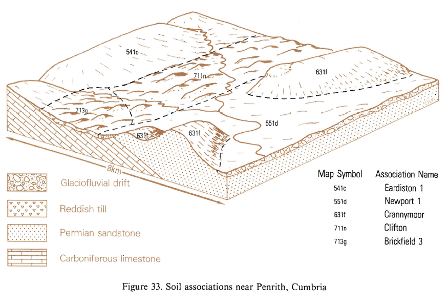
The association covers 30 km² in western Cumbria at St Bees Head and around Egremont. It runs from sea level to over 130 m O.D. on reddish St Bees Sandstone and associated shales.
In the Forest of Dean and the Wye valley, Devonian sandstones form narrow ridges and rounded hilltops separated by steep-sided valleys. On wooded slopes deep coarse loamy drift soils of the Oglethorpe and Escrick series are locally important while Newtondale soils occur on ridge crests. A narrow tract of steeply sloping bouldery ground occurs below small cliffs and bluffs formed by the Quartz Conglomerate. The association is also mapped in south Avon where Devonian sandstones outcrop on the northern slopes of the Failand Ridge.
Soil Water Regime
The Eardiston and Bromsgrove series are underlain by permeable sandstone and so are well drained (Wetness Class I). The Bromyard series with only moderately porous subsoils is normally waterlogged for short periods in winter with some variation depending on slope or long-term land use (Wetness Class I to III). The Eardiston association readily accepts winter rain even on steep slopes.
Cropping and Land Use
The range in altitude in this association causes a wide variation of rainfall from less than 700 mm per annum in the Ross-on-Wye lowlands to more than 1000 mm in the hills of south-west Herefordshire. Because of the range of climate and slope there is a variation in land use from rough grazing to orchards and horticulture. The higher and steeper ground is mostly permanent grassland with livestock rearing as the main enterprise. The grassland is generally improved although steep slopes are often left in rough grazing, sometimes unenclosed and covered with bracken. Cultivation is restricted by climate to reseeding and occasional forage crops. The small surface retained water capacities of these extremely porous soils ensure that bearing strengths are sufficient to allow grazing during most of the year in spite of high rainfall. In the driest districts there is a long growing season and a short field capacity period. A wide range of crops, including cereals, sugar beet, potatoes, vegetables and top fruit is also grown. Reserves of profile available water vary according to soil depth. Where profiles are deeper than 60 cm only grass suffers unduly from drought in most years. Growth in cereals and root crops is checked in prolonged dry spells, with a slight reduction in yield but, generally cereals and roots are little affected by drought. Where soils are less than 60 cm deep irrigation improves the yield of all crops. Cultivation is easy and even in wet years there is scope for springtime working excepting northern parts. Usually only one rain-free day is required for the topsoil to dry sufficiently for cultivation, although a slightly longer period is preferable to avoid subsoil compaction. Repeated cultivation depletes organic matter and the repeated passage of machinery, especially during wet years under intensive cropping, weakens topsoil structure and thus increases the risk of compaction, slaking and subsequent erosion. Erosion is prevalent on cultivated slopes greater than 7 degrees. Sheet and gully erosion often occur during heavy storms particularly in the winter and spring when soils are fallow or where crop cover is incomplete. In extreme cases gullies cut down to sandstone have been observed. Top fruit is successful without irrigation except on the shallowest soils. Dessert apples and pears are the main crops. Soft fruit, mainly blackcurrants and strawberries, are also locally important. Sloping land is usually preferred for top and soft fruit to avoid frost pockets and slopes with a southern aspect also benefit from high insolation rates. Eardiston soils are naturally acid and have little available phosphorus. Boron deficiency is common in sugar beet and magnesium deficiency is widespread but in general there are few other trace element problems. Weediness is a problem at establishment but, even without fertilizer, Sitka spruce and Douglas fir yield well. The soils are also suitable for a wide range of broad-leaf species.
0541c EARDISTON 1
Distribution Map
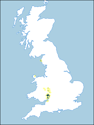 |
Note that the yellow shading represents a buffer to highlight the location of very small areas of the association.
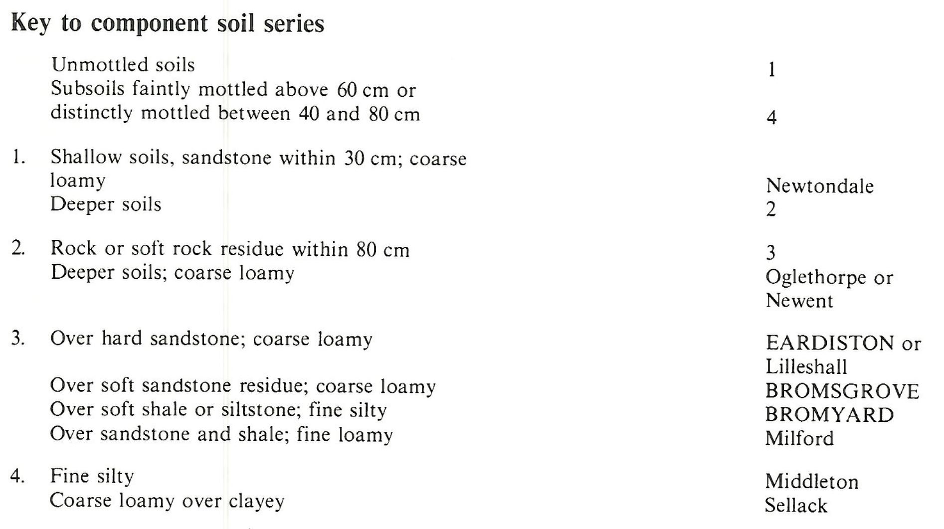
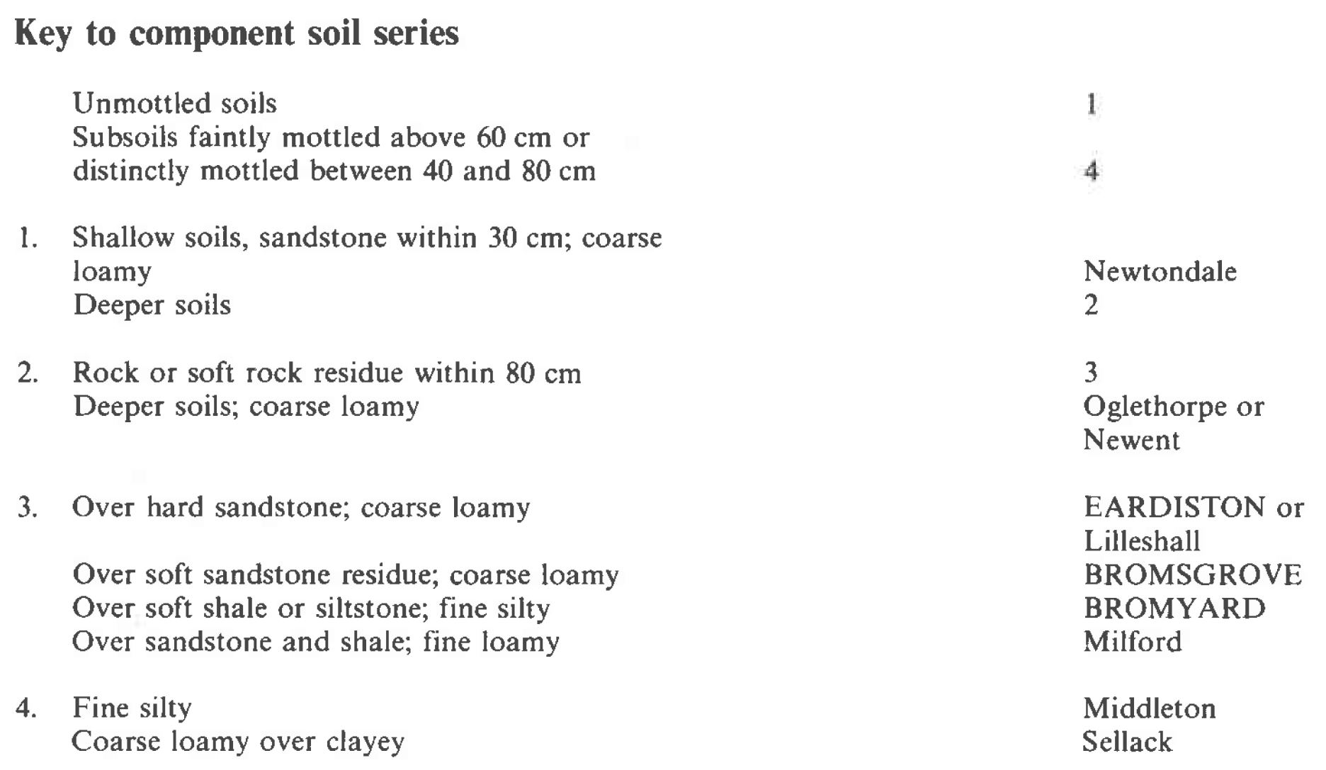
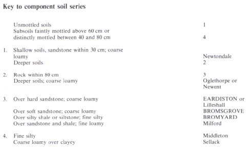
Keys to component soil series
South Western Region
 |
Midlands
 |
Wales
 |
Typical Landscapes
Northern Region
 |
All information Copyright, Cranfield University © 2025
Citation: To use information from this web resource in your work, please cite this as follows:
Cranfield University 2025. The Soils Guide. Available: www.landis.org.uk. Cranfield University, UK. Last accessed 25/04/2025
