
Soil Associations
0541j DENBIGH 1
Soil and site characteristics
Well drained fine loamy and fine silty soils over rock. Some similar soils with slowly permeable subsoils and slight seasonal waterlogging. Shallow soils and some bare rock locally. some bare rock locally.
Geology
Palaeozoic slaty mudstone and siltstone
Cropping and Land Use
Stock rearing in uplands, dairying and some cereals in moist lowlands; coniferous and deciduous woodland and rough grazing on steep slopes.
Component soil series
| Subgroup | Series name | Percentage | WRB 2006 link |
|---|---|---|---|
| 5.41 | DENBIGH | 40% | Eutric Endoleptic Cambisols |
| 3.13 | POWYS | 10% | Umbric Leptosols |
| 5.42 | SANNAN | 10% | Eutric Endostagnic Cambisols |
| 5.41 | BARTON | 10% | Eutric Endoleptic Cambisols |
| 6.11 | MANOD | 5% | Chromic Mollic Endoskeletic Umbrisols |
Covers 4630 km2 in England and Wales
Soilscapes Classification
| 6 |
Freely draining slightly acid loamy soils |
0541j DENBIGH 1
Detailed Description
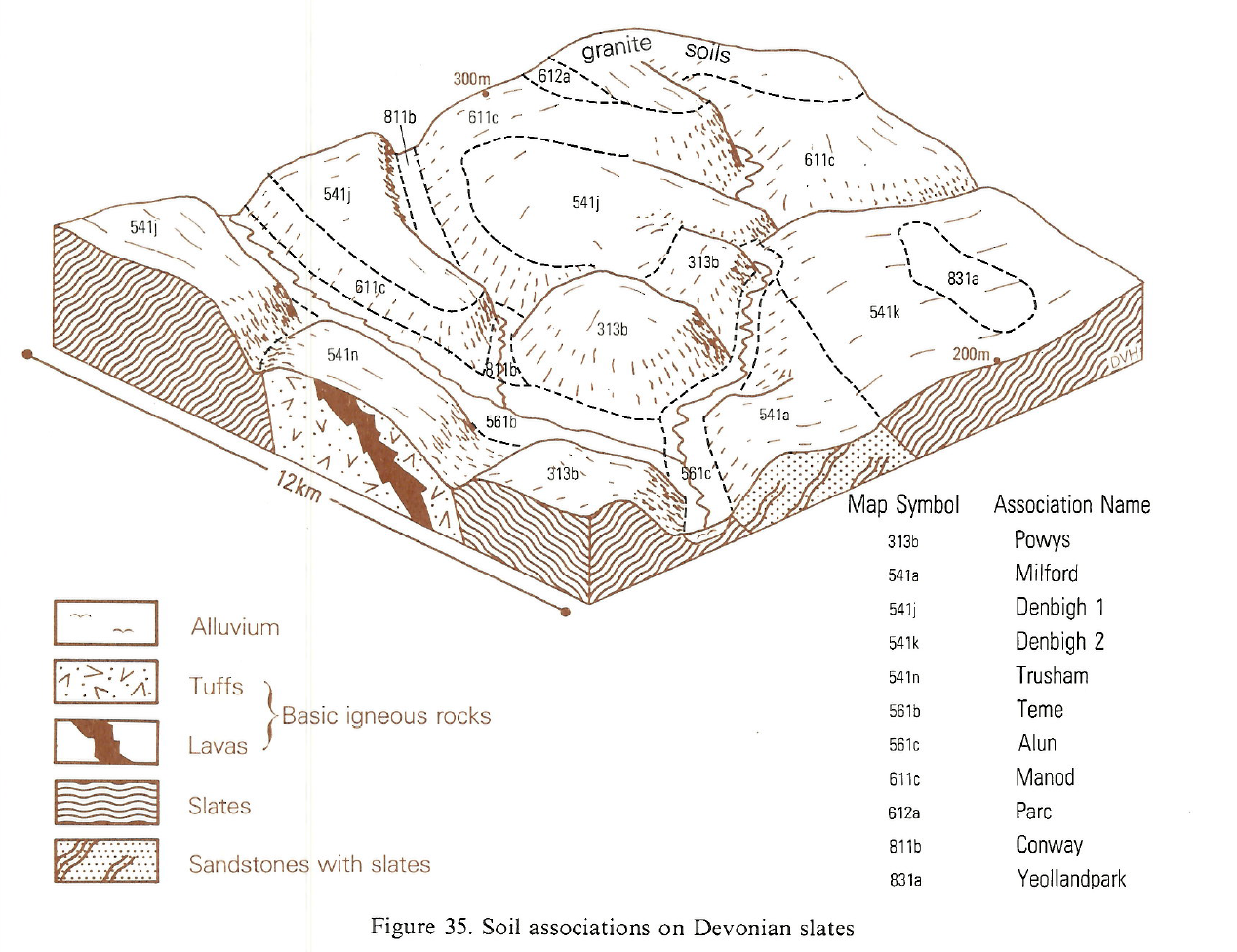
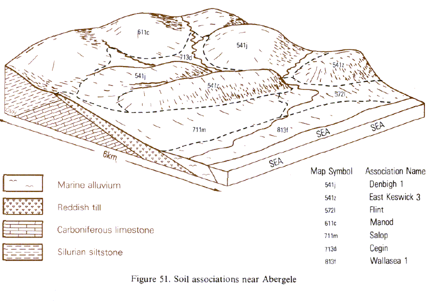
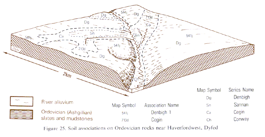
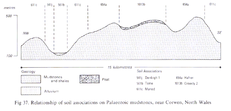
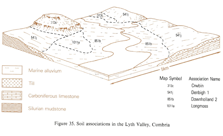
This association has brown stony well drained soils of moderate depth over Palaeozoic sedimentary rocks. It extends over more than 4,600 km² in the foothills of the Lake District, the Pennines, in South West England and Wales on hills and ridges from sea level to about 300 m O.D. Fine loamy typical brown earths, Denbigh series, cover much of the land with loamy brown rankers, Powys series, fine loamy or fine silty typical brown podzolic soils, Manod series, fine silty stagnogleyic brown earths, Sannan series, and fine silty typical brown earths, Barton series, as the main subsidiary soils. Denbigh soils are permeable clay loams on solid or shattered rock within 80 cm depth. A dark topsoil with fine subangular blocky structure overlies dull brown subsoil horizons with medium subangular blocky structure. Manod soils differ in having brightly coloured subsoil horizons with finer, often granular structure. Some Denbigh profiles also have bright subsoils similar to those of the Manod series but have less pyrophosphate extractable iron and aluminium (Thompson 1982) and usually a blockier structure. Powys soils are loamy and also free draining but shallow over massive or broken rock. The stones and rock consist mainly of Palaeozoic siltstone, mudstone, shale or slate with sandstone. While most of the soils are over rock, the silty Sannan series is in deep drift. This series is similar to the Denbigh series except below 40 cm depth where the subsoil has grey or rusty mottles indicating seasonal waterlogging and slow permeability. The East Keswick series in thick drift is also present locally and Cegin and similar soils, differing slightly in texture, are of minor extent. The Denbigh and Sannan soils are usually on cultivable slopes up to about 7 degrees. The silty Barton series is most common in the east. Manod soils often mantle steeper land while Powys series is on knolls or ridges often around rock outcrops, or on slopes eroded by cultivation or natural solifluction. Eriviat series (Clayden and Hollis 1984), on compact drift, occupies sites like those of the Powys soils. Rock outcrops and narrow valleys with alluvium and small river terraces occur locally.
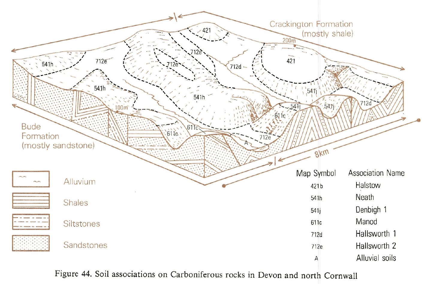
Formerly mapped widely in the South West as Highweek series, Denbigh series covers most of the cultivable slopes on low ground, but Manod soils are found on steeper land and on relatively level, higher ground around the moors, while Powys series occurs on brows and ridges. Fine loamy stagnogleyic and gleyic brown earths, Sannan and Ivybridge series, are rare. Although there are few steep slopes on higher ground in north Devon, the proportion of Manod soils is greater than elsewhere and there are few Powys soils. Some Denbigh profiles have bright subsoils like those of Manod series but they have less pyrophosphate extractable iron and aluminium and structures are generally more blocky.
Typical brown earths differing from Denbigh series in soil depth and texture are scattered widely, for example the fine loamy East Keswick series are deeper. In west Somerset, north-east Devon and the South Hams reddish fine loamy Milford soils sometimes replace the Denbigh series over reddened rocks. On much of the Devonian outcrop, the association covers valley sides as well as relatively level land on both footslopes and ridges. However, on the Carboniferous Crackington shales west of Exeter, Denbigh soils occur only on steep ground where they were mapped as Dunsford series by Clayden (1971). Here, non-calcareous pelosols belonging to the Halstow series are a minor associate on relatively level sites. Rocky outcrops are rare except between Ilfracombe and Morte Point.
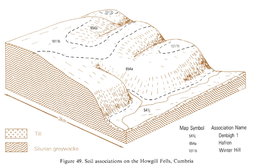
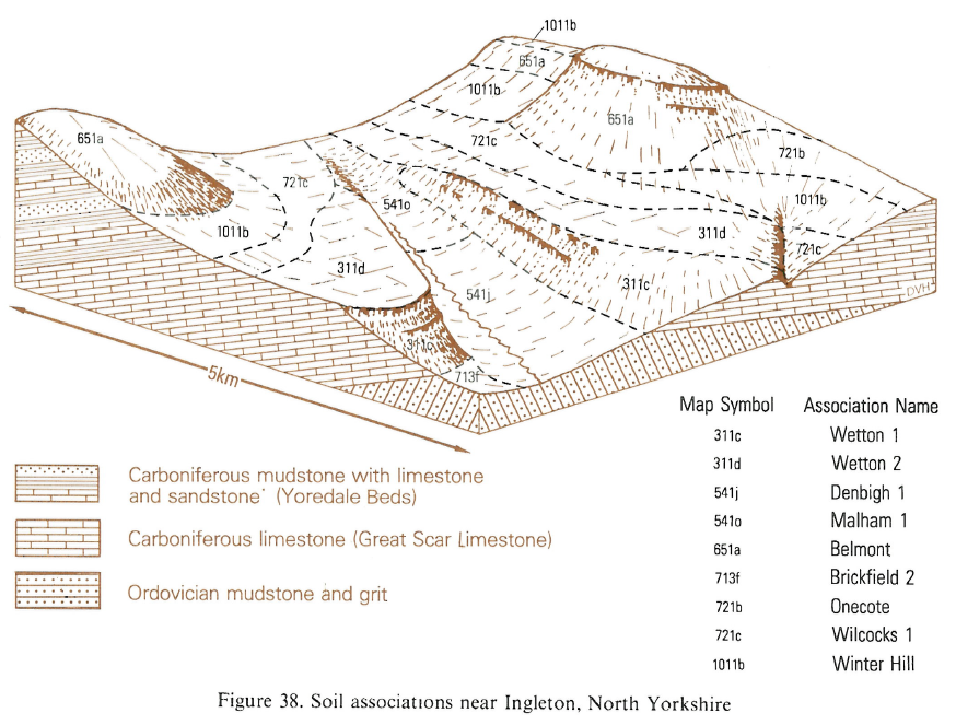
The association extends from Hawkshead to Sedbergh and is common around Morecambe Bay. It also occurs within the inliers of Silurian rock in Ribblesdale and near Ingleton. Denbigh soils are permeable clay loam soils on solid or shattered rock within 80 cm depth. A dark topsoil with fine subangular blocky structure overlies dull brown subsoil horizons with medium subangular blocky structure.
Soil Water Regime
Most of the soils are permeable and naturally well drained (Wetness Class I). Sannan soils experience occasional waterlogging (Wetness Classes II to Hp depending on situation and subsoil permeability. The soils accept most winter rain but temporary water storage capacity is limited by rock or, locally, by compact drift at less than 80 cm depth, which cause some run-off. For most of the land drought restrictions to crop production in average years are slight. Exceptions occur in drier districts where grassland and more rarely cereals suffer moisture stress on Denbigh and similar soils. Crops on the shallow Powys soils are susceptible to drought even in moist areas.
Cropping and Land Use
Long-term grass is traditionally the most common crop although the soils are more frequently cultivated in the drier districts. The land is firm enough to carry farm vehicles and resist poaching. The growing season is usually seven to nine months (Smith 1976) but the livestock grazing period is often a month or two less to avoid damage to sward and soil structure. Rainfall is the main limitation to arable crops, particularly in the west where August is usually one of the wettest months. Apart from steeper land, the Denbigh soils are suitable for direct drilling. Patchy distribution of the wetter soils can reduce the time available for working some fields. Bare soil, even on gentle slopes, is eroded during heavy rain and capping occurs from raindrop impact where organic matter in the plough layer has been depleted by long continued arable use. Conditions for disposal of slurry on Denbigh and Manod soils are generally favourable since there is little risk of pollution (Lea 1979), and soils carry traffic well, particularly when spreading is done during drier periods. Forest clearance over the centuries has left a scatter of woods mainly on steep or otherwise inaccessible ground. Such land is valuable for wildlife and game cover and adds scenic interest. Although the land is well suited for trees, large new plantations are expensive to establish, needing stockproof fencing and control of vigorous weeds which can smother young trees. Sitka spruce and Douglas fir yield well and many other soft and hard wood species are also grown for scenic as well as timber value. On Powys soils where rooting is shallow, trees are liable to be blown over. These mainly well drained loamy soils are well suited to a range of recreational and amenity uses, particularly in summer as camp, caravan and picnic sites (George and Jarvis 1979, Palmer and Jarvis 1979).
0541j DENBIGH 1
Distribution Map
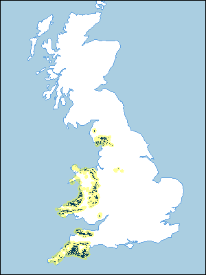 |
Note that the yellow shading represents a buffer to highlight the location of very small areas of the association.
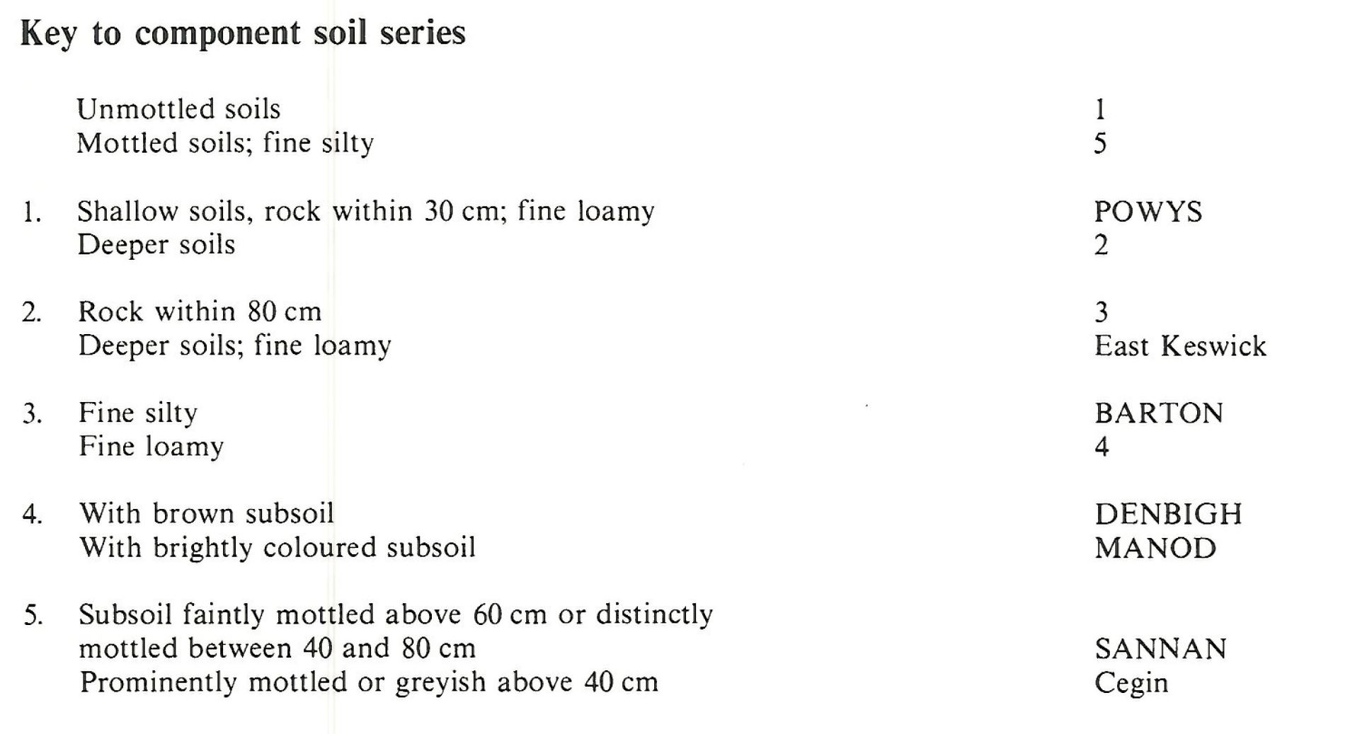
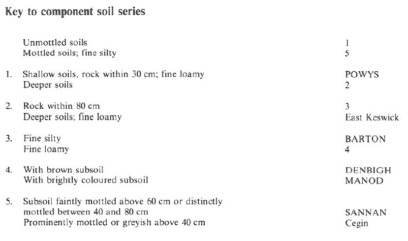
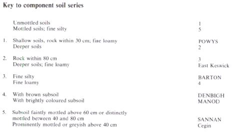
Keys to component soil series
South Western Region
 |
Northern Region
 |
Wales
 |
Typical Landscapes
South Western Region
 |
South Western Region
 |
Wales
 |
Wales
 |
Wales
 |
Northern Region
 |
Northern Region
 |
Northern Region
 |
All information Copyright, Cranfield University © 2025
Citation: To use information from this web resource in your work, please cite this as follows:
Cranfield University 2025. The Soils Guide. Available: www.landis.org.uk. Cranfield University, UK. Last accessed 25/04/2025
