Soil Associations
0541l BARTON
Soil and site characteristics
Well drained silty soils over siltstone, shallow in places. Some fine silty soils with slowly permeable subsoils and slight seasonal waterlogging. Slight risk of water erosion
Geology
Silurian siltstone
Cropping and Land Use
Stock rearing on permanent grassland, some cereals.
Component soil series
| Subgroup | Series name | Percentage | WRB 2006 link |
|---|---|---|---|
| 5.41 | BARTON | 50% | Eutric Endoleptic Cambisols |
| 5.41 | MUNSLOW | 25% | Eutric Endoleptic Cambisols |
| 5.72 | YELD | 15% | Endostagnic Luvisols |
Covers 268 km2 in England and Wales
Soilscapes Classification
| 6 |
Freely draining slightly acid loamy soils |
0541l BARTON
Detailed Description
The Barton association consists of brown well drained silty soils developed over hard Lower Palaeozoic siltstones with thin interbedded silty shales and covers about 220 km² in the Welsh Borderland. The olive and buff coloured rock has been mostly decalcified and weathers to give moderately deep, very porous soils, often with stony subsoils. The land is between 120 and 450 m O.D. and mainly steeper than 7 degrees. This is a uniform association, most of the soils being typical brown earths. Barton soils are developed over hard argillaceous siltstone which occurs within 80 cm of the surface. The main subsidiary soils belong to the Munslow series, coarse silty typical brown earths, over coarser siltstones and interbedded fine sandstones. Silty shales give fine silty stagnogleyic argillic brown earths of the Yeld series, with slight waterlogging but these occupy less than a quarter of the land. Deep fine silty soils of the Atrim series occur where the siltstone is soft and deeply weathered. Hard gritty sandstones weather to give fine loamy profiles of the Denbigh series locally and hill tops are often capped with bare rock and are fringed with shallow Powys soils. The association is developed mainly on Silurian rocks which form dissected hills between Bishop's Castle and Presteigne. It is also found along the scarp from Church Stretton to Acton Burnell and around Hope Bowdler, on Ordovician and Cambrian strata. In the Clun Forest, where slopes are frequently more than 16 degrees, there are inclusions of Manod soils. Siltstone usually occurs between 40 and 70 cm depth but is deeper in Atrim soils which are found on footslopes where colluvium has accumulated over the bedrock. The soft shales in which Yeld soils are developed often form the lower ground.
Soil Water Regime
Barton and Munslow series are well drained (Wetness Class I) but the Yeld soils suffer some waterlogging in winter (Wetness Class III). Surplus winter rainfall can pass downwards through the permeable profiles of the Barton and Munslow series, though there is a moderate amount of run-off. Surface capping caused by prolonged heavy rain on cultivated soils can significantly reduce infiltration and result in erosion.
Cropping and Land Use
Much of the land is under permanent grass which has been improved for intensive agricultural use. The steepest slopes are bracken infested and are in rough grazing; about one-fifth of the association is wooded. Livestock rearing, mainly sheep, is the most important enterprise. Poaching is negligible except on the Yeld series where there can be a significant risk of damage. Some of the land, particularly that with deep soils or on gentle slopes, is cultivated for cereals, mainly barley, and seed potatoes have been introduced recently to take advantage of the relatively disease-free environment. The soils are easy to cultivate where slopes are less than 8 degrees and good seedbeds can be produced even in spring, despite the short landwork period. The large content of silt and fine sand leads to capping during heavy rain and run-off then causes erosion on slopes. The risks are greatest in spring before crop cover is established and during summer storms which follow dry spells. There are large woods east of Knighton, and in the Clun Forest. The soils are generally well suited to trees so plantations of Scots pine, European larch, Western hemlock and Sitka spruce flourish. Some oak, sycamore and beech are grown on the fringes of the woods or occur as remnants of larger stands of mixed deciduous trees. Surface horizons of the soils under woodland become strongly acid, particularly under coniferous trees.
0541l BARTON
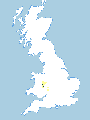
Distribution Map
 |
Note that the yellow shading represents a buffer to highlight the location of very small areas of the association.
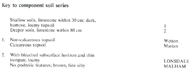
Keys to component soil series
Midlands
 |
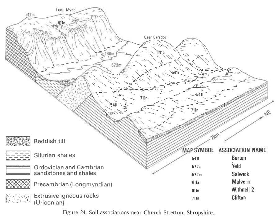
Typical Landscapes
Midlands
 |
All information Copyright, Cranfield University © 2025
Citation: To use information from this web resource in your work, please cite this as follows:
Cranfield University 2025. The Soils Guide. Available: www.landis.org.uk. Cranfield University, UK. Last accessed 25/04/2025
