Soil Associations
0541v RHEIDOL
Soil and site characteristics
Well drained fine loamy soils over gravel, shallow in places. Some related soils affected by groundwater in hollows.
Geology
Glaciofluvial or river terrace gravel
Cropping and Land Use
Stock rearing on permanent grassland; some cereals.
Component soil series
| Subgroup | Series name | Percentage | WRB 2006 link |
|---|---|---|---|
| 5.41 | RHEIDOL | 70% | Eutric Endoskeleti-Eutric Cambisols |
| 6.11 | NEFERN | 10% | Eutric Chromic Endoskeletic Cambisols |
| 5.43 | HOPSFORD | 10% | Eutric Endogleyic Cambisols |
Covers 107 km2 in England and Wales
Soilscapes Classification
| 6 |
Freely draining slightly acid loamy soils |
0541v RHEIDOL
Detailed Description
This association consists mainly of well drained permeable fine loamy brown earths over gravels. It is mapped on river terraces and glaciofluvial outwash deposits and covers 87 km² mainly in narrow strips along rivers and in larger areas around river confluences. It is most extensive in Dyfed along the middle reaches of the Teifi and Tywi. Locally there are kettle holes, small enclosed depressions, some of which contain small lakes surrounded by ground-water gley soils. The Rheidol series which belongs to the typical brown earths is most extensive with the typical brown podzolic Nefern series distinguished by its brighter ochreous subsoils. In hollows, gleyic brown earths of the Hopsford series occur with fine loamy wetter soils related to the Rockland series. Deeper soils include the East Keswick, Meline and Wigton Moor series. Southminster soils are rare. The terraces along the larger rivers lie up to 15 m above the floodplain from which they are usually separated by a steep bluff. Elsewhere, especially in the upper reaches of rivers the terraces are more recent so they grade gently into the alluvium. In places small strips of alluvial Conway and Teme series are included.
Soil Water Regime
Cropping and Land Use
The land is usually more sheltered than that of surrounding slopes but some occurs near the coast. It is locally much valued, supporting arable crops such as winter barley as well as providing ley grassland and good permanent pastures. Near Welshpool summer temperatures are higher than elsewhere so there are more arable crops, although grass is dominant almost everywhere. In many districts, this level land with its well drained soils is the best available. The soils readily absorb winter rain so that waterlogging is rare and there is little risk of poaching. The soils are mainly non-droughty, but are moderately droughty in the Severn valley near Welshpool where moisture deficits are highest. The association frequently occurs at the bridging points of rivers or at confluences where villages and towns have developed, or is occupied by old parkland, where the presence of hollows and kettle holes adds to the landscape value. The land is generally suitable for playing fields and camp sites where topsoils are not too stony.
0541v RHEIDOL
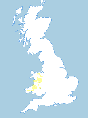
Distribution Map
 |
Note that the yellow shading represents a buffer to highlight the location of very small areas of the association.
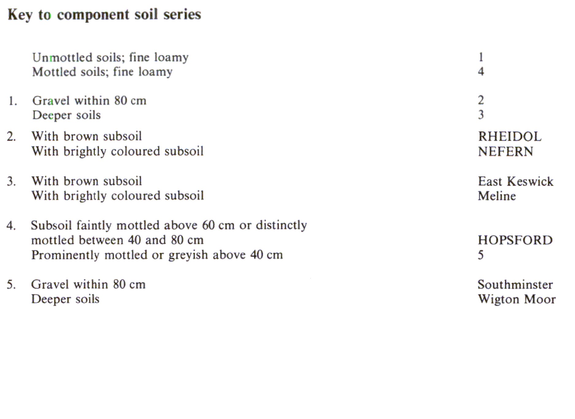
Keys to component soil series
Wales
 |
All information Copyright, Cranfield University © 2025
Citation: To use information from this web resource in your work, please cite this as follows:
Cranfield University 2025. The Soils Guide. Available: www.landis.org.uk. Cranfield University, UK. Last accessed 25/04/2025
