Soil Associations
0541C NEWBIGGIN
Soil and site characteristics
Deep well drained reddish fine loamy soils and similar soils with slowly permeable subsoils and slight seasonal waterlogging. Bare limestone with associated shallow stony soils in places.
Geology
Reddish drift
Cropping and Land Use
Stock rearing on permanent and some short term grassland.
Component soil series
| Subgroup | Series name | Percentage | WRB 2006 link |
|---|---|---|---|
| 5.41 | NEWBIGGIN | 65% | Eutric Chromic Cambisols |
| 5.72 | SALWICK | 35% | Chromic Endostagnic Luvisols |
Covers 117 km2 in England and Wales
Soilscapes Classification
| 6 |
Freely draining slightly acid loamy soils |
0541C NEWBIGGIN
Detailed Description
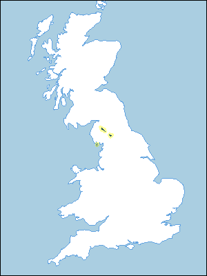
This association covers 112 km² in reddish drift overlying part of the Carboniferous Limestone outcrop, which fringes the Lake District near Penrith, Kirkby Stephen and Barrow-in-Furness. Well drained fine loamy soils of the Newbiggin series, typical brown earths, predominate. Soils of the Salwick series, stagnogleyic argillic brown earths subject to slight seasonal waterlogging, occur less frequently. Relief is gently to moderately undulating, broken by limestone exposures at higher altitudes. On lower ground it may become accentuated, with drumlins and hillocks, particularly near Barrow. Altitudes are as low as 50 m O.D. in the Barrow district but mainly between 180 m and 400 m O.D. elsewhere. The Newbiggin series has a brown or reddish brown topsoil over a strikingly reddish subsoil. The soils are usually clay loam throughout and normally non-calcareous, although in places they are slightly calcareous at depth. Limestone sometimes occurs within 1 m depth and is not generally more than 2 m below the surface. These distinctive soils occur where reddish drift, mainly from Permo-Triassic rocks, overlies limestone. In Furness the map unit includes the Lindal association which was mapped by Hall and Folland (1970). Near limestone exposures, Crwbin series is found. In hollows and less well drained sites, Salwick and, less commonly, Clifton soils occur, particularly at lower altitudes.
Soil Water Regime
Newbiggin soils are permeable and naturally well drained (Wetness Class I). The Salwick series has a moderately permeable subsoil and waterlogging varies with the extent of land drainage (Wetness Class II or III). Even where the drift is considerably more than 1 m thick, the limestone clearly has influenced the moisture regime because soils in similar reddish drift over other rocks in Cumbria are invariably strongly gleyed. The available water capacity is large and, with an annual rainfall ranging between 1000 mm and 1300 mm, there are ample reserves of soil water for grass growth. There is little winter run¬off of rainwater although this increases on steeper slopes.
Cropping and Land Use
Despite the good internal drainage of the Newbiggin series the wet climate prevents much landwork during autumn and spring. The soils are well suited to grassland, although some barley, roots and potatoes are grown. High yields are obtainable from permanent grass, which is used for rearing and fattening sheep and beef cattle or for dairying. The fine loamy topsoil and the long periods at field capacity create a risk of severe poaching however and stocking needs to be carefully managed during wet periods. The risk of poaching is correspondingly greater on the less permeable Salwick series.
0541C NEWBIGGIN
Distribution Map
 |
Note that the yellow shading represents a buffer to highlight the location of very small areas of the association.
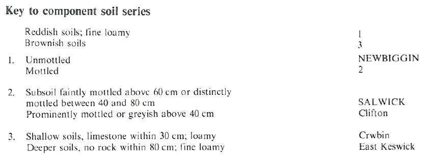
Keys to component soil series
Northern Region
 |
All information Copyright, Cranfield University © 2025
Citation: To use information from this web resource in your work, please cite this as follows:
Cranfield University 2025. The Soils Guide. Available: www.landis.org.uk. Cranfield University, UK. Last accessed 25/04/2025
